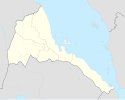
List of World Heritage Sites in Eritrea

Last updated

Flag of Eritrea.svg
Welterbe.svg UNESCO logo.svg

The United Nations Educational, Scientific and Cultural Organization (UNESCO) World Heritage Sites are places of importance to cultural or natural heritage as described in the UNESCO World Heritage Convention, established in 1972. [1] Eritrea accepted the convention, making its historical sites eligible for inclusion on the list. As of 2023, Eritrea has only one World Heritage Sites. [2]

Contents

Location of sites

Eritrea adm location map.svg
Location of World Heritage Sites in Flag of Eritrea.svg  Eritrea

List of sites

NameImageLocationCriteriaYearDescription
Asmara: A Modernist African City Catholic Cathedral.jpg Central Region

15°19′22″N38°55′30″E / 15.322778°N 38.925°E / 15.322778; 38.925 (Asmara: A Modernist African City)

Cultural (ii) (iv)2017Located at over 2,000 m above sea level, the capital of Eritrea developed from the 1890s onwards as a military outpost for the Italian colonial power. After 1935, Asmara underwent a large scale programme of construction applying the Italian rationalist idiom of the time to governmental edifices, residential and commercial buildings, churches, mosques, synagogues, cinemas, hotels, etc. The property encompasses the area of the city that resulted from various phases of planning between 1893 and 1941, as well as the indigenous unplanned neighbourhoods of Arbate Asmera and Abbashawel. It is an exceptional example of early modernist urbanism at the beginning of the 20th century and its application in an African context. [3]

Tentative List

SiteImageLocation Criteria Area
ha (acre)
Year of submissionDescription
Qohaito Cultural Landscape Kohaito, grotta di adi alauti con pitture rupestri databili al 2500 ac ca. 14 bestiame.JPG Debub Region 14°52′43″N39°25′38″E / 14.878611°N 39.427222°E / 14.878611; 39.427222 (Qohaito Cultural Landscape) Cultural (iii) (v)2011 [4]

Related Research Articles

<span class="mw-page-title-main">Asmara</span> Capital and largest city of Eritrea

Asmara, or Asmera, is the capital and most populous city of Eritrea, in the country's Central Region. It sits at an elevation of 2,325 metres (7,628 ft), making it the sixth highest capital in the world by altitude and the second highest capital in Africa. The city is located at the tip of an escarpment that is both the northwestern edge of the Eritrean Highlands and the Great Rift Valley in neighbouring Ethiopia. In 2017, the city was declared as a UNESCO World Heritage Site for its well-preserved modernist architecture. The site of Asmera was first settled in 800 BC with a population ranging from 100 to 1,000. The city was then founded in the 12th century AD after four separate villages unified to live together peacefully after long periods of conflict. Under Italian rule the city of Asmara was made capital of Eritrea in the last years of the 19th century.

<span class="mw-page-title-main">Governor's Palace, Asmara</span>

The Governor's Palace is the city hall of Asmara, Eritrea. It was built during the colonial period in the city centre, in an Italian Art Deco style.

<span class="mw-page-title-main">Eritrea</span> Country in the Horn of Africa

Eritrea, officially the State of Eritrea, is a country in the Horn of Africa region of Eastern Africa, with its capital and largest city at Asmara. It is bordered by Ethiopia in the south, Sudan in the west, and Djibouti in the southeast. The northeastern and eastern parts of Eritrea have an extensive coastline along the Red Sea. The nation has a total area of approximately 117,600 km2 (45,406 sq mi), and includes the Dahlak Archipelago and several of the Hanish Islands.

The following is a timeline of the history of the city of Asmara, Eritrea. Asmara was under Italian colonial rule from 1889 until 1941.

References

  1. "The World Heritage Convention". UNESCO. Retrieved December 11, 2023.
  2. "Eritrea". UNESCO. Retrieved November 20, 2023.
  3. "Asmara: A Modernist African City". UNESCO World Heritage Centre. Retrieved 2023-11-20. CC-BY icon.svg Text was copied from this source, which is available under a Creative Commons Attribution 3.0 IGO (CC BY 3.0 IGO) license.
  4. "Qohaito Cultural Landscape". UNESCO World Heritage Centre (in French). Retrieved 2023-11-20.