
Roseau is the capital and largest city of Dominica, with a population of 16,571 as of 2023. It is a small and compact urban settlement, in the Saint George parish and surrounded by the Caribbean Sea, the Roseau River and Morne Bruce. Built on the site of the ancient Island Carib village of Sairi, it is the oldest and most important urban settlement on the island of Dominica.

The flag of Dominica was adopted on 3 November 1978, with some small changes having been made in 1981, 1988, and 1990. The original flag was designed by playwright Alwin Bully in early 1978 as the country prepared for independence.

The Dominica national football team represents Dominica in international football and is controlled by the Dominica Football Association. They are a member of CONCACAF.

Air Sunshine is an airline based in the United States and in Puerto Rico. It operates scheduled service to and from San Juan and Vieques, Puerto Rico, St. Lucia, Anguilla, Dominica, Sint Maarten, Nevis, St. Kitts, Tortola and Virgin Gorda in the British Virgin Islands and Saint Thomas, US Virgin Islands. Its main base is Fort Lauderdale, with a Caribbean hub located in San Juan, Puerto Rico.

Saint Andrew is one of Dominica's 10 administrative parishes. It is bordered by St. John and St. Peter, St. Joseph, and St. David.

Saint Paul is one of Dominica's 10 administrative parishes. It is bordered by St. Joseph to the north, St. David to the east, and St. George to the south. It has an area of 67.4 km² (26.02 mi²), and a population of 8,397.

Clayton J. Lloyd International Airport is a small international airport located on the island of Anguilla, a British Overseas Territory in the Caribbean. It is located very close to The Valley, the island's capital. Wallblake Airport is also a featured airport in one of the Flight Simulator X game demos. It has a small terminal with no jetways and is the only airport in Anguilla.

Douglas–Charles Airport, formerly known as Melville Hall Airport, is an airport located on the northeast coast of Dominica, 2 mi (3.2 km) northwest of Marigot. It is about one hour away from the second largest city Portsmouth. It is one of only two airports in the island nation of Dominica, the other being Canefield Airport located three miles (5 km) northeast of Roseau.

The Canefield Airport is an airport on the west coast of the island nation of Dominica. It is 3 miles (5 km) north of Roseau, the capital. Construction began in early 1979 with British funding, shortly after Dominica's independence. The airport was officially opened in 1982. It is one of only two airports in the island nation of Dominica, the other being Douglas-Charles Airport.
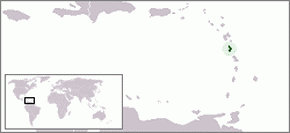
Dominica officially the Commonwealth of Dominica, is an island country in the Caribbean. The capital, Roseau, is located on the western side of the island. It is geographically situated as part of the Windward Islands chain in the Lesser Antilles archipelago in the Caribbean Sea. Dominica's closest neighbours are two constituent territories of the European Union, the overseas departments of France, Guadeloupe to the northwest and Martinique to the south-southeast. Dominica comprises a land area of 750 km2 (290 sq mi), and the highest point is Morne Diablotins, at 1,447 m (4,747 ft) in elevation. Its population was 71,293 at the 2011 census.
The following outline is provided as an overview of and topical guide to Dominica:
Azua Dominica Airport is an airport 2 kilometres (1.2 mi) south of the city of Azua in the Azua Province of the Dominican Republic. It is an old airport that is used only for the emergency landing of domestic flights. This airport has never had regularly scheduled flights, although some airlines have operated charter or tourist flights here.
Air Guadeloupe was a small French international airline with its head office in Les Abymes, Guadeloupe, France. At one time, it was on the property of Le Raizet Airport. Later it was located in the Immeuble Le Caducet.

Air Martinique was an airline based in the island of Martinique in the Lesser Antilles in the Caribbean. Its head office was on the grounds of Fort-de-France Airport, now Martinique Aimé Césaire International Airport, in Le Lamentin.
The following is an alphabetical list of topics related to the nation of Dominica.

Tropical Storm Erika was one of the deadliest and most destructive natural disasters in Dominica since Hurricane David in 1979. The fifth named storm of the 2015 Atlantic hurricane season, Erika developed from a westward-moving tropical wave while well east of the Lesser Antilles. Hostile conditions, including dry air and wind shear, inhibited significant development, and Erika failed to acquire sustained winds beyond 50 mph (80 km/h). Contrary to predictions of a northwesterly recurvature, the cyclone persisted on a westerly course and passed through the Leeward Islands and emerged over the Caribbean Sea on August 27. Erika succumbed to adverse conditions the following day, dissipating as a tropical cyclone near the Dominican Republic. The remnant system persisted for several more days, moving into the northeastern Gulf of Mexico, before dissipating over Georgia on September 3.
Sky High Aviation Services S.A. is an airline based in Dominican Republic and operates scheduled flights in the Caribbean.

Dominica is an island nation in the Windward islands in the Lesser Antilles archipelago in the Caribbean Sea. Most people arrive in Dominica via Douglas–Charles Airport, where most commercial flights to the island land. Dominica also utilizes sea transport and a roadway network.
Woodford Hill is a village in Saint Andrew Parish in north-eastern Dominica. Woodford Hill was an estate extending from Eden River to L’anse Noire. An Amerindian village existed at the mouth of the Woodford Hill river about 1,400 years ago. The present day village of Woodford Hill is on the western boundary of the old estate. It is made up of various sections including Small Farm, Mount Sylvie, Falang, Larieu, Fond Cole, Joe Road, and Big Cedar. According to the 2011 census report, Woodford Hill had a population of 1,034.