List of airports in Bermuda

Last updated

Map of Bermuda Bermuda-CIA WFB Map.png
Map of Bermuda

This is a list of airports in Bermuda .

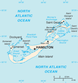
Bermuda, officially the Bermuda Islands, is a British overseas territory in the North Atlantic Ocean. Located off the east coast of the United States, its nearest landmass is Cape Hatteras, North Carolina, about 1,030 kilometres (640 mi) to the west-northwest. It is about 1,373 km (853 mi) south of Halifax, Nova Scotia, Canada, and 1,770 km (1,100 mi) northeast of Miami, Florida. The territory consists of approximately 138 islands, with a total area of 71.7 km2 (27.7 sq. mi.). Its capital city is Hamilton.

Contents

Airports

Parish Island ICAO IATA Airport name Coordinates
Current airport
St. George's St. David's Island TXKFBDA L.F. Wade International Airport (formerly Bermuda Int'l) 32°21′51″N064°40′43″W / 32.36417°N 64.67861°W / 32.36417; -64.67861 (L.F. Wade International Airport)
Former military airports
St. George's St. David's Island Kindley AFB (1948-1970) / NAS Bermuda (1970-1995) 32°21′51″N064°40′43″W / 32.36417°N 64.67861°W / 32.36417; -64.67861 (Kindley AFB/NAS Bermuda)
Sandys Boaz Island RNAS Boaz Island (HMS Malabar) (1939-1944) 32°18′31″N064°51′06″W / 32.30861°N 64.85167°W / 32.30861; -64.85167 (RNAS Boaz Island (HMS Malabar))

See also

Map all coordinates using: OpenStreetMap  
Download coordinates as: KML

Related Research Articles

International Civil Aviation Organization Specialised agency of the United Nations

The International Civil Aviation Organization (ICAO) is a specialized agency of the United Nations. It changes the principles and techniques of international air navigation and fosters the planning and development of international air transport to ensure safe and orderly growth. Its headquarters is located in the Quartier International of Montreal, Quebec, Canada.

References