List of airports in the Falkland Islands

Last updated

Map of the Falkland Islands Falkland Islands (Islas Malvinas)-CIA WFB Map.png
Map of the Falkland Islands

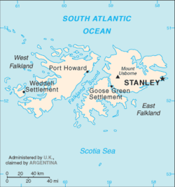
The Falkland Islands are an archipelago in the South Atlantic Ocean, located about 250 nautical miles (460  km ; 290  mi ) from the coast of mainland South America and 600 nautical miles (1,100 km; 690 mi) from mainland Antarctica. The archipelago, consisting of East Falkland, West Falkland and 776 lesser islands, is a self-governing Overseas Territory of the United Kingdom. [1] The capital, Stanley, is on East Falkland. The islands contain two airports with paved runways, with settlements around the archipelago served by grass airstrips.

Contents

Airports

Location served ICAO IATA Airport nameCoordinates
Civil airports
Stanley SFALPSY Port Stanley Airport 51°41′10″S57°46′39″W / 51.68611°S 57.77750°W / -51.68611; -57.77750 (Port Stanley Airport)
Military airports
Mount Pleasant EGYPMPN RAF Mount Pleasant (Royal Air Force base) 51°49′22″S58°26′50″W / 51.82278°S 58.44722°W / -51.82278; -58.44722 (Mount Pleasant)

Other FIGAS airstrips

East Falklands:

West Falklands:

Source: [2] [3]

They are in general 500–700 metres (1,600–2,300 ft) long

See also

References

Footnotes

  1. "The Islands: Location". Falkland Islands Government web site. 2007. Archived from the original on 28 April 2007. Retrieved 8 April 2007.
  2. "FIGAS (Falkland Islands Government Air Service) - Visitor Information".
  3. Camp Airstrips