List


The following table lists the 42 cities and communes in Saxony with a population of at least 25,000 on May 15, 2022, as estimated by the Federal Statistical Office of Germany. [2] A city is displayed in bold if it is a state or federal capital.
- The city rank by population as of May 15, 2022, as enumerated by the 2022 German Census. [2]
- The city name [2]
- The name of the district (Landkreis) in which the city lies (some cities are districts on their own called urban districts) [2]
- The city population as of May 15, 2022, as enumerated by the 2022 German Census [2]
- The city population as of May 9, 2011, as enumerated by the 2011 European Union census [3]
- The city land area as of May 15, 2022 [2]
- The city population density as of May 15, 2022 (residents per unit of land area) [2]
| 2022 rank | City | District | 2022 census | 2011 census | 2022 land area | 2022 pop. density |
|---|---|---|---|---|---|---|
| 1 | Leipzig | urban district | 598,899 | 502,979 | 298 km2 | 2,011/km2 |
| 2 | Dresden | urban district | 557,782 | 512,354 | 328 km2 | 1,698/km2 |
| 3 | Chemnitz | urban district | 240,078 | 240,253 | 221 km2 | 1,086/km2 |
| 4 | Zwickau | Zwickau | 87,020 | 93,081 | 103 km2 | 848.3/km2 |
| 5 | Plauen | Vogtlandkreis | 64,674 | 64,468 | 102 km2 | 633.4/km2 |
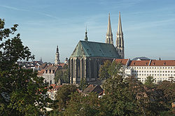
| 6 | Görlitz | Görlitz | 54,664 | 54,441 | 67.5 km2 | 809.5/km2 |
| 7 | Freiberg | Mittelsachsen | 40,103 | 39,825 | 48.3 km2 | 830.1/km2 |
| 8 | Pirna | Sächsische Schweiz-Osterzgebirge | 39,411 | 37,451 | 53.1 km2 | 742.8/km2 |
| 9 | Freital | Sächsische Schweiz-Osterzgebirge | 39,355 | 38,388 | 40.5 km2 | 972.7/km2 |
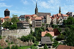
| 10 | Bautzen | Bautzen | 38,084 | 40,273 | 66.7 km2 | 571.2/km2 |
| 11 | Radebeul | Meissen | 33,497 | 33,201 | 26.1 km2 | 1,281/km2 |
| 12 | Hoyerswerda | Bautzen | 31,064 | 36,107 | 95.5 km2 | 327.0/km2 |
| 13 | Riesa | Meissen | 29,434 | 32,539 | 58.9 km2 | 499.6/km2 |
| 14 | Meissen | Meissen | 28,487 | 27,055 | 30.9 km2 | 921.3/km2 |
| 15 | Grimma | Leipzig | 27,639 | 29,271 | 218 km2 | 126.7/km2 |
| 16 | Delitzsch | Delitzsch | 25,816 | 25,361 | 85.9 km2 | 300.5/km2 |
| 17 | Zittau | Görlitz | 25,585 | 26,777 | 66.8 km2 | 383.3/km2 |
| 18 | Markkleeberg | Leipzig | 25,581 | 23,672 | 31.4 km2 | 812.6/km2 |
| 19 | Limbach-Oberfrohna | Zwickau | 23,708 | 24,721 | 50.2 km2 | 472.2/km2 |
| 20 | Döbeln | Döbeln | 23,488 | 24,485 | 91.7 km2 | 256.0/km2 |
| 21 | Glauchau | Zwickau | 21,821 | 23,578 | 51.6 km2 | 422.7/km2 |
| 22 | Werdau | Zwickau | 20,668 | 21,712 | 65.6 km2 | 315.0/km2 |
| 23 | Coswig | Meissen | 20,369 | 20,689 | 25.9 km2 | 787.1/km2 |
| 24 | Torgau | Torgau-Oschatz | 20,096 | 20,700 | 103 km2 | 195.4/km2 |
| 25 | Reichenbach im Vogtland | Vogtlandkreis | 20,001 | 22,399 | 34.5 km2 | 580.2/km2 |
| 26 | Aue-Bad Schlema | Erzgebirgskreis | 19,278 | 22,038 | 36.4 km2 | 529.2/km2 |
| 27 | Schkeuditz | Nordsachsen | 19,003 | 16,922 | 81.5 km2 | 233.3/km2 |
| 28 | Borna | Leipzig | 18,998 | 19,784 | 62.4 km2 | 304.2/km2 |
| 29 | Annaberg-Buchholz | Erzgebirgskreis | 18,942 | 21,105 | 28.1 km2 | 672.9/km2 |
| 30 | Radeberg | Bautzen | 18,724 | 18,039 | 29.8 km2 | 627.7/km2 |
| 31 | Crimmitschau | Zwickau | 18,718 | 20,078 | 61.1 km2 | 306.1/km2 |
| 32 | Großenhain | Meissen | 18,300 | 18,797 | 130 km2 | 140.4/km2 |
| 33 | Auerbach (Vogtland) | Vogtlandkreis | 17,732 | 19,604 | 55.5 km2 | 319.4/km2 |
| 34 | Kamenz | Bautzen | 17,282 | 17,808 | 98.3 km2 | 175.8/km2 |
| 35 | Heidenau | Sächsische Schweiz-Osterzgebirge | 16,753 | 15,953 | 11.1 km2 | 1,513/km2 |
| 36 | Marienberg | Erzgebirgskreis | 16,439 | 18,033 | 134 km2 | 123.1/km2 |
| 37 | Markranstädt | Leipzig | 16,182 | 14,763 | 58.5 km2 | 276.8/km2 |
| 38 | Eilenburg | Nordsachsen | 16,155 | 15,794 | 46.8 km2 | 344.9/km2 |
| 39 | Taucha | Nordsachsen | 15,978 | 14,128 | 33.2 km2 | 481.0/km2 |
| 40 | Schwarzenberg | Erzgebirgskreis | 15,917 | 18,109 | 46.3 km2 | 343.7/km2 |
| 41 | Wurzen | Leipzig | 15,902 | 16,928 | 69.0 km2 | 230.5/km2 |
| 42 | Weißwasser | Görlitz | 15,348 | 18,175 | 63.4 km2 | 242.0/km2 |
