List


The following table lists the 76 cities in North Rhine Westphalia with a population of at least 50,000 on 15 May 2022, as estimated by the Federal Statistical Office of Germany. [2] A city is displayed in bold if it is a state or federal capital.
- The city rank by population as of 15 May 2022, as estimated by the Federal Statistical Office of German [2]
- The city name [2]
- The name of the district (Landkreis) in which the city lies (some cities are districts on their own called urban districts) [2]
- The city population as of 15 May 2022, as estimated by the Federal Statistical Office of Germany [2]
- The city population as of 9 May 2011, as enumerated by the 2011 European Union census [3]
- The city land area as of 15 May 2022 [2]
- The city population density as of 15 May 2022 (residents per unit of land area) [2]
- Yearly population growth between 2011 and 2022
| 2022 rank | City | District | 2022 census | 2011 census | 2022 land area | 2022 pop. density | Annual growth (2011–2022) |
|---|---|---|---|---|---|---|---|
| 1 | Cologne | urban district | 1,017,355 | 1,005,775 | 405 km² | 2,512/km² | 0.10% |
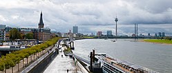
| 2 | Düsseldorf | urban district | 611,258 | 586,291 | 217 km² | 2,812/km² | 0.38% |
| 3 | Dortmund | urban district | 598,246 | 571,143 | 281 km² | 2,131/km² | 0.42% |
| 4 | Essen | urban district | 571,039 | 566,201 | 210 km² | 2,715/km² | 0.08% |
| 5 | Duisburg | urban district | 501,415 | 488,468 | 233 km² | 2,154/km² | 0.24% |
| 6 | Wuppertal | urban district | 356,768 | 342,661 | 168 km² | 2,119/km² | 0.37% |
| 7 | Bochum | urban district | 354,288 | 362,286 | 146 km² | 2,432/km² | -0.20% |
| 8 | Bielefeld | urban district | 330,072 | 326,870 | 259 km² | 1,275/km² | 0.09% |
| 9 | Bonn | urban district | 321,544 | 305,765 | 141 km² | 2,279/km² | 0.46% |
| 10 | Münster | urban district | 303,772 | 289,576 | 303 km² | 1,002/km² | 0.44% |
| 11 | Gelsenkirchen | urban district | 264,130 | 258,766 | 105 km² | 2,517/km² | 0.19% |
| 12 | Mönchengladbach | urban district | 264,089 | 255,188 | 170 km² | 1,549/km² | 0.31% |
| 13 | Aachen | Aachen | 261,178 | 236,420 | 161 km² | 1,624/km² | 0.91% |
| 14 | Krefeld | urban district | 230,666 | 222,247 | 138 km² | 1,674/km² | 0.34% |
| 15 | Oberhausen | urban district | 212,127 | 210,216 | 77.1 km² | 2,752/km² | 0.08% |
| 16 | Hagen | urban district | 189,614 | 187,944 | 160 km² | 1,182/km² | 0.08% |
| 17 | Hamm | urban district | 179,070 | 176,037 | 226 km² | 790.9/km² | 0.16% |
| 18 | Mülheim an der Ruhr | urban district | 171,435 | 166,865 | 91.3 km² | 1,878/km² | 0.25% |
| 19 | Leverkusen | urban district | 166,356 | 158,984 | 78.9 km² | 2,109/km² | 0.41% |
| 20 | Solingen | urban district | 164,621 | 155,265 | 89.5 km² | 1,839/km² | 0.53% |
| 21 | Paderborn | Paderborn | 155,516 | 142,365 | 180 km² | 866.0/km² | 0.81% |
| 22 | Herne | urban district | 155,446 | 155,160 | 51.4 km² | 3,023/km² | 0.02% |
| 23 | Neuss | Rhein-Kreis Neuss | 153,079 | 150,568 | 99.5 km² | 1,538/km² | 0.15% |
| 24 | Bottrop | urban district | 117,921 | 117,311 | 101 km² | 1,172/km² | 0.05% |
| 25 | Recklinghausen | Recklinghausen | 115,216 | 115,958 | 66.5 km² | 1,733/km² | -0.06% |
| 26 | Remscheid | urban district | 113,743 | 110,708 | 74.5 km² | 1,526/km² | 0.25% |
| 27 | Bergisch Gladbach | Rheinisch-Bergischer Kreis | 110,898 | 108,878 | 83.1 km² | 1,335/km² | 0.17% |
| 28 | Siegen | Siegen-Wittgenstein | 102,275 | 99,187 | 115 km² | 891.8/km² | 0.28% |
| 29 | Moers | Wesel | 100,465 | 104,009 | 67.7 km² | 1,484/km² | -0.31% |
| 30 | Gütersloh | Gütersloh | 99,344 | 94,172 | 112 km² | 886.8/km² | 0.49% |
| 31 | Düren | Düren | 94,149 | 88,789 | 85.0 km² | 1,108/km² | 0.53% |
| 32 | Iserlohn | Märkischer Kreis | 91,941 | 94,630 | 125 km² | 732.7/km² | -0.26% |
| 33 | Witten | Ennepe-Ruhr-Kreis | 91,735 | 96,382 | 72.4 km² | 1,267/km² | -0.45% |
| 34 | Ratingen | Mettmann | 88,425 | 86,967 | 88.7 km² | 996.5/km² | 0.15% |
| 35 | Marl | Recklinghausen | 85,684 | 84,782 | 87.8 km² | 976.5/km² | 0.10% |
| 36 | Lünen | Unna | 85,234 | 86,010 | 59.4 km² | 1,435/km² | -0.08% |
| 37 | Minden | Minden-Lübbecke | 83,743 | 80,121 | 101 km² | 828.2/km² | 0.40% |
| 38 | Velbert | Mettmann | 82,319 | 81,303 | 74.9 km² | 1,099/km² | 0.11% |
| 39 | Rheine | Steinfurt | 76,344 | 72,749 | 145 km² | 526.5/km² | 0.44% |
| 40 | Viersen | Viersen | 76,146 | 74,941 | 91.1 km² | 835.9/km² | 0.14% |
| 41 | Gladbeck | Recklinghausen | 75,515 | 73,974 | 36.0 km² | 2,100/km² | 0.19% |
| 42 | Troisdorf | Rhein-Sieg-Kreis | 75,335 | 72,408 | 62.0 km² | 1,215/km² | 0.36% |
| 43 | Arnsberg | Hochsauerlandkreis | 74,861 | 74,383 | 194 km² | 386.4/km² | 0.06% |
| 44 | Detmold | Lippe | 74,486 | 73,743 | 129 km² | 575.7/km² | 0.09% |
| 45 | Dorsten | Recklinghausen | 74,257 | 76,860 | 171 km² | 433.5/km² | -0.31% |
| 46 | Castrop-Rauxel | Recklinghausen | 72,839 | 74,629 | 51.7 km² | 1,409/km² | -0.22% |
| 47 | Bocholt | Borken | 71,985 | 71,256 | 119 km² | 602.9/km² | 0.09% |
| 48 | Lüdenscheid | Märkischer Kreis | 71,688 | 73,762 | 87.0 km² | 823.8/km² | -0.26% |
| 49 | Lippstadt | Soest | 68,100 | 65,886 | 114 km² | 599.0/km² | 0.30% |
| 50 | Herford | Herford | 66,985 | 65,213 | 79.2 km² | 846.3/km² | 0.24% |
| 51 | Dinslaken | Wesel | 66,606 | 67,853 | 47.7 km² | 1,398/km² | -0.17% |
| 52 | Kerpen | Rhein-Erft-Kreis | 65,763 | 63,273 | 114 km² | 577.1/km² | 0.35% |
| 53 | Grevenbroich | Rhein-Kreis Neuss | 65,230 | 61,741 | 102 km² | 636.9/km² | 0.50% |
| 54 | Dormagen | Rhein-Kreis Neuss | 64,259 | 62,208 | 85.5 km² | 751.6/km² | 0.29% |
| 55 | Bergheim | Rhein-Erft-Kreis | 61,449 | 58,922 | 96.3 km² | 637.8/km² | 0.38% |
| 56 | Hürth | Rhein-Erft-Kreis | 61,209 | 55,082 | 51.2 km² | 1,195/km² | 0.96% |
| 57 | Herten | Recklinghausen | 61,062 | 61,505 | 37.3 km² | 1,636/km² | -0.07% |
| 58 | Wesel | Wesel | 59,988 | 60,335 | 123 km² | 489.5/km² | -0.05% |
| 59 | Langenfeld, Rhineland | Mettmann | 59,650 | 56,829 | 41.2 km² | 1,450/km² | 0.44% |
| 60 | Unna | Unna | 59,515 | 59,149 | 88.6 km² | 672.0/km² | 0.06% |
| 61 | Euskirchen | Euskirchen | 58,697 | 55,414 | 139 km² | 420.8/km² | 0.52% |
| 62 | Stolberg, Rhineland | Aachen | 57,165 | 56,206 | 98.5 km² | 580.5/km² | 0.15% |
| 63 | Eschweiler | Aachen | 57,093 | 54,671 | 75.8 km² | 753.7/km² | 0.39% |
| 64 | Meerbusch | Rhein-Kreis Neuss | 56,999 | 54,313 | 64.4 km² | 885.1/km² | 0.44% |
| 65 | Sankt Augustin | Rhein-Sieg-Kreis | 55,985 | 53,850 | 34.2 km² | 1,636/km² | 0.35% |
| 66 | Pulheim | Rhein-Erft-Kreis | 55,199 | 52,929 | 72.2 km² | 765.1/km² | 0.38% |
| 67 | Hilden | Mettmann | 55,085 | 54,390 | 26.0 km² | 2,123/km² | 0.12% |
| 68 | Bad Salzuflen | Lippe | 53,889 | 52,285 | 100 km² | 538.6/km² | 0.27% |
| 69 | Hattingen | Ennepe-Ruhr-Kreis | 52,758 | 54,253 | 71.7 km² | 736.2/km² | -0.25% |
| 70 | Ahlen | Warendorf | 52,669 | 52,280 | 123 km² | 427.8/km² | 0.07% |
| 71 | Menden, Sauerland | Märkischer Kreis | 52,434 | 54,495 | 86.1 km² | 609.0/km² | -0.35% |
| 72 | Kleve | Kleve | 52,208 | 47,438 | 97.8 km² | 534.0/km² | 0.87% |
| 73 | Frechen | Rhein-Erft-Kreis | 51,863 | 49,657 | 45.1 km² | 1,151/km² | 0.40% |
| 74 | Gummersbach | Oberbergischer Kreis | 51,327 | 49,951 | 95.4 km² | 538.0/km² | 0.25% |
| 75 | Ibbenbüren | Steinfurt | 50,618 | 50,569 | 109 km² | 464.9/km² | 0.01% |
| 75 | Bad Oeynhausen | Minden-Lübbecke | 50,394 | 48,623 | 64.8 km² | 777.3/km² | 0.33% |
