List of cities in Mecklenburg-Western Pomerania

Last updated

Rostock 2018 - Petrikirche - Rostock.jpg
Rostock

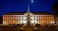
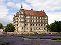
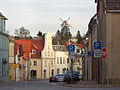
In the German state of Mecklenburg-Western Pomerania (German: Mecklenburg-Vorpommern) there are 84 officially recognised towns and cities.

Contents

In addition there are the two district-free cities of Rostock and Schwerin.

District capitals

Current districts of Mecklenburg-Vorpommern, including capitals Mecklenburg-Vorpommern districts 2011 colored labeled district capitals.svg
Current districts of Mecklenburg-Vorpommern, including capitals

There are 6 district capitals in the state of Mecklenburg-Vorpommern:

Table

You can sort the table by clicking one of the upper columns. Data from 2017 is included for 21 cities and communes in Mecklenburg-Vorpommern with a population of at least 10,000 on December 31, 2017, as estimated by the Federal Statistical Office of Germany.

City/TownCoat of ArmsDistrictfirst mentionedTown privilegesArea in km2Pop. at Dec. 31, 2013 [1] 2017 est [2] 2017 pop. density [2] Image
Altentreptow Stadtwappen Altentreptow.PNG Mecklenburgische Seenplatte 1245124552,835188 Altentreptow - Rathaus mit Pfarrkirche St. Petri.JPG
Anklam Wappen Hansestadt Anklam V2.svg Vorpommern-Greifswald 1243126456,571217712,521220.9/km² Anklam Peene Fussgangerbrucke.JPG
Bad Doberan Wappen Bad Doberan.png Rostock 1177187932,741275212,290374.1/km² Bad Doberan Munster 02 2012-05-08.jpg
Bad Sülze Wappen Bad Sulze.png Vorpommern-Rügen 12431257 [3] 26,371758 Bad Sulze Muhle.jpg
Barth DEU Barth COA.svg Vorpommern-Rügen 1255125540,838692 Barth, houses on the Lange Strasse.jpg
Bergen auf Rügen Wappen bergen auf ruegen.svg Vorpommern-Rügen 1314161351,421364713,555263.3/km² Bergen Markt 2.jpg
Boizenburg/Elbe BoizenburgElbe-Wappen2.svg Ludwigslust-Parchim 1158126747,261068910,630224.1/km² Boizenburg Graben um die Innenstadt.jpg
Brüel Wappen Brueel.svg Ludwigslust-Parchim 12221340 [4] 27,302602 Roter See - Bruel.jpg
Burg Stargard Wappen Burg Stargard.svg Mecklenburgische Seenplatte 12441259 [5] 61,685323 Burg Stargard Burg 2011-03-07 014verzerrt 3.JPG
Bützow Butzow-Wappen.PNG Rostock 1171123639,707970 Buetzow Rathaus 2009-03-04 034.jpg
Crivitz Crivitz Wappen1.svg Ludwigslust-Parchim 1302130275,484770 Crivitz Kirche 2008-07-26 003.jpg
Dargun DEU Dargun COA.svg Mecklenburgische Seenplatte 11721938117,154334 Dargun Kloster und Schlossruine.jpg
Dassow Dassow-Wappen.PNG Nordwestmecklenburg 1219193866,544065 DassowLutgenhof.JPG
Demmin Stadtwappen Demmin.svg Mecklenburgische Seenplatte 10701236 [6] 81,561033710,865132.4/km² Demmin Kahldenbruecke 01.jpg
Dömitz Wappen Doemitz.svg Ludwigslust-Parchim 1235125960,382991 Domitz2.JPG
Eggesin DEU Eggesin COA.svg Vorpommern-Greifswald 1216196688,014700 Eggesin Fachwerkkirche.JPG
Franzburg Wappen Franzburg.PNG Vorpommern-Rügen 1231158715,191367 KlostergartenFranzburg.JPG
Friedland Wappen Friedland.PNG Mecklenburgische Seenplatte 1244124497,646423 Friedland Neubrandenburger Tor 2011-01-28 181.JPG
Gadebusch Gadebusch Wappen.PNG Nordwestmecklenburg 1194122547,655417 Rathaus Gadebusch.jpg
Garz/Rügen Garz-Wappen.PNG Vorpommern-Rügen 1207131965,442254 Gross Schoritz EMArndt Geburtshaus.jpg
Gnoien Gnoien-Wappen.PNG Rostock 1257129041,082865 Gnoien Haus 2009-08-20 093.jpg
Goldberg DEU Goldberg (Mecklenburg) COA.svg Ludwigslust-Parchim 1227124864,853368 Goldberg town hall.jpg
Grabow Grabow Wappen1.svg Ludwigslust-Parchim 1186125247,685500 Grabow Rathaus.jpg
Greifswald DEU Greifswald COA.svg Vorpommern-Greifswald 1241125050,505933258,8861,159/km² Rubenowplatz Greifswald.jpg
Grevesmühlen Wappen der Stadt Grevesmuhlen.svg Nordwestmecklenburg 1226126152,321044010,410198.7/km² Galeriehollander Grevesmuhlen.jpg
Grimmen Wappen Grimmen.svg Vorpommern-Rügen 1267128750,299260 Grimmen-wasserturm.jpg
Güstrow Wappen Gustrow.svg Rostock 1222122870,862902629,429414.0/km² GustrowSchloss&Park.JPG
Gützkow DEU Gutzkow COA.svg Vorpommern-Greifswald 1301135342,682923 Guetzkow Ostvorpommern Rathaus.jpg
Hagenow Hagenow Wappen1.svg Ludwigslust-Parchim 1190 [7] 175467,441214611,968177.2/km² Hagenow Stadtkirche 2007-05-28 019.jpg
Jarmen DEU Jarmen COA.svg Vorpommern-Greifswald 1269172030,642922 Jarmen Kornspeicher am Hafen.JPG
Klütz Klutzer Wappen.PNG Nordwestmecklenburg 1188193844,123067 Schloss Bothmer.jpg
Krakow am See Wappen Krakow am See.svg Rostock 1298146787,073422 KrakowAmSeePanorama.JPG
Kröpelin Wappen Kropelin.svg Rostock 1177124967,264811 Kropelin 2.jpg
Kühlungsborn Wappen Kuhlungsborn.svg Rostock 1938 [8] 193816,167964 Strandpromenade kuehlungsborn.JPG
Laage Laage-Wappen.PNG Rostock 1216133681,276450 Rathaus Laage.JPG
Lassan Wappen Lassan.svg Vorpommern-Greifswald 1136127427,981456 Peenestrom Wolgast.jpg
Loitz Wappen Loitz.svg Vorpommern-Greifswald 1242124289,534233 Loitz Wasserbahnhof.jpg
Lübtheen Lubtheen Wappen1.svg Ludwigslust-Parchim 13631938119,694686 Quassel Schloss 2008-05-28 144.jpg
Lübz DE-MV 13-0-76-089 Luebz COA.png Ludwigslust-Parchim 13081456 [9] 49,126167 Lubz Germany alteramstturm.jpg
Ludwigslust Ludwigslust Wappen1.svg Ludwigslust-Parchim 1754187678,301207012,267195.7/km² SchlossLudwigslust.jpg
Malchin Stadtwappen Malchin.PNG Mecklenburgische Seenplatte 1236123694,507282 Kalensches Tor 2 Malchin.JPG
Malchow Malchow-Wappen.PNG Mecklenburgische Seenplatte 1147123544,606512 Malchow-orgelmuseum.jpg
Marlow Wappen Marlow.PNG Vorpommern-Rügen 12101459139,814665 Marlow - Blick zum Rathaus - geograph.org.uk - 8739.jpg
Mirow Wappen Mirow.svg Mecklenburgische Seenplatte 1226191984,083890 Mirow Schloss.jpg
Neubrandenburg DEU Neubrandenburg COA.svg Mecklenburgische Seenplatte 1248124885,656304364,259746.2/km² Tollensesee-02-06-2008-187.jpg
Neubukow Wappen Neubukow.svg Rostock 1260143524,993973 Neubukow Markt Kirche Rathaus 2012-01-26 034.JPG
Neukalen Neukalen-Wappen.PNG Mecklenburgische Seenplatte 1174 [10] 1253 [11] 46,841744 Neukalen-rathaus.jpg
Neukloster Neukloster-Wappen.PNG Nordwestmecklenburg 1219193827,494015 Neukloster Kloster 2.jpg
Neustadt-Glewe Wappen Neustadt-Glewe.svg Ludwigslust-Parchim 1248124893,916969 Neustadt-Glewe Alte Burg 2007-05-05 021.jpg
Neustrelitz DEU Neustrelitz 1794 COA.svg Mecklenburgische Seenplatte 12781733138,152010320,135144.0/km² Schlosskirche (Neustrelitz) Front.jpg
Parchim Parchim Wappen1.svg Ludwigslust-Parchim 11701226106,611746718,074144.8/km² Parchim Kaiserl Postamt.jpg
Pasewalk Wappen Pasewalk.svg Vorpommern-Greifswald 11211251 [12] 54,99984110,281186.2/km² Pasewalk Amtsgericht.jpg
Penkun Wappen Penkun.png Vorpommern-Greifswald 1240126978,631773 Penkun Schloss 2011-08-19.jpg
Penzlin Wappen der Stadt Penzlin.svg Mecklenburgische Seenplatte 11701263115,474134 Burg Penzlin.jpg
Plau am See Plau am See Wappen1.svg Ludwigslust-Parchim 12351226115,996091 Plau am See 20080510.jpg
Putbus Wappen Putbus.svg Vorpommern-Rügen 1810181066,604499 Putbus (2011-05-21) 3.JPG
Rehna DEU Rehna COA.svg Nordwestmecklenburg 1230179122,523598 Luftaufnahme kloster rehna a.jpg
Rerik Wappen Rerik.svg Rostock 1238 [13] 1938 [14] 33,452166 Rerik Seebruecke.jpg
Ribnitz-Damgarten Wappen Ribnitz-Damgarten 1999.png Vorpommern-Rügen 19501950122,201545115,197123.7/km² Ribnitz Damgarten Rostocker Tor.jpg
Richtenberg Wappen Richtenberg.svg Vorpommern-Rügen 1231129715,631319 2011-04-22 Franzburg-Richtenberger-See Rundgang DSCN0092.JPG
Röbel/Müritz Wappen der Stadt Robel-Muritz.png Mecklenburgische Seenplatte 1226126130,175055 Stadtkern von Robel Muritz.jpg
Rostock Rostock Wappen.svg Kreisfreie Stadt 11611218181,44208400208,4091,149/km² Warnemunder Mole.jpg
Sassnitz Wappen Sassnitz.svg Vorpommern-Rügen 1906 [15] 195746,459064 Ruegen, Sassnitz, Haengebruecke zum Hafen 3.jpg
Schönberg Wappen Schonberg.PNG Nordwestmecklenburg 1219182238,094676 OberteichSchonberg04.JPG
Schwaan Wappen Schwaan.svg Rostock 1276127638,285037 Schwaan Rathaus Kirche 2009-08-04 073.jpg
Schwerin (state capital) DEU Schwerin COA.svg Kreisfreie Stadt 1018 [16] 1160130,469574095,797734.0/km² Schwerin Castle Aerial View Island Luftbild Schweriner Schloss Insel See.jpg
Stavenhagen Wappen Stavenhagen.PNG Mecklenburgische Seenplatte 1230126440,845687 Stavenhagen Schloss Park Front barock.JPG
Sternberg GER Sternberg COA.svg Ludwigslust-Parchim 1248124867,674031 Sternberg Kirche Stadtmauer 2009-03-04 009.jpg
Stralsund Wappen Stralsund.svg Vorpommern-Rügen 1234123438,975917159,5171,099/km² Stralsund (2013-07-23), by Klugschnacker in Wikipedia (9).JPG
Strasburg (Uckermark) Wappen Strasburg (Uckermark).svg Vorpommern-Greifswald 1250 [17] 1250 [18] 86,834471 Strasburg Uckermark01.jpg
Tessin Wappen Tessin1.svg Rostock 1121134324,523926 Tessin Kirche 3.jpg
Teterow Teterow Wappen.PNG Rostock 1215 [19] 1272 [20] 47,178310 Teterow Bergring Wegweiser.jpg
Torgelow DEU Torgelow COA.svg Vorpommern-Greifswald 1281194549,468929 Torgelow evangelische Kirche 1.jpg
Tribsees Wappen Tribsees.svg Vorpommern-Rügen 1136128554,752623 Trebel-bei-Tribsees-02-07-2008-241.JPG
Ueckermünde Wappen Ueckermuende.png Vorpommern-Greifswald 1178126084,698457 Uede strand.jpg
Usedom DEU Usedom COA.svg Vorpommern-Greifswald 1128129838,571741 Maison du Mecklenburg-Vorpommern.jpg
Waren (Müritz) DEU Waren (Mueritz) COA.svg Mecklenburgische Seenplatte 1260 [21] 1260 [22] 158,392111621,210133.0/km² Mueritzeum in Waren Mueritz.JPG
Warin Warin-Wappen.PNG Nordwestmecklenburg 1178130644,263191 Warin Kirche 2009-04-16 063.jpg
Wesenberg Wappen Wesenberg.svg Mecklenburgische Seenplatte 1252125289,433057 Wesenberg Burg 1.jpg
Wismar Wappen Wismar.svg Nordwestmecklenburg 1147122641,364278542,9061,028/km² Wismarer Wasserkunst.jpg
Wittenburg Wittenburg Wappen1.svg Ludwigslust-Parchim 1154123046,256355 Wittenburg Rathaus 2012-10-30 045.JPG
Woldegk Woldegk-Wappen.PNG Mecklenburgische Seenplatte 1236 [23] 1298103,704241 Woldegk Erdhollander.JPG
Wolgast Wappen Wolgast.png Vorpommern-Greifswald 1123125761,521189012,084195.7/km² Wolgast11.JPG
Zarrentin am Schaalsee Wappen Zarrentin.svg Ludwigslust-Parchim 1139193891,895421 Zarrentin convent building.jpg

Former cities on the current territory of Mecklenburg-Vorpommern

CityCoat of ArmsDistrictfirst mentionedCity
from-until
Altkalen N/A Rostock 11741253–1281Town privileges given to Neukalen
Damgarten Wappen Damgarten.png Vorpommern-Rügen 12581258–19501950 fusion with Ribnitz to Ribnitz-Damgarten
Feldberg DEU Feldberger Seenlandschaft COA.svg Mecklenburgische Seenplatte 12561919–1999on June 13, 1999 incorporated in Feldberger Seenlandschaft
Kummerow Wappen der Gemeinde Kummerow (am See).jpg Mecklenburgische Seenplatte 12221255–1671after depopulation in 30-years-war
Ribnitz Wappen Ribnitz.png Vorpommern-Rügen 12101233–19501950 fusion with Damgarten to Ribnitz-Damgarten
Strelitz-Alt DEU Neustrelitz 1794 COA.svg Mecklenburgische Seenplatte 12781349–19311931 incorporation into Neustrelitz

Sources

  1. MV Stats: Census results
  2. 1 2 "Homepage - Federal Statistical Office (Destatis)". www.destatis.de.
  3. Town privileges between 1255 and 1260
  4. 1377 according to other sources
  5. 1259 is the date for the town of Stargard; the "Burg" area with the castle was incorporated in 1929, the town renamed to Burg Stargard.
  6. Town privileges given between 1236 and 1249
  7. Town privileges given between 1190 and 1195
  8. Fusion of the former villages/seaside resorts of Fulgen, Brunshaupten and Arendsee
  9. exact date not really clear, town privileges received definitely until 1506
  10. Altkalen
  11. 1281 new foundation 10 km further south
  12. unsettled date, definite town privileges at 1276
  13. for the village of Alt Gaarz
  14. for renaming of Alt Gaarz to Rerik
  15. merging of the fishing villages Saßnitz and Crampas
  16. around 1018
  17. around 1250
  18. around 1250
  19. Construction of the church started
  20. probably in 1235 already, unclear
  21. between 1260 and 1270
  22. between 1260 and 1270
  23. between 1236 and 1250

Related Research Articles

<span class="mw-page-title-main">Mecklenburg</span> Historical region of Germany

Mecklenburg is a historical region in northern Germany comprising the western and larger part of the federal-state Mecklenburg-Western Pomerania. The largest cities of the region are Rostock, Schwerin, Neubrandenburg, Wismar and Güstrow.

<span class="mw-page-title-main">Mecklenburg-Vorpommern</span> State in Germany

Mecklenburg-Vorpommern ; also known by its anglicized name Mecklenburg–Western Pomerania, is a state in the north-east of Germany. Of the country's sixteen states, Mecklenburg-Vorpommern ranks 14th in population; it covers an area of 23,213 km2 (8,963 sq mi), making it the sixth largest German state in area; and it is 16th in population density. Schwerin is the state capital and Rostock is the largest city. Other major cities include Neubrandenburg, Stralsund, Greifswald, Wismar, and Güstrow. It was named after the two regions of Mecklenburg and Vorpommern, and its name means the "nearer part of Pomerania", with the rest now lying in Poland.

Nordwestmecklenburg is a Kreis (district) in the north-western part of Mecklenburg-Vorpommern, Germany. It is situated on the coast of the Baltic Sea and borders on Schleswig-Holstein to the west. Neighboring districts are Rostock, Ludwigslust-Parchim and the district-free city Schwerin, and the district Lauenburg and the district-free city Lübeck in Schleswig-Holstein. The district seat is the town Wismar.

<span class="mw-page-title-main">Ludwigslust (district)</span> District in Mecklenburg-Western Pomerania, Germany

Ludwigslust is a former Kreis (district) in the southwest of Mecklenburg-Vorpommern, Germany. Neighboring districts were Nordwestmecklenburg, the district-free city Schwerin, Parchim, Prignitz in Brandenburg, Lüchow-Dannenberg and Lüneburg in Lower Saxony and the district Lauenburg in Schleswig-Holstein. The district was disbanded at the district reform of September 2011. Its territory has been part of the Ludwigslust-Parchim district since.

<span class="mw-page-title-main">Hamburg Metropolitan Region</span> Place in Germany

The Hamburg Metropolitan Region is a metropolitan area centred around the city of Hamburg in northern Germany, consisting of eight districts in the federal state of Lower Saxony, six districts in the state of Schleswig-Holstein and two districts in the state of Mecklenburg-Vorpommern along with the city-state of Hamburg itself. It covers an area of roughly 26,000 square kilometres (10,000 sq mi) and is home to more than 5.1 million inhabitants.

<span class="mw-page-title-main">Burg Stargard</span> Town in Mecklenburg-Vorpommern, Germany

Burg Stargard is a small town in the Mecklenburgische Seenplatte district, in Mecklenburg-Vorpommern, Germany. It is situated 8 kilometres (5.0 mi) southeast of Neubrandenburg.

Mecklenburgische Seenplatte is a district in the southeast of Mecklenburg-Vorpommern, Germany. It is bounded by the districts Ludwigslust-Parchim, Rostock (district), Vorpommern-Rügen, Vorpommern-Greifswald, and the state Brandenburg to the south. The district covers the largest area of all German districts and more than doubles the area of the state Saarland. The district seat is the town Neubrandenburg.

Vorpommern-Rügen is a district in the north of Mecklenburg-Vorpommern, Germany. It is bounded by the Baltic Sea and the districts Vorpommern-Greifswald, Mecklenburgische Seenplatte and Rostock. The district seat is the Hanseatic city of Stralsund.

<span class="mw-page-title-main">Vorpommern-Greifswald</span> District in Mecklenburg-Western Pomerania, Germany

Vorpommern-Greifswald is a district in the east of Mecklenburg-Vorpommern, Germany. It is bounded by the districts of Mecklenburgische Seenplatte and Vorpommern-Rügen, the Baltic Sea, Poland and the state of Brandenburg. The district seat is the University and Hanseatic City of Greifswald. A lake called Berliner See is found in the district.

Ludwigslust-Parchim is a district in the west of Mecklenburg-Vorpommern, Germany. The district seat is Parchim, a branch office of the administration is located in Ludwigslust.

Rostock is a district in the north of Mecklenburg-Vorpommern, Germany. It is bounded by the district Nordwestmecklenburg, the Baltic Sea, the district-free city Rostock and the districts Vorpommern-Rügen, Mecklenburgische Seenplatte and Ludwigslust-Parchim. The district seat is the town Güstrow.

<span class="mw-page-title-main">Western Pomerania</span> Historical region in present-day northeast Germany

Historical Western Pomerania, also called Cispomerania,Fore Pomerania, Front Pomerania or Hither Pomerania, is the western extremity of the historic region of Pomerania forming the southern coast of the Baltic Sea. Western Pomerania's boundaries have changed through the centuries as it belonged to various countries such as Poland, the Duchy of Pomerania, Sweden, Denmark, as well as Prussia which incorporated it as the Province of Pomerania.

<span class="mw-page-title-main">Ludwigslust-Parchim II – Nordwestmecklenburg II – Landkreis Rostock I</span> Federal electoral district of Germany

Ludwigslust-Parchim II – Nordwestmecklenburg II – Landkreis Rostock I is an electoral constituency represented in the Bundestag. It elects one member via first-past-the-post voting. Under the current constituency numbering system, it is designated as constituency 13. It is located in western Mecklenburg-Vorpommern, comprising the eastern parts of the districts of Ludwigslust-Parchim and Nordwestmecklenburg, and the northwestern part of Landkreis Rostock.

<span class="mw-page-title-main">Mecklenburgische Seenplatte II – Landkreis Rostock III</span> Federal electoral district of Germany

Mecklenburgische Seenplatte II – Landkreis Rostock III is an electoral constituency represented in the Bundestag. It elects one member via first-past-the-post voting. Under the current constituency numbering system, it is designated as constituency 17. It is located in central Mecklenburg-Vorpommern, comprising the most of the Mecklenburgische Seenplatte district and the southern part of the Landkreis Rostock district.

<span class="mw-page-title-main">Greifswald – Demmin – Ostvorpommern</span> Defunct federal electoral district of Germany

Greifswald – Demmin – Ostvorpommern was a constituency in Mecklenburg-Vorpommern for the elections to the German Bundestag from 1990 to 2013.