List


The following table lists the 75 cities and municipalities in Bavaria with a population of at least 20,000 on May 15, 2022, as estimated by the Federal Statistical Office of Germany. [2] A city is displayed in bold if it is a state or federal capital.
- The city rank by population as of May 15, 2022, as enumerated by the 2022 German census [2] [3]
- The city name [2]
- The name of the district (Landkreis) in which the city lies (some cities are districts on their own called urban districts) [2]
- The city population as of May 15, 2022, as enumerated by the 2022 German census [2]
- The city population as of May 9, 2011, as enumerated by the 2011 European Union census [4]
- The city land area as of May 15, 2022 [2]
- The city population density as of May 15, 2022 (residents per unit of land area) [2]
- Yearly population growth since 2011
| 2022 rank | City | District | 2022 census | 2011 census | 2022 land area | 2022 pop. density | Growth (2011–2022) |
|---|---|---|---|---|---|---|---|
| 1 | Munich | urban district | 1,478,638 | 1,348,335 | 311 km2 | 4,759/km2 | +0.84% |
| 2 | Nuremberg | urban district | 522,554 | 486,314 | 186 km2 | 2,803/km2 | +0.65% |
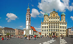
| 3 | Augsburg | urban district | 294,647 | 267,767 | 147 km2 | 2,006/km2 | +0.87% |
| 4 | Regensburg | urban district | 145,901 | 135,403 | 80.9 km2 | 1,894/km2 | +0.68% |
| 5 | Ingolstadt | urban district | 136,468 | 124,927 | 133 km2 | 1,023/km2 | +0.81% |
| 6 | Würzburg | urban district | 131,316 | 124,297 | 87.6 km2 | 1,499/km2 | +0.50% |
| 7 | Fürth | urban district | 130,126 | 115,613 | 63.4 km2 | 2,054/km2 | +1.08% |
| 8 | Erlangen | urban district | 112,220 | 103,719 | 77.0 km2 | 1,458/km2 | +0.72% |
| 9 | Bamberg | urban district | 72,764 | 70,635 | 54.6 km2 | 1,332/km2 | +1.34% |
| 10 | Bayreuth | urban district | 72,289 | 70,808 | 66.9 km2 | 1,081/km2 | +0.19% |
| 11 | Aschaffenburg | urban district | 71,692 | 67,359 | 62.5 km2 | 1,148/km2 | +0.57% |
| 12 | Landshut | urban district | 67,880 | 63,544 | 65.8 km2 | 1,031/km2 | +0.60% |
| 13 | Kempten (Allgäu) | urban district | 65,050 | 64,078 | 63.3 km2 | 1,028/km2 | +0.14% |
| 14 | Rosenheim | urban district | 63,284 | 59,329 | 37.2 km2 | 1,700/km2 | +0.59% |
| 15 | Neu-Ulm | Neu-Ulm (district) | 60,597 | 52,706 | 81.0 km2 | 749/km2 | +1.27% |
| 16 | Schweinfurt | urban district | 53,242 | 52,143 | 35.7 km2 | 1,491/km2 | +0.19% |
| 17 | Passau | urban district | 51,907 | 48,649 | 69.6 km2 | 746/km2 | +0.59% |
| 18 | Freising | Freising (district) | 47,727 | 44,578 | 88.6 km2 | 539/km2 | +0.62% |
| 19 | Straubing | urban district | 46,167 | 44,488 | 67.6 km2 | 683/km2 | +0.34% |
| 20 | Dachau | Dachau (district) | 45,965 | 43,402 | 35.0 km2 | 1,315/km2 | +0.52% |
| 21 | Hof | urban district | 45,598 | 44,759 | 58.0 km2 | 786/km2 | +0.17% |
| 22 | Kaufbeuren | urban district | 45,186 | 41,550 | 40.0 km2 | 1,129/km2 | +0.76% |
| 23 | Memmingen | urban district | 43,300 | 41,241 | 70.1 km2 | 618/km2 | +0.44% |
| 24 | Weiden in der Oberpfalz | urban district | 42,047 | 41,746 | 70.6 km2 | 596/km2 | +0.07% |
| 25 | Amberg | urban district | 41,876 | 41,911 | 50.1 km2 | 835/km2 | –0.01% |
| 26 | Schwabach | urban district | 40,865 | 38,469 | 40.8 km2 | 1,002/km2 | +0.55% |
| 27 | Coburg | urban district | 40,296 | 41,023 | 48.3 km2 | 835/km2 | –0.16% |
| 28 | Neumarkt in der Oberpfalz | Neumarkt (district) | 40,232 | 38,362 | 79.0 km2 | 509/km2 | +0.43% |
| 29 | Germering | Fürstenfeldbruck (district) | 39,897 | 37,724 | 21.6 km2 | 1,846/km2 | +0.51% |
| 30 | Ansbach | urban district | 39,601 | 39,491 | 99.9 km2 | 396/km2 | +0.03% |
| 31 | Erding | Erding (district) | 36,235 | 33,528 | 54.6 km2 | 664/km2 | +0.71% |
| 32 | Fürstenfeldbruck | Fürstenfeldbruck (district) | 35,844 | 33,379 | 32.5 km2 | 1,102/km2 | +0.65% |
| 33 | Deggendorf | Deggendorf (district) | 33,563 | 31,491 | 77.1 km2 | 435/km2 | +0.58% |
| 34 | Forchheim | Forchheim (district) | 32,041 | 30,329 | 44.5 km2 | 721/km2 | +0.50% |
| 35 | Neuburg an der Donau | Neuburg-Schrobenhausen | 29,629 | 27,733 | 81.3 km2 | 365/km2 | +0.60% |
| 36 | Friedberg | Aichach-Friedberg | 29,595 | 28,640 | 81.3 km2 | 364/km2 | +0.30% |
| 37 | Schwandorf | Schwandorf (district) | 29,096 | 27,556 | 124 km2 | 235/km2 | +0.49% |
| 38 | Landsberg am Lech | Landsberg (district) | 28,441 | 27,324 | 57.9 km2 | 491/km2 | +0.36% |
| 39 | Garmisch-Partenkirchen | Garmisch (district) | 28,173 | 25,581 | 206 km2 | 137/km2 | +0.88% |
| 40 | Unterschleißheim | Munich (district) | 28,114 | 25,872 | 14.9 km2 | 1,930/km2 | +0.76% |
| 41 | Königsbrunn | Augsburg (district) | 27,726 | 26,997 | 18.4 km2 | 1,507/km2 | +0.24% |
| 42 | Olching | Fürstenfeldbruck (district) | 27,317 | 24,751 | 29.9 km2 | 913/km2 | +0.90% |
| 43 | Zirndorf | Fürth (district) | 26,234 | 24,752 | 28.8 km2 | 911/km2 | +0.53% |
| 44 | Kulmbach | Kulmbach (district) | 26,159 | 26,678 | 92.8 km2 | 282/km2 | –0.18% |
| 45 | Unterhaching | Munich (district) | 26,073 | 22,298 | 10.4 km2 | 2,514/km2 | +1.43% |
| 46 | Lauf an der Pegnitz | Nürnberger Land | 26,019 | 25,629 | 59.8 km2 | 435/km2 | +0.14% |
| 47 | Geretsried | Bad Tölz-Wolfratshausen | 25,705 | 23,042 | 24.6 km2 | 1,045/km2 | +1.00% |
| 48 | Pfaffenhofen an der Ilm | Pfaffenhofen (district) | 25,700 | 23,603 | 92.6 km2 | 277/km2 | +0.78% |
| 49 | Lindau (Bodensee) | Lindau (district) | 25,394 | 24,491 | 33.1 km2 | 768/km2 | +0.33% |
| 50 | Waldkraiburg | Mühldorf (district) | 25,382 | 21,435 | 21.6 km2 | 1,177/km2 | +1.55% |
| 51 | Roth | Roth (district) | 25,281 | 24,348 | 96.3 km2 | 263/km2 | +0.34% |
| 52 | Vaterstetten | Ebersberg (district) | 24,250 | 21,069 | 34.1 km2 | 712/km2 | +1.28% |
| 53 | Starnberg | Starnberg (district) | 24,168 | 22,165 | 61.9 km2 | 391/km2 | +0.79% |
| 54 | Herzogenaurach | Erlangen-Höchstadt | 23,750 | 22,214 | 47.6 km2 | 4899/km2 | +0.61% |
| 55 | Senden | Neu-Ulm (district) | 23,237 | 21,560 | 25.2 km2 | 922/km2 | +0.68% |
| 56 | Gersthofen | Augsburg (district) | 22,972 | 20,743 | 34.0 km2 | 675/km2 | +0.93% |
| 57 | Bad Kissingen | Bad Kissingen (district) | 22,924 | 20,993 | 69.9 km2 | 328/km2 | +0.80% |
| 58 | Weilheim in Oberbayern | Weilheim-Schongau | 22,720 | 21,149 | 55.5 km2 | 409/km2 | +0.65% |
| 59 | Ottobrunn | Munich (district) | 22,311 | 20,082 | 5.2 km2 | 4,266/km2 | +0.96% |
| 60 | Neusäß | Augsburg (district) | 22,178 | 21,052 | 25.2 km2 | 879/km2 | +0.47% |
| 61 | Kitzingen | Kitzingen (district) | 21,982 | 20,237 | 47.0 km2 | 468/km2 | +0.75% |
| 62 | Mühldorf am Inn | Mühldorf am Inn (district) | 21,917 | 16,807 | 29.4 km2 | 684.0/km2 | +2.44% |
| 63 | Gauting | Starnberg (district) | 21,583 | 19,294 | 55.5 km2 | 389/km2 | +1.02% |
| 64 | Haar | Munich (district) | 21,427 | 19,231 | 12.9 km2 | 1,661/km2 | +0.99% |
| 65 | Sonthofen | Oberallgäu | 21,381 | 21,105 | 46.5 km2 | 459/km2 | +0.12% |
| 66 | Aichach | Aichach-Friedberg | 21,328 | 20,247 | 92.8 km2 | 230/km2 | +0.47% |
| 67 | Günzburg | Günzburg (district) | 21,172 | 19,436 | 55.4 km2 | 382/km2 | +0.78% |
| 68 | Karlsfeld | Dachau (district) | 21,168 | 18,117 | 15.6 km2 | 1,356/km2 | +1.42% |
| 69 | Puchheim | Fürstenfeldbruck (district) | 20,950 | 19,613 | 12.2 km2 | 1,72/km2 | +0.60% |
| 70 | Neufahrn bei Freising | Freising (district) | 20,464 | 18,392 | 45.5 km2 | 449/km2 | +0.97% |
| 71 | Lichtenfels | Lichtenfels (district) | 20,352 | 20,204 | 122 km2 | 167/km2 | +0.07% |
| 72 | Traunstein | Traunstein (district) | 20,248 | 18,635 | 48.6 km2 | 417/km2 | +0.76% |
| 73 | Dingolfing | Dingolfing-Landau | 20,221 | 17,773 | 44.0 km2 | 460/km2 | +1.18% |
| 74 | Nördlingen | Donau-Ries | 20,185 | 19,051 | 68.1 km2 | 296/km2 | +0.53% |
| 75 | Traunreut | Traunstein (district) | 20,125 | 19,941 | 45.1 km2 | 447/km2 | +0.08% |
