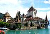
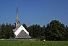
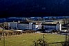
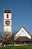
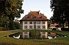
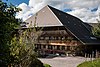
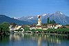
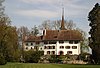
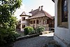
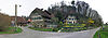
List of cultural property of national significance in Switzerland: Bern N-Z

Last updated

This list contains about half of the cultural property of national significance (class A) in the canton of Bern from the 2009 Swiss Inventory of Cultural Property of National and Regional Significance. It is sorted by municipality and contains 345 individual buildings, 43 collections, 30 archaeological finds and 4 other, special sites or objects.

Contents

The geographic coordinates provided are in the Swiss coordinate system as given in the Inventory.

Contents: Top - A through M N O P R S T U V W Z

Nidau

KGS No.?
PictureNameStreet Address CH1903 X coordinateCH1903 Y coordinateLocation
8982
Rathaus (Town council house) Rathaus-Nidau.jpg
Rathaus (Town council house)
Rathaus (Town council house)Hauptstrasse 32584.940219.426 47°07′32″N7°14′25″E / 47.125648°N 7.240163°E / 47.125648; 7.240163
1119
Nidau Castle Schloss Nidau 01.jpg
Nidau Castle
Nidau Castle Hauptstrasse 2–8584.943219.663 47°07′40″N7°14′25″E / 47.12778°N 7.240195°E / 47.12778; 7.240195
9034
Strandbad Biel (Beach along Lake Biel) Swiss-bienne-city-1.JPG
Strandbad Biel (Beach along Lake Biel)
Strandbad Biel (Beach along Lake Biel)Uferweg 40584.596219.893 47°07′47″N7°14′08″E / 47.12984°N 7.235614°E / 47.12984; 7.235614
Unknown ISOS Town / Region: Nidau

Nods

KGS No.?
PictureNameStreet Address CH1903 X coordinateCH1903 Y coordinateLocation
Unknown ISOS village: Nods

Oberbalm

KGS No.?
PictureNameStreet Address CH1903 X coordinateCH1903 Y coordinateLocation
9231
Farm House Oberbalm Stockli Bauernhaus.jpg
Farm House
Farm HouseStöckli 203597.453189.700 46°51′30″N7°24′19″E / 46.858425°N 7.405237°E / 46.858425; 7.405237
9210
Granary Oberbalm Horbermatt 114 Speicher.jpg
Granary
GranaryHorbermatt 114598.883191.515 46°52′29″N7°25′26″E / 46.874755°N 7.423985°E / 46.874755; 7.423985
9232
Granary Speicher, Oberbalmstrasse 209 A, Vorderansicht.jpg
Granary
GranaryOberbalmstrasse 209 A597.156191.378 46°52′25″N7°24′05″E / 46.873518°N 7.401332°E / 46.873518; 7.401332

Oberbipp

KGS No.?
PictureNameStreet Address CH1903 X coordinateCH1903 Y coordinateLocation
Unknown ISOS Village: Oberbipp

Oberburg

KGS No.?
PictureNameStreet Address CH1903 X coordinateCH1903 Y coordinateLocation
9769
Staldenhof Oberburg Staldenhof1.jpg
Staldenhof
StaldenhofUntere Oschwandstrasse 38614.170208.653 47°01′44″N7°37′30″E / 47.028765°N 7.625045°E / 47.028765; 7.625045
Unknown ISOS hamlet: Brittenwald
Unknown ISOS hamlet: Rohrmoos

Oberdiessbach

KGS No.?
PictureNameStreet Address CH1903 X coordinateCH1903 Y coordinateLocation
1137
Chapel of the Von Wattenwyl Family Oberdiessbach Grabkapelle von Wattenwyl Anbau.jpg
Chapel of the Von Wattenwyl Family
Chapel of the Von Wattenwyl FamilyBurgdorfstrasse 6613.780187.690 46°50′25″N7°37′09″E / 46.840207°N 7.61928°E / 46.840207; 7.61928
1136
Country Estate Diessenhof Oberdiessbach Diessenhof-2.jpg
Country Estate Diessenhof
Country Estate DiessenhofLindenstrasse 20–24614.001187.138 46°50′07″N7°37′20″E / 46.835237°N 7.62216°E / 46.835237; 7.62216
9502
Oberdiessbach Castle Oberdiessbach Neues Schloss-06.jpg
Oberdiessbach Castle
Oberdiessbach Castle Schlossstrasse 50614.299187.549 46°50′20″N7°37′34″E / 46.838927°N 7.626079°E / 46.838927; 7.626079
9764
Statthalterhof KGS-9764-ps (6) Statthalterhof-b-Oberbleiken.JPG
Statthalterhof
StatthalterhofOberbleiken 402, Bleiken bei Oberdiessbach615.771185.140 46°49′02″N7°38′43″E / 46.817224°N 7.645292°E / 46.817224; 7.645292
Unknown ISOS Urbanized Village: Oberdiessbach

Oberhofen

KGS No.?
PictureNameStreet Address CH1903 X coordinateCH1903 Y coordinateLocation
1138
Oberhofen Castle Schloss Oberhofen.jpg
Oberhofen Castle
Oberhofen Castle Schloss 1–11617.568175.413 46°43′47″N7°40′06″E / 46.729681°N 7.668465°E / 46.729681; 7.668465
1142
Wichterheer-Gut Wichterheergut.jpeg
Wichterheer-Gut
Wichterheer-GutStaatsstrasse 16–20617.821175.280 46°43′43″N7°40′18″E / 46.728478°N 7.67177°E / 46.728478; 7.67177
Unknown ISOS Urbanized Village: Oberhofen am Thunersee

Oberried

KGS No.?
PictureNameStreet Address CH1903 X coordinateCH1903 Y coordinateLocation
9235
Farm House Bauernhaus Platzli Hus.jpg
Farm House
Farm HousePlatzli 83639.941176.332 46°44′13″N7°57′40″E / 46.736983°N 7.961227°E / 46.736983; 7.961227

Oberwil bei Büren

KGS No.?
PictureNameStreet Address CH1903 X coordinateCH1903 Y coordinateLocation
Unknown ISOS Village: Oberwil bei Büren

Oberwil im Simmental

KGS No.?
PictureNameStreet Address CH1903 X coordinateCH1903 Y coordinateLocation
9236
Venner House Oberwil i.S. Vennerhaus 03.jpg
Venner House
Venner HouseBüel 201601.099167.694 46°39′38″N7°27′11″E / 46.660475°N 7.452996°E / 46.660475; 7.452996
Unknown ISOS Village: Oberwil im Simmental
Unknown ISOS hamlet: Pfaffenried

Ochlenberg

KGS No.?
PictureNameStreet Address CH1903 X coordinateCH1903 Y coordinateLocation
Unknown ISOS hamlet: Ochlenberg
Unknown ISOS hamlet: Wäckerschwend

Orpund

KGS No.?
PictureNameStreet Address CH1903 X coordinateCH1903 Y coordinateLocation
Unknown
ISOS Spezialfall: Gottstatt Kloster Gottstatt.JPG
ISOS Spezialfall: Gottstatt

Orvin

KGS No.?
PictureNameStreet Address CH1903 X coordinateCH1903 Y coordinateLocation
Unknown ISOS village: Orvin
Unknown
ISOS Spezialfall: Taubenlochschlucht Taubenlochschlucht.jpg
ISOS Spezialfall: Taubenlochschlucht

Péry-La Heutte

KGS No.?
PictureNameStreet Address CH1903 X coordinateCH1903 Y coordinateLocation
9571
Le Van,
Medieval Glass Factory Mittelalterliche Glashuette Le Van, La Heutte 02 10.jpg
Le Van,
Medieval Glass Factory
Le Van,
Medieval Glass Factory
La Heutte583.180227.480 47°11′53″N7°13′00″E / 47.198049°N 7.216668°E / 47.198049; 7.216668
Unknown
ISOS Spezialfall: Taubenlochschlucht Taubenlochschlucht.jpg
ISOS Spezialfall: Taubenlochschlucht

Petit-Val

KGS No.?
PictureNameStreet Address CH1903 X coordinateCH1903 Y coordinateLocation
9576
Forets Du Beucle, medieval iron mine Monible Forets du Beucle (mittelalterliches Eisenbergwerk).jpg
Forêts Du Beucle, medieval iron mine
Forêts Du Beucle, medieval iron mineMonible582.050235.450 47°16′11″N7°12′05″E / 47.269706°N 7.201438°E / 47.269706; 7.201438
1233
Reformed Church Sornetan Eglise.jpg
Reformed Church
Reformed Church Village 8, Sornetan583.000235.930 47°16′27″N7°12′50″E / 47.274049°N 7.213974°E / 47.274049; 7.213974
Unknown ISOS village: Souboz
Unknown ISOS village: Châtelat

Pieterlen

KGS No.?
PictureNameStreet Address CH1903 X coordinateCH1903 Y coordinateLocation
Unknown Totenweg / Bünden / Kirche
(Medieval Graveyard and Church)

Plateau de Diesse

KGS No.?
PictureNameStreet Address CH1903 X coordinateCH1903 Y coordinateLocation
Unknown ISOS village: Diesse

Pohlern

KGS No.?
PictureNameStreet Address CH1903 X coordinateCH1903 Y coordinateLocation
1160
Farm House Pohlern Rohrmoos.jpg
Farm House
Farm HouseRohrmoos, Rohrmooshof 3607.950174.253 46°43′10″N7°32′33″E / 46.71943°N 7.542621°E / 46.71943; 7.542621
9772
Farm House Mattli Pohlern Bauernhaus Mattli.jpg
Farm House Mättli
Farm House MättliMettli 23607.632174.782 46°43′27″N7°32′18″E / 46.724193°N 7.53847°E / 46.724193; 7.53847

Rapperswil

KGS No.?
PictureNameStreet Address CH1903 X coordinateCH1903 Y coordinateLocation
Unknown ISOS Village: Seewil
Unknown ISOS hamlet: Moosaffoltern
Unknown ISOS hamlet: Zimlisberg
Unknown ISOS Village: Bangerten

Reconvilier

KGS No.?
PictureNameStreet Address CH1903 X coordinateCH1903 Y coordinateLocation
Unknown ISOS village urbanisé: Reconvilier

Reichenbach im Kandertal

KGS No.?
PictureNameStreet Address CH1903 X coordinateCH1903 Y coordinateLocation
1165
Gasthof Baren Reichenbach BE, Gasthaus Baren (1542).jpg
Gasthof Bären
Gasthof BärenDorfstrasse619.585163.849 46°37′32″N7°41′40″E / 46.625601°N 7.694359°E / 46.625601; 7.694359
10424
Letzi Mulenen
Medieval Fortified Wall Reichenbach BE, Letzi Mulenen.jpg
Letzi Mülenen
Medieval Fortified Wall
Letzi Mülenen
Medieval Fortified Wall
Talsperre619.400165.200 46°38′16″N7°41′31″E / 46.63776°N 7.692°E / 46.63776; 7.692
9233
Notar-Sieber-House Notar Sieber-Haus (6).jpg
Notar-Sieber-House
Notar-Sieber-HouseDorfstrasse619.548163.799 46°37′31″N7°41′38″E / 46.625153°N 7.693874°E / 46.625153; 7.693874

Renan

KGS No.?
PictureNameStreet Address CH1903 X coordinateCH1903 Y coordinateLocation
Unknown ISOS village: Renan (BE)

Riggisberg

KGS No.?
PictureNameStreet Address CH1903 X coordinateCH1903 Y coordinateLocation
8547
Abegg-Stiftung Abeggstiftung DSC05459.jpg
Abegg-Stiftung
Abegg-StiftungWerner Abegg-Strasse 67604.267184.920 46°48′56″N7°29′40″E / 46.815418°N 7.494548°E / 46.815418; 7.494548
1196
Speicherstockli Rueti bei Riggisberg 01.jpg
Speicherstöckli
Speicherstöckli Rüti bei Riggisberg, Grand Nr. 15 (111 A)603.431180.477 46°46′32″N7°29′01″E / 46.775457°N 7.48356°E / 46.775457; 7.48356
1192
Rumligen Castle SchlossRuemligen 6329.jpg
Rümligen Castle
Rümligen Castle Schloss 26603.909186.461 46°49′45″N7°29′24″E / 46.829282°N 7.48987°E / 46.829282; 7.48987

Ringgenberg

KGS No.?
PictureNameStreet Address CH1903 X coordinateCH1903 Y coordinateLocation
1175
Church and Ruins of Ringgenberg Castle 5475 - Ringgenberg - Kirche am Brienzersee.JPG
Church and Ruins of Ringgenberg Castle
Church and Ruins of Ringgenberg Castle Bir Chilchen 60635.060172.300 46°42′04″N7°53′49″E / 46.700988°N 7.897057°E / 46.700988; 7.897057
Unknown ISOS Village: Ringgenberg

Rohrbach

KGS No.?
PictureNameStreet Address CH1903 X coordinateCH1903 Y coordinateLocation
Unknown ISOS Village: Rohrbach

Röthenbach im Emmental

KGS No.?
PictureNameStreet Address CH1903 X coordinateCH1903 Y coordinateLocation
9237 Alp GabelspitzSchallenberg-Gabelspitz 150626.695186.569 46°49′47″N7°47′19″E / 46.82973°N 7.788516°E / 46.82973; 7.788516
1178
Church of Wurzbrunnen Roethenbach Wuerzbrunnen Kirche.jpg
Church of Würzbrunnen
Church of WürzbrunnenWürzbrunnen 295622.755190.305 46°51′49″N7°44′13″E / 46.863483°N 7.737063°E / 46.863483; 7.737063

Rubigen

KGS No.?
PictureNameStreet Address CH1903 X coordinateCH1903 Y coordinateLocation
Unknown ISOS hamlet: Kleinhöchstetten

Rüderswil

KGS No.?
PictureNameStreet Address CH1903 X coordinateCH1903 Y coordinateLocation
Unknown ISOS Village: Rüderswil
Unknown ISOS Village: Ranflüh (Lützelflüh, Rüderswil)
Unknown ISOS hamlet: Ried

Rüeggisberg

KGS No.?
PictureNameStreet Address CH1903 X coordinateCH1903 Y coordinateLocation
9775
Rossgrabenbrucke (Bridge, Shared with Wahlern) Rossgrabenbruecke 02 09.jpg
Rossgrabenbrücke (Bridge, Shared with Wahlern)
Rossgrabenbrücke (Bridge, Shared with Wahlern)596.920186.295 46°49′40″N7°23′54″E / 46.827794°N 7.398271°E / 46.827794; 7.398271
1186
Ruins of the former Cluniac Rueggisberg Priory Church KlosterruineRueggisberg.jpg
Ruins of the former Cluniac Rüeggisberg Priory Church
Ruins of the former Cluniac Rüeggisberg Priory ChurchMonastery 1599.878185.357 46°49′10″N7°26′13″E / 46.819363°N 7.437039°E / 46.819363; 7.437039
1185
Schwandbachbrucke (Bridge) Schwandbachbruecke 01 09.jpg
Schwandbachbrücke (Bridge)
Schwandbachbrücke (Bridge)Schwandbach597.236186.466 46°49′46″N7°24′09″E / 46.829333°N 7.402411°E / 46.829333; 7.402411
Unknown ISOS Dorf
Unknown ISOS hamlet: Oberbütschel
Unknown ISOS hamlet: Schwanden

Rüegsau

KGS No.?
PictureNameStreet Address CH1903 X coordinateCH1903 Y coordinateLocation
10492
Holzbrucke (Wooden Bridge) Holzbrucke von Hasle-Ruegsau 01 09.jpg
Holzbrücke (Wooden Bridge)
Holzbrücke (Wooden Bridge)Winterseistrasse / Brückenstrasse (Shared With Hasle bei Burgdorf)615.980207.785 47°01′15″N7°38′56″E / 47.020916°N 7.648825°E / 47.020916; 7.648825

Rumendingen

KGS No.?
PictureNameStreet Address CH1903 X coordinateCH1903 Y coordinateLocation
Unknown ISOS Village: Rumendingen

Rüti bei Büren

KGS No.?
PictureNameStreet Address CH1903 X coordinateCH1903 Y coordinateLocation
Unknown ISOS Village: Rüti bei Büren

Saanen

KGS No.?
PictureNameStreet Address CH1903 X coordinateCH1903 Y coordinateLocation
1198 Alte KastlaneiDavidsmatte 231586.929148.698 46°29′22″N7°16′06″E / 46.489469°N 7.268398°E / 46.489469; 7.268398
1200
Church Saanen eglise1 ag1.jpg
Church
ChurchPfruendmatte 74586.165148.790 46°29′25″N7°15′30″E / 46.490281°N 7.258445°E / 46.490281; 7.258445
Unknown ISOS Village: Saanen

Saicourt

KGS No.?
PictureNameStreet Address CH1903 X coordinateCH1903 Y coordinateLocation
1203
Former Premonstratensian Abbey Bellelay.jpg
Former Premonstratensian Abbey
Former Premonstratensian AbbeyBelellay 163579.563234.834 47°15′51″N7°10′07″E / 47.264094°N 7.168602°E / 47.264094; 7.168602
Unknown ISOS cas particulier: Bellelay

Saint-Imier

KGS No.?
PictureNameStreet Address CH1903 X coordinateCH1903 Y coordinateLocation
1245
Collegiale Saint Imier Collegiale Canton Berne.jpg
Collégiale
CollégialePlace Du Marché 10566.478222.495 47°09′09″N6°59′48″E / 47.152575°N 6.996631°E / 47.152575; 6.996631
9282
Longines watchmaking factory Longines Saint-Imier 02 12.jpg
Longines watchmaking factory
Longines watchmaking factoryLes Longines 8566.998222.127 47°08′57″N7°00′13″E / 47.149291°N 7.003514°E / 47.149291; 7.003514
Unknown ISOS village urbanisé: Saint-Imier

Sauge

KGS No.?
PictureNameStreet Address CH1903 X coordinateCH1903 Y coordinateLocation
Unknown
ISOS Spezialfall: Taubenlochschlucht (Biel/Bienne, Orvin, Pery, Sauge) Taubenloch3.jpg
ISOS Spezialfall: Taubenlochschlucht (Biel/Bienne, Orvin, Péry, Sauge)

Schangnau

KGS No.?
PictureNameStreet Address CH1903 X coordinateCH1903 Y coordinateLocation
9238
Kramer House Schangnau-Kraemerhaus.jpg
Krämer House
Krämer HouseDorf 39632.196186.336 46°49′39″N7°51′38″E / 46.827391°N 7.860597°E / 46.827391; 7.860597

Schüpfen

KGS No.?
PictureNameStreet Address CH1903 X coordinateCH1903 Y coordinateLocation
Unknown ISOS Village: Schwanden
Unknown ISOS hamlet: Winterswil

Schwarzenburg

KGS No.?
PictureNameStreet Address CH1903 X coordinateCH1903 Y coordinateLocation
1327
Bauernhof Aeckenmatt Aeckenmatt Bauernhaus DSC05386.jpg
Bauernhof Aeckenmatt
Bauernhof AeckenmattAeckenmatt 6594.270189.650 46°51′29″N7°21′49″E / 46.857955°N 7.363498°E / 46.857955; 7.363498
1317
Castle Ruin Grasburg Grasburg Ruins Wahlern Sep2010.jpg
Castle Ruin Grasburg
Castle Ruin Grasburg 591.850186.970 46°50′02″N7°19′55″E / 46.833823°N 7.331811°E / 46.833823; 7.331811
1319
Fruhmess Chapel Chappeli 001.jpg
Frühmess Chapel
Frühmess ChapelKäppeligässli 5592.620185.100 46°49′01″N7°20′31″E / 46.81701°N 7.341934°E / 46.81701; 7.341934
1318 Rossgrabenbrücke
(Bridge, shared with Rüeggisberg)
596.920186.295 46°49′40″N7°23′54″E / 46.827794°N 7.398271°E / 46.827794; 7.398271
1320
Schwarzenburg Castle Schloss Schwarzenburg, Gesamtansicht.jpg
Schwarzenburg Castle
Schwarzenburg Castle Schlossgasse 13592.579184.882 46°48′54″N7°20′29″E / 46.815049°N 7.341401°E / 46.815049; 7.341401
9230
Granary Speicher Henzischwand 298a DSC05450.jpg
Granary
GranaryHenzischwand 298 A595.786184.288 46°48′35″N7°23′00″E / 46.809734°N 7.383427°E / 46.809734; 7.383427
Unknown ISOS Town / Region: Schwarzenburg
Unknown ISOS hamlet: Aeckenmatt
Unknown ISOS hamlet: Elisried

Seeberg

KGS No.?
PictureNameStreet Address CH1903 X coordinateCH1903 Y coordinateLocation
Unknown ISOS Village: Riedtwil

Signau

KGS No.?
PictureNameStreet Address CH1903 X coordinateCH1903 Y coordinateLocation
Unknown ISOS Village: Signau

Sigriswil

KGS No.?
PictureNameStreet Address CH1903 X coordinateCH1903 Y coordinateLocation
Unknown ISOS hamlet: Wiler

Siselen

KGS No.?
PictureNameStreet Address CH1903 X coordinateCH1903 Y coordinateLocation
1229
Rectory Siselen Pfarrhaus.jpg
Rectory
Rectory Juchen 5581.023208.969 47°01′53″N7°11′20″E / 47.031487°N 7.18898°E / 47.031487; 7.18898
Unknown ISOS Village: Siselen

Sonvilier

KGS No.?
PictureNameStreet Address CH1903 X coordinateCH1903 Y coordinateLocation
1230 Ferme De La Grande CoronelleLa Coronelle 94562.541223.600 47°09′44″N6°56′41″E / 47.162303°N 6.944629°E / 47.162303; 6.944629

Spiez

KGS No.?
PictureNameStreet Address CH1903 X coordinateCH1903 Y coordinateLocation
9578 Bürg (Prehistoric / Medieval Hilltop Settlement)619.630170.000 46°40′51″N7°41′43″E / 46.680931°N 7.695209°E / 46.680931; 7.695209
1236
Swiss Reformed Castle Church Schlosskirche Spiez.JPG
Swiss Reformed Castle Church
Swiss Reformed Castle ChurchSchlossstrasse 17619.110170.899 46°41′21″N7°41′18″E / 46.689033°N 7.68845°E / 46.689033; 7.68845
1237
Spiez Castle SchlossSpiez02.jpg
Spiez Castle
Spiez Castle Schlossstrasse 16619.028170.912 46°41′21″N7°41′15″E / 46.689153°N 7.687378°E / 46.689153; 7.687378
9239
Weinbauernhof Spiez 020 Rebbaumuseum.jpg
Weinbauernhof
WeinbauernhofSpiezbergstrasse 46618.770171.095 46°41′27″N7°41′02″E / 46.690806°N 7.684013°E / 46.690806; 7.684013

Steffisburg

KGS No.?
PictureNameStreet Address CH1903 X coordinateCH1903 Y coordinateLocation
9089 Former Regie of SteffisburgSchwäbis 103613.560179.092 46°45′46″N7°36′58″E / 46.762869°N 7.616141°E / 46.762869; 7.616141

Studen

KGS No.?
PictureNameStreet Address CH1903 X coordinateCH1903 Y coordinateLocation
1247
Petinesca
Roman era Vicus / Temple Complex Petinesca Tempelbezirk Studen.jpg
Petinesca
Roman era Vicus / Temple Complex
Petinesca
Roman era Vicus / Temple Complex
589.150217.700 47°06′37″N7°17′44″E / 47.110205°N 7.295688°E / 47.110205; 7.295688

Sumiswald

KGS No.?
PictureNameStreet Address CH1903 X coordinateCH1903 Y coordinateLocation
9240
Gasthof Baren Gasthof Baren.jpg
Gasthof Bären
Gasthof BärenMarktgasse 1623.353208.548 47°01′39″N7°44′45″E / 47.02756°N 7.745842°E / 47.02756; 7.745842
9241
Rectory Sumiswald Pfarrhaus-1.jpg
Rectory
Rectory Pfarrgässli 2623.363208.590 47°01′41″N7°44′46″E / 47.027938°N 7.745975°E / 47.027938; 7.745975
1250
Swiss Reformed Church Sumiswald-Kirche.jpg
Swiss Reformed Church
Swiss Reformed ChurchKirchgasse 4623.290208.570 47°01′40″N7°44′42″E / 47.027761°N 7.745014°E / 47.027761; 7.745014
Unknown ISOS Village: Sumiswald

Sutz-Lattrigen

KGS No.?
PictureNameStreet Address CH1903 X coordinateCH1903 Y coordinateLocation
9579 Neolithic / Bronze Age Lake-Side Settlement583.000217.200 47°06′20″N7°12′53″E / 47.105578°N 7.21468°E / 47.105578; 7.21468
9127
Von Rutte-Gut Von Ruette Gut, Sutz-Lattrigen 01 10.jpg
Von Rütte-Gut
Von Rütte-GutSeestrasse 6582.945216.877 47°06′10″N7°12′50″E / 47.102671°N 7.213968°E / 47.102671; 7.213968

Tavannes

KGS No.?
PictureNameStreet Address CH1903 X coordinateCH1903 Y coordinateLocation
9765
Eglise Du Christ-Roi Tavannes Eglise du Christ-Roi 01.jpg
Eglise Du Christ-Roi
Eglise Du Christ-RoiRue Du Général Voirol 7581.730230.099 47°13′18″N7°11′51″E / 47.221568°N 7.197427°E / 47.221568; 7.197427
9580
Pierre Pertuis
(passage carved into the rock above the Roman road) Pierre Pertuis - Ancienne voie et passage 02.jpg
Pierre Pertuis
(passage carved into the rock above the Roman road)
Pierre Pertuis
(passage carved into the rock above the Roman road)
passage taillé dans le rocher581.480229.150 47°12′47″N7°11′39″E / 47.213025°N 7.194166°E / 47.213025; 7.194166
Unknown ISOS village urbanisé: Tavannes

Thun

KGS No.?
PictureNameStreet Address CH1903 X coordinateCH1903 Y coordinateLocation
1260
Dampfschiff Bluemlisalp
(Steamship Bluemlisalp) Swiss Steamboat Bluemlisalp lake Thun.jpg
Dampfschiff Blüemlisalp
(Steamship Blüemlisalp)
Dampfschiff Blüemlisalp
(Steamship Blüemlisalp)
614.745178.125 46°45′15″N7°37′54″E / 46.754145°N 7.631621°E / 46.754145; 7.631621
1269
Former Hotel Bellevue-Du Parc Thun Hotel BellevueDuParc.jpg
Former Hotel Bellevue-Du Parc
Former Hotel Bellevue-Du ParcGöttibachweg 2614.801178.511 46°45′27″N7°37′57″E / 46.757616°N 7.632367°E / 46.757616; 7.632367
1272
Former Hotel Thunerhof Thunerhof2.jpg
Former Hotel Thunerhof
Former Hotel ThunerhofHofstettenstrasse 14614.927178.324 46°45′21″N7°38′02″E / 46.755931°N 7.63401°E / 46.755931; 7.63401
1261
zum Rosengarten House Thun Haus Rosengarten Seite Baelliz.jpg
zum Rosengarten House
zum Rosengarten HouseFreienhofgasse 20614.666178.478 46°45′26″N7°37′50″E / 46.757322°N 7.630599°E / 46.757322; 7.630599
1271
Landsitz Bellerive Thun Landsitz Bellerive Parkseite.jpg
Landsitz Bellerive
Landsitz BelleriveGwattstrasse 120614.227174.968 46°43′33″N7°37′29″E / 46.725758°N 7.624744°E / 46.725758; 7.624744
1273
Mannschaftskaserne (Armory) Mannschaftskaserne Thun rechte Halfte.jpg
Mannschaftskaserne (Armory)
Mannschaftskaserne (Armory)Allmendstrasse 243–248613.851178.710 46°45′34″N7°37′12″E / 46.759427°N 7.619938°E / 46.759427; 7.619938
9512
Platzschulhaus (Former Hospital) Platzschulhaus.jpg
Platzschulhaus (Former Hospital)
Platzschulhaus (Former Hospital)Rathausplatz 3614.544178.728 46°45′34″N7°37′44″E / 46.759574°N 7.62901°E / 46.759574; 7.62901
1262
Rathaus (Town council house) Thun Rathaus.JPG
Rathaus (Town council house)
Rathaus (Town council house)Rathausplatz 1614.486178.713 46°45′34″N7°37′42″E / 46.75944°N 7.62825°E / 46.75944; 7.62825
1263
Reformed Church of Scherzligen Thun Scherzligenkirche Flussseite.jpg
Reformed Church of Scherzligen
Reformed Church of ScherzligenSeestrasse 41615.110177.370 46°44′50″N7°38′11″E / 46.747345°N 7.636374°E / 46.747345; 7.636374
11719 Sammlung Historisches Armeematerial
(Collection of Historical Military Equipment)
(Shared between Thun, Burgdorf and Dübendorf in Zurich)
613.800178.500 46°45′27″N7°37′09″E / 46.757539°N 7.619265°E / 46.757539; 7.619265
1264
Thun Castle SchlossThun.jpg
Thun Castle
Thun Castle Schlossberg 1614.606178.784 46°45′36″N7°37′47″E / 46.760076°N 7.629823°E / 46.760076; 7.629823
1265
Schadau Castle SchlossSchadau 6383.jpg
Schadau Castle
Schadau Castle Seestrasse 45615.184177.234 46°44′46″N7°38′14″E / 46.74612°N 7.637338°E / 46.74612; 7.637338
8586 Schweizerisches Armeemuseum
(Swiss Army Museum)
612.901178.926 46°45′41″N7°36′27″E / 46.761389°N 7.60751°E / 46.761389; 7.60751
10423
City Walls Venner-Zyroturm Aussen Suden II.jpg
City Walls
City Walls614.680178.700 46°45′34″N7°37′51″E / 46.759319°N 7.630789°E / 46.759319; 7.630789
1276 Vaporama, Museum of Steam PowerSchadau-Kutscherei615.081177.186 46°44′44″N7°38′10″E / 46.745691°N 7.635988°E / 46.745691; 7.635988
1267
Wocher-Panorama Wocher Panorama.jpg
Wocher-Panorama
Wocher-PanoramaSeestrasse 45 F615.081177.186 46°44′44″N7°38′10″E / 46.745691°N 7.635988°E / 46.745691; 7.635988
Unknown ISOS Stadt: Thun

Thunstetten

KGS No.?
PictureNameStreet Address CH1903 X coordinateCH1903 Y coordinateLocation
1277
Thunstetten Castle 2012-03-17-Supra Argovio (Foto Dietrich Michael Weidmann) 259.JPG
Thunstetten Castle
Thunstetten Castle Bergasse 5623.865228.322 47°12′19″N7°45′13″E / 47.205406°N 7.753621°E / 47.205406; 7.753621

Toffen

KGS No.?
PictureNameStreet Address CH1903 X coordinateCH1903 Y coordinateLocation
1279
Toffen Castle SchlossToffen 8935.jpg
Toffen Castle
Toffen Castle Schlossweg 4603.843190.259 46°51′48″N7°29′21″E / 46.863447°N 7.489037°E / 46.863447; 7.489037

Trachselwald

KGS No.?
PictureNameStreet Address CH1903 X coordinateCH1903 Y coordinateLocation
1281
Village Church KircheTrachselwald.jpg
Village Church
Village ChurchVillage 4622.740207.320 47°01′00″N7°44′16″E / 47.016536°N 7.737716°E / 47.016536; 7.737716
1283
Trachselwald Castle SchlossTrachselwald.jpg
Trachselwald Castle
Trachselwald Castle Schloss 8623.056207.430 47°01′03″N7°44′31″E / 47.017514°N 7.741878°E / 47.017514; 7.741878
Unknown ISOS Village: Trachselwald (Lützelflüh)

Tramelan

KGS No.?
PictureNameStreet Address CH1903 X coordinateCH1903 Y coordinateLocation
Unknown ISOS hameau: Le Cernil / La Chaux de Tramelan

Trub

KGS No.?
PictureNameStreet Address CH1903 X coordinateCH1903 Y coordinateLocation
9767 Farm HouseHinter Hütten 239633.009203.129 46°58′42″N7°52′21″E / 46.978406°N 7.872468°E / 46.978406; 7.872468
9227
Farm House Ober-Brandosch Trub Bauernhaus Brandoesch Frontteil.jpg
Farm House Ober-Brandösch
Farm House Ober-BrandöschBrandösch 146634.713202.527 46°58′22″N7°53′41″E / 46.972905°N 7.894817°E / 46.972905; 7.894817
9228
Farm House Trub Bauernhaus Schmittenhof.jpg
Farm House
Farm HouseSchwithtenhof 11631.819197.863 46°55′52″N7°51′23″E / 46.931097°N 7.85646°E / 46.931097; 7.85646
Unknown ISOS Village: Trub

Tschugg

KGS No.?
PictureNameStreet Address CH1903 X coordinateCH1903 Y coordinateLocation
1291
Former Landgut Steiger Tschugg Von Steiger 2.jpg
Former Landgut Steiger
Former Landgut SteigerUnterdorf 44572.614208.457 47°01′36″N7°04′42″E / 47.026588°N 7.078386°E / 47.026588; 7.078386

Twann-Tüscherz

KGS No.?
PictureNameStreet Address CH1903 X coordinateCH1903 Y coordinateLocation
1294
Former Clunic Priory Petersinsel-01.jpg
Former Clunic Priory
Former Clunic Priory St. Petersinsel 26577.517213.230 47°04′11″N7°08′34″E / 47.069705°N 7.142645°E / 47.069705; 7.142645
1297
Former Thormanngut Wingreis Thormannhaus Nord4.jpg
Former Thormanngut
Former ThormanngutWingreis 22580.024216.784 47°06′06″N7°10′32″E / 47.101753°N 7.175493°E / 47.101753; 7.175493
9229
Fraubrunnen House Fraubrunnenhaus Twann.jpg
Fraubrunnen House
Fraubrunnen HouseDorfgasse 28578.693216.052 47°05′42″N7°09′29″E / 47.095127°N 7.157994°E / 47.095127; 7.157994
Unknown ISOS Village: Tüscherz
Unknown ISOS Village: Twann
Unknown ISOS hamlet: Wingreis

Unterseen

KGS No.?
PictureNameStreet Address CH1903 X coordinateCH1903 Y coordinateLocation
9581
Old City of Unterseen Unterseen.jpg
Old City of Unterseen
Old City of Unterseen631.400170.700 46°41′12″N7°50′57″E / 46.686778°N 7.849093°E / 46.686778; 7.849093
1301
Weissenau Ruins Ruine Weissenau06461.jpg
Weissenau Ruins
Weissenau Ruins 630.140168.840 46°40′12″N7°49′57″E / 46.670105°N 7.832501°E / 46.670105; 7.832501
Unknown ISOS Town / Region: Unterseen

Utzenstorf

KGS No.?
PictureNameStreet Address CH1903 X coordinateCH1903 Y coordinateLocation
9582 Bürglenhubel,
Neolithic Hilltop Settlement
610.900220.050 47°07′53″N7°34′56″E / 47.131342°N 7.582302°E / 47.131342; 7.582302
9774
Gasthof Baren Utzenstorf Baeren Nordostecke.jpg
Gasthof Bären
Gasthof BärenHauptstrasse 18609.010219.786 47°07′44″N7°33′27″E / 47.128996°N 7.557386°E / 47.128996; 7.557386
1307
Landshut Castle SchlossLandshut.jpg
Landshut Castle
Landshut Castle Schlossstrasse 15–21608.343220.715 47°08′14″N7°32′55″E / 47.137361°N 7.548613°E / 47.137361; 7.548613
Unknown ISOS Spezialfall: Landshut Castle

Vechigen

KGS No.?
PictureNameStreet Address CH1903 X coordinateCH1903 Y coordinateLocation
Unknown ISOS hamlet: Lindental

Vinelz

KGS No.?
PictureNameStreet Address CH1903 X coordinateCH1903 Y coordinateLocation
9583 Ländti, Neolithic /
Bronze Age Lakeshore Settlement
575.150209.660 47°02′15″N7°06′42″E / 47.037508°N 7.111679°E / 47.037508; 7.111679
Unknown ISOS Village: Vinelz

Walperswil

KGS No.?
PictureNameStreet Address CH1903 X coordinateCH1903 Y coordinateLocation
1330
Rectory Walperswil Pfarrhaus 01.jpg
Rectory
Rectory Kirchweg583.976212.050 47°03′33″N7°13′40″E / 47.059279°N 7.22772°E / 47.059279; 7.22772
Unknown ISOS Village: Walperswil

Wangen an der Aare

KGS No.?
PictureNameStreet Address CH1903 X coordinateCH1903 Y coordinateLocation
9251
Former Watch Tower, now Rectory Wangen, Pfarrhaus.jpg
Former Watch Tower, now Rectory
Former Watch Tower, now Rectory Städtli 40616.292231.703 47°14′10″N7°39′14″E / 47.236047°N 7.653791°E / 47.236047; 7.653791
1333
Wooden Bridge Die aare bruecke wangen an der aare schweiz.jpg
Wooden Bridge
Wooden BridgeAarebrücke616.400231.830 47°14′14″N7°39′19″E / 47.237186°N 7.655222°E / 47.237186; 7.655222
1337
Castle 2011-11-30-Mezlando (Foto Dietrich Michael Weidmann) 066.JPG
Castle
Castle Städtli 26616.346231.714 47°14′10″N7°39′16″E / 47.236144°N 7.654504°E / 47.236144; 7.654504
Unknown ISOS Town / Region: Wangen an der Aare

Wiedlisbach

KGS No.?
PictureNameStreet Address CH1903 X coordinateCH1903 Y coordinateLocation
Unknown ISOS Town / Region: Wiedlisbach

Wiggiswil

KGS No.?
PictureNameStreet Address CH1903 X coordinateCH1903 Y coordinateLocation
Unknown ISOS hamlet: Wiggiswil

Wilderswil

KGS No.?
PictureNameStreet Address CH1903 X coordinateCH1903 Y coordinateLocation
Unknown ISOS Urbanized Village: Wilderswil
Unknown ISOS Village: Gsteig bei Interlaken (with Gsteigwiler)

Wileroltigen

KGS No.?
PictureNameStreet Address CH1903 X coordinateCH1903 Y coordinateLocation
Unknown ISOS Village: Wileroltigen

Willadingen

KGS No.?
PictureNameStreet Address CH1903 X coordinateCH1903 Y coordinateLocation
Unknown ISOS Village: Willadingen

Wimmis

KGS No.?
PictureNameStreet Address CH1903 X coordinateCH1903 Y coordinateLocation
1347
Village Church Wimmis Eglise Suisse canton Berne.jpg
Village Church
Village ChurchSchlossgasse 2 A615.064169.100 46°40′23″N7°38′08″E / 46.672954°N 7.6355°E / 46.672954; 7.6355
10474
Letzi Spissi KGS-Wimmis-Letzi-(1).JPG
Letzi Spissi
Letzi SpissiTalsperre614.590168.480 46°40′03″N7°37′45″E / 46.667387°N 7.629286°E / 46.667387; 7.629286
9925
Wimmis Castle SchlossWimmis.jpg
Wimmis Castle
Wimmis Castle Schlossgasse 6614.981169.051 46°40′21″N7°38′04″E / 46.672515°N 7.634414°E / 46.672515; 7.634414
Unknown ISOS Village: Wimmis

Wohlen bei Bern

KGS No.?
PictureNameStreet Address CH1903 X coordinateCH1903 Y coordinateLocation
1348
Hofenmuhle Hofenmuhle Sud.jpg
Hofenmühle
Hofenmühle Mühlegasse 21593.325201.915 46°58′06″N7°21′03″E / 46.968273°N 7.350926°E / 46.968273; 7.350926
Unknown ISOS hamlet: Hofen
Unknown ISOS hamlet: Illiswil
Unknown ISOS hamlet: Möriswil
Unknown ISOS hamlet: Oberdettigen

Worb

KGS No.?
PictureNameStreet Address CH1903 X coordinateCH1903 Y coordinateLocation
1352
Worb Castle or Altes Schloss SchlossWorb.jpg
Worb Castle or Altes Schloss
Worb Castle or Altes SchlossSchloss 2–6609.819197.816 46°55′53″N7°34′03″E / 46.931363°N 7.567573°E / 46.931363; 7.567573
1354
Swiss Reformed Church Worb ref Kirche.jpg
Swiss Reformed Church
Swiss Reformed ChurchEnggisteinstrasse 6609.575197.680 46°55′49″N7°33′52″E / 46.930143°N 7.564366°E / 46.930143; 7.564366
Unknown ISOS hamlet: Wattenwil

Wynau

KGS No.?
PictureNameStreet Address CH1903 X coordinateCH1903 Y coordinateLocation
9782
Rectory Wynau Pfarrhaus 01.jpg
Rectory
Rectory Kirchweg 12627.994234.657 47°15′44″N7°48′31″E / 47.262224°N 7.808511°E / 47.262224; 7.808511
1356
Swiss Reformed Church Wynau Reformierte Kirche.jpg
Swiss Reformed Church
Swiss Reformed ChurchKirchweg 10627.984234.656 47°15′44″N7°48′30″E / 47.262216°N 7.808378°E / 47.262216; 7.808378
9252
Speicherstockli Wynau Speicherstockli 01.jpg
Speicherstöckli
SpeicherstöckliAarwangenstrasse 5627.994234.514 47°15′39″N7°48′31″E / 47.260938°N 7.808502°E / 47.260938; 7.808502

Wynigen

KGS No.?
PictureNameStreet Address CH1903 X coordinateCH1903 Y coordinateLocation
9253
Farm House Wynigen Oberbuhl 239.jpg
Farm House
Farm HouseOberbühl 239619.763217.166 47°06′19″N7°41′56″E / 47.105196°N 7.698992°E / 47.105196; 7.698992
9768
Farm House Glungge Glungge 1.jpg
Farm House Glungge
Farm House GlunggeBrechershäusern 340618.829218.754 47°07′10″N7°41′12″E / 47.119507°N 7.686754°E / 47.119507; 7.686754
9254
Dorfbrunnen (Fountain) Wynigen Dorfbrunnen.jpg
Dorfbrunnen (Fountain)
Dorfbrunnen (Fountain)Dorfstrasse617.382217.248 47°06′22″N7°40′03″E / 47.106°N 7.667629°E / 47.106; 7.667629
1358
Former Gasthof Wilder Mann Wynigen Ehem Wilder Mann im Umbau.jpg
Former Gasthof Wilder Mann
Former Gasthof Wilder MannDorfstrasse 12617.288217.225 47°06′21″N7°39′59″E / 47.105796°N 7.666389°E / 47.105796; 7.666389
1360
Rectory Wynigen Pfarrhaus1.jpg
Rectory
Rectory Dorfstrasse 8617.310217.255 47°06′22″N7°40′00″E / 47.106065°N 7.66668°E / 47.106065; 7.66668
9255
Granary in Oberbuel Wynigen Oberbuhl Spycher239c.jpg
Granary in Oberbüel
Granary in OberbüelOberbüel 239 C619.747217.158 47°06′18″N7°41′56″E / 47.105124°N 7.698781°E / 47.105124; 7.698781
Unknown ISOS hamlet: Breitenegg

Zollikofen

KGS No.?
PictureNameStreet Address CH1903 X coordinateCH1903 Y coordinateLocation
9167
Archiv Schweizer Milchproduzenten
(Archive of Swiss Milk Production) Archiv der Schw.Milchproduzenten2.jpg
Archiv Schweizer Milchproduzenten
(Archive of Swiss Milk Production)
Archiv Schweizer Milchproduzenten
(Archive of Swiss Milk Production)
Molkereistrasse 23601.634204.699 46°59′36″N7°27′36″E / 46.993347°N 7.460118°E / 46.993347; 7.460118
1364
Reichenbach Castle Zollikofen Schloss.jpg
Reichenbach Castle
Reichenbach Castle Schloss Reichenbach 6–11600.826204.411 46°59′27″N7°26′58″E / 46.990758°N 7.449496°E / 46.990758; 7.449496
Unknown ISOS hamlet: Büelikofen / Graben

Zweisimmen

KGS No.?
PictureNameStreet Address CH1903 X coordinateCH1903 Y coordinateLocation
1367
Swiss Reformed Church and Rectory Zweisimmen Eglise canton Berne Suisse.jpg
Swiss Reformed Church and Rectory
Swiss Reformed Church and RectoryKirchgasse 231595.650157.820 46°34′18″N7°22′55″E / 46.57164°N 7.381896°E / 46.57164; 7.381896
1369
Ruins of Oberer Mannenberg Castle Oberer Mannenberg - 1.jpg
Ruins of Oberer Mannenberg Castle
Ruins of Oberer Mannenberg Castle Manneberg Riedli595.480157.680 46°34′13″N7°22′47″E / 46.570379°N 7.37968°E / 46.570379; 7.37968
11720
Ruins of Unterer Mannenberg Castle Unterer Mannenberg - 2.jpg
Ruins of Unterer Mannenberg Castle
Ruins of Unterer Mannenberg Castle 594.874155.626 46°33′07″N7°22′18″E / 46.551898°N 7.371798°E / 46.551898; 7.371798

References