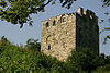
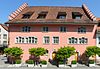
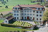
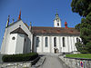
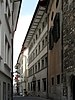
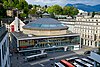
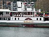
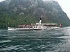
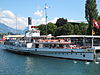
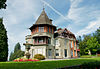
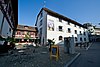
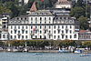
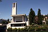
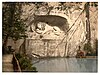
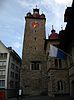
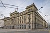
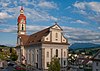
List of cultural property of national significance in Switzerland: Lucerne

Last updated

This list contains all cultural property of national significance (class A) in the canton of Lucerne from the 2009 Swiss Inventory of Cultural Property of National and Regional Significance. It is sorted by municipality and contains 83 individual buildings, 27 collections, 17 archaeological finds and 6 other, special sites.

Contents

The geographic coordinates provided are in the Swiss coordinate system as given in the Inventory.

Adligenswil

KGS No.?
PictureNameStreet Address CH1903 X coordinateCH1903 Y coordinateLocation
Unknown ISOS Weiler: Dottenberg

Alberswil

KGS No.?
PictureNameStreet Address CH1903 X coordinateCH1903 Y coordinateLocation
3629
Kastelen Tower Picswiss LU-24-25.jpg
Kastelen Tower
Kastelen Tower 642.047221.923 47°08′49″N7°59′35″E / 47.146944°N 7.992994°E / 47.146944; 7.992994
8587
Schweizerisches Museum fur Landwirtschaft und Agrartechnik Alberswil-Agrarmuseum-3.jpg
Schweizerisches Museum für Landwirtschaft und Agrartechnik
Schweizerisches Museum für Landwirtschaft und AgrartechnikBurgrain 8642.571221.511 47°08′36″N8°00′00″E / 47.143204°N 7.999864°E / 47.143204; 7.999864
Unknown ISOS Spezialfall: Landscapes Kastelen

Altishofen

KGS No.?
PictureNameStreet Address CH1903 X coordinateCH1903 Y coordinateLocation
Unknown ISOS Dorf: Altishofen

Beromünster

KGS No.?
PictureNameStreet Address CH1903 X coordinateCH1903 Y coordinateLocation
3636
Canon and Prebendary House, North Group Chorherren und Prundhauser Nordgruppe IMG 4703.jpg
Canon and Prebendary House, North Group
Canon and Prebendary House, North GroupStift 7 – 11656.877228.591 47°12′21″N8°11′22″E / 47.20581°N 8.189347°E / 47.20581; 8.189347
10094
Canon and Prebendary House, South Group Chorherren- und Pfrundhaeuser Suedgruppe Beromuenster 2011.jpg
Canon and Prebendary House, South Group
Canon and Prebendary House, South GroupStift 33 – 38656.943228.527 47°12′19″N8°11′25″E / 47.205228°N 8.19021°E / 47.205228; 8.19021
3638
Former Administration Building (Gasthof Hirschen) Ehemaliges Amthaus Beromuenster 2011.jpg
Former Administration Building (Gasthof Hirschen)
Former Administration Building (Gasthof Hirschen)Hirschenplatz 1657.005228.592 47°12′21″N8°11′28″E / 47.205808°N 8.191036°E / 47.205808; 8.191036
10095
Kustorei Kustorei Stift Beromunster 2008.jpg
Kustorei
KustoreiStift 3656.839228.566 47°12′20″N8°11′20″E / 47.205588°N 8.188842°E / 47.205588; 8.188842
10093
Landessender Beromunster Landessender Beromunster IMG 4677.jpg
Landessender Beromünster
Landessender Beromünster Walterswil, Blosenberg655.525227.964 47°12′01″N8°10′17″E / 47.200285°N 8.171426°E / 47.200285; 8.171426
3642
Provost's House Propstei Stift Beromunster 2008.jpg
Provost's House
Provost's House Stift 1656.852228.535 47°12′19″N8°11′20″E / 47.205308°N 8.18901°E / 47.205308; 8.18901
8908, 8621, 9304/extendedHtmlPopup 3637, 8908, 8621, 9304
Collegiate church with
Archive, Library and Church Treasures Picswiss LU-18-04.jpg
Collegiate church with
Archive, Library and Church Treasures
Collegiate church with
Archive, Library and Church Treasures
656.939228.604 47°12′21″N8°11′25″E / 47.205921°N 8.190167°E / 47.205921; 8.190167
Unknown ISOS Kleinstadt / Flecken: Beromünster

Buchrain

KGS No.?
PictureNameStreet Address CH1903 X coordinateCH1903 Y coordinateLocation
Unknown ISOS Spezialfall: Perlen (shared with Root)

Buttisholz

KGS No.?
PictureNameStreet Address CH1903 X coordinateCH1903 Y coordinateLocation
3649
Buttisholz Castle and Surrounding Lands Schloss, Buttisholz IMG 4989.jpg
Buttisholz Castle and Surrounding Lands
Buttisholz Castle and Surrounding Lands649.966218.444 47°06′54″N8°05′49″E / 47.115101°N 8.097011°E / 47.115101; 8.097011
Unknown ISOS Dorf: Buttisholz

Dierikon

KGS No.?
PictureNameStreet Address CH1903 X coordinateCH1903 Y coordinateLocation
3653
Gotzental Castle with Chapel Dierikon, Schlossli Gotzental IMG 4791.jpg
Götzental Castle with Chapel
Götzental Castle with Chapel671.245216.069 47°05′30″N8°22′37″E / 47.091792°N 8.376996°E / 47.091792; 8.376996
Unknown ISOS Weiler: Dierikon

Egolzwil

KGS No.?
PictureNameStreet Address CH1903 X coordinateCH1903 Y coordinateLocation
3657 Wauwilermoos
(Egolzwil, Wauwil, Schötz, Ettiswil, Mauensee),
Paleolithic-Neolithic Lake Shore Settlement
644.530225.500 47°10′44″N8°01′34″E / 47.178955°N 8.026082°E / 47.178955; 8.026082

Emmen

KGS No.?
PictureNameStreet Address CH1903 X coordinateCH1903 Y coordinateLocation
10097
Flugzeugmontagehalle Ruag Flugzeugmontagehalle RUAG IMG 4472.jpg
Flugzeugmontagehalle Ruag
Flugzeugmontagehalle RuagHochdorfstrasse666.151215.801 47°05′24″N8°18′36″E / 47.08991°N 8.30987°E / 47.08991; 8.30987
10098 Rothenburger BridgeRothenburgstrasse / Bertiswilstrasse663.460216.150 47°05′36″N8°16′28″E / 47.093312°N 8.27448°E / 47.093312; 8.27448
8805
Von Moos Stahl AG, Historic Archive Von Moos Archiv IMG 4485.jpg
Von Moos Stahl AG, Historic Archive
Von Moos Stahl AG, Historic ArchiveEmmenweidstrasse 90662.965213.573 47°04′13″N8°16′03″E / 47.070181°N 8.267602°E / 47.070181; 8.267602

Ermensee

KGS No.?
PictureNameStreet Address CH1903 X coordinateCH1903 Y coordinateLocation
Unknown ISOS Dorf: Ermensee

Escholzmatt

KGS No.?
PictureNameStreet Address CH1903 X coordinateCH1903 Y coordinateLocation
Unknown ISOS Dorf: Escholzmatt

Ettiswil

KGS No.?
PictureNameStreet Address CH1903 X coordinateCH1903 Y coordinateLocation
Unknown Wauwilermoos
(Egolzwil, Wauwil, Schötz, Ettiswil, Mauensee),
Paleolithic-Neolithic Lake Shore Settlement
644.530225.500 47°10′44″N8°01′34″E / 47.178955°N 8.026082°E / 47.178955; 8.026082
Unknown ISOS Weiler: Seewagen

Gettnau

KGS No.?
PictureNameStreet Address CH1903 X coordinateCH1903 Y coordinateLocation
10480 StadtägertliBurgstelle639.830220.500 47°08′03″N7°57′49″E / 47.134281°N 7.96364°E / 47.134281; 7.96364
Unknown ISOS Spezialfall: Landscapes Kastelen

Geuensee

KGS No.?
PictureNameStreet Address CH1903 X coordinateCH1903 Y coordinateLocation
Unknown ISOS Weiler: Krummbach

Greppen

KGS No.?
PictureNameStreet Address CH1903 X coordinateCH1903 Y coordinateLocation
Unknown ISOS Dorf: Greppen

Hasle

KGS No.?
PictureNameStreet Address CH1903 X coordinateCH1903 Y coordinateLocation
3683
Wallfahrtskirche Heiligkreuz Hasle-Heiligkreuz-Q.jpg
Wallfahrtskirche Heiligkreuz
Wallfahrtskirche HeiligkreuzHeiligkreuz 201646.425200.009 46°56′58″N8°02′54″E / 46.94954°N 8.048468°E / 46.94954; 8.048468
Unknown ISOS Spezialfall: Wallfahrtsort Heiligkreuz

Hitzkirch

KGS No.?
PictureNameStreet Address CH1903 X coordinateCH1903 Y coordinateLocation
3691
Former Teutonic Knights Commandry Deutschordenskommende.jpg
Former Teutonic Knights Commandry
Former Teutonic Knights Commandry Kommendeweg 3662.594230.793 47°13′30″N8°15′54″E / 47.225098°N 8.265105°E / 47.225098; 8.265105
3690
Richensee
Megalithic Tower 20110209 Wehrturm-Richensee 001 web.jpg
Richensee
Megalithic Tower
Richensee
Megalithic Tower
Megalithturm661.599230.227 47°13′12″N8°15′07″E / 47.220101°N 8.251891°E / 47.220101; 8.251891
3671
Heidegg Castle with House and Chapel Schloss Heidegg Schlossturm.jpg
Heidegg Castle with House and Chapel
Heidegg Castle with House and ChapelHeidegg663.165229.871 47°13′00″N8°16′21″E / 47.216751°N 8.272515°E / 47.216751; 8.272515
3689 Seematt,
Neolithic Lake Shore Settlement
661.300229.750 47°12′57″N8°14′52″E / 47.215839°N 8.247879°E / 47.215839; 8.247879
Unknown ISOS Dorf: Hitzkirch
Unknown ISOS Spezialfall: Richensee
Unknown ISOS Spezialfall: Castle Heidegg

Hochdorf

KGS No.?
PictureNameStreet Address CH1903 X coordinateCH1903 Y coordinateLocation
9587 Baldegg,
Neolithic / Bronze Age
Lake Shore Settlement
663.300226.000 47°10′55″N8°16′26″E / 47.181922°N 8.273753°E / 47.181922; 8.273753

Hohenrain

KGS No.?
PictureNameStreet Address CH1903 X coordinateCH1903 Y coordinateLocation
3715
Ruins of Nunegg Castle Ruine-Nunegg Westwand.jpg
Ruins of Nünegg Castle
Ruins of Nünegg Castle 665.549229.023 47°12′32″N8°18′14″E / 47.208892°N 8.303861°E / 47.208892; 8.303861
3695
Former Knights Hospitaller Commandry Johanniter-Kommende-Hohenrain.jpg
Former Knights Hospitaller Commandry
Former Knights Hospitaller Commandry Dorf666.693225.761 47°10′46″N8°19′07″E / 47.179439°N 8.318478°E / 47.179439; 8.318478
3696 Ottenhusenrömischer Gutshof667.900224.300 47°09′58″N8°20′03″E / 47.166176°N 8.33418°E / 47.166176; 8.33418
Unknown ISOS Spezialfall: Hohenrain

Horw

KGS No.?
PictureNameStreet Address CH1903 X coordinateCH1903 Y coordinateLocation
3702
Farm House Oberdorni Luzern Horw Oberdorni.jpg
Farm House Oberdorni
Farm House OberdorniOberdorni 903668.013206.787 47°00′31″N8°19′59″E / 47.008645°N 8.333038°E / 47.008645; 8.333038

Inwil

KGS No.?
PictureNameStreet Address CH1903 X coordinateCH1903 Y coordinateLocation
9588
Alt-Eschenbach,
Medieval City Ruins, Ruined Castle Alt Eschenbach konservierte Reste der Stadtmauern.jpg
Alt-Eschenbach,
Medieval City Ruins, Ruined Castle
Alt-Eschenbach,
Medieval City Ruins, Ruined Castle
669.500218.750 47°06′58″N8°21′16″E / 47.116091°N 8.354427°E / 47.116091; 8.354427

Kriens

KGS No.?
PictureNameStreet Address CH1903 X coordinateCH1903 Y coordinateLocation
11621
Hergiswald Bridge Luzern Kriens Hergiswaldbruecke.jpg
Hergiswald Bridge
Hergiswald Bridge661.060208.472 47°01′28″N8°14′31″E / 47.024478°N 8.241836°E / 47.024478; 8.241836
3713
Pilgrimage Church Unser Liebe Frau im Hergiswald with Kaplanei Luzern Kriens Wallfahrtskirche Unsere Liebe Frau front.jpg
Pilgrimage Church Unser Liebe Frau im Hergiswald with Kaplanei
Pilgrimage Church Unser Liebe Frau im Hergiswald with Kaplanei660.610208.280 47°01′22″N8°14′09″E / 47.022792°N 8.235892°E / 47.022792; 8.235892
Unknown ISOS Spezialfall: Wallfahrtsort Hergiswald

Luthern

KGS No.?
PictureNameStreet Address CH1903 X coordinateCH1903 Y coordinateLocation
Unknown ISOS Dorf: Luthern

Luzern

KGS No.?
PictureNameStreet Address CH1903 X coordinateCH1903 Y coordinateLocation
9589
Old City, Medieval / Early Modern City Altstadt06.jpg
Old City, Medieval / Early Modern City
Old City, Medieval / Early Modern City665.750211.600 47°03′08″N8°18′14″E / 47.052164°N 8.303979°E / 47.052164; 8.303979
3748
Am Rhyn-Haus LuzernAmRhyn.jpg
Am Rhyn-Haus
Am Rhyn-HausFurrengasse 21665.934211.583 47°03′07″N8°18′23″E / 47.051993°N 8.306398°E / 47.051993; 8.306398
3751
Atelierhaus Blaesi Luzern Atelier Blaesi front.jpg
Atelierhaus Blaesi
Atelierhaus BlaesiAdligenswilerstrasse 31666.985212.137 47°03′25″N8°19′13″E / 47.056871°N 8.320311°E / 47.056871; 8.320311
8494/extendedHtmlPopup 3720, 8494
Bourbaki Panorama Bourbaki Panorama.jpg
Bourbaki Panorama
Bourbaki Panorama Löwenplatz 11666.297212.134 47°03′25″N8°18′41″E / 47.056913°N 8.311256°E / 47.056913; 8.311256
3721
Paddle Steam Ship Gallia SGV (1913) Gallia1.jpg
Paddle Steam Ship Gallia SGV (1913)
Paddle Steam Ship Gallia SGV (1913) Werftstrasse666.700211.200 47°02′54″N8°18′59″E / 47.048471°N 8.316422°E / 47.048471; 8.316422
3722
Paddle Steam Ship Schiller SGV (1906) Schiller1.jpg
Paddle Steam Ship Schiller SGV (1906)
Paddle Steam Ship Schiller SGV (1906) Werftstrasse666.700211.200 47°02′54″N8°18′59″E / 47.048471°N 8.316422°E / 47.048471; 8.316422
3723
Paddle Steam Ship Stadt Luzern SGV (1928) Stadtluzern1.jpg
Paddle Steam Ship Stadt Luzern SGV (1928)
Paddle Steam Ship Stadt Luzern SGV (1928) Werftstrasse Dampfschiff Stadt Luzern SGV (1928),666.700211.200 47°02′54″N8°18′59″E / 47.048471°N 8.316422°E / 47.048471; 8.316422
3724
Paddle Steam Ship Unterwalden SGV (1902) Unterwalden 2011 6.jpg
Paddle Steam Ship Unterwalden SGV (1902)
Paddle Steam Ship Unterwalden SGV (1902) Werftstrasse666.700211.200 47°02′54″N8°18′59″E / 47.048471°N 8.316422°E / 47.048471; 8.316422
3725
Paddle Steam Ship Uri SGV (1901) Dampfschiff Uri in Luzern.JPG
Paddle Steam Ship Uri SGV (1901)
Paddle Steam Ship Uri SGV (1901) Werftstrasse666.700211.200 47°02′54″N8°18′59″E / 47.048471°N 8.316422°E / 47.048471; 8.316422
10412
Dreilindenpark with Villa
and Surrounding Buildings Konservatorium-Dreilinden.jpg
Dreilindenpark with Villa
and Surrounding Buildings
Dreilindenpark with Villa
and Surrounding Buildings
Dreilindenstrasse 91–93667.108212.579 47°03′39″N8°19′19″E / 47.060834°N 8.321995°E / 47.060834; 8.321995
3758
Dula School House Luzern Dula-Schulhaus ludothek.jpg
Dula School House
Dula School HouseBruchstrasse 78665.705210.929 47°02′46″N8°18′12″E / 47.046133°N 8.303289°E / 47.046133; 8.303289
3726
Former Franciscan Church of St. Maria in der Au 6407-6408 - Luzern - Franziskanerkirche.jpg
Former Franciscan Church of St. Maria in der Au
Former Franciscan Church of St. Maria in der AuFranziskanerplatz 1 a665.713211.327 47°02′59″N8°18′12″E / 47.049712°N 8.303452°E / 47.049712; 8.303452
3737
Former Ritter'scher Palast (Administration Building) LuzernRitter.jpg
Former Ritter‘scher Palast (Administration Building)
Former Ritter‘scher Palast (Administration Building)Bahnhofstrasse 15665.777211.397 47°03′01″N8°18′15″E / 47.050336°N 8.304305°E / 47.050336; 8.304305
8498/extendedHtmlPopup 9060, 8498
Former National Bank Building and Rosengart Collection Sammlung Rosengart, Luzern IMG 4908.jpg
Former National Bank Building and Rosengart Collection
Former National Bank Building and Rosengart CollectionPilatusstrasse 10666.008211.329 47°02′59″N8°18′26″E / 47.049701°N 8.307335°E / 47.049701; 8.307335
8495/extendedHtmlPopup 3744, 8495
Former Armory and
Collection of the History Museum Luzern Zeughaus.jpg
Former Armory and
Collection of the History Museum
Former Armory and
Collection of the History Museum
Pfisterngasse 24, 26665.581211.507 47°03′05″N8°18′06″E / 47.051344°N 8.301741°E / 47.051344; 8.301741
3763
Felsberg School House Luzern Felsberg Schulhaus part2.jpg
Felsberg School House
Felsberg School HouseFelsbergstrasse 10, 12666.549212.278 47°03′29″N8°18′53″E / 47.058183°N 8.314593°E / 47.058183; 8.314593
10100
Cemetery Friedental with Crematorium
Jewish Cemetery and Memorial Hall Luzern Friedhof Friedental2.jpg
Cemetery Friedental with Crematorium
Jewish Cemetery and Memorial Hall
Cemetery Friedental with Crematorium
Jewish Cemetery and Memorial Hall
Friedentalstrasse 40665.535212.530 47°03′38″N8°18′05″E / 47.06055°N 8.301284°E / 47.06055; 8.301284
3770 Gewerbeschulhaus HeimbachHeimbachweg 12665.401211.004 47°02′49″N8°17′57″E / 47.046838°N 8.2993°E / 47.046838; 8.2993
8585/extendedHtmlPopup 3771, 8585
Gletschergarten with Museum Luzern Gletschergarten 4.04.02 04.jpg
Gletschergarten with Museum
Gletschergarten with MuseumDenkmalstrasse 4666.215212.352 47°03′32″N8°18′37″E / 47.058882°N 8.310208°E / 47.058882; 8.310208
3727
Grand-Hotel National Grand-Hotel National, Luzern IMG 4957.jpg
Grand-Hotel National
Grand-Hotel NationalHaldenstrasse 4666.551211.888 47°03′17″N8°18′52″E / 47.054675°N 8.314562°E / 47.054675; 8.314562
3775
Hammetschwandlift (shared with Ennetburgen) Hammetschwand.jpg
Hammetschwandlift (shared with Ennetbürgen)
Hammetschwandlift (shared with Ennetbürgen)Bürgenstock672.816206.000 47°00′04″N8°23′46″E / 47.001057°N 8.396067°E / 47.001057; 8.396067
3796
Main Post Office (Kreispostdirektion) 6227 - Luzern - Bahnhof.JPG
Main Post Office (Kreispostdirektion)
Main Post Office (Kreispostdirektion)Bahnhofstrasse 3666.098211.444 47°03′03″N8°18′31″E / 47.050726°N 8.308536°E / 47.050726; 8.308536
3745
Haus Zurgilgen (zur Gilgen) Stadtbefestigung Luzern, Haus-Zurgilgen-Turm IMG 4899.jpg
Haus Zurgilgen (zur Gilgen)
Haus Zurgilgen (zur Gilgen)Kapellplatz 1666.077211.659 47°03′10″N8°18′30″E / 47.052662°N 8.308291°E / 47.052662; 8.308291
3782
Hotel Montana Hotel Montana, Luzern IMG 4953.jpg
Hotel Montana
Hotel MontanaAdligenswilerstrasse 22666.935212.086 47°03′23″N8°19′11″E / 47.056417°N 8.319645°E / 47.056417; 8.319645
3784
Hotel Schweizerhof Hotel Schweizerhof, Luzern IMG 4963.jpg
Hotel Schweizerhof
Hotel SchweizerhofSchweizerhofquai 3666.218211.871 47°03′16″N8°18′37″E / 47.054555°N 8.310177°E / 47.054555; 8.310177
10634/extendedHtmlPopup 3728, 10634
Jesuit Church of St. Franz Xaver with Sacristy and Church Treasure 6417 - Luzern - Jesuitenkirche.JPG
Jesuit Church of St. Franz Xaver with Sacristy and Church Treasure
Jesuit Church of St. Franz Xaver with Sacristy and Church TreasureBahnhofstrasse 11 a / Hirschengraben 8665.840211.409 47°03′02″N8°18′18″E / 47.050437°N 8.305136°E / 47.050437; 8.305136
3729
Kapellbrucke with Paintings and Wasserturm 7104 - Luzern - Kapellbrucke.JPG
Kapellbrücke with Paintings and Wasserturm
Kapellbrücke with Paintings and WasserturmWesemlinstrasse 42666.004211.500 47°03′04″N8°18′26″E / 47.051239°N 8.307307°E / 47.051239; 8.307307
9336, 8905/extendedHtmlPopup 3791, 9336, 8905
Capuchin Monastery auf dem Wesemlin
and Library and Provincial Archive of the Swiss Capuchins
(German: Provinzarchiv der Schweizer Kapuziner
or PAL) Museum Schweizer Kapuziner IMG 4528-1.jpg
Capuchin Monastery auf dem Wesemlin
and Library and Provincial Archive of the Swiss Capuchins
(German: Provinzarchiv der Schweizer Kapuziner or PAL)
Capuchin Monastery auf dem Wesemlin
and Library and Provincial Archive of the Swiss Capuchins
(German: Provinzarchiv der Schweizer Kapuziner or PAL)
Wesemlinstrasse 42666.449212.670 47°03′42″N8°18′48″E / 47.061719°N 8.313335°E / 47.061719; 8.313335
3792
Allmend Barracks Luzern Kaserne Allmend1.jpg
Allmend Barracks
Allmend Barracks Murmattweg 6665.438209.693 47°02′06″N8°17′59″E / 47.035043°N 8.299598°E / 47.035043; 8.299598
3787
Catholic Pauluskirche 7320 - Luzern - Pauluskirche on Obergrundstrasse.JPG
Catholic Pauluskirche
Catholic PauluskircheMoosmattstrasse 2665.697210.463 47°02′31″N8°18′11″E / 47.041943°N 8.303117°E / 47.041943; 8.303117
3788
St. Karl's Church Kirche zu St. Karl IMG 4794.jpg
St. Karl's Church
St. Karl's ChurchSt. Karlistrasse 23664.859211.986 47°03′21″N8°17′32″E / 47.055724°N 8.292309°E / 47.055724; 8.292309
8505/extendedHtmlPopup 3799, 8505
Landsitz Tribschen and Richard Wagner Museum Luzern Haus Tribschen.JPG
Landsitz Tribschen and Richard Wagner Museum
Landsitz Tribschen and Richard Wagner MuseumWagnerweg 27667.668210.535 47°02′33″N8°19′45″E / 47.042392°N 8.329061°E / 47.042392; 8.329061
3732
Lowendenkmal with Chapel Lion Monument, Lucerne, Switzerland-LCCN2001703054.jpg
Löwendenkmal with Chapel
Löwendenkmal with ChapelDenkmalstrasse666.284212.294 47°03′30″N8°18′40″E / 47.058353°N 8.311108°E / 47.058353; 8.311108
10102
Muhlesporne Luzern Muhlesporne Nadelwehr overview.jpg
Mühlesporne
MühlesporneNadelwehr666.284212.294 47°03′30″N8°18′40″E / 47.058353°N 8.311108°E / 47.058353; 8.311108
3807
Museggmagazin Museggmagazin IMG 4924.jpg
Museggmagazin
MuseggmagazinMuseggstrasse 37665.629211.697 47°03′11″N8°18′09″E / 47.053049°N 8.302401°E / 47.053049; 8.302401
3736
Rathaus (Town council house) 6421-6422 - Turmuhr & Rathaus am Kornmarkt.jpg
Rathaus (Town council house)
Rathaus (Town council house)Kornmarkt 3665.914211.574 47°03′07″N8°18′22″E / 47.051914°N 8.306133°E / 47.051914; 8.306133
8497
Collection at the Natural History Museum Luzern Naturhistorisches Museum.JPG
Collection at the Natural History Museum
Collection at the Natural History MuseumKasernenplatz 6665.526211.543 47°03′06″N8°18′04″E / 47.051674°N 8.301023°E / 47.051674; 8.301023
8496
Art Museum Collection Basler-Kopp Schmied Volund.jpg
Art Museum Collection
Art Museum CollectionEuropaplatz 1666.362211.409 47°03′01″N8°18′43″E / 47.050385°N 8.312005°E / 47.050385; 8.312005
8841/extendedHtmlPopup 3823, 8841
Schweizerische Unfallversicherungsanstalt SUVA and the Archive of the SUVA Luzern SUVA archiv.jpg
Schweizerische Unfallversicherungsanstalt SUVA and the Archive of the SUVA
Schweizerische Unfallversicherungsanstalt SUVA and the Archive of the SUVAFluhmattstrasse 1666.142212.067 47°03′23″N8°18′33″E / 47.056326°N 8.309206°E / 47.056326; 8.309206
3738
Spreuer Bridge Luzern - Spreuerbrucke.JPG
Spreuer Bridge
Spreuer Bridge 665.570211.560 47°03′07″N8°18′06″E / 47.051822°N 8.301604°E / 47.051822; 8.301604
8790
Regional Archive of the Canton of Lucerne Luzern Stadtarchiv.jpg
Regional Archive of the Canton of Lucerne
Regional Archive of the Canton of Lucerne Schützenstrasse 9665.428211.416 47°03′02″N8°17′59″E / 47.050541°N 8.299715°E / 47.050541; 8.299715
8869 City Archive of LuzernIndustriestrasse 6666.290210.407 47°02′29″N8°18′39″E / 47.04138°N 8.310911°E / 47.04138; 8.310911
10103
City Fortifications
(not including the bridges) Picswiss LU-03-22.jpg
City Fortifications
(not including the bridges)
City Fortifications
(not including the bridges)
665.764211.836 47°03′15″N8°18′15″E / 47.054285°N 8.304197°E / 47.054285; 8.304197
3767
Collegiate church Yard im Hof St. Leodegar im Hof, Luzern IMG 4863.jpg
Collegiate church Yard im Hof
Collegiate church Yard im HofSt. Leodegarstrasse 3 – 7666.412211.981 47°03′20″N8°18′46″E / 47.055525°N 8.312747°E / 47.055525; 8.312747
10635/extendedHtmlPopup 3740, 10635
Collegiate church St. Leodegar and Mauritius
with Church Treasures 6304 - Luzern - Haupttreppe and Hofkirche St. Leodegar above Sankt-Leodegar-Strasse.JPG
Collegiate church St. Leodegar and Mauritius
with Church Treasures
Collegiate church St. Leodegar and Mauritius
with Church Treasures
St. Leodegarstrasse 5 a–d666.515211.985 47°03′20″N8°18′51″E / 47.055551°N 8.314103°E / 47.055551; 8.314103
8779/extendedHtmlPopup 8499, 8779
Verkehrshaus of the Schweiz and Verkehrsarchiv des Verkehrshauses Verkehrshaus4.jpg
Verkehrshaus of the Schweiz and Verkehrsarchiv des Verkehrshauses
Verkehrshaus of the Schweiz and Verkehrsarchiv des VerkehrshausesLidostrasse 5668.175211.735 47°03′11″N8°20′09″E / 47.053133°N 8.335912°E / 47.053133; 8.335912
8832/extendedHtmlPopup 10104, 8832
Administration Building of the Gotthardbahn and Archives of the Bundesverwaltungsgerichts, Sozialrechtliche Abteilungen Luzern asv2022-10 Gotthardgebaude img01.jpg
Administration Building of the Gotthardbahn and Archives of the Bundesverwaltungsgerichts, Sozialrechtliche Abteilungen
Administration Building of the Gotthardbahn and Archives of the Bundesverwaltungsgerichts, Sozialrechtliche AbteilungenSchweizerhofquai 6666.347211.919 47°03′18″N8°18′43″E / 47.054974°N 8.311882°E / 47.054974; 8.311882
3742
Villa Bellerive with Park Luzern Villa Bellerive fountain pond.jpg
Villa Bellerive with Park
Villa Bellerive with ParkBellerivestrasse 19667.721212.150 47°03′25″N8°19′48″E / 47.056913°N 8.329999°E / 47.056913; 8.329999
9335, 8930/extendedHtmlPopup 3743, 9335, 8930
Central and University Library of Lucerne
with Musical and Special Collection Zhb luzern.jpg
Central and University Library of Lucerne
with Musical and Special Collection
Central and University Library of Lucerne
with Musical and Special Collection
Sempacherstrasse 10666.011211.175 47°02′54″N8°18′26″E / 47.048316°N 8.307352°E / 47.048316; 8.307352
Unknown ISOS Stadt: Luzern

Malters

KGS No.?
PictureNameStreet Address CH1903 X coordinateCH1903 Y coordinateLocation
3837
Pilgrimage Chapel St. Jost In Blatten with Kaplanei Luzern Malters Wallfahrtskapelle St Jost front.jpg
Pilgrimage Chapel St. Jost In Blatten with Kaplanei
Pilgrimage Chapel St. Jost In Blatten with KaplaneiLuzernstrasse 149/150659.720210.280 47°02′27″N8°13′28″E / 47.040862°N 8.224449°E / 47.040862; 8.224449
Unknown ISOS Weiler: Blatten

Marbach

KGS No.?
PictureNameStreet Address CH1903 X coordinateCH1903 Y coordinateLocation
Unknown ISOS Dorf: Marbach

Mauensee

KGS No.?
PictureNameStreet Address CH1903 X coordinateCH1903 Y coordinateLocation
11750 Wauwilermoos
(Egolzwil, Wauwil, Schötz, Ettiswil, Mauensee),
Paleolithic-Neolithic Lake Shore Settlement
644.530225.500 47°10′44″N8°01′34″E / 47.178955°N 8.026082°E / 47.178955; 8.026082
Unknown ISOS Spezialfall: Mauensee

Meggen

KGS No.?
PictureNameStreet Address CH1903 X coordinateCH1903 Y coordinateLocation
3840
Catholic Piuskirche Piuskirche meggen sudwand mit altar.jpg
Catholic Piuskirche
Catholic PiuskircheSchlösslistrasse 101670.957211.014 47°02′47″N8°22′21″E / 47.046357°N 8.372411°E / 47.046357; 8.372411
3844
Meggenhorn Castle Schloss Meggenhorn.jpg
Meggenhorn Castle
Meggenhorn Castle Meggenhorn669.741209.760 47°02′07″N8°21′22″E / 47.035207°N 8.356217°E / 47.035207; 8.356217
Unknown ISOS Spezialfall: Villenlandschaft Meggen

Meierskappel

KGS No.?
PictureNameStreet Address CH1903 X coordinateCH1903 Y coordinateLocation
3845
Farm House Hinterspichten Bauernhof Hinterspichten, Meierskappel IMG 4777.jpg
Farm House Hinterspichten
Farm House HinterspichtenHinterspichten 23676.469218.796 47°06′57″N8°26′47″E / 47.115737°N 8.446254°E / 47.115737; 8.446254

Menznau

KGS No.?
PictureNameStreet Address CH1903 X coordinateCH1903 Y coordinateLocation
Unknown ISOS Weiler: Geiss

Neudorf

KGS No.?
PictureNameStreet Address CH1903 X coordinateCH1903 Y coordinateLocation
3847
Pilgrimage Chapel Gormund with Kaplanei Wallfahrtskapelle Gormund IMG 4492.jpg
Pilgrimage Chapel Gormund with Kaplanei
Pilgrimage Chapel Gormund with KaplaneiGormund 7659.246223.482 47°09′35″N8°13′12″E / 47.15965°N 8.219942°E / 47.15965; 8.219942

Nottwil

KGS No.?
PictureNameStreet Address CH1903 X coordinateCH1903 Y coordinateLocation
3851
Farm House Mittler-Huprachtigen Bauernhaus Mittler-Huprachtigen, Nottwil IMG 4967.jpg
Farm House Mittler-Huprächtigen
Farm House Mittler-HuprächtigenHuprächtigen653.765218.653 47°07′00″N8°08′50″E / 47.116683°N 8.14709°E / 47.116683; 8.14709

Pfaffnau

KGS No.?
PictureNameStreet Address CH1903 X coordinateCH1903 Y coordinateLocation
3855
Former Monastery of St. Urban Picswiss LU-21-04.jpg
Former Monastery of St. Urban
Former Monastery of St. UrbanSankt Urban 168 – 171 E630.403231.302 47°13′55″N7°50′24″E / 47.231941°N 7.840113°E / 47.231941; 7.840113
3858
Catholic Parish Church of St. Vinzenz
with Cemetery Chapel Pfaffnau-Kirche-2.jpg
Catholic Parish Church of St. Vinzenz
with Cemetery Chapel
Catholic Parish Church of St. Vinzenz
with Cemetery Chapel
634.799230.935 47°13′42″N7°53′53″E / 47.228424°N 7.898133°E / 47.228424; 7.898133
3859
Rectory with Tithe barn Pfaffnau-Pfarrhaus-2.jpg
Rectory with Tithe barn
Rectory with Tithe barn Altweg 7 a634.807231.021 47°13′45″N7°53′54″E / 47.229197°N 7.898245°E / 47.229197; 7.898245

Reiden

KGS No.?
PictureNameStreet Address CH1903 X coordinateCH1903 Y coordinateLocation
9590 Stumpen
Early-Paleolithic Settlement
640.220233.850 47°15′16″N7°58′12″E / 47.254335°N 7.969972°E / 47.254335; 7.969972

Root

KGS No.?
PictureNameStreet Address CH1903 X coordinateCH1903 Y coordinateLocation
Unknown ISOS Spezialfall: Perlen (zusammen with Buchrain)

Rothenburg

KGS No.?
PictureNameStreet Address CH1903 X coordinateCH1903 Y coordinateLocation
3873
Rothenburger Brucke (Bridge) Alte Brucke Rothenburg IMG 4414.jpg
Rothenburger Brücke (Bridge)
Rothenburger Brücke (Bridge)Bertiswilstrasse / Rothenburgstrasse663.451216.158 47°05′36″N8°16′28″E / 47.093385°N 8.274363°E / 47.093385; 8.274363

Ruswil

KGS No.?
PictureNameStreet Address CH1903 X coordinateCH1903 Y coordinateLocation
3874 Farm House Unter RotUnder Rot 112651.761217.601 47°06′27″N8°07′14″E / 47.107381°N 8.120565°E / 47.107381; 8.120565
3875
Catholic Church of St. Mauritius KGS 3875 Katholische Kirche St. Mauritius.jpg
Catholic Church of St. Mauritius
Catholic Church of St. MauritiusPfarrhofstrasse 2652.250215.120 47°05′06″N8°07′36″E / 47.085027°N 8.12672°E / 47.085027; 8.12672
Unknown ISOS Dorf: Ruswil
Unknown ISOS Spezialfall: Monastery Werthenstein

Schötz

KGS No.?
PictureNameStreet Address CH1903 X coordinateCH1903 Y coordinateLocation
3883
Farm House Hinter Buttenberg Luzern Schoetz Bauernhaus Hinter Buttenberg.jpg
Farm House Hinter Buttenberg
Farm House Hinter ButtenbergButtenberg641.074222.547 47°09′09″N7°58′49″E / 47.152617°N 7.980223°E / 47.152617; 7.980223
11761 Wauwilermoos
(Egolzwil, Wauwil, Schötz, Ettiswil, Mauensee),
Paleolithic-Neolithic Lake Shore Settlement
644.530225.500 47°10′44″N8°01′34″E / 47.178955°N 8.026082°E / 47.178955; 8.026082
Unknown ISOS Spezialfall: Landscapes Kastelen

Schwarzenberg

KGS No.?
PictureNameStreet Address CH1903 X coordinateCH1903 Y coordinateLocation
10107
Farm House Scharmoos Luzern Schwarzenberg Scharmoos Bauernhof Lamas.jpg
Farm House Scharmoos
Farm House ScharmoosScharmoos 95657.925208.413 47°01′27″N8°12′02″E / 47.024228°N 8.200593°E / 47.024228; 8.200593

Sempach

KGS No.?
PictureNameStreet Address CH1903 X coordinateCH1903 Y coordinateLocation
3891
Catholic Church St. Martin Auf Kirchbuhl with Charnel house Kirchbuhl.jpg
Catholic Church St. Martin Auf Kirchbühl with Charnel house
Catholic Church St. Martin Auf Kirchbühl with Charnel house Kirchbühl 259656.740221.850 47°08′43″N8°11′12″E / 47.14519°N 8.186691°E / 47.14519; 8.186691
3896
Rathaus (Town council house) with a fountain Picswiss LU-23-40.jpg
Rathaus (Town council house) with a fountain
Rathaus (Town council house) with a fountainStadtstrasse 28657.093220.820 47°08′09″N8°11′28″E / 47.135896°N 8.191214°E / 47.135896; 8.191214
3892
Schlachtkapelle St. Jakob Kapelle Sempach 1.jpg
Schlachtkapelle St. Jakob
Schlachtkapelle St. JakobSchlacht / Sempacherstrasse658.674221.964 47°08′46″N8°12′44″E / 47.146047°N 8.212202°E / 47.146047; 8.212202
Unknown ISOS Kleinstadt / Flecken: Sempach
Unknown ISOS Weiler: Kirchbühl

Sursee

KGS No.?
PictureNameStreet Address CH1903 X coordinateCH1903 Y coordinateLocation
9337
Museum of the Swiss Capuchin Monks
and Monastery Library of the
former Capuchin Monastery of Sursee Museum Schweizer Kapuziner IMG 4528-1.jpg
Museum of the Swiss Capuchin Monks
and Monastery Library of the
former Capuchin Monastery of Sursee
Museum of the Swiss Capuchin Monks
and Monastery Library of the
former Capuchin Monastery of Sursee
Geuenseestrasse 2 a650.958224.992 47°10′26″N8°06′39″E / 47.173922°N 8.11082°E / 47.173922; 8.11082
3906 Neolithic to Early Modern Settlement651.000225.000 47°10′26″N8°06′41″E / 47.17399°N 8.111375°E / 47.17399; 8.111375
3899
Rathaus (Town council house) Picswiss LU-20-03.jpg
Rathaus (Town council house)
Rathaus (Town council house)650.849224.860 47°10′22″N8°06′34″E / 47.172743°N 8.109367°E / 47.172743; 8.109367
8575/extendedHtmlPopup 3900, 8575
St. Urbanhof with City Museum Picswiss LU-20-28.jpg
St. Urbanhof with City Museum
St. Urbanhof with City MuseumTheaterstrasse 9650.850224.960 47°10′25″N8°06′34″E / 47.173642°N 8.109392°E / 47.173642; 8.109392
3901
Pilgrimage Church of Mariazell with Zellkapelle Picswiss LU-20-38.jpg
Pilgrimage Church of Mariazell with Zellkapelle
Pilgrimage Church of Mariazell with Zellkapelle651.660224.940 47°10′24″N8°07′12″E / 47.173399°N 8.120074°E / 47.173399; 8.120074
Unknown ISOS Kleinstadt / Flecken: Sursee

Udligenswil

KGS No.?
PictureNameStreet Address CH1903 X coordinateCH1903 Y coordinateLocation
9143
Otto Pfeifer House Haus Otto Pfeifer IMG 4767.jpg
Otto Pfeifer House
Otto Pfeifer HouseHaasenberg671.991216.048 47°05′29″N8°23′13″E / 47.091523°N 8.386817°E / 47.091523; 8.386817

Vitznau

KGS No.?
PictureNameStreet Address CH1903 X coordinateCH1903 Y coordinateLocation
9621
Steigfadbalm, Paleolithic Cave Dwelling Luzern Vitznau Steigelfadbalm.jpg
Steigfadbalm, Paleolithic Cave Dwelling
Steigfadbalm, Paleolithic Cave Dwelling680.250207.925 47°01′03″N8°29′39″E / 47.017514°N 8.494144°E / 47.017514; 8.494144

Wauwil

KGS No.?
PictureNameStreet Address CH1903 X coordinateCH1903 Y coordinateLocation
9622
Wauwilermoos
(Egolzwil, Wauwil, Schotz, Ettiswil, Mauensee),
Paleolithic-Neolithic Lake Shore Settlement Wauwilermoos 033.jpg
Wauwilermoos
(Egolzwil, Wauwil, Schötz, Ettiswil, Mauensee),
Paleolithic-Neolithic Lake Shore Settlement
Wauwilermoos
(Egolzwil, Wauwil, Schötz, Ettiswil, Mauensee),
Paleolithic-Neolithic Lake Shore Settlement
644.530225.500 47°10′44″N8°01′34″E / 47.178955°N 8.026082°E / 47.178955; 8.026082

Werthenstein

KGS No.?
PictureNameStreet Address CH1903 X coordinateCH1903 Y coordinateLocation
3914
Wallfahrtskirche U. L. Frau Werthenstein-Monahhejo kaj preghejo 225.jpg
Wallfahrtskirche U. L. Frau
Wallfahrtskirche U. L. FrauOberdorf650.500211.700 47°03′16″N8°06′12″E / 47.054401°N 8.103294°E / 47.054401; 8.103294
Unknown ISOS Spezialfall: Monastery Werthenstein

Willisau

KGS No.?
PictureNameStreet Address CH1903 X coordinateCH1903 Y coordinateLocation
9623
Old City,
Medieval / Early Modern City Picswiss LU-25-15.jpg
Old City,
Medieval / Early Modern City
Old City,
Medieval / Early Modern City
641.900219.000 47°07′14″N7°59′27″E / 47.120661°N 7.990785°E / 47.120661; 7.990785
3919
Catholic Church of St. Peter and Paul Picswiss LU-25-16.jpg
Catholic Church of St. Peter and Paul
Catholic Church of St. Peter and Paul641.837218.920 47°07′12″N7°59′24″E / 47.119946°N 7.989947°E / 47.119946; 7.989947
3920
Landvogteischloss
Bailiff's Castle Picswiss LU-25-21.jpg
Landvogteischloss
Bailiff's Castle
Landvogteischloss
Bailiff's Castle
Schlossstrasse 3641.882218.850 47°07′10″N7°59′26″E / 47.119313°N 7.990534°E / 47.119313; 7.990534
3921
Pilgrimage Chapel Heiligblut Willisau-Wallfahrtskapelle.jpg
Pilgrimage Chapel Heiligblut
Pilgrimage Chapel Heiligblut641.745218.964 47°07′13″N7°59′19″E / 47.120347°N 7.988739°E / 47.120347; 7.988739
Unknown ISOS Kleinstadt / Flecken: Willisau

References