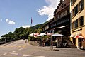
Aarau
| KGS No.? | Picture | Name | Street Address | CH1903 X coordinate | CH1903 Y coordinate | Location |
|---|---|---|---|---|---|---|
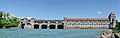
| 8924 8489 9321 | 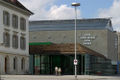 | Aargau Cantonal Library and Aargauer Kunsthaus | Aargauerplatz | 645.755 | 248.963 | 47°23′24″N8°02′41″E / 47.389903°N 8.044631°E |
| 7 |  | Alte Kantonsschule (Old Cantonal School) | Bahnhofstrasse 91 | 646.400 | 249.350 | 47°23′36″N8°03′12″E / 47.393339°N 8.053214°E |
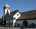
| 9815 |  | Christian Catholic Rectory (former Helferei) | Adelbändli 2 | 645.621 | 249.320 | 47°23′35″N8°02′34″E / 47.393123°N 8.042893°E |
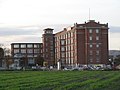
| 9281 |  | Former Rickenbach factory | Rohrerstrasse 12 | 646.649 | 249.405 | 47°23′38″N8°03′23″E / 47.393816°N 8.056517°E |
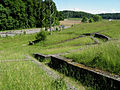
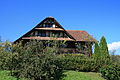
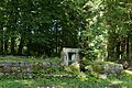
| 10465 |  | Garten Schmidlin | Wasserfluhweg 5 | 645.894 | 248.056 | 47°22′54″N8°02′47″E / 47.381736°N 8.046379°E |
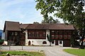
| 9386 | 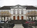 | Grossratsgebäude (Grand Council building) | Obere Vorstadt 10 | 645.827 | 248.936 | 47°23′23″N8°02′44″E / 47.389655°N 8.045582°E |
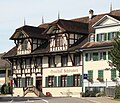
| 9115 |  | House zum Erker | Rathausgasse 10 | 645.666 | 249.282 | 47°23′34″N8°02′37″E / 47.392778°N 8.043485°E |
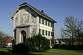
| 12 | 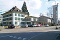 | Katholisches Rectory (former Feerhaus) | Laurenzenvorstadt 80 | 646.190 | 249.394 | 47°23′37″N8°03′02″E / 47.393749°N 8.050437°E |
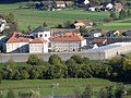
| 9817 | 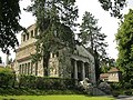 | Krematorium | Rosengartenweg | 645.942 | 248.758 | 47°23′17″N8°02′50″E / 47.388046°N 8.047087°E |
| 8490 | 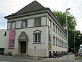 | Naturama Aargau | Feerstrasse 15 | 646.269 | 249.263 | 47°23′33″N8°03′05″E / 47.392565°N 8.05147°E |
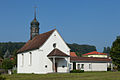
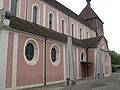
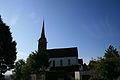
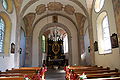
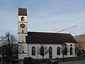
| 23 |  | Swiss Reformed Stadtkirche | Kirchplatz | 645.595 | 249.273 | 47°23′34″N8°02′33″E / 47.392702°N 8.042544°E |
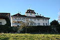
| 5 |  | Regierungsgebäude | Regierungsplatz | 645.813 | 248.982 | 47°23′24″N8°02′43″E / 47.39007°N 8.045401°E |
| 9387 |  | Restaurant Zunftstube | Pelzgasse 19 | 645.768 | 249.249 | 47°23′33″N8°02′41″E / 47.392475°N 8.044833°E |
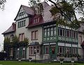
| 9388 | 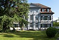 | «Schlossgarten» | Laurenzenvorstadt 3 | 645.848 | 249.425 | 47°23′39″N8°02′45″E / 47.394052°N 8.04591°E |
| 8786 |  | State Archives des Canton Aargau (State Archives) | Entfelderstrasse 22 | 646.121 | 248.740 | 47°23′16″N8°02′58″E / 47.387872°N 8.049456°E |
| Unknown | ISOS City: Aarau |