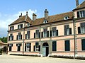
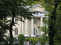
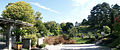
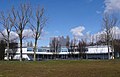
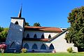
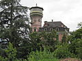
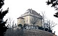
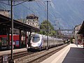
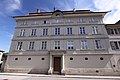
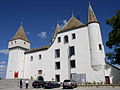
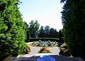
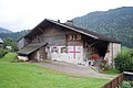
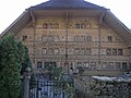
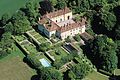
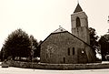
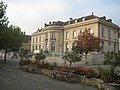
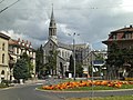
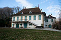
List of cultural property of national significance in Switzerland: Vaud

Last updated

This list contains all cultural property of national significance (class A) in the canton of Vaud from the 2009 Swiss Inventory of Cultural Property of National and Regional Significance. It is sorted by municipality and contains 186 individual buildings, 46 collections, 32 archaeological finds and 2 other, special sites or objects.

Contents

The geographic coordinates provided are in the Swiss coordinate system as given in the Inventory.

Agiez

KGS No.?
PictureNameStreet Address CH1903 X coordinateCH1903 Y coordinateLocation
Unknown ISOS village: Agiez

Aigle

KGS No.?
PictureNameStreet Address CH1903 X coordinateCH1903 Y coordinateLocation
5889
8694
Aigle Castle and Museum de la vigne Aigle Schloss2.jpg
Aigle Castle and Museum de la vigne
Aigle Castle and Museum de la vigneDu vin and de l'étiquette, Chemin564.381129.400 46°18′54″N6°58′34″E / 46.315055°N 6.976214°E / 46.315055; 6.976214
5897
Swiss Reformed Church of Saint-Maurice Aigle Kirche.jpg
Swiss Reformed Church of Saint-Maurice
Swiss Reformed Church of Saint-MauriceAvenue du cloître564.208129.503 46°18′57″N6°58′26″E / 46.315972°N 6.97396°E / 46.315972; 6.97396
5890 De la dîme HouseChemin du château564.331129.386 46°18′54″N6°58′32″E / 46.314926°N 6.975566°E / 46.314926; 6.975566
Unknown ISOS petite City / bourg: Aigle

Allaman

KGS No.?
PictureNameStreet Address CH1903 X coordinateCH1903 Y coordinateLocation
5898
Allaman Castle Chateau allaman1.JPG
Allaman Castle
Allaman Castle 520.063147.196 46°28′17″N6°23′52″E / 46.471317°N 6.397841°E / 46.471317; 6.397841

Arnex-sur-Orbe

KGS No.?
PictureNameStreet Address CH1903 X coordinateCH1903 Y coordinateLocation
Unknown ISOS village: Arnex-sur-Orbe

Arzier

KGS No.?
PictureNameStreet Address CH1903 X coordinateCH1903 Y coordinateLocation
9687
Oujon Charterhouse and House Basse Ruines d'Oujon 01.jpg
Oujon Charterhouse and House Basse
Oujon Charterhouse and House BasseMonastère médiéval503.480146.670 46°27′52″N6°10′55″E / 46.464402°N 6.182071°E / 46.464402; 6.182071

Aubonne

KGS No.?
PictureNameStreet Address CH1903 X coordinateCH1903 Y coordinateLocation
10315
Former Federal Powder Mill AnciennePoudrerieFederale(2).jpg
Former Federal Powder Mill
Former Federal Powder MillChemin de la vaux 48520.514148.916 46°29′13″N6°24′12″E / 46.486842°N 6.403417°E / 46.486842; 6.403417
5905
Aubonne Castle Aubonne-Eglise-Bourg.jpg
Aubonne Castle
Aubonne Castle 519.596150.026 46°29′48″N6°23′29″E / 46.496716°N 6.39127°E / 46.496716; 6.39127
5908
City Hall and grenette Aubonne-Hotel-de-Ville.jpg
City Hall and grenette
City Hall and grenetteGrande rue 2519.580149.890 46°29′44″N6°23′28″E / 46.495491°N 6.391085°E / 46.495491; 6.391085
5910
D'Aspre House With Orangery MaisondAspre(1).jpg
D'Aspre House With Orangery
D'Aspre House With Orangery Le clos d'Aspre519.650149.775 46°29′40″N6°23′31″E / 46.494465°N 6.392016°E / 46.494465; 6.392016
5911
Manoir et manege Manoir de Bougy.jpg
Manoir et manège
Manoir et manègeBougy-Saint-Martin 6518.853149.629 46°29′35″N6°22′54″E / 46.493056°N 6.381662°E / 46.493056; 6.381662
Unknown ISOS petite City / bourg: Aubonne
Unknown ISOS cas particulier: Poudrerie fédérale

Avenches

KGS No.?
PictureNameStreet Address CH1903 X coordinateCH1903 Y coordinateLocation
5918
5913
Aventicum,
Roman City Picswiss VD-48-24.jpg
Aventicum,
Roman City
Aventicum,
Roman City
570.400192.400 46°52′55″N7°03′01″E / 46.882059°N 7.050307°E / 46.882059; 7.050307
5915
Avenches Castle Picswiss VD-48-30.jpg
Avenches Castle
Avenches Castle Rue du château569.700192.323 46°52′53″N7°02′28″E / 46.881334°N 7.041129°E / 46.881334; 7.041129
5920
Cure Avenches - cure.jpg
Cure
CureRue du Jura 2569.636192.281 46°52′51″N7°02′25″E / 46.880954°N 7.040292°E / 46.880954; 7.040292
5923
Swiss Reformed Church Avenches, church st marie-madeleine - ch.jpg
Swiss Reformed Church
Swiss Reformed ChurchPlace de l'église569.664192.201 46°52′49″N7°02′26″E / 46.880235°N 7.040665°E / 46.880235; 7.040665
6051
Temple a Donatyre Picswiss VD-48-11.jpg
Temple à Donatyre
Temple à DonatyreRoute de Villarepos570.990191.790 46°52′36″N7°03′29″E / 46.876597°N 7.058086°E / 46.876597; 7.058086
10508
L'eveque Tower With Amphitheatre and Roman Museum Avenches - arenes.jpg
L'évêque Tower With Amphitheatre and Roman Museum
L'évêque Tower With Amphitheatre and Roman Museum569.860192.300 46°52′52″N7°02′36″E / 46.881135°N 7.043229°E / 46.881135; 7.043229
Unknown ISOS petite City / bourg: Avenches
Unknown ISOS cas particulier: Haras fédéral

Baulmes

KGS No.?
PictureNameStreet Address CH1903 X coordinateCH1903 Y coordinateLocation
5927 Abri de la Cure
Prehistoric Shelter
529.700182.800 46°47′34″N6°31′04″E / 46.792652°N 6.517865°E / 46.792652; 6.517865
11687
Beffroi communal Baulmes-Beffroi.jpg
Beffroi communal
Beffroi communalPlace de la tour529.965182.585 46°47′27″N6°31′17″E / 46.790746°N 6.521369°E / 46.790746; 6.521369
Unknown ISOS village: Baulmes

Begnins

KGS No.?
PictureNameStreet Address CH1903 X coordinateCH1903 Y coordinateLocation
Unknown ISOS village: Begnins

Bex

KGS No.?
PictureNameStreet Address CH1903 X coordinateCH1903 Y coordinateLocation
5946
Church Bell Tower Eglisebex02.JPG
Church Bell Tower
Church Bell Tower567.125122.290 46°15′04″N7°00′44″E / 46.251237°N 7.012338°E / 46.251237; 7.012338
5945
Salt Mining Complex Bex salt mines.jpg
Salt Mining Complex
Salt Mining ComplexRoute de Gryon 29568.457123.312 46°15′38″N7°01′46″E / 46.260494°N 7.029541°E / 46.260494; 7.029541
5948
Fortifications de l'Arzillier Fortifications01.JPG
Fortifications de l'Arzillier
Fortifications de l'Arzillier566.720119.440 46°13′32″N7°00′26″E / 46.22558°N 7.00729°E / 46.22558; 7.00729
10498
Bridge Over the Rhone
Shared With St-Maurice in Valais. Pont sur le Rhone - Saint-Maurice.jpg
Bridge Over the Rhone
Shared With St-Maurice in Valais.
Bridge Over the Rhone
Shared With St-Maurice in Valais.
Route de Saint-Maurice / Route du Chablais566.421119.207 46°13′24″N7°00′12″E / 46.223469°N 7.003431°E / 46.223469; 7.003431
Unknown ISOS village: Les Posses
Unknown ISOS cas particulier: Le Bévieux

Blonay

KGS No.?
PictureNameStreet Address CH1903 X coordinateCH1903 Y coordinateLocation
5956
Blonay Castle Blonay Schloss.jpg
Blonay Castle
Blonay Castle Chemin du château557.849146.616 46°28′10″N6°53′23″E / 46.469542°N 6.889852°E / 46.469542; 6.889852

Bofflens

KGS No.?
PictureNameStreet Address CH1903 X coordinateCH1903 Y coordinateLocation
Unknown ISOS village: Bofflens

Bonvillars

KGS No.?
PictureNameStreet Address CH1903 X coordinateCH1903 Y coordinateLocation
Unknown ISOS village: Bonvillars

Bougy-Villars

KGS No.?
PictureNameStreet Address CH1903 X coordinateCH1903 Y coordinateLocation
Unknown ISOS village: Bougy-Villars

Bourg-en-Lavaux

KGS No.?
PictureNameStreet Address CH1903 X coordinateCH1903 Y coordinateLocation
6106
Maison Maillardoz Grandvaux.png
Maison Maillardoz
Maison MaillardozRue Saint-Georges 11544.618149.426 46°29′38″N6°43′02″E / 46.493855°N 6.717263°E / 46.493855; 6.717263
Unknown UNESCO World Heritage Site: Lavaux, Vineyard Terraces
Unknown ISOS village: Grandvaux
Unknown ISOS village: Riex
Unknown ISOS village: Aran
Unknown ISOS petite City / bourg: Cully
Unknown ISOS village: Epesses

Bursinel

KGS No.?
PictureNameStreet Address CH1903 X coordinateCH1903 Y coordinateLocation
5964 Villa Choisy and OutbuildingsChoisy513.759143.783 46°26′23″N6°18′59″E / 46.439836°N 6.316408°E / 46.439836; 6.316408

Bursins

KGS No.?
PictureNameStreet Address CH1903 X coordinateCH1903 Y coordinateLocation
5968
Swiss Reformed Church of Saint-Martin,
Formerly Site of a Priory Bursins - Ancien prieure - Eglise 01.jpg
Swiss Reformed Church of Saint-Martin,
Formerly Site of a Priory
Swiss Reformed Church of Saint-Martin,
Formerly Site of a Priory
Rue de l'église511.734145.292 46°27′11″N6°17′23″E / 46.453146°N 6.289774°E / 46.453146; 6.289774
11665 Tuilerie de Vinzel avec four HoffmannEn Beroche511.275144.683 46°26′51″N6°17′02″E / 46.447607°N 6.283917°E / 46.447607; 6.283917
Unknown ISOS village: Bursins

Burtigny

KGS No.?
PictureNameStreet Address CH1903 X coordinateCH1903 Y coordinateLocation
Unknown ISOS village: Burtigny

Champagne

KGS No.?
PictureNameStreet Address CH1903 X coordinateCH1903 Y coordinateLocation
Unknown ISOS village: Champagne

Champvent

KGS No.?
PictureNameStreet Address CH1903 X coordinateCH1903 Y coordinateLocation
5970
Champvent Castle Chateau de Champvent.JPG
Champvent Castle
Champvent Castle Chemin du château533.758181.231 46°46′44″N6°34′16″E / 46.778955°N 6.571238°E / 46.778955; 6.571238
5971
Manoir de Saint-Christophe Champvent, manoir de Saint-Christophe 02.jpg
Manoir de Saint-Christophe
Manoir de Saint-ChristopheSaint-Christophe532.061180.580 46°46′23″N6°32′57″E / 46.772929°N 6.549116°E / 46.772929; 6.549116
Unknown ISOS cas particulier: Champvent
Unknown ISOS cas particulier: Saint-Christophe

Chardonne

KGS No.?
PictureNameStreet Address CH1903 X coordinateCH1903 Y coordinateLocation
Unknown UNESCO World Heritage Site: Lavaux, Vineyard Terraces

Château-d'Œx

KGS No.?
PictureNameStreet Address CH1903 X coordinateCH1903 Y coordinateLocation
Unknown Les Ciernes-Picat
Mesolithic Shelter
Unknown ISOS hameau: l’Etivaz

Chavannes-le-Chêne

KGS No.?
PictureNameStreet Address CH1903 X coordinateCH1903 Y coordinateLocation
10509 Vallon des Vaux,
Prehistoric and High Medieval Settlement
548.700180.650 46°46′30″N6°46′01″E / 46.775047°N 6.766949°E / 46.775047; 6.766949

Chavannes-le-Veyron

KGS No.?
PictureNameStreet Address CH1903 X coordinateCH1903 Y coordinateLocation
10319
Scierie Chavannes-le-Veyron - Scierie - 1.jpg
Scierie
ScierieVeyron les Charbonnières 49, 31524.280161.843 46°36′13″N6°27′01″E / 46.603555°N 6.450339°E / 46.603555; 6.450339

Chavannes-près-Renens

KGS No.?
PictureNameStreet Address CH1903 X coordinateCH1903 Y coordinateLocation
8792
Cantonal Archives of Vaud Archives cantonales vaudoises.jpg
Cantonal Archives of Vaud
Cantonal Archives of VaudRue de la Mouline 32533.980153.071 46°31′32″N6°34′41″E / 46.525679°N 6.578188°E / 46.525679; 6.578188

Chavannes-sur-Moudon

KGS No.?
PictureNameStreet Address CH1903 X coordinateCH1903 Y coordinateLocation
Unknown ISOS village: Chavannes-sur-Moudon

Chavornay

KGS No.?
PictureNameStreet Address CH1903 X coordinateCH1903 Y coordinateLocation
5984
Swiss Reformed Church of Saint-Maurice KGS-Nr 5984 bis.JPG
Swiss Reformed Church of Saint-Maurice
Swiss Reformed Church of Saint-Maurice En Couvalau533.596172.628 46°42′06″N6°34′13″E / 46.701556°N 6.570364°E / 46.701556; 6.570364

Chêne-Pâquier

KGS No.?
PictureNameStreet Address CH1903 X coordinateCH1903 Y coordinateLocation
5985
Temple et cure Chenepaquiercure.jpg
Temple et cure
Temple et cureLe Pâquier548.460180.140 46°46′14″N6°45′50″E / 46.770441°N 6.763864°E / 46.770441; 6.763864
Unknown ISOS cas particulier: Chêne-Pâquier

Cheseaux-Noréaz

KGS No.?
PictureNameStreet Address CH1903 X coordinateCH1903 Y coordinateLocation
5990
Campagne de Champittet Champ-Pittet.JPG
Campagne de Champittet
Campagne de ChampittetChâteau de Champittet540.989181.670 46°47′01″N6°39′57″E / 46.783584°N 6.665861°E / 46.783584; 6.665861

Chéserex

KGS No.?
PictureNameStreet Address CH1903 X coordinateCH1903 Y coordinateLocation
5993
Church of the Old Bonmont Abbey Abbaye de Bonmont 4.JPG
Church of the Old Bonmont Abbey
Church of the Old Bonmont Abbey Bonmont500.839139.872 46°24′10″N6°08′57″E / 46.402873°N 6.149149°E / 46.402873; 6.149149

Chexbres

KGS No.?
PictureNameStreet Address CH1903 X coordinateCH1903 Y coordinateLocation
Unknown UNESCO World Heritage Site: Lavaux, Vineyard Terraces

Concise

KGS No.?
PictureNameStreet Address CH1903 X coordinateCH1903 Y coordinateLocation
6005 Ancienne chartreuse de la LanceLa Lance546.514189.998 46°51′32″N6°44′14″E / 46.858961°N 6.737235°E / 46.858961; 6.737235
6006
La Raisse / En Favarges
Roman Quarry Concise La Raisse DSC9849 20110923.jpg
La Raisse / En Favarges
Roman Quarry
La Raisse / En Favarges
Roman Quarry
547.100190.250 46°51′41″N6°44′42″E / 46.861274°N 6.74489°E / 46.861274; 6.74489
9690
Sous-Colachoz
Bay and Lakeshore Neolithic and Bronze Age Settlements Concise DSC9839 20110923.jpg
Sous-Colachoz
Bay and Lakeshore Neolithic and Bronze Age Settlements
Sous-Colachoz
Bay and Lakeshore Neolithic and Bronze Age Settlements
545.000188.700 46°50′50″N6°43′03″E / 46.847162°N 6.717538°E / 46.847162; 6.717538
Unknown ISOS village: Concise
Unknown ISOS cas particulier: La Lance

Coppet

KGS No.?
PictureNameStreet Address CH1903 X coordinateCH1903 Y coordinateLocation
6010
9174
Coppet Castle and
Institut europeen de l'universite de Geneve, centre d'archives europeennes Coppet Schloss.jpg
Coppet Castle and
Institut européen de l'université de Genève, centre d'archives européennes
Coppet Castle and
Institut européen de l'université de Genève, centre d'archives européennes
Rue de la gare 2503.985130.290 46°19′02″N6°11′31″E / 46.317145°N 6.192032°E / 46.317145; 6.192032
6013
Temple
(Former Church of the Dominicans) Temple de Coppet (VD).JPG
Temple
(Former Church of the Dominicans)
Temple
(Former Church of the Dominicans)
Grand-Rue504.064130.141 46°18′57″N6°11′35″E / 46.315816°N 6.193088°E / 46.315816; 6.193088
Unknown ISOS petite City / bourg: Coppet

Corcelles-près-Concise

KGS No.?
PictureNameStreet Address CH1903 X coordinateCH1903 Y coordinateLocation
Unknown ISOS village: Corcelles-près-Concise

Corseaux

KGS No.?
PictureNameStreet Address CH1903 X coordinateCH1903 Y coordinateLocation
6020
Villa le Lac Cors02.jpg
Villa le Lac
Villa le Lac Route de Lavaux 21553.210146.525 46°28′06″N6°49′46″E / 46.468415°N 6.829466°E / 46.468415; 6.829466
Unknown UNESCO World Heritage Site: Lavaux, Vineyard Terraces

Corsier-sur-Vevey

KGS No.?
PictureNameStreet Address CH1903 X coordinateCH1903 Y coordinateLocation
6021
Cafe de la place Corsier-sur-Vevey - Cafe de la Place.jpg
Café de la place
Café de la placePlace du temple 5554.141146.754 46°28′14″N6°50′30″E / 46.47054°N 6.841564°E / 46.47054; 6.841564
6022 Manoir de Ban: House de maître
With Outbuildings and Park
Route de Fénil 2554.903147.293 46°28′32″N6°51′05″E / 46.47544°N 6.851432°E / 46.47544; 6.851432
Unknown UNESCO World Heritage Site: Lavaux, Vineyard Terraces

Cossonay

KGS No.?
PictureNameStreet Address CH1903 X coordinateCH1903 Y coordinateLocation
6029
Swiss Reformed Church of St Peter and St Paul Cossonay - Clocher du Temple.jpg
Swiss Reformed Church of St Peter and St Paul
Swiss Reformed Church of St Peter and St PaulPlace du temple528.800162.970 46°36′51″N6°30′33″E / 46.614189°N 6.509155°E / 46.614189; 6.509155
Unknown ISOS petite City / bourg: Cossonay
Unknown ISOS village: La Chaux

Crans-près-Céligny

KGS No.?
PictureNameStreet Address CH1903 X coordinateCH1903 Y coordinateLocation
6031
Crans Castle Chateau de Crans.JPG
Crans Castle
Crans Castle Château de Crans505.352134.784 46°21′28″N6°12′32″E / 46.357761°N 6.208863°E / 46.357761; 6.208863

Cronay

KGS No.?
PictureNameStreet Address CH1903 X coordinateCH1903 Y coordinateLocation
Unknown ISOS village: Cronay

Cuarnens

KGS No.?
PictureNameStreet Address CH1903 X coordinateCH1903 Y coordinateLocation
Unknown ISOS village: Cuarnens

Cudrefin

KGS No.?
PictureNameStreet Address CH1903 X coordinateCH1903 Y coordinateLocation
6034
Fountain of Justice Picswiss VD-52-01.jpg
Fountain of Justice
Fountain of JusticePlace de la justice568.022200.547 46°57′19″N7°01′07″E / 46.955232°N 7.018538°E / 46.955232; 7.018538
Unknown ISOS village: Montet

Curtilles

KGS No.?
PictureNameStreet Address CH1903 X coordinateCH1903 Y coordinateLocation
6045
Curtilles Castle Chateau de Curtilles.jpg
Curtilles Castle
Curtilles Castle Au village554.844172.069 46°41′54″N6°50′54″E / 46.698304°N 6.848237°E / 46.698304; 6.848237

Daillens

KGS No.?
PictureNameStreet Address CH1903 X coordinateCH1903 Y coordinateLocation
6047
Clocher du temple Daillens, clocher du temple, cote route.jpg
Clocher du temple
Clocher du templeAu village531.840163.640 46°37′14″N6°32′55″E / 46.620532°N 6.548738°E / 46.620532; 6.548738

Démoret

KGS No.?
PictureNameStreet Address CH1903 X coordinateCH1903 Y coordinateLocation
Unknown ISOS village: Démoret

Donneloye

KGS No.?
PictureNameStreet Address CH1903 X coordinateCH1903 Y coordinateLocation
Unknown ISOS village: Prahins

Duillier

KGS No.?
PictureNameStreet Address CH1903 X coordinateCH1903 Y coordinateLocation
6053
Duillier Castle Chateau Duillier2.jpg
Duillier Castle
Duillier Castle Rue du château507.389140.207 46°24′25″N6°14′03″E / 46.406822°N 6.234244°E / 46.406822; 6.234244
6054
Grange des dimes Grange des dimes de Duillier (Suisse).jpg
Grange des dîmes
Grange des dîmesVerchère507.280140.380 46°24′30″N6°13′58″E / 46.408363°N 6.232792°E / 46.408363; 6.232792

Dully

KGS No.?
PictureNameStreet Address CH1903 X coordinateCH1903 Y coordinateLocation
6055 Dully Castle and OutbuildingsRue du village512.095142.652 46°25′46″N6°17′42″E / 46.429447°N 6.294973°E / 46.429447; 6.294973

Echichens

KGS No.?
PictureNameStreet Address CH1903 X coordinateCH1903 Y coordinateLocation
6492
Mestral Castle Saint-Saphorin-sur-Morges Castle.jpg
Mestral Castle
Mestral Castle Saint-Saphorin-sur-Morges, Le Pavé527.054155.339 46°32′43″N6°29′15″E / 46.54536°N 6.487571°E / 46.54536; 6.487571
Unknown ISOS village: Saint-Saphorin-sur-Morges
Unknown ISOS village: Colombier

Eclépens

KGS No.?
PictureNameStreet Address CH1903 X coordinateCH1903 Y coordinateLocation
6063
Abandoned D'Entreroches Canal Canal d'Entreroches.jpg
Abandoned D'Entreroches Canal
Abandoned D'Entreroches Canal532.260168.194 46°39′42″N6°33′13″E / 46.661538°N 6.55355°E / 46.661538; 6.55355
11776
Le Mormont
Proto-Historic Through Iron Age Site Eclepens, Le Mormont, site Proto-historique et age du Fer.jpg
Le Mormont
Proto-Historic Through Iron Age Site
Le Mormont
Proto-Historic Through Iron Age Site
530.730167.500 46°39′19″N6°32′01″E / 46.655139°N 6.533666°E / 46.655139; 6.533666
Unknown ISOS village: Eclépens

Écublens

KGS No.?
PictureNameStreet Address CH1903 X coordinateCH1903 Y coordinateLocation
10596
Archives of Modern Construction,
EPFL, SG-Ecublens Archives de la construction moderne EPFL.jpg
Archives of Modern Construction,
EPFL, SG-Ecublens
Archives of Modern Construction,
EPFL, SG-Ecublens
532.880152.557 46°31′15″N6°33′50″E / 46.520946°N 6.563928°E / 46.520946; 6.563928
8933
9348
Cantonal and University Library of Lausanne and University of Lausanne,
Manuscripts Department UNIL-p1010648.jpg
Cantonal and University Library of Lausanne and University of Lausanne,
Manuscripts Department
Cantonal and University Library of Lausanne and University of Lausanne,
Manuscripts Department
Allée de Dorigny534.078152.738 46°31′22″N6°34′46″E / 46.522693°N 6.579513°E / 46.522693; 6.579513
9159
Jean Monnet Foundation for Europe Fondation Jean Monnet pour l'Europe(2).jpg
Jean Monnet Foundation for Europe
Jean Monnet Foundation for Europe Route de la Sorge534.299152.880 46°31′26″N6°34′57″E / 46.523992°N 6.582373°E / 46.523992; 6.582373

Essertines-sur-Rolle

KGS No.?
PictureNameStreet Address CH1903 X coordinateCH1903 Y coordinateLocation
Unknown ISOS hameau: Bugnaux

Essertines-sur-Yverdon

KGS No.?
PictureNameStreet Address CH1903 X coordinateCH1903 Y coordinateLocation
Unknown ISOS village: Essertines-sur-Yverdon

Etoy

KGS No.?
PictureNameStreet Address CH1903 X coordinateCH1903 Y coordinateLocation
Unknown ISOS village: Etoy

Faoug

KGS No.?
PictureNameStreet Address CH1903 X coordinateCH1903 Y coordinateLocation
10322
Domaine Cornaz et ses dependances La Gordanne.jpg
Domaine Cornaz et ses dépendances
Domaine Cornaz et ses dépendancesRoute de Salavaux572.340195.278 46°54′29″N7°04′32″E / 46.90803°N 7.075583°E / 46.90803; 7.075583

Féchy

KGS No.?
PictureNameStreet Address CH1903 X coordinateCH1903 Y coordinateLocation
6072 La Gordanne,
Main House and Outbuildings
Route suisse 6518.485146.761 46°28′02″N6°22′39″E / 46.467214°N 6.377374°E / 46.467214; 6.377374
Unknown ISOS village: Féchy

Ferreyres

KGS No.?
PictureNameStreet Address CH1903 X coordinateCH1903 Y coordinateLocation
Unknown ISOS village: Ferreyres

Fiez

KGS No.?
PictureNameStreet Address CH1903 X coordinateCH1903 Y coordinateLocation
Unknown ISOS village: Fiez

Fontaines-sur-Grandson

KGS No.?
PictureNameStreet Address CH1903 X coordinateCH1903 Y coordinateLocation
Unknown ISOS village: Fontaines-sur-Grandson

Giez

KGS No.?
PictureNameStreet Address CH1903 X coordinateCH1903 Y coordinateLocation
Unknown ISOS cas particulier: Giez

Gilly

KGS No.?
PictureNameStreet Address CH1903 X coordinateCH1903 Y coordinateLocation
6082 Campagne de BeaulieuRoute de Genève 68513.805144.670 46°26′52″N6°19′01″E / 46.44782°N 6.316842°E / 46.44782; 6.316842
6081
Vincy Castle Gilly - Chateau de Vincy 01.jpg
Vincy Castle
Vincy Castle Vincy 2512.611146.269 46°27′43″N6°18′04″E / 46.462048°N 6.301003°E / 46.462048; 6.301003
10323
Farm House ECA 148 Gilly - Ferme ECA 148.jpg
Farm House ECA 148
Farm House ECA 148La rue 14512.281145.898 46°27′31″N6°17′48″E / 46.458668°N 6.296778°E / 46.458668; 6.296778

Gimel

KGS No.?
PictureNameStreet Address CH1903 X coordinateCH1903 Y coordinateLocation
Unknown ISOS village: Gimel

Givrins

KGS No.?
PictureNameStreet Address CH1903 X coordinateCH1903 Y coordinateLocation
Unknown ISOS village: Givrins

Gland

KGS No.?
PictureNameStreet Address CH1903 X coordinateCH1903 Y coordinateLocation
10325
La Rajada
Villa, Outbuildings, and Lands La Rajada.jpg
La Rajada
Villa, Outbuildings, and Lands
La Rajada
Villa, Outbuildings, and Lands
511.644141.119 46°24′56″N6°17′22″E / 46.415599°N 6.289398°E / 46.415599; 6.289398

Grandcour

KGS No.?
PictureNameStreet Address CH1903 X coordinateCH1903 Y coordinateLocation
6093
Grandcour Castle Grandcour - Chateau.jpg
Grandcour Castle
Grandcour Castle Au village561.223191.519 46°52′25″N6°55′48″E / 46.873662°N 6.929989°E / 46.873662; 6.929989
6092
Swiss Reformed Church of Notre-Dame de Ressudens Grandcour - eglise reformee.jpg
Swiss Reformed Church of Notre-Dame de Ressudens
Swiss Reformed Church of Notre-Dame de RessudensRessudens562.580191.220 46°52′16″N6°56′52″E / 46.87105°N 6.947813°E / 46.87105; 6.947813
Unknown ISOS village: Grandcour

Grandson

KGS No.?
PictureNameStreet Address CH1903 X coordinateCH1903 Y coordinateLocation
6094
Grandson Castle Grandson Schloss1.jpg
Grandson Castle
Grandson Castle Place du château 14539.582184.584 46°48′35″N6°38′49″E / 46.809669°N 6.647052°E / 46.809669; 6.647052
6095
Swiss Reformed Church of Saint-Jean-Baptiste Grandsontemple.jpg
Swiss Reformed Church of Saint-Jean-Baptiste
Swiss Reformed Church of Saint-Jean-BaptisteRue haute539.324184.447 46°48′30″N6°38′37″E / 46.808413°N 6.64369°E / 46.808413; 6.64369
Unknown ISOS petite City / bourg: Grandson

Gressy

KGS No.?
PictureNameStreet Address CH1903 X coordinateCH1903 Y coordinateLocation
10991
Oppidum de Sermuz,
Iron Age Settlement Sermuz, murus gallicus 1.JPG
Oppidum de Sermuz,
Iron Age Settlement
Oppidum de Sermuz,
Iron Age Settlement
539.400178.700 46°45′24″N6°38′44″E / 46.756726°N 6.645447°E / 46.756726; 6.645447

Gryon

KGS No.?
PictureNameStreet Address CH1903 X coordinateCH1903 Y coordinateLocation
Unknown ISOS village urbanisé: Gryon
Unknown ISOS cas particulier: Taveyanne

Hautemorges

KGS No.?
PictureNameStreet Address CH1903 X coordinateCH1903 Y coordinateLocation
Unknown ISOS village: Pampigny

Jongny

KGS No.?
PictureNameStreet Address CH1903 X coordinateCH1903 Y coordinateLocation
Unknown UNESCO World Heritage Site: Lavaux, Vineyard Terraces

Jorat-Mézières

KGS No.?
PictureNameStreet Address CH1903 X coordinateCH1903 Y coordinateLocation
6234
Theatre du Jorat Theatre du Jorat, Mezieres, 1921.jpg
Théâtre du Jorat
Théâtre du Jorat Rue du théâtre, Mézières548.892160.965 46°35′53″N6°46′18″E / 46.597992°N 6.771653°E / 46.597992; 6.771653

Jouxtens-Mézery

KGS No.?
PictureNameStreet Address CH1903 X coordinateCH1903 Y coordinateLocation
Unknown ISOS cas particulier: Jouxtens-Mézery

L'Abbaye

KGS No.?
PictureNameStreet Address CH1903 X coordinateCH1903 Y coordinateLocation
5885
Manoir de haute roche L'Abbaye Manoir de Haute-Roche.jpg
Manoir de haute roche
Manoir de haute rocheLe pont515.338169.127 46°40′05″N6°19′56″E / 46.667999°N 6.332303°E / 46.667999; 6.332303
Unknown ISOS village: Le Pont

La Sarraz

KGS No.?
PictureNameStreet Address CH1903 X coordinateCH1903 Y coordinateLocation
6466
Chapelle Saint-Antoine La-Sarraz-Temple.jpg
Chapelle Saint-Antoine
Chapelle Saint-AntoineDite du Jacquemart, Grand-Rue529.280168.014 46°39′35″N6°30′53″E / 46.65961°N 6.514645°E / 46.65961; 6.514645
6467
La Sarraz Castle Schloss La Sarraz.jpg
La Sarraz Castle
La Sarraz Castle Rue du château529.241168.102 46°39′37″N6°30′51″E / 46.660397°N 6.514122°E / 46.660397; 6.514122
Unknown ISOS petite City / bourg: La Sarraz

La Tour-de-Peilz

KGS No.?
PictureNameStreet Address CH1903 X coordinateCH1903 Y coordinateLocation
6502
Villa Kenwin Villa Kenwin (2).jpg
Villa Kenwin
Villa KenwinChemin du Vallon 19556.936144.117 46°26′49″N6°52′42″E / 46.447004°N 6.878198°E / 46.447004; 6.878198

Lausanne

KGS No.?
PictureNameStreet Address CH1903 X coordinateCH1903 Y coordinateLocation
6116
Former Hospital Gymnase de la Cite Mercerie.jpg
Former Hospital
Former HospitalRue Mercerie 24538.375152.555 46°31′17″N6°38′08″E / 46.521456°N 6.635534°E / 46.521456; 6.635534
6117
Former Federal Supreme Court of Switzerland (Montbenon) LausanneAncienTribunalFederal(2).jpg
Former Federal Supreme Court of Switzerland (Montbenon)
Former Federal Supreme Court of Switzerland (Montbenon)Allée Ernest-Ansermet 2537.707152.463 46°31′14″N6°37′37″E / 46.520567°N 6.626841°E / 46.520567; 6.626841
6118
8714
Former Residence of the Bishop of Lausanne
and the Historical Museum of Lausanne Ancien eveche et Musee historique de Lausanne.jpg
Former Residence of the Bishop of Lausanne
and the Historical Museum of Lausanne
Former Residence of the Bishop of Lausanne
and the Historical Museum of Lausanne
Place de la cathédrale 4538.331152.642 46°31′20″N6°38′06″E / 46.522235°N 6.634949°E / 46.522235; 6.634949
6119
Former Academy Lausanne, Ancienne Academie 3.jpg
Former Academy
Former AcademyRue Cité-Devant 7538.334152.804 46°31′25″N6°38′06″E / 46.523692°N 6.634966°E / 46.523692; 6.634966
11779
Archives of the Banque Vaudoise Archives de la Banque Vaudoise, Lausanne.jpg
Archives of the Banque Vaudoise
Archives of the Banque VaudoisePlace Saint-François538.300152.280 46°31′08″N6°38′05″E / 46.518975°N 6.634593°E / 46.518975; 6.634593
8777
Archives of the City of Lausanne Archives de la ville de Lausanne.JPG
Archives of the City of Lausanne
Archives of the City of LausanneRue du Maupas 47537.528152.973 46°31′30″N6°37′28″E / 46.525137°N 6.62444°E / 46.525137; 6.62444
11837
Archives of l'Energie Ouest Suisse (EOS) Archives d'Energie Ouest Suisse Lausanne.jpg
Archives of l'Energie Ouest Suisse (EOS)
Archives of l'Energie Ouest Suisse (EOS)Chemin de Mornex 10537.840152.260 46°31′08″N6°37′43″E / 46.518753°N 6.628602°E / 46.518753; 6.628602
11781
Bibliotheque des cedres (formerly Bibliotheque des pasteurs) Bibliotheque des Cedres, Lausanne.JPG
Bibliothèque des cèdres (formerly Bibliothèque des pasteurs)
Bibliothèque des cèdres (formerly Bibliothèque des pasteurs)Chemin des cèdres 7537.730153.011 46°31′32″N6°37′37″E / 46.525498°N 6.627067°E / 46.525498; 6.627067
6122
Casino de Montbenon Casino Montbenon.jpg
Casino de Montbenon
Casino de Montbenon Allée Ernest-Ansermet 3537.569152.444 46°31′13″N6°37′30″E / 46.520383°N 6.625046°E / 46.520383; 6.625046
6123
Notre-Dame Cathedral Lausanne-cathe7.JPG
Notre-Dame Cathedral
Notre-Dame Cathedral Place de la cathédrale538.370152.680 46°31′21″N6°38′08″E / 46.52258°N 6.635452°E / 46.52258; 6.635452
8977
University Hospital of Lausanne (CHUV) CHUV Lausanne Suisse 045.JPG
University Hospital of Lausanne (CHUV)
University Hospital of Lausanne (CHUV) Rue du Bugnon 46538.922152.927 46°31′29″N6°38′33″E / 46.524852°N 6.642613°E / 46.524852; 6.642613
6124
Chateau Saint-Maire Chateau St-Maire.jpg
Château Saint-Maire
Château Saint-Maire Place du château 4538.375152.926 46°31′29″N6°38′08″E / 46.524793°N 6.635484°E / 46.524793; 6.635484
6150
8697
Beaulieu Castle and
collection de l'art brut (Collection of Outsider art) Lausannebeaulieu.jpg
Beaulieu Castle and
collection de l'art brut (Collection of Outsider art)
Beaulieu Castle and
collection de l'art brut (Collection of Outsider art)
Avenue des bergières 11537.570153.200 46°31′38″N6°37′30″E / 46.527183°N 6.624956°E / 46.527183; 6.624956
10327
Bois-de-Vaux Cemetery BoisVaux4.JPG
Bois-de-Vaux Cemetery
Bois-de-Vaux Cemetery Route de Chavannes 2535.835152.222 46°31′06″N6°36′09″E / 46.518222°N 6.602481°E / 46.518222; 6.602481
9694
Roman era / Medieval Hill Top City Suisse, canton de Vaud, Lausanne, colline de la Cite, vestiges.jpg
Roman era / Medieval Hill Top City
Roman era / Medieval Hill Top City537.700152.880 46°31′28″N6°37′36″E / 46.524317°N 6.626694°E / 46.524317; 6.626694
6136
Swiss Reformed Church of Saint-Francois Picswiss VD-46-21.jpg
Swiss Reformed Church of Saint-François
Swiss Reformed Church of Saint-FrançoisPlace Saint-François 18538.220152.360 46°31′11″N6°38′01″E / 46.519688°N 6.63354°E / 46.519688; 6.63354
6203
Swiss Reformed Church of Saint-Laurent St-Laurent Lausanne.jpg
Swiss Reformed Church of Saint-Laurent
Swiss Reformed Church of Saint-LaurentRue Haldimand538.020152.650 46°31′20″N6°37′51″E / 46.522278°N 6.630895°E / 46.522278; 6.630895
6173
8698
Fondation de l'Hermitage,
House de maitre Hermitagefoundation.jpg
Fondation de l’Hermitage,
House de maître
Fondation de l’Hermitage,
House de maître
Route du signal 2538.513153.302 46°31′41″N6°38′14″E / 46.528188°N 6.637233°E / 46.528188; 6.637233
8667
Fondation Toms Pauli
Collection des tapisseries et d'art textile Le Dromadaire Tapestry.jpg
Fondation Toms Pauli
Collection des tapisseries et d'art textile
Fondation Toms Pauli
Collection des tapisseries et d'art textile
Rue Caroline 2538.502152.424 46°31′13″N6°38′14″E / 46.520289°N 6.637206°E / 46.520289; 6.637206
6164
Galeries Saint-Francois Lausannegaleriesstfrancois.jpg
Galeries Saint-François
Galeries Saint-François538.323152.358 46°31′11″N6°38′06″E / 46.519679°N 6.634882°E / 46.519679; 6.634882
6126
Main Train Station Gare-lausanne-IMG 0002.JPG
Main Train Station
Main Train StationPlace de la gare537.882152.067 46°31′01″N6°37′45″E / 46.517021°N 6.629175°E / 46.517021; 6.629175
6190
Hotel Beau-Rivage Palace Beau Rivage Hotel, Lausanne.jpg
Hôtel Beau-Rivage Palace
Hôtel Beau-Rivage PalaceChemin de beau-rivage537.950151.050 46°30′28″N6°37′49″E / 46.507879°N 6.630197°E / 46.507879; 6.630197
6127
City Hall LausanneHotelDeVille(2).jpg
City Hall
City Hall Place de la palud 2538.172152.588 46°31′18″N6°37′58″E / 46.521734°N 6.632884°E / 46.521734; 6.632884
6198
Hotel des postes Lausanneposte.jpg
Hôtel des postes
Hôtel des postesPlace Saint-François 15538.172152.322 46°31′10″N6°37′59″E / 46.519341°N 6.632919°E / 46.519341; 6.632919
10510
Administration Building of Andre & Cie. S.A., Immeuble administratif Andre & Cie S.A.jpg
Administration Building of André & Cie. S.A.,
Administration Building of André & Cie. S.A.,Chemin Messidor 5, 7538.798151.828 46°30′54″N6°38′28″E / 46.514955°N 6.641142°E / 46.514955; 6.641142
10331
Administration Building of the Vaudoise Assurances TschumiMutuelleAssurance03.jpg
Administration Building of the Vaudoise Assurances
Administration Building of the Vaudoise AssurancesAvenue de cour 41537.146151.760 46°30′51″N6°37′11″E / 46.514191°N 6.619626°E / 46.514191; 6.619626
6169
Apartment and Office Building Immeuble d'habitation et de bureau, Lausanne.JPG
Apartment and Office Building
Apartment and Office BuildingRue du Grand-Chêne 8538.020152.376 46°31′11″N6°37′51″E / 46.519813°N 6.630932°E / 46.519813; 6.630932
9032
Les bains de Bellerive Les-Bains-de-Bellerive.jpg
Les bains de Bellerive
Les bains de BelleriveAvenue de Rhodanie 23536.925151.489 46°30′42″N6°37′00″E / 46.511732°N 6.616784°E / 46.511732; 6.616784
11682
L'Esterel House Lausanneesterel.jpg
L'Estérel House
L'Estérel HouseAvenue d'Ouchy 16–18537.953151.639 46°30′47″N6°37′49″E / 46.513178°N 6.630157°E / 46.513178; 6.630157
6177
8711
Musee de l'Elysee et maison de l'Elysee Musee de l'Elysee 4.jpg
Musée de l'Élysée et maison de l'Élysée
Musée de l'Élysée et maison de l'ÉlyséeAvenue de l'Élysée 18538.158151.275 46°30′36″N6°37′58″E / 46.509922°N 6.632877°E / 46.509922; 6.632877
11782
House Maison d'habitation Lausanne 2.jpg
House
HouseChemin de Chandolin 4539.197152.124 46°31′04″N6°38′47″E / 46.517654°N 6.646302°E / 46.517654; 6.646302
6128
Mon-Repos,
park, Home, Fountain, Stables, Orangery, and Temple of Love PMR20.jpg
Mon-Repos,
park, Home, Fountain, Stables, Orangery, and Temple of Love
Mon-Repos,
park, Home, Fountain, Stables, Orangery, and Temple of Love
Parc de Mon-Repos 1538.927152.269 46°31′08″N6°38′34″E / 46.518934°N 6.642765°E / 46.518934; 6.642765
8701
Museum of Contemporary Design and Applied Arts (MUDAC) Lausanne, Musee de design et d'arts appliques contemporains (MUDAC), vue laterale.jpg
Museum of Contemporary Design and Applied Arts (MUDAC)
Museum of Contemporary Design and Applied Arts (MUDAC)Place de la cathédrale 6538.360152.630 46°31′20″N6°38′07″E / 46.522129°N 6.635328°E / 46.522129; 6.635328
8712
Cantonal Museum and Botanical Gardens Musee-et-jardins-botaniques-cantonaux.jpg
Cantonal Museum and Botanical Gardens
Cantonal Museum and Botanical GardensAvenue de cour 14537.456151.607 46°30′46″N6°37′25″E / 46.512843°N 6.623686°E / 46.512843; 6.623686
10674
11614
Olympic Museum and Archives of the CIO Musee olympique.jpg
Olympic Museum and Archives of the CIO
Olympic Museum and Archives of the CIOQuai d'Ouchy 1538.278151.057 46°30′29″N6°38′04″E / 46.507972°N 6.63447°E / 46.507972; 6.63447
11616
Roman Museum Musee romain de Nyon7.jpg
Roman Museum
Roman MuseumChemin du Bois-de-Vaux 24535.553152.302 46°31′08″N6°35′56″E / 46.518915°N 6.598795°E / 46.518915; 6.598795
6131
Ouchy, Vessels of the CGN:
La Suisse (1910), Savoie (1914), Simplon (1920), Rhone (1927) Ouchy waterfront statue.JPG
Ouchy, Vessels of the CGN:
La Suisse (1910), Savoie (1914), Simplon (1920), Rhône (1927)
Ouchy, Vessels of the CGN:
La Suisse (1910), Savoie (1914), Simplon (1920), Rhône (1927)
537.000151.150 46°30′31″N6°37′04″E / 46.50869°N 6.617807°E / 46.50869; 6.617807
6132
8715
8699
8700
8713
8837
Palais de Rumine et musee cantonal de geologie,
Cantonal Museum of Zoology,
Cantonal Museum of Fine Arts,
Musee monetaire cantonal (Cabinet des medailles)
et Musee d'archeologie et d'histoire Lausanne, Palais de Rumine et Musee cantonal de geologie, vue bis.jpg
Palais de Rumine et musée cantonal de géologie,
Cantonal Museum of Zoology,
Cantonal Museum of Fine Arts,
Musée monétaire cantonal (Cabinet des médailles)
et Musée d'archéologie et d'histoire
Palais de Rumine et musée cantonal de géologie,
Cantonal Museum of Zoology,
Cantonal Museum of Fine Arts,
Musée monétaire cantonal (Cabinet des médailles)
et Musée d'archéologie et d'histoire
Place de la Riponne 6538.223152.801 46°31′25″N6°38′01″E / 46.523655°N 6.63352°E / 46.523655; 6.63352
6197
Pont Chauderon Pont Chauderon.jpg
Pont Chauderon
Pont Chauderon537.475152.650 46°31′20″N6°37′26″E / 46.522227°N 6.623793°E / 46.522227; 6.623793
8947
Radio Suisse Romande
Archives Radio Suisse Romande Lausanne.jpg
Radio Suisse Romande
Archives
Radio Suisse Romande
Archives
Avenue du Temple 40539.422153.852 46°32′00″N6°38′56″E / 46.533218°N 6.649007°E / 46.533218; 6.649007
6206
Rural et site de Vernand-Dessus Vernand-Dessus - 2.jpg
Rural et site de Vernand-Dessus
Rural et site de Vernand-DessusAvenue de Vernand-Dessus 2536.891158.334 46°34′24″N6°36′55″E / 46.5733°N 6.615405°E / 46.5733; 6.615405
9485
Site de l'Expo 64 avec theatre de Vidy Theatre-de-vidy.jpg
Site de l'Expo 64 avec théatre de Vidy
Site de l'Expo 64 avec théatre de VidyAvenue Emile-H.-Jaques-Dalcroze 5536.491151.608 46°30′46″N6°36′40″E / 46.512762°N 6.611113°E / 46.512762; 6.611113
6202
Synagogue Lausanne synagogue.jpg
Synagogue
Synagogue Avenue de Florimont538.540151.975 46°30′59″N6°38′16″E / 46.516254°N 6.637761°E / 46.516254; 6.637761
6204
Tour Bel-Air Tour Belair Lausanne.jpg
Tour Bel-Air
Tour Bel-AirPlace Bel-Air 1537.871152.639 46°31′20″N6°37′44″E / 46.522165°N 6.628955°E / 46.522165; 6.628955
6137
8837
Tribunal federal suisse and Archives Tribunal Federal.jpg
Tribunal fédéral suisse and Archives
Tribunal fédéral suisse and ArchivesAvenue du tribunal fédéral 29539.041152.341 46°31′11″N6°38′39″E / 46.519592°N 6.644241°E / 46.519592; 6.644241
6138
Vidy / Lousanna
prehistoric settlement, Roman era Vicus Lousonna port 1 ag.jpg
Vidy / Lousanna
prehistoric settlement, Roman era Vicus
Vidy / Lousanna
prehistoric settlement, Roman era Vicus
535.700152.000 46°30′58″N6°36′03″E / 46.516212°N 6.600753°E / 46.516212; 6.600753
Unknown ISOS ville: Lausanne
Unknown ISOS cas particulier: Vernand-Dessus

Lavigny

KGS No.?
PictureNameStreet Address CH1903 X coordinateCH1903 Y coordinateLocation
Unknown ISOS village: Lavigny

Le Chenit

KGS No.?
PictureNameStreet Address CH1903 X coordinateCH1903 Y coordinateLocation
Unknown ISOS village urbanisé: Le Sentier
Unknown ISOS village: Le Solliat
Unknown ISOS hameau: Chez-les-Aubert

Le Lieu

KGS No.?
PictureNameStreet Address CH1903 X coordinateCH1903 Y coordinateLocation
Unknown ISOS village: Le Lieu
Unknown ISOS village: Le Séchey

Les Clées

KGS No.?
PictureNameStreet Address CH1903 X coordinateCH1903 Y coordinateLocation
5998
Les Clees Castle
With Ruins and Village Les-Clees-Burg.jpg
Les Clées Castle
With Ruins and Village
Les Clées Castle
With Ruins and Village
525.400175.960 46°43′50″N6°27′46″E / 46.730661°N 6.462665°E / 46.730661; 6.462665
Unknown ISOS hameau: La Russille
Unknown ISOS cas particulier: Les Clées

Les Tavernes

KGS No.?
PictureNameStreet Address CH1903 X coordinateCH1903 Y coordinateLocation
10992
De haut cret Cistercian Abbey Les Tavernes, abbaye cistercienne de Haut Cret, domaine de la Dausaz.jpg
De haut crêt Cistercian Abbey
De haut crêt Cistercian Abbey552.350156.350 46°33′24″N6°49′02″E / 46.556734°N 6.817257°E / 46.556734; 6.817257

Leysin

KGS No.?
PictureNameStreet Address CH1903 X coordinateCH1903 Y coordinateLocation
Unknown ISOS village urbanisé: Leysin
Unknown ISOS hameau: Veyges

Lignerolle

KGS No.?
PictureNameStreet Address CH1903 X coordinateCH1903 Y coordinateLocation
Unknown ISOS village: Lignerolle

L'Isle

KGS No.?
PictureNameStreet Address CH1903 X coordinateCH1903 Y coordinateLocation
6111
L'Isle Castle Chateau de L'Isle.jpg
L'Isle Castle
L'Isle Castle Rue du château521.335163.615 46°37′09″N6°24′42″E / 46.619153°N 6.411603°E / 46.619153; 6.411603
Unknown ISOS cas particulier: L'Isle

Lonay

KGS No.?
PictureNameStreet Address CH1903 X coordinateCH1903 Y coordinateLocation
Unknown ISOS village: Lonay

Lovatens

KGS No.?
PictureNameStreet Address CH1903 X coordinateCH1903 Y coordinateLocation
Unknown ISOS village: Lovatens

Lucens

KGS No.?
PictureNameStreet Address CH1903 X coordinateCH1903 Y coordinateLocation
6220
Lucens Castle Castle lucens.jpg
Lucens Castle
Lucens Castle Rue du château553.976173.451 46°42′38″N6°50′12″E / 46.710676°N 6.83675°E / 46.710676; 6.83675
Unknown ISOS petite city / bourg: Lucens

Luins

KGS No.?
PictureNameStreet Address CH1903 X coordinateCH1903 Y coordinateLocation
11683
Luins Castle Entree du chateau de Luins (Suisse).jpg
Luins Castle
Luins Castle Au village510.321144.340 46°26′40″N6°16′18″E / 46.444395°N 6.271569°E / 46.444395; 6.271569
Unknown ISOS hameau: Luins

Lutry

KGS No.?
PictureNameStreet Address CH1903 X coordinateCH1903 Y coordinateLocation
6226
Lutry Castle / Rodeurs Castle RoyLindmanLutry 001.jpg
Lutry Castle / Rôdeurs Castle
Lutry Castle / Rôdeurs CastleRue du château 4542.295150.472 46°30′11″N6°41′13″E / 46.503068°N 6.686876°E / 46.503068; 6.686876
11783
Roman Catholic Church of Saint-Martin Eglise catholique Saint-Martin, vue d'ensemble.jpg
Roman Catholic Church of Saint-Martin
Roman Catholic Church of Saint-MartinRoute de Taillepied541.523150.778 46°30′21″N6°40′36″E / 46.505754°N 6.676781°E / 46.505754; 6.676781
6223
Swiss Reformed Church Saint-Martin RoyLindmanLutry 007.jpg
Swiss Reformed Church Saint-Martin
Swiss Reformed Church Saint-MartinPlace du temple542.267150.412 46°30′09″N6°41′11″E / 46.502526°N 6.686519°E / 46.502526; 6.686519
11784
Gothic Facade House Lutry, maison a facade gothique, facade 3.jpg
Gothic Facade House
Gothic Facade HouseRue du bourg 8542.265150.465 46°30′11″N6°41′11″E / 46.503003°N 6.686486°E / 46.503003; 6.686486
Unknown UNESCO World Heritage Site: Lavaux, Vineyard Terraces
Unknown ISOS petite City / bourg: Lutry
Unknown ISOS hameau: Châtelard
Unknown ISOS hameau: Savuit

Maracon

KGS No.?
PictureNameStreet Address CH1903 X coordinateCH1903 Y coordinateLocation
10341 Farm House and Rural De Praz-Derrey (Eca 31)Praz-Derrey556.441155.391 46°32′54″N6°52′14″E / 46.548386°N 6.870694°E / 46.548386; 6.870694

Marchissy

KGS No.?
PictureNameStreet Address CH1903 X coordinateCH1903 Y coordinateLocation
Unknown ISOS village: Marchissy

Mathod

KGS No.?
PictureNameStreet Address CH1903 X coordinateCH1903 Y coordinateLocation
6231
Mathod Castle Chateau de Mathod et ses dependances.jpg
Mathod Castle
Mathod Castle Route de Suscevaz533.345179.781 46°45′57″N6°33′58″E / 46.765872°N 6.566042°E / 46.765872; 6.566042

Mex

KGS No.?
PictureNameStreet Address CH1903 X coordinateCH1903 Y coordinateLocation
6233
D'En-Bas Castle Mexchateau.jpg
D'En-Bas Castle
D'En-Bas Castle Route de Cossonay 1531.982158.781 46°34′37″N6°33′05″E / 46.57684°N 6.551309°E / 46.57684; 6.551309
Unknown ISOS village: Mex (VD)

Mollens

KGS No.?
PictureNameStreet Address CH1903 X coordinateCH1903 Y coordinateLocation
Unknown ISOS village: Mollens

Molondin

KGS No.?
PictureNameStreet Address CH1903 X coordinateCH1903 Y coordinateLocation
6236
Saint-Martin-du-Chene
Castle Ruins and an Abandoned Settlement Tour Saint-Martin 2.jpg
Saint-Martin-du-Chêne
Castle Ruins and an Abandoned Settlement
Saint-Martin-du-Chêne
Castle Ruins and an Abandoned Settlement
548.100180.710 46°46′32″N6°45′33″E / 46.77554°N 6.759087°E / 46.77554; 6.759087
Unknown ISOS village: Molondin

Montanaire

KGS No.?
PictureNameStreet Address CH1903 X coordinateCH1903 Y coordinateLocation
Unknown ISOS village: Denezy

Montcherand

KGS No.?
PictureNameStreet Address CH1903 X coordinateCH1903 Y coordinateLocation
6239
Swiss Reformed Church of Sainte-Etienne The Swiss Reformed Church of Sainte-Etienne fresco.JPG
Swiss Reformed Church of Sainte-Etienne
Swiss Reformed Church of Sainte-EtienneAu village529.075176.130 46°43′57″N6°30′39″E / 46.732591°N 6.510713°E / 46.732591; 6.510713
Unknown ISOS village: Montcherand

Mont-la-Ville

KGS No.?
PictureNameStreet Address CH1903 X coordinateCH1903 Y coordinateLocation
10993
Rock Shelter at Mollendruz,
Prehistoric Settlement Mont-la-ville, abri sous roche du Mollendruz.jpg
Rock Shelter at Mollendruz,
Prehistoric Settlement
Rock Shelter at Mollendruz,
Prehistoric Settlement
518.560166.520 46°38′42″N6°22′30″E / 46.644951°N 6.374863°E / 46.644951; 6.374863

Montreux

KGS No.?
PictureNameStreet Address CH1903 X coordinateCH1903 Y coordinateLocation
8716 Audiorama, Swiss National Audiovisual MuseumAvenue de Chillon 74560.478141.637 46°25′30″N6°55′28″E / 46.424914°N 6.924504°E / 46.424914; 6.924504
6250
Cretes Castle Chateau des Cretes (11).jpg
Crêtes Castle
Crêtes Castle Avenue des Bosquets-de-Julie 13557.906143.908 46°26′43″N6°53′27″E / 46.445186°N 6.89084°E / 46.445186; 6.89084
6240
Chatelard Castle Chateauchatelard.jpg
Châtelard Castle
Châtelard Castle Chemin Planchamp-Dessous 1558.559144.156 46°26′51″N6°53′58″E / 46.447457°N 6.899315°E / 46.447457; 6.899315
6242
Train Station Eurocity-Abfahrt im Bahnhof Montreux.jpg
Train Station
Train StationAvenue des Alpes 74559.399142.862 46°26′09″N6°54′37″E / 46.435869°N 6.91036°E / 46.435869; 6.91036
6243
Hotel Montreux Palace Fairmont Le Montreux-Palace.jpg
Hôtel Montreux Palace
Hôtel Montreux Palace 559.150143.144 46°26′18″N6°54′26″E / 46.43839°N 6.907096°E / 46.43839; 6.907096
6251
Ile and Villa Salagnon Villa Salagnon.jpg
Ile and Villa Salagnon
Ile and Villa SalagnonChemin de l'ile de Salagnon557.301143.388 46°26′26″N6°52′59″E / 46.44047°N 6.883015°E / 46.44047; 6.883015
6266
Marche couvert Montreux, Marche couvert, vue d'ensemble.jpg
Marché couvert
Marché couvertGrand-Rue559.351142.470 46°25′56″N6°54′35″E / 46.432339°N 6.90977°E / 46.432339; 6.90977
6246
Palace-Hotel Cauxpalace.jpeg
Palace-Hôtel
Palace-HôtelCaux, Rue du Panorama 2561.480142.437 46°25′56″N6°56′15″E / 46.432168°N 6.937472°E / 46.432168; 6.937472
6244
Territet
Formerly the Grand-Hotel, Hotel des Alpes Territethoteldesalpes.jpg
Territet
Formerly the Grand-Hôtel, Hôtel des Alpes
Territet
Formerly the Grand-Hôtel, Hôtel des Alpes
Avenue de Chillon 78560.418141.715 46°25′32″N6°55′25″E / 46.425612°N 6.923717°E / 46.425612; 6.923717
6241
Villa Karma Villa Karma (4).jpg
Villa Karma
Villa KarmaRue du lac 171556.954143.962 46°26′44″N6°52′42″E / 46.445611°N 6.878446°E / 46.445611; 6.878446
Unknown ISOS village urbanisé:Territet/Veytaux
Unknown ISOS cas particulier: Caux
Unknown ISOS cas particulier: Montreux
Unknown ISOS cas particulier: Villas Dubochet

Mont-sur-Rolle

KGS No.?
PictureNameStreet Address CH1903 X coordinateCH1903 Y coordinateLocation
Unknown ISOS village: Mont-sur-Rolle

Morges

KGS No.?
PictureNameStreet Address CH1903 X coordinateCH1903 Y coordinateLocation
6276 Ancienne auberge de la croix blancheGrand-Rue 72527.787151.271 46°30′32″N6°29′52″E / 46.508848°N 6.497763°E / 46.508848; 6.497763
6283
Batiment Morges - Musee Alexis Forel 01.jpg
Bâtiment
BâtimentGrand-Rue 54527.808151.324 46°30′34″N6°29′53″E / 46.509327°N 6.498028°E / 46.509327; 6.498028
6287 BâtimentGrand-Rue 94527.727151.208 46°30′30″N6°29′49″E / 46.508275°N 6.496991°E / 46.508275; 6.496991
6277
8688
Morges Castle and Military Museum of Vaud Morges chateau ag1.jpg
Morges Castle and Military Museum of Vaud
Morges Castle and Military Museum of VaudPlace de la navigation527.680151.025 46°30′24″N6°29′47″E / 46.506624°N 6.496407°E / 46.506624; 6.496407
6291
City Hall Hotel de ville Morges.JPG
City Hall
City Hall Rue Louis-de-Savoie 70527.803151.197 46°30′29″N6°29′53″E / 46.508184°N 6.497983°E / 46.508184; 6.497983
9695
Les Roseaux / La Grande Cite,
Bronze Age Shore Line Settlement Palafitte Morges Les Roseaux 5 1.jpg
Les Roseaux / La Grande Cité,
Bronze Age Shore Line Settlement
Les Roseaux / La Grande Cité,
Bronze Age Shore Line Settlement
528.600151.950 46°30′54″N6°30′30″E / 46.515043°N 6.50825°E / 46.515043; 6.50825
6281
Temple Temple de Morges (609089803).jpg
Temple
TemplePlace de l'église527.989151.478 46°30′39″N6°30′01″E / 46.510732°N 6.500362°E / 46.510732; 6.500362
Unknown ISOS petite City / bourg: Morges

Moudon

KGS No.?
PictureNameStreet Address CH1903 X coordinateCH1903 Y coordinateLocation
10342
Former Granary Old Granary Mezieres Moudon Aug 2011.jpg
Former Granary
Former GranaryRue du château 21550.704168.887 46°40′10″N6°47′40″E / 46.669388°N 6.794451°E / 46.669388; 6.794451
6301
Swiss Reformed Church of Saint-Etienne Picswiss VD-50-08.jpg
Swiss Reformed Church of Saint-Etienne
Swiss Reformed Church of Saint-Etienne Place Saint-Etienne551.048168.756 46°40′06″N6°47′56″E / 46.668235°N 6.79896°E / 46.668235; 6.79896
6313
Fountain de Moise
(Moses Fountain) Picswiss VD-50-31.jpg
Fountain de Moïse
(Moses Fountain)
Fountain de Moïse
(Moses Fountain)
Rue du château550.575168.900 46°40′10″N6°47′34″E / 46.669495°N 6.792764°E / 46.669495; 6.792764
6318
City Hall Hotel de Ville Moudon Aug 2011.jpg
City Hall
City Hall Place de l'hôtel-de-ville 1550.922168.827 46°40′08″N6°47′50″E / 46.668864°N 6.797306°E / 46.668864; 6.797306
9114
D'Arnay House D Arnay House Moudon Aug 2011.jpg
D'Arnay House
D'Arnay HouseRue du château 34550.719168.922 46°40′11″N6°47′41″E / 46.669704°N 6.794643°E / 46.669704; 6.794643
9106
Etats de Vaud House Maison des Etats de Vaud - Moudon.jpg
États de Vaud House
États de Vaud HouseRue du château 15550.761168.885 46°40′10″N6°47′43″E / 46.669374°N 6.795196°E / 46.669374; 6.795196
9098
Loys de Villardin House Loys de Villardin House Moudon Aug 2011.jpg
Loys de Villardin House
Loys de Villardin HouseRue Grenade 34551.070168.887 46°40′10″N6°47′57″E / 46.669415°N 6.799234°E / 46.669415; 6.799234
6311
De Rochefort House De Rochefort House Moudon Aug 2011.jpg
De Rochefort House
De Rochefort HouseRue du château 50550.591168.906 46°40′10″N6°47′35″E / 46.669551°N 6.792973°E / 46.669551; 6.792973
11681
Tacheron House Tacheron House Moudon Aug 2011.jpg
Tacheron House
Tacheron HouseGrand-Rue 8550.896168.854 46°40′09″N6°47′49″E / 46.669105°N 6.796964°E / 46.669105; 6.796964
6329
Moudon Castle Tower Moudon Bourg.jpg
Moudon Castle Tower
Moudon Castle TowerRue du château550.798168.908 46°40′11″N6°47′44″E / 46.669584°N 6.795677°E / 46.669584; 6.795677
Unknown ISOS petite City / bourg: Moudon

Novalles

KGS No.?
PictureNameStreet Address CH1903 X coordinateCH1903 Y coordinateLocation
Unknown ISOS hameau: Novalles

Noville

KGS No.?
PictureNameStreet Address CH1903 X coordinateCH1903 Y coordinateLocation
Unknown ISOS village: Noville

Nyon

KGS No.?
PictureNameStreet Address CH1903 X coordinateCH1903 Y coordinateLocation
6332
9385
Nyon Castle and the
Museum of the History of Porcelain NyonCastle.jpg
Nyon Castle and the
Museum of the History of Porcelain
Nyon Castle and the
Museum of the History of Porcelain
Place du château507.840137.446 46°22′55″N6°14′26″E / 46.38205°N 6.240656°E / 46.38205; 6.240656
9696
Colonia Iulia Equestris,
Roman City Roman column - Nyon, Vaud, Switzerland.jpg
Colonia Iulia Equestris,
Roman City
Colonia Iulia Equestris,
Roman City
507.700137.500 46°22′57″N6°14′20″E / 46.382517°N 6.238826°E / 46.382517; 6.238826
6350
Swiss Reformed Church of Notre-Dame Temple of Nyon.jpg
Swiss Reformed Church of Notre-Dame
Swiss Reformed Church of Notre-Dame507.620137.310 46°22′51″N6°14′16″E / 46.380797°N 6.237824°E / 46.380797; 6.237824
6346
Manoir Manoir 2-4 rue Maupertuis, Nyon 5.JPG
Manoir
ManoirRue Maupertuis 2, 4507.826137.399 46°22′54″N6°14′26″E / 46.381626°N 6.240484°E / 46.381626; 6.240484
11615 Roman MuseumRue Maupertuis507.760137.370 46°22′53″N6°14′23″E / 46.381356°N 6.239632°E / 46.381356; 6.239632
9160
Union des associations europeennes de football ((UEFA)) Siege UEFA Nyon (Suisse).JPG
Union des associations européennes de football ((UEFA))
Union des associations européennes de football ((UEFA))507.089136.224 46°22′15″N6°13′52″E / 46.370955°N 6.23114°E / 46.370955; 6.23114
Unknown ISOS ville: Nyon

Ogens

KGS No.?
PictureNameStreet Address CH1903 X coordinateCH1903 Y coordinateLocation
Unknown ISOS village: Ogens

Ollon

KGS No.?
PictureNameStreet Address CH1903 X coordinateCH1903 Y coordinateLocation
6356
Saint-Triphon et Charpigny,
Prehistoric to Medieval Hilltop Settlement Ollon, Saint-Triphon et Charpigny, site prehistorique 10.jpg
Saint-Triphon et Charpigny,
Prehistoric to Medieval Hilltop Settlement
Saint-Triphon et Charpigny,
Prehistoric to Medieval Hilltop Settlement
564.320127.170 46°17′42″N6°58′32″E / 46.294992°N 6.975593°E / 46.294992; 6.975593
Unknown ISOS village: Huémoz
Unknown ISOS village: Ollon

Onnens

KGS No.?
PictureNameStreet Address CH1903 X coordinateCH1903 Y coordinateLocation
6364
Swiss Reformed Church of Saint-Martin Onnens - Eglise reformee Saint-Martin.jpg
Swiss Reformed Church of Saint-Martin
Swiss Reformed Church of Saint-MartinRue de l'église542.600187.765 46°50′19″N6°41′10″E / 46.838549°N 6.686191°E / 46.838549; 6.686191
Unknown ISOS village: Onnens (VD)

Orbe

KGS No.?
PictureNameStreet Address CH1903 X coordinateCH1903 Y coordinateLocation
6366 Boscéaz,
Gallo-Roman Villa
531.100177.420 46°44′40″N6°32′13″E / 46.744406°N 6.53701°E / 46.744406; 6.53701
6370
Orbe Castle
With Its Two Towers and Plaza Orbe 5.JPG
Orbe Castle
With Its Two Towers and Plaza
Orbe Castle
With Its Two Towers and Plaza
530.750175.370 46°43′33″N6°31′58″E / 46.725931°N 6.53274°E / 46.725931; 6.53274
6367
Reformed Church of Notre-Dame Orbe 4.JPG
Reformed Church of Notre-Dame
Reformed Church of Notre-Dame Rue du château530.748175.222 46°43′29″N6°31′58″E / 46.724599°N 6.532736°E / 46.724599; 6.532736
6371
City Hall Orbe-Hotel-de-Ville.jpg
City Hall
City Hall Place du marché 2530.671175.181 46°43′27″N6°31′54″E / 46.724222°N 6.531735°E / 46.724222; 6.531735
Unknown ISOS petite City / bourg: Orbe

Ormont-Dessous

KGS No.?
PictureNameStreet Address CH1903 X coordinateCH1903 Y coordinateLocation
6379
Pont des planches Pont des Planches, cote Nord.jpg
Pont des planches
Pont des planches570.487133.866 46°21′20″N7°03′19″E / 46.355525°N 7.0552°E / 46.355525; 7.0552
Unknown ISOS village: La Forclaz

Ormont-Dessus

KGS No.?
PictureNameStreet Address CH1903 X coordinateCH1903 Y coordinateLocation
10601
Swiss Reformed Church of Saint-Theodule Vers05.jpg
Swiss Reformed Church of Saint-Théodule
Swiss Reformed Church of Saint-ThéoduleVers-l'église576.376133.636 46°21′13″N7°07′54″E / 46.353689°N 7.131722°E / 46.353689; 7.131722
6386 Scierie
(Sawmill)
576.100133.780 46°21′18″N7°07′41″E / 46.354974°N 7.128129°E / 46.354974; 7.128129
Unknown ISOS village: Vers-l'église
Unknown ISOS hamlet: La ville

Orny

KGS No.?
PictureNameStreet Address CH1903 X coordinateCH1903 Y coordinateLocation
Unknown ISOS village: Orny

Oron

KGS No.?
PictureNameStreet Address CH1903 X coordinateCH1903 Y coordinateLocation
6391
Temple Oron-la-Ville, Eglise reformee d'Oron.jpg
Temple
Temple553.129157.872 46°34′14″N6°49′38″E / 46.57048°N 6.82726°E / 46.57048; 6.82726
6392
9312
Oron Castle and Library Oron Chateau05.jpg
Oron Castle and Library
Oron Castle and LibraryPetit clos553.900158.320 46°34′28″N6°50′14″E / 46.574563°N 6.837272°E / 46.574563; 6.837272
Unknown ISOS cas particulier: Oron-le-Châtel

Payerne

KGS No.?
PictureNameStreet Address CH1903 X coordinateCH1903 Y coordinateLocation
6400
Payerne Abbey Church and Former Convent Buildings Payerne Abtei.jpg
Payerne Abbey Church and Former Convent Buildings
Payerne Abbey Church and Former Convent Buildings561.755185.631 46°49′15″N6°56′15″E / 46.820729°N 6.937461°E / 46.820729; 6.937461
10346
Ancien tribunal Abbatiale, anciens batiments conventuels et ancien Tribunal.jpg
Ancien tribunal
Ancien tribunalPlace du marché 3561.813185.614 46°49′14″N6°56′18″E / 46.82058°N 6.938222°E / 46.82058; 6.938222
10344
Swiss Reformed Church of Notre-Dame Picswiss VD-49-09.jpg
Swiss Reformed Church of Notre-Dame
Swiss Reformed Church of Notre-DameRue du temple561.831185.644 46°49′15″N6°56′18″E / 46.820851°N 6.938456°E / 46.820851; 6.938456
6401
Fountain du Banneret Picswiss VD-49-08.jpg
Fountain du Banneret
Fountain du BanneretPlace St. Laurent561.811185.654 46°49′15″N6°56′17″E / 46.820939°N 6.938193°E / 46.820939; 6.938193
Unknown ISOS petite City / bourg: Payerne

Penthaz

KGS No.?
PictureNameStreet Address CH1903 X coordinateCH1903 Y coordinateLocation
8948 Centre d'archivage de la Cinémathèque suisse Chemin de la Vaux530.850161.600 46°36′07″N6°32′10″E / 46.602081°N 6.53612°E / 46.602081; 6.53612

Perroy

KGS No.?
PictureNameStreet Address CH1903 X coordinateCH1903 Y coordinateLocation
Unknown ISOS village: Perroy

Prangins

KGS No.?
PictureNameStreet Address CH1903 X coordinateCH1903 Y coordinateLocation
6412
11778
Prangins Castle and Surroundings,
National Museum Schloss Prangins 1.jpg
Prangins Castle and Surroundings,
National Museum
Prangins Castle and Surroundings,
National Museum
508.731138.779 46°23′39″N6°15′07″E / 46.394162°N 6.251975°E / 46.394162; 6.251975
6414
Villa les bleuets Prangins - Les Bleuets portail.jpg
Villa les bleuets
Villa les bleuetsRoute de Promenthoux509.880138.518 46°23′31″N6°16′01″E / 46.391969°N 6.266962°E / 46.391969; 6.266962
Unknown ISOS village: Prangins

Provence

KGS No.?
PictureNameStreet Address CH1903 X coordinateCH1903 Y coordinateLocation
10350 Chalet d'alpage la Redalle539.735192.409 46°52′48″N6°38′53″E / 46.880068°N 6.648024°E / 46.880068; 6.648024
Unknown ISOS village: Provence

Puidoux

KGS No.?
PictureNameStreet Address CH1903 X coordinateCH1903 Y coordinateLocation
Unknown UNESCO World Heritage Site: Lavaux, Vineyard Terraces
Unknown ISOS hameau: Treytorrens

Pully

KGS No.?
PictureNameStreet Address CH1903 X coordinateCH1903 Y coordinateLocation
10459
Gardens of Villa Eupalinos Villa Eupalinos a Pully, vue sur le lac.jpg
Gardens of Villa Eupalinos
Gardens of Villa EupalinosChemin de la bruyère 17540.431152.775 46°31′25″N6°39′44″E / 46.523621°N 6.662297°E / 46.523621; 6.662297
11702
Prieure,
Roman Villa Villa romaine du Prieure, peintures murales, mosaiques.jpg
Prieuré,
Roman Villa
Prieuré,
Roman Villa
540.380151.190 46°30′34″N6°39′43″E / 46.509359°N 6.661837°E / 46.509359; 6.661837
Unknown ISOS village urbanisé: Pully

Rances

KGS No.?
PictureNameStreet Address CH1903 X coordinateCH1903 Y coordinateLocation
Unknown ISOS village: Rances

Rivaz

KGS No.?
PictureNameStreet Address CH1903 X coordinateCH1903 Y coordinateLocation
Unknown UNESCO World Heritage Site: Lavaux, Vineyard Terraces
Unknown ISOS village: Rivaz

Rolle

KGS No.?
PictureNameStreet Address CH1903 X coordinateCH1903 Y coordinateLocation
6437
9313
Rolle Castle and the
Library of the Community of Rolle Rolle Schloss.jpg
Rolle Castle and the
Library of the Community of Rolle
Rolle Castle and the
Library of the Community of Rolle
Grand-Rue 1515.714145.850 46°27′31″N6°20′29″E / 46.458677°N 6.341468°E / 46.458677; 6.341468
6438
Ile de la Harpe Ile de la Harpe.jpg
Ile de la Harpe
Ile de la HarpeGrand-Rue 1515.550145.500 46°27′20″N6°20′22″E / 46.455508°N 6.339398°E / 46.455508; 6.339398
Unknown ISOS petite City / bourg: Rolle

Romainmôtier-Envy

KGS No.?
PictureNameStreet Address CH1903 X coordinateCH1903 Y coordinateLocation
6444
Former Clunic Romainmotier Abbey Ab romainmotier 1.jpg
Former Clunic Romainmôtier Abbey
Former Clunic Romainmôtier Abbey Au village525.255171.825 46°41′36″N6°27′41″E / 46.693451°N 6.461441°E / 46.693451; 6.461441
9692 Prehistoric / Medieval Foundry526.550169.450 46°40′20″N6°28′43″E / 46.672232°N 6.47875°E / 46.672232; 6.47875
Unknown ISOS petite City / bourg: Romainmôtier-Envy

Rossinière

KGS No.?
PictureNameStreet Address CH1903 X coordinateCH1903 Y coordinateLocation
6456
La maison de la place Rossiniere - Maison de la place.jpg
La maison de la place
La maison de la placeLa place572.632146.243 46°28′01″N7°04′56″E / 46.466953°N 7.082338°E / 46.466953; 7.082338
6457
Grand Chalet Grand Chalet Rossiniere R0011303.jpg
Grand Chalet
Grand Chalet Le Borjoz572.795146.103 46°27′57″N7°05′04″E / 46.4657°N 7.084468°E / 46.4657; 7.084468
Unknown ISOS village: Rossinière

Rougemont

KGS No.?
PictureNameStreet Address CH1903 X coordinateCH1903 Y coordinateLocation
6464
Swiss Reformed Church of Saint-Nicolas de Myre Rougemont Kirche.jpg
Swiss Reformed Church of Saint-Nicolas de Myre
Swiss Reformed Church of Saint-Nicolas de Myre582.160148.510 46°29′16″N7°12′23″E / 46.487667°N 7.206293°E / 46.487667; 7.206293
Unknown ISOS village: Rougemont
Unknown ISOS hameau: Flendruz

Saint-George

KGS No.?
PictureNameStreet Address CH1903 X coordinateCH1903 Y coordinateLocation
6481
Mill Saint-George, scierie et ancien moulin.jpg
Mill
MillLe moulin509.872151.542 46°30′33″N6°15′52″E / 46.509114°N 6.264324°E / 46.509114; 6.264324

Saint-Légier-La Chiésaz

KGS No.?
PictureNameStreet Address CH1903 X coordinateCH1903 Y coordinateLocation
6482
Hauteville Castle Hauteville Manor view.jpg
Hauteville Castle
Hauteville Castle Chemin des boulingrins556.198146.341 46°28′01″N6°52′06″E / 46.466962°N 6.868383°E / 46.466962; 6.868383
6483
Swiss Reformed Church of Notre-Dame Saint-Legier-La Chiesaz, Eglise reformee Notre-Dame, vue d'ensemble.jpg
Swiss Reformed Church of Notre-Dame
Swiss Reformed Church of Notre-DameChemin de l'église557.400146.822 46°28′17″N6°53′02″E / 46.471366°N 6.883987°E / 46.471366; 6.883987

Saint-Livres

KGS No.?
PictureNameStreet Address CH1903 X coordinateCH1903 Y coordinateLocation
Unknown ISOS village: Saint-Livres

Saint-Prex

KGS No.?
PictureNameStreet Address CH1903 X coordinateCH1903 Y coordinateLocation
6484
Swiss Reformed Church of Notre-Dame St-Prex-Kirche.jpg
Swiss Reformed Church of Notre-Dame
Swiss Reformed Church of Notre-DameRue du Motty524.727148.265 46°28′53″N6°27′30″E / 46.481473°N 6.458387°E / 46.481473; 6.458387
Unknown ISOS petite City / bourg: Saint-Prex

Saint-Saphorin (Lavaux)

KGS No.?
PictureNameStreet Address CH1903 X coordinateCH1903 Y coordinateLocation
6489
Swiss Reformed Church of Saint-Symphorien With
Saint-Saphorin Roman Villa Saint-Saphorin Kirche.jpg
Swiss Reformed Church of Saint-Symphorien With
Saint-Saphorin Roman Villa
Swiss Reformed Church of Saint-Symphorien With
Saint-Saphorin Roman Villa
Chemin neuf550.650147.100 46°28′24″N6°47′46″E / 46.473404°N 6.796077°E / 46.473404; 6.796077
Unknown UNESCO World Heritage Site: Lavaux, Vineyard Terraces
Unknown ISOS village: Saint-Saphorin

Saint-Sulpice

KGS No.?
PictureNameStreet Address CH1903 X coordinateCH1903 Y coordinateLocation
6493
Swiss Reformed Church and Priory of Sainte-Marie-Madeleine Church St-Sulpice.JPG
Swiss Reformed Church and Priory of Sainte-Marie-Madeleine
Swiss Reformed Church and Priory of Sainte-Marie-MadeleineChemin du crêt532.538151.209 46°30′32″N6°33′35″E / 46.508786°N 6.559668°E / 46.508786; 6.559668

Sainte-Croix

KGS No.?
PictureNameStreet Address CH1903 X coordinateCH1903 Y coordinateLocation
Unknown ISOS village urbanisé: L'Auberson
Unknown ISOS village urbanisé: Sainte-Croix
Unknown ISOS hameau: La Chaux

Sergey

KGS No.?
PictureNameStreet Address CH1903 X coordinateCH1903 Y coordinateLocation
Unknown ISOS hameau: Sergey

Sottens

KGS No.?
PictureNameStreet Address CH1903 X coordinateCH1903 Y coordinateLocation
10354
Emetteur national de Sottens Transmitter Sottens 765khz 1.jpg
Emetteur national de Sottens
Emetteur national de SottensRoute de Peyres-Possens546.171167.458 46°39′22″N6°44′07″E / 46.656184°N 6.735386°E / 46.656184; 6.735386

Tartegnin

KGS No.?
PictureNameStreet Address CH1903 X coordinateCH1903 Y coordinateLocation
Unknown ISOS hameau: Tartegnin

Tévenon

KGS No.?
PictureNameStreet Address CH1903 X coordinateCH1903 Y coordinateLocation
Unknown ISOS hameau: Vaugondry

Trey

KGS No.?
PictureNameStreet Address CH1903 X coordinateCH1903 Y coordinateLocation
Unknown ISOS village: Trey

Treytorrens

KGS No.?
PictureNameStreet Address CH1903 X coordinateCH1903 Y coordinateLocation
6505
Swiss Reformed Church of Saint-Jean-Baptiste Treytorrenseglise.jpg
Swiss Reformed Church of Saint-Jean-Baptiste
Swiss Reformed Church of Saint-Jean-BaptisteAu village551.280180.190 46°46′16″N6°48′03″E / 46.771103°N 6.800777°E / 46.771103; 6.800777
Unknown ISOS village: Treytorrens (Payerne)

Ursins

KGS No.?
PictureNameStreet Address CH1903 X coordinateCH1903 Y coordinateLocation
6506 Roman Sanctuary541.120176.300 46°44′07″N6°40′06″E / 46.735292°N 6.668267°E / 46.735292; 6.668267

Valbroye

KGS No.?
PictureNameStreet Address CH1903 X coordinateCH1903 Y coordinateLocation
Unknown ISOS village: Combremont-le-Petit
Unknown ISOS village urbanisé: Granges-près-Marnand
Unknown ISOS village: Sassel

Valeyres-sous-Rances

KGS No.?
PictureNameStreet Address CH1903 X coordinateCH1903 Y coordinateLocation
6509
Bonstetten House Gare-Vallorbe1.jpg
Bonstetten House
Bonstetten HouseRue du village 5530.229178.355 46°45′10″N6°31′32″E / 46.752726°N 6.525471°E / 46.752726; 6.525471
Unknown ISOS village: Valeyres-sous-Rances

Vallorbe

KGS No.?
PictureNameStreet Address CH1903 X coordinateCH1903 Y coordinateLocation
6513
International Train Station Vallorbe Bahnhof.JPG
International Train Station
International Train Station Rue de la gare 1518.337174.017 46°42′44″N6°22′14″E / 46.712357°N 6.370618°E / 46.712357; 6.370618
Unknown ISOS village urbanisé: Vallorbe

Vaulion

KGS No.?
PictureNameStreet Address CH1903 X coordinateCH1903 Y coordinateLocation
Unknown ISOS village urbanisé: Vaulion

Vevey

KGS No.?
PictureNameStreet Address CH1903 X coordinateCH1903 Y coordinateLocation
8707
Alimentarium,
Museum of Food Alimentarium.jpg
Alimentarium,
Museum of Food
Alimentarium,
Museum of Food
Quai Perdonnet 25554.507145.398 46°27′30″N6°50′47″E / 46.458367°N 6.846462°E / 46.458367; 6.846462
6521
8898
Administration Building and Historical Archives of Nestle SA 2009-08-27 Lake Geneva 403.JPG
Administration Building and Historical Archives of Nestlé SA
Administration Building and Historical Archives of Nestlé SAAvenue Nestlé 55553.610146.331 46°28′00″N6°50′05″E / 46.466698°N 6.834693°E / 46.466698; 6.834693
6516
Aile Castle Chateau vevey.JPG
Aile Castle
Aile Castle Grande place 1554.086145.502 46°27′33″N6°50′27″E / 46.459274°N 6.840972°E / 46.459274; 6.840972
6525
Cour au chantre Vevey - Cour au chantre.jpg
Cour au chantre
Cour au chantreRue du Simplon 22554.449145.588 46°27′36″N6°50′44″E / 46.460072°N 6.845688°E / 46.460072; 6.845688
6517
Roman Catholic Church of Notre-Dame Vevey - Eglise catholique Notre-Dame.jpg
Roman Catholic Church of Notre-Dame
Roman Catholic Church of Notre-DameRue des chenevières555.001145.442 46°27′32″N6°51′10″E / 46.458796°N 6.852888°E / 46.458796; 6.852888
6528
Orthodox Church Picswiss VD-43-24.jpg
Orthodox Church
Orthodox Church Rue des Communaux 12554.453145.789 46°27′43″N6°50′45″E / 46.46188°N 6.845721°E / 46.46188; 6.845721
6519
Swiss Reformed Church of Saint-Martin Picswiss VD-43-25.jpg
Swiss Reformed Church of Saint-Martin
Swiss Reformed Church of Saint-MartinBoulevard Saint-Martin554.550145.820 46°27′44″N6°50′49″E / 46.462166°N 6.84698°E / 46.462166; 6.84698
6533
City Hall Vevey town hall.JPG
City Hall
City Hall Rue du lac 2554.560145.460 46°27′32″N6°50′50″E / 46.458928°N 6.847146°E / 46.458928; 6.847146
6534
Hotel des Trois-Couronnes Vevey, Hotel des trois couronnes.jpg
Hôtel des Trois-Couronnes
Hôtel des Trois-CouronnesRue du château 1554.657145.382 46°27′30″N6°50′54″E / 46.458233°N 6.848416°E / 46.458233; 6.848416
6532
La Grenette and place du marche Vevey, Place du marche et Grenette 5.jpg
La Grenette and place du marché
La Grenette and place du marchéGrande place 29554.222145.630 46°27′38″N6°50′34″E / 46.460434°N 6.842729°E / 46.460434; 6.842729
8708 Museum de la confrérie des vigneronsRue du château 2554.704145.363 46°27′29″N6°50′57″E / 46.458065°N 6.849029°E / 46.458065; 6.849029
8717
Museum Jenisch
(Musee des Beaux-Arts, Cabinet cantonal des estampes) Musee Jenisch.JPG
Museum Jenisch
(Musée des Beaux-Arts, Cabinet cantonal des estampes)
Museum Jenisch
(Musée des Beaux-Arts, Cabinet cantonal des estampes)
Avenue de la gare 2538.495152.049 46°31′01″N6°38′14″E / 46.516916°N 6.637165°E / 46.516916; 6.637165
8718
Museum suisse de l'appareil photographique Vevey, Musee suisse de l'appareil photographique 1.jpg
Museum suisse de l'appareil photographique
Museum suisse de l'appareil photographiqueGrande place554.120145.575 46°27′36″N6°50′29″E / 46.459933°N 6.841407°E / 46.459933; 6.841407
11688
Saint-Jean Tower and Fountain Tour Saint Jean et fontaine 2.jpg
Saint-Jean Tower and Fountain
Saint-Jean Tower and FountainRue du lac554.559145.461 46°27′32″N6°50′50″E / 46.458937°N 6.847133°E / 46.458937; 6.847133
Unknown ISOS ville: Vevey

Veytaux

KGS No.?
PictureNameStreet Address CH1903 X coordinateCH1903 Y coordinateLocation
6544
Chillon Castle 2009-08-27 Lake Geneva 358.JPG
Chillon Castle
Chillon Castle Avenue du Chillon 21560.703140.445 46°24′51″N6°55′39″E / 46.414204°N 6.927532°E / 46.414204; 6.927532
9513
Viaduc autoroutier de Chillon sur la N9 Viaduc de Chillon.JPG
Viaduc autoroutier de Chillon sur la N9
Viaduc autoroutier de Chillon sur la N9560.920140.370 46°24′49″N6°55′49″E / 46.413542°N 6.93036°E / 46.413542; 6.93036
Unknown ISOS village urbanisé:Territet/Veytaux
Unknown ISOS cas particulier: Castle de Chillon

Villarzel

KGS No.?
PictureNameStreet Address CH1903 X coordinateCH1903 Y coordinateLocation
Unknown ISOS village: Villarzel

Villeneuve

KGS No.?
PictureNameStreet Address CH1903 X coordinateCH1903 Y coordinateLocation
Unknown ISOS petite City / bourg: Villeneuve

Vinzel

KGS No.?
PictureNameStreet Address CH1903 X coordinateCH1903 Y coordinateLocation
Unknown ISOS hameau: Vinzel

Vufflens-la-Ville

KGS No.?
PictureNameStreet Address CH1903 X coordinateCH1903 Y coordinateLocation
Unknown ISOS village: Vufflens-la-Ville

Vufflens-le-Château

KGS No.?
PictureNameStreet Address CH1903 X coordinateCH1903 Y coordinateLocation
6561
Vufflens Castle Chateau de Vufflens.jpg
Vufflens Castle
Vufflens Castle Chemin de la balle 1526.161153.069 46°31′29″N6°28′35″E / 46.524844°N 6.476292°E / 46.524844; 6.476292
Unknown ISOS cas particulier: Vufflens-le-Château

Vullierens

KGS No.?
PictureNameStreet Address CH1903 X coordinateCH1903 Y coordinateLocation
6563
Vullierens Castle and Surroundings Vullierens Castle.jpg
Vullierens Castle and Surroundings
Vullierens Castle and SurroundingsRue du château526.498158.197 46°34′16″N6°28′48″E / 46.571007°N 6.479867°E / 46.571007; 6.479867
Unknown ISOS village: Vullierens

Vully-les-Lacs

KGS No.?
PictureNameStreet Address CH1903 X coordinateCH1903 Y coordinateLocation
6330
Guevaux Castle Chateau de Guevaux - devant.jpg
Guévaux Castle
Guévaux Castle 570.900198.630 46°56′17″N7°03′23″E / 46.93812°N 7.056468°E / 46.93812; 7.056468
Unknown ISOS hameau: Cotterd
Unknown ISOS hameau: Vallamand-Dessous

Yens

KGS No.?
PictureNameStreet Address CH1903 X coordinateCH1903 Y coordinateLocation
Unknown ISOS village: Yens

Yverdon-les-Bains

KGS No.?
PictureNameStreet Address CH1903 X coordinateCH1903 Y coordinateLocation
9314
Public Library of Yverdon-les-Bains Ancienne Poste.jpg
Public Library of Yverdon-les-Bains
Public Library of Yverdon-les-BainsPlace de l'Ancienne-Poste 4538.957181.305 46°46′48″N6°38′21″E / 46.780117°N 6.639301°E / 46.780117; 6.639301
6564
8709
Castle and Museum Yverdon-les-Bains Castle.jpg
Castle and Museum
Castle and MuseumPlace Pestalozzi539.108181.093 46°46′42″N6°38′29″E / 46.778224°N 6.641307°E / 46.778224; 6.641307
9679
Clendy,
Littoral Settlement and Prehistoric Megalithic Site Yverdon-Clendy, Switzerland (p6080566-8).jpg
Clendy,
Littoral Settlement and Prehistoric Megalithic Site
Clendy,
Littoral Settlement and Prehistoric Megalithic Site
540.300181.400 46°46′52″N6°39′25″E / 46.781094°N 6.656874°E / 46.781094; 6.656874
6585
Eburodunum,
Celtic Oppidum, Roman Vicus,
Medieval and Modern Village Picswiss VD-47-76.jpg
Eburodunum,
Celtic Oppidum, Roman Vicus,
Medieval and Modern Village
Eburodunum,
Celtic Oppidum, Roman Vicus,
Medieval and Modern Village
539.130180.670 46°46′28″N6°38′30″E / 46.774422°N 6.641651°E / 46.774422; 6.641651
6566
Town Hall Yverdon Rathaus.jpg
Town Hall
Town Hall Place Pestalozzi 1539.079181.104 46°46′42″N6°38′27″E / 46.778321°N 6.640926°E / 46.778321; 6.640926
10355
Former Hotel de l'Aigle Picswiss VD-47-56.jpg
Former Hôtel de l'Aigle
Former Hôtel de l'AiglePlace Pestalozzi 2539.035181.109 46°46′42″N6°38′25″E / 46.778362°N 6.640349°E / 46.778362; 6.640349
6567
Thorens House (Formerly Steiner House) Maison Thorens a Yverdon les Bains.jpg
Thorens House (Formerly Steiner House)
Thorens House (Formerly Steiner House)Rue du four 17538.950181.100 46°46′42″N6°38′21″E / 46.778273°N 6.639237°E / 46.778273; 6.639237
6568
Temple Yverdon Church.jpg
Temple
Temple Place Pestalozzi / Rue du lac539.058181.158 46°46′44″N6°38′26″E / 46.778804°N 6.640643°E / 46.778804; 6.640643
6586
Villa d'Entremont Picswiss VD-47-58.jpg
Villa d'Entremont
Villa d'EntremontAvenue des bains 20539.696180.428 46°46′20″N6°38′57″E / 46.772296°N 6.649093°E / 46.772296; 6.649093

See also

References