List of high-voltage underground and submarine cables

Last updated

This is a list of high voltage (above 150 kV) AC electrical transmission lines. This list is incomplete.

Contents

For high-voltage direct current, both underground and submarine, see List of HVDC projects.

Austria

FacilityLength (km)Year of inaugurationVoltageCoordinates of endpoints
Vienna/Substation-South - Vienna/Kendlergasse ?1984380 kV 48°09′54″N16°19′52″E / 48.1651°N 16.3312°E / 48.1651; 16.3312 (Vienna South Substation)  ; 48°12′19″N16°18′40″E / 48.2052°N 16.3111°E / 48.2052; 16.3111 (Vienna/Kendlergasse substation)
Vienna/Kendlergasse - Simmering ? ?380 kV 48°12′19″N16°18′40″E / 48.2052°N 16.3111°E / 48.2052; 16.3111 (Vienna/Kendlergasse substation)  ; 48°10′53″N16°26′02″E / 48.1813°N 16.4338°E / 48.1813; 16.4338 (Simmering substation)
Vienna/Substation-North - Vienna/Dr.-Nekowitschstrasse5,52006380 kV 48°15′27″N16°23′24″E / 48.2576°N 16.3900°E / 48.2576; 16.3900 (Vienna North Substation)  ; 48°17′48″N16°23′45″E / 48.2968°N 16.3958°E / 48.2968; 16.3958 (Vienna/Dr.-Nekowitschstrasse Cable Terminal)
Vienna/Substation-South - Vienna-South Cable Terminal ? ?380 kV 48°09′54″N16°19′52″E / 48.1651°N 16.3312°E / 48.1651; 16.3312 (Vienna South Substation)  ; 48°08′10″N16°20′26″E / 48.1362°N 16.3406°E / 48.1362; 16.3406 (Vienna-South Cable Terminal)

Belgium

FacilityLength (km)Year of inaugurationVoltageCoordinates of endpoints
Van Maerlant Substation - Gezelle Substation9.82017380 kV 51°13′38″N3°18′56″E / 51.2273°N 3.3156°E / 51.2273; 3.3156 (Van Maerlant Substation) ; 51°15′49″N3°12′04″E / 51.2636°N 3.2011°E / 51.2636; 3.2011 (Gezelle Substation)
Nemo Link Converter Station - Gezelle Substation0.82018380 kV 51°15′54″N3°12′35″E / 51.2650°N 3.2097°E / 51.2650; 3.2097 (Nemo Link Converter Station) ; 51°15′49″N3°12′04″E / 51.2636°N 3.2011°E / 51.2636; 3.2011 (Gezelle Substation)
Nobelwind Offshore Substation - Northwind Offshore Substation12.72016220 kV 51°41′24″N2°49′31″E / 51.6900°N 2.8254°E / 51.6900; 2.8254 (Nobelwind Offshore Substation) ; 51°37′11″N2°55′04″E / 51.6198°N 2.9177°E / 51.6198; 2.9177 (Northwind Offshore Substation)
Northwind Offshore Substation - Stevin Substation41.62016220 kV 51°37′11″N2°55′04″E / 51.6198°N 2.9177°E / 51.6198; 2.9177 (Northwind Offshore Substation) ; 51°19′34″N3°11′03″E / 51.3260°N 3.1841°E / 51.3260; 3.1841 (Stevin Substation)
Norther Offshore Substation - Stevin Substation27.62019220 kV 51°30′49″N2°59′29″E / 51.5135°N 2.9915°E / 51.5135; 2.9915 (Norther Offshore Substation) ; 51°19′34″N3°11′03″E / 51.3260°N 3.1841°E / 51.3260; 3.1841 (Stevin Substation)
Rentel Offshore Substation - Stevin Substation40.32019220 kV 51°34′32″N2°55′08″E / 51.5756°N 2.9189°E / 51.5756; 2.9189 (Rentel Offshore Substation) ; 51°19′34″N3°11′03″E / 51.3260°N 3.1841°E / 51.3260; 3.1841 (Stevin Substation)
OSY1 Offshore Substation - Stevin Substation39.92019220 kV 51°34′57″N2°52′07″E / 51.5824°N 2.8686°E / 51.5824; 2.8686 (OSY1 Offshore Substation) ; 51°19′34″N3°11′03″E / 51.3260°N 3.1841°E / 51.3260; 3.1841 (Stevin Substation)
Rentel Offshore Substation - OSY1 Offshore Substation4.12019220 kV 51°34′32″N2°55′08″E / 51.5756°N 2.9189°E / 51.5756; 2.9189 (Rentel Offshore Substation) ; 51°34′57″N2°52′07″E / 51.5824°N 2.8686°E / 51.5824; 2.8686 (OSY1 Offshore Substation)
Seastar Offshore Substation - OSY1 Offshore Substation6.72020220 kV 51°37′27″N2°50′40″E / 51.6242°N 2.8444°E / 51.6242; 2.8444 (Seastar Offshore Substation) ; 51°34′57″N2°52′07″E / 51.5824°N 2.8686°E / 51.5824; 2.8686 (OSY1 Offshore Substation)
Mermaid Offshore Substation - OSY1 Offshore Substation21.62020220 kV 51°42′43″N2°43′26″E / 51.7120°N 2.7238°E / 51.7120; 2.7238 (Mermaid Offshore Substation) ; 51°34′57″N2°52′07″E / 51.5824°N 2.8686°E / 51.5824; 2.8686 (OSY1 Offshore Substation)
Northwester 2 Offshore Substation - OSY1 Offshore Substation17.22020220 kV 51°41′18″N2°45′33″E / 51.6882°N 2.7593°E / 51.6882; 2.7593 (Northwester 2 Offshore Substation) ; 51°34′57″N2°52′07″E / 51.5824°N 2.8686°E / 51.5824; 2.8686 (OSY1 Offshore Substation)
Sources: Elia, [1] OpenInfraMap, [2] HoogspanningsNet [3]

Belgium/Germany

FacilityLength (km)Year of inaugurationVoltageCoordinates of endpoints
Aachen Liege Electricity Grid Overlay (ALEGrO)902020380 kV DC 50°45′11″N5°40′03″E / 50.7530°N 5.6676°E / 50.7530; 5.6676 (ALEGrO Converter Station Lixhe) ; 50°52′18″N6°27′10″E / 50.8718°N 6.4529°E / 50.8718; 6.4529 (ALEGrO Converter Station Oberzier)

Czech Republic

FacilityLength (km)Year of inaugurationVoltageCoordinates of endpoints
Hradec substation, powerline to Etzenricht  ?1993380 kV 50°20′48″N13°19′26″E / 50.3466°N 13.3239°E / 50.3466; 13.3239 (Hradec substation, powerline to Etzenricht, busbar terminal)  ; 50°20′42″N13°19′54″E / 50.3451°N 13.3317°E / 50.3451; 13.3317 (Hradec substation, powerline to Etzenricht, overhead line terminal)

Denmark

FacilityLength (km)Year of inaugurationVoltageCoordinates of endpoints
Gistrup - Skudshale8?400 kV 57°00′24″N10°00′23″E / 57.0067°N 10.0064°E / 57.0067; 10.0064 (Gistrup Cable Terminal) ; 56°59′23″N9°53′47″E / 56.9896°N 9.8963°E / 56.9896; 9.8963 (Skudshale Cable Terminal)
Little Belt Crossing12?400 kV 55°32′06″N9°40′11″E / 55.5351°N 9.6697°E / 55.5351; 9.6697 ; 55°28′14″N9°47′25″E / 55.4706°N 9.7902°E / 55.4706; 9.7902
Great Belt power link 582010400 kV DC 55°22′01″N10°30′24″E / 55.3669°N 10.5068°E / 55.3669; 10.5068 (Fraugde Converter Station) ; 55°31′54″N11°18′55″E / 55.5316°N 11.3152°E / 55.5316; 11.3152 (Herslev Converter Station)
Tørveslettevej - Glentegård Substation11?400 kV 55°44′18″N12°19′58″E / 55.7383°N 12.3328°E / 55.7383; 12.3328 (Tørveslettevej) ; 55°45′08″N12°29′56″E / 55.7522°N 12.4990°E / 55.7522; 12.4990 (Glentegård Substation)
H. C. Ørsted Power Station - Avedøre Power Station9?400 kV 55°39′24″N12°33′22″E / 55.6567°N 12.5560°E / 55.6567; 12.5560 (H. C. Ørsted Power Station) ; 55°36′16″N12°28′46″E / 55.6044°N 12.4794°E / 55.6044; 12.4794 (Avedøre Power Station)
Avedøre Power Station - Ishøj Substation12?400 kV 55°36′16″N12°28′46″E / 55.6044°N 12.4794°E / 55.6044; 12.4794 (Avedøre Power Station) ; 55°37′57″N12°19′14″E / 55.6324°N 12.3206°E / 55.6324; 12.3206 (Ishøj Substation)
Bjæverskov Substation - Ishøj Substation332018220 kV 55°27′05″N12°00′22″E / 55.4515°N 12.0061°E / 55.4515; 12.0061 (Bjæverskov Substation) ; 55°37′57″N12°19′14″E / 55.6324°N 12.3206°E / 55.6324; 12.3206 (Ishøj Substation)
Hovegård Substation - Ishøj Substation172019400 kV 55°43′56″N12°14′02″E / 55.7323°N 12.2338°E / 55.7323; 12.2338 (Hovegård Substation) ; 55°37′57″N12°19′14″E / 55.6324°N 12.3206°E / 55.6324; 12.3206 (Ishøj Substation)
Anholt Offshore Substation - Trige Substation832013220 kV 56°35′45″N11°09′12″E / 56.5957°N 11.1533°E / 56.5957; 11.1533 (Anholt Offshore Substation) ; 56°16′27″N10°08′22″E / 56.2743°N 10.1395°E / 56.2743; 10.1395 (Trige Substation)
Horns Rev 3 Offshore Substation - Endrup Substation792016220 kV 55°41′25″N7°41′10″E / 55.6902°N 7.6861°E / 55.6902; 7.6861 (Horns Rev 3 Offshore Substation) ; 55°31′51″N8°42′21″E / 55.5308°N 8.7058°E / 55.5308; 8.7058 (Endrup Susbstation)
Kriegers Flak A Offshore Substation - Kriegers Flak B Offshore Substation92020220 kV 55°01′38″N12°51′03″E / 55.0272°N 12.8509°E / 55.0272; 12.8509 (Kriegers Flak A Offshore Substation) ; 55°02′55″N12°56′43″E / 55.0485°N 12.9453°E / 55.0485; 12.9453 (Kriegers Flak B Offshore Substation)
Kriegers Flak A Offshore Substation - Bjæverskov Substation762020220 kV 55°01′38″N12°51′03″E / 55.0272°N 12.8509°E / 55.0272; 12.8509 (Kriegers Flak A Offshore Substation) ; 55°27′05″N12°00′22″E / 55.4515°N 12.0061°E / 55.4515; 12.0061 (Bjæverskov Substation)
Kriegers Flak B Offshore Substation - Bjæverskov Substation792020220 kV 55°02′55″N12°56′43″E / 55.0485°N 12.9453°E / 55.0485; 12.9453 (Kriegers Flak B Offshore Substation) ; 55°27′05″N12°00′22″E / 55.4515°N 12.0061°E / 55.4515; 12.0061 (Bjæverskov Substation)
Sources: OpenInfraMap [4]

Denmark/Germany

FacilityLength (km)Year of inaugurationVoltageCoordinates of endpoints
Kontek 1711995400 kV DC 55°27′05″N12°00′22″E / 55.4515°N 12.0061°E / 55.4515; 12.0061 (Bjæverskov Substation) ; 54°06′03″N12°12′58″E / 54.1008°N 12.2161°E / 54.1008; 12.2161 (Bentwisch Substation)
Kriegers Flak B Offshore Substation - Baltic 2 Offshore Substation242021150-170 kV 55°02′55″N12°56′43″E / 55.0485°N 12.9453°E / 55.0485; 12.9453 (Kriegers Flak B Offshore Substation) ; 54°58′20″N13°09′42″E / 54.9721°N 13.1617°E / 54.9721; 13.1617 (Baltic 2 Offshore Substation)

Denmark/Netherlands

FacilityLength (km)Year of inaugurationVoltageCoordinates of endpoints
COBRAcable 3252019320 kV DC 55°31′51″N8°42′21″E / 55.5308°N 8.7058°E / 55.5308; 8.7058 (Endrup Susbstation) ; 53°26′08″N6°52′01″E / 53.4356°N 6.8670°E / 53.4356; 6.8670 (COBRA Converter Station Eemshaven)

Denmark/Norway

FacilityLength (km)Year of inaugurationVoltageCoordinates of endpoints
Skagerrak 1 and 21271977250 kV DC 57°07′34″N9°03′59″E / 57.1262°N 9.0663°E / 57.1262; 9.0663 (Bulbjerg Cable Terminal) ; 58°07′45″N8°10′03″E / 58.1291°N 8.1676°E / 58.1291; 8.1676 (Cable Terminal)
Skagerrak 31271993350 kV DC 57°07′34″N9°03′59″E / 57.1262°N 9.0663°E / 57.1262; 9.0663 (Bulbjerg Cable Terminal) ; 58°07′45″N8°10′03″E / 58.1291°N 8.1676°E / 58.1291; 8.1676 (Cable Terminal)
Skagerrak 42372014500 kV DC 56°28′44″N9°34′00″E / 56.4788°N 9.5666°E / 56.4788; 9.5666 (Tjele Converter Station) ; 58°15′35″N7°53′59″E / 58.2597°N 7.8997°E / 58.2597; 7.8997 (Kristiansand Converter Station)

Denmark/Sweden

FacilityLength (km)Year of inaugurationVoltageCoordinates of endpoints
Øresund Crossing Helsingør/Helsingborg 8?380 kV 56°04′58″N12°30′01″E / 56.0829°N 12.5002°E / 56.0829; 12.5002 (Helsingor Cable Terminal) ; 56°07′57″N12°35′44″E / 56.1324°N 12.5955°E / 56.1324; 12.5955 (Helsingborg Cable Terminal)
Konti-Skan 1 (Lyngså-Læsø)221965285 kV DC 57°14′02″N10°32′29″E / 57.2338°N 10.5414°E / 57.2338; 10.5414 (Lyngså Cable Terminal) ; 57°15′09″N10°54′13″E / 57.2524°N 10.9036°E / 57.2524; 10.9036 (Tusholm Cable Terminal)
Konti-Skan 1 (Læsø-Ambjörnhagen)591965285 kV DC 57°18′32″N11°07′35″E / 57.3090°N 11.1265°E / 57.3090; 11.1265 (Osterby Cable Terminal) ; 57°34′11″N11°58′28″E / 57.5698°N 11.9744°E / 57.5698; 11.9744 (Ambjörnhagen Cable Terminal)
Konti-Skan 2 (Lyngså-Læsø)221988300 kV DC 57°14′02″N10°32′29″E / 57.2338°N 10.5414°E / 57.2338; 10.5414 (Lyngså Cable Terminal) ; 57°15′09″N10°54′13″E / 57.2524°N 10.9036°E / 57.2524; 10.9036 (Tusholm Cable Terminal)
Konti-Skan 2 (Læsø-Ambjörnhagen)591988300 kV DC 57°18′32″N11°07′35″E / 57.3090°N 11.1265°E / 57.3090; 11.1265 (Osterby Cable Terminal) ; 57°34′11″N11°58′28″E / 57.5698°N 11.9744°E / 57.5698; 11.9744 (Ambjörnhagen Cable Terminal)

Egypt/Jordan

FacilityLength (km)Year of inaugurationVoltageCoordinates of endpoints
Red Sea Cable 13.61998400 kV 29°29′11″N34°52′31″E / 29.4863°N 34.8754°E / 29.4863; 34.8754 (Taba Cable Terminal)  ; 29°25′57″N34°58′38″E / 29.4324°N 34.9771°E / 29.4324; 34.9771 (Aqaba Cable Terminal)

Germany

FacilityLength (km)Year of inaugurationVoltageCoordinates of endpoints
Berlin/Mitte - Berlin/Stadtautobahn11,51977380 kV 52°30′12″N13°22′09″E / 52.5033°N 13.3691°E / 52.5033; 13.3691 (Berlin-Mitte Substation) ; 52°31′35″N13°16′51″E / 52.5265°N 13.2809°E / 52.5265; 13.2809 (Terminal Berlin Stadtautobahn)
Berlin/Reutter - Berlin/Teufelsbruch ?1993380 kV 52°34′50″N13°12′42″E / 52.5806°N 13.2116°E / 52.5806; 13.2116 (Teufelsbruch Substation)  ; 52°31′54″N13°14′56″E / 52.5316°N 13.2488°E / 52.5316; 13.2488 (Reutter Substation)
Berlin/Mitte - Berlin/Friedrichshain6,31998380 kV 52°30′12″N13°22′09″E / 52.5033°N 13.3691°E / 52.5033; 13.3691 (Berlin-Mitte Substation)  ; 52°31′20″N13°27′26″E / 52.5223°N 13.4571°E / 52.5223; 13.4571 (Berlin-Friedrichshain Substation)
Berlin/Friedrichshain - Berlin/Marzahn5,22000380 kV 52°31′20″N13°27′26″E / 52.5223°N 13.4571°E / 52.5223; 13.4571 (Berlin-Friedrichshain Substation) ; 52°32′07″N13°31′26″E / 52.5354°N 13.5240°E / 52.5354; 13.5240 (Berlin-Marzahn Substation)
Kraftwerk Altbach0,3 ?380 kV 48°43′08″N9°22′15″E / 48.7190°N 9.3708°E / 48.7190; 9.3708 (Altbach Terminal West) ; 48°43′07″N9°22′28″E / 48.7187°N 9.3745°E / 48.7187; 9.3745 (Altbach Terminal East)
Lübeck/Bargerbück - Lübeck/Siems ?2004220 kV 53°54′35″N10°45′30″E / 53.9098°N 10.7584°E / 53.9098; 10.7584 (Lübeck-Siems Substation) ; 53°55′09″N10°38′27″E / 53.9192°N 10.6408°E / 53.9192; 10.6408 (Lübeck-Bargerbück Substation)
SITAC Park Undercrossing ? ?220 kV 52°25′52″N13°30′23″E / 52.4312°N 13.5064°E / 52.4312; 13.5064 (SITAC Park Undercrossing, Terminal West) ; 52°25′30″N13°31′24″E / 52.4249°N 13.5232°E / 52.4249; 13.5232 (SITAC Park Undercrossing, Terminal East)
Neckarwestheim/Nuclear Power Plant, Unit 2 - Neckarwestheim/Traction Current Inverter Station ?2011380 kV 49°02′23″N9°10′36″E / 49.0396°N 9.1768°E / 49.0396; 9.1768 (Neckarwestheim/Nuclear Power Plant, Unit 2) ; 49°02′17″N9°10′47″E / 49.0380°N 9.1797°E / 49.0380; 9.1797 (Neckarwestheim/Traction Current Inverter Station)
Paulaner Brewery Cable Tunnel ?380 kV 48°10′42″N11°25′51″E / 48.1782°N 11.4309°E / 48.1782; 11.4309 (Paulaner Brewery Cable Tunnel, Terminal West) ; 48°10′34″N11°26′03″E / 48.1762°N 11.4341°E / 48.1762; 11.4341 (Paulaner Brewery Cable Tunnel, Terminal East)

Germany/Norway

FacilityLength (km)Year of inaugurationVoltageCoordinates of endpoints
NordLink 5702021500 kV DC 53°55′09″N9°20′39″E / 53.9192°N 9.3443°E / 53.9192; 9.3443 (Wilster Converter Station) ; 58°15′59″N6°40′47″E / 58.2664°N 6.6798°E / 58.2664; 6.6798 (Djupvik Cable Terminal)

Germany/Sweden

FacilityLength (km)Year of inaugurationVoltageCoordinates of endpoints
Baltic Cable 2501994450 kV DC 53°53′46″N10°48′09″E / 53.8961°N 10.8024°E / 53.8961; 10.8024 (Herrenwyk Converter Station) ; 55°25′27″N13°03′44″E / 55.4241°N 13.0621°E / 55.4241; 13.0621 (Västra Värlinge Cable Terminal)

Morocco/ Spain

FacilityLength (km)Year of inaugurationVoltageCoordinates of endpoints
Gibraltar Strait Power Cable ?1998380 kV 35°49′51″N5°36′49″W / 35.8309°N 5.6137°W / 35.8309; -5.6137 (Morocco Cable Terminal)  ; 36°01′56″N5°36′22″W / 36.0323°N 5.6061°W / 36.0323; -5.6061 (Tarifa Cable Terminal)

Italy

FacilityLength (km)Year of inaugurationVoltageCoordinates of endpoints
Messina Strait Cable ?1985380 kV 38°12′12″N15°38′16″E / 38.2032°N 15.6379°E / 38.2032; 15.6379 (Villa San Giovanni Cable Terminal)  ; 38°13′43″N15°33′40″E / 38.2286°N 15.5611°E / 38.2286; 15.5611 (Messina Cable Terminal)
Milan Section of Turbigo-Rho line8.52006380 kV 45°31′46″N8°58′17″E / 45.5294°N 8.9714°E / 45.5294; 8.9714 (Pogliano Cable Terminal)  ; 45°32′38″N9°03′24″E / 45.5439°N 9.0568°E / 45.5439; 9.0568 (Rho Cable Terminal)

Italy / Malta

FacilityLength (km)Year of inaugurationVoltageCoordinates of endpoints
Malta–Sicily interconnector 1202015220 kV 36°52′51″N14°40′51″E / 36.8809°N 14.6809°E / 36.8809; 14.6809 (Ragusa Substation)  ; 35°56′19″N14°26′17″E / 35.9386°N 14.4380°E / 35.9386; 14.4380 (Magħtab Substation)

Japan

FacilityLength (km)Year of inaugurationVoltageCoordinates of endpoints
Shin-Toyosu Line [5] 40November 2000500 kV35.6479°N, 139.7913°E ; 35.7801°N, 140.07131°E

Luxembourg

FacilityLength (km)Year of inaugurationVoltageCoordinates of endpoints
Bettembourg West Bypass ( Part of 220 kV-line Schifflange-Berchem) ? ?220 kV 49°30′58″N6°05′24″E / 49.5160°N 6.0899°E / 49.5160; 6.0899 (Bettembourg West Bypass, Terminal South)  ; 49°31′59″N6°06′06″E / 49.5331°N 6.1017°E / 49.5331; 6.1017 (Bettembourg West Bypass, Terminal North)

Netherlands

FacilityLength (km)Year of inaugurationVoltageCoordinates of endpoints
Nieuwe Waterweg/Calandkanaal crossing2.12005380 kV 51°56′45″N4°09′09″E / 51.9459°N 4.1526°E / 51.9459; 4.1526 (Callandkanaal Cable Terminal) ; 51°57′35″N4°09′44″E / 51.9598°N 4.1622°E / 51.9598; 4.1622 (Hoek van Holland Substation)
North Sea Canal crossing0.92017380 kV 52°27′09″N4°40′15″E / 52.4524°N 4.6707°E / 52.4524; 4.6707 (Velsen Zuid Cable Terminal) ; 52°27′36″N4°40′29″E / 52.4599°N 4.6747°E / 52.4599; 4.6747 (Beverwijk Cable Terminal)
Delft - Pijnacker 10.82013380 kV 51°58′50″N4°20′00″E / 51.9806°N 4.3334°E / 51.9806; 4.3334 (Delft) ; 52°00′41″N4°27′26″E / 52.0115°N 4.4572°E / 52.0115; 4.4572 (Pijnacker)
Rijpwetering 22019380 kV 52°10′46″N4°35′06″E / 52.1795°N 4.5849°E / 52.1795; 4.5849 ; 52°11′29″N4°36′14″E / 52.1913°N 4.6039°E / 52.1913; 4.6039
Hoofddorp 3.62019380 kV 52°18′19″N4°37′13″E / 52.3052°N 4.6202°E / 52.3052; 4.6202 ; 52°19′45″N4°39′19″E / 52.3293°N 4.6554°E / 52.3293; 4.6554
Vijfhuizen - Vijfhuizen Substation2.92019380 kV 52°20′59″N4°41′37″E / 52.3497°N 4.6937°E / 52.3497; 4.6937 ; 52°22′25″N4°41′43″E / 52.3737°N 4.6953°E / 52.3737; 4.6953 (Vijfhuizen Substation)
Sloe Power Plant - Borssele Substation3.72010380 kV 51°26′53″N3°41′33″E / 51.4480°N 3.6924°E / 51.4480; 3.6924 (Sloe Power Plant) ; 51°25′59″N3°43′38″E / 51.4331°N 3.7273°E / 51.4331; 3.7273 (Borssele Substation)
Maasstroom Power Plant - Simonshaven Substation12.42011380 kV 51°53′23″N4°21′09″E / 51.8898°N 4.3526°E / 51.8898; 4.3526 (Maasstroom Power Plant) ; 51°50′22″N4°15′57″E / 51.8394°N 4.2658°E / 51.8394; 4.2658 (Simonshaven Substation)
Enecogen Power Plant - Maasvlakte Substation12.22012380 kV 51°57′29″N4°05′33″E / 51.9581°N 4.0926°E / 51.9581; 4.0926 (Enecogen Power Plant) ; 51°57′19″N4°01′20″E / 51.9553°N 4.0222°E / 51.9553; 4.0222 (Maasvlakte Substation)
Onyx Power Plant - Maasvlakte Substation4.82016380 kV 51°56′39″N4°04′18″E / 51.9442°N 4.0718°E / 51.9442; 4.0718 (Onyx Power Plant) ; 51°57′19″N4°01′20″E / 51.9553°N 4.0222°E / 51.9553; 4.0222 (Maasvlakte Substation)
Maasvlakte Power Plant - Maasvlakte Substation0.82016380 kV 51°57′44″N4°01′13″E / 51.9621°N 4.0204°E / 51.9621; 4.0204 (Maasvlakte Power Plant) ; 51°57′19″N4°01′20″E / 51.9553°N 4.0222°E / 51.9553; 4.0222 (Maasvlakte Substation)
Hollandse Kust Zuid Onshore Substation - Maasvlakte Substation3.72021380 kV 51°59′02″N4°01′38″E / 51.9839°N 4.0271°E / 51.9839; 4.0271 (Hollandse Kust Zuid Onshore Substation) ; 51°57′19″N4°01′20″E / 51.9553°N 4.0222°E / 51.9553; 4.0222 (Maasvlakte Substation)
Gemini Onshore Substation - Eemshaven Oudeschip Substation1.72016380 kV 53°26′38″N6°52′17″E / 53.4439°N 6.8713°E / 53.4439; 6.8713 (Gemini Onshore Substation) ; 53°26′09″N6°51′45″E / 53.4359°N 6.8625°E / 53.4359; 6.8625 (Eemshaven Oudeschip Substation)
Eemshaven Filter Station - Eemshaven Oudeschip Substation0.82021380 kV 53°26′15″N6°52′07″E / 53.4375°N 6.8686°E / 53.4375; 6.8686 (Eemshaven Filter Station) ; 53°26′09″N6°51′45″E / 53.4359°N 6.8625°E / 53.4359; 6.8625 (Eemshaven Oudeschip Substation)
COBRA Converter Station - Eemshaven Oudeschip Substation0.32019380 kV 53°26′08″N6°52′02″E / 53.4356°N 6.8673°E / 53.4356; 6.8673 (COBRA Converter Station) ; 53°26′09″N6°51′45″E / 53.4359°N 6.8625°E / 53.4359; 6.8625 (Eemshaven Oudeschip Substation)
NorNed Converter Station - Eemshaven Substation1.32008380 kV 53°26′05″N6°51′59″E / 53.4346°N 6.8664°E / 53.4346; 6.8664 (NorNed Converter Station) ; 53°25′29″N6°52′27″E / 53.4248°N 6.8743°E / 53.4248; 6.8743 (Eemshaven Substation)
Wijk aan Zee Onshore Subtation - Beverwijk Substation5.52023380 kV 52°29′13″N4°37′08″E / 52.4869°N 4.6189°E / 52.4869; 4.6189 (Wijk aan Zee Onshore Subtation) ; 52°28′22″N4°40′45″E / 52.4728°N 4.6793°E / 52.4728; 4.6793 (Beverwijk Substation)
Gemini I Offshore Subtation - Gemini II Offshore Substation8.82017220 kV 54°02′13″N6°02′30″E / 54.0370°N 6.0416°E / 54.0370; 6.0416 (Gemini I Offshore Subtation) ; 54°01′57″N5°53′19″E / 54.0326°N 5.8885°E / 54.0326; 5.8885 (Gemini II Offshore Subtation)
Gemini I Offshore Subtation - Gemini Onshore Substation962016220 kV 54°02′13″N6°02′30″E / 54.0370°N 6.0416°E / 54.0370; 6.0416 (Gemini I Offshore Subtation) ; 53°26′38″N6°52′17″E / 53.4439°N 6.8713°E / 53.4439; 6.8713 (Gemini Onshore Substation)
Gemini II Offshore Subtation - Gemini Onshore Substation1032016220 kV 54°01′57″N5°53′19″E / 54.0326°N 5.8885°E / 54.0326; 5.8885 (Gemini II Offshore Subtation) ; 53°26′38″N6°52′17″E / 53.4439°N 6.8713°E / 53.4439; 6.8713 (Gemini Onshore Substation)
Borssele Alpha Offshore Substation - Zeeuwse Kust Onshore Substation612019220 kV 51°42′00″N3°03′24″E / 51.7000°N 3.0567°E / 51.7000; 3.0567 (Borssele Alpha Offshore Substation) ; 51°25′53″N3°43′33″E / 51.4315°N 3.7258°E / 51.4315; 3.7258 (Zeeuwse Kust Onshore Substation)
Borssele Beta Offshore Substation - Zeeuwse Kust Onshore Substation672019220 kV 51°43′34″N2°57′56″E / 51.7262°N 2.9655°E / 51.7262; 2.9655 (Borssele Beta Offshore Substation) ; 51°25′53″N3°43′33″E / 51.4315°N 3.7258°E / 51.4315; 3.7258 (Zeeuwse Kust Onshore Substation)
Hollandse Kust Zuid Alpha Offshore Substation - Hollandse Kust Zuid Onshore Substation422021220 kV 52°19′11″N4°02′37″E / 52.3197°N 4.0436°E / 52.3197; 4.0436 (Hollandse Kust Zuid Alpha Offshore Substation) ; 51°59′02″N4°01′38″E / 51.9839°N 4.0271°E / 51.9839; 4.0271 (Hollandse Kust Zuid Onshore Substation)
Hollandse Kust Zuid Beta Offshore Substation - Hollandse Kust Zuid Onshore Substation342022220 kV 52°15′28″N4°05′14″E / 52.2579°N 4.0871°E / 52.2579; 4.0871 (Hollandse Kust Zuid Beta Offshore Substation) ; 51°59′02″N4°01′38″E / 51.9839°N 4.0271°E / 51.9839; 4.0271 (Hollandse Kust Zuid Onshore Substation)
Hollandse Kust Noord Offshore Substation - Wijk aan Zee Onshore Substation2023220 kV 52°41′52″N4°17′37″E / 52.6978°N 4.2935°E / 52.6978; 4.2935 (Hollandse Kust Noord Offshore Substation) ; 52°29′13″N4°37′08″E / 52.4869°N 4.6189°E / 52.4869; 4.6189 (Wijk aan Zee Onshore Subtation)
Hollandse Kust West Alpha Offshore Substation - Wijk aan Zee Onshore Substation2024 (under construction)220 kV 52°40′49″N3°48′19″E / 52.6804°N 3.8054°E / 52.6804; 3.8054 (Hollandse Kust West Alpha Offshore Substation) ; 52°29′13″N4°37′08″E / 52.4869°N 4.6189°E / 52.4869; 4.6189 (Wijk aan Zee Onshore Subtation)
Hollandse Kust West Beta Offshore Substation - Wijk aan Zee Onshore Substation2025 (under construction)220 kV 52°36′52″N3°44′16″E / 52.6145°N 3.7379°E / 52.6145; 3.7379 (Hollandse Kust West Beta Offshore Substation) ; 52°29′13″N4°37′08″E / 52.4869°N 4.6189°E / 52.4869; 4.6189 (Wijk aan Zee Onshore Subtation)
IJmuiden Ver Alpha Offshore Converter Station - IJmuiden Ver Alpha Onshore Converter Stationplanned525 kV DC
IJmuiden Ver Alpha Onshore Converter Station - Borssele Substationplanned380 kV 51°26′19″N3°43′25″E / 51.4387°N 3.7236°E / 51.4387; 3.7236 (IJmuiden Ver Alpha Onshore Converter Station) ; 51°25′59″N3°43′38″E / 51.4331°N 3.7273°E / 51.4331; 3.7273 (Borssele Substation)
IJmuiden Ver Beta Offshore Converter Station - IJmuiden Ver Beta Onshore Converter Stationplanned525 kV DC
IJmuiden Ver Beta Onschore Converter Station - Maasvlakte Substationplanned380 kV 51°56′54″N4°00′35″E / 51.9484°N 4.0098°E / 51.9484; 4.0098 (IJmuiden Ver Beta Onshore Converter Station) ; 51°57′19″N4°01′20″E / 51.9553°N 4.0222°E / 51.9553; 4.0222 (Maasvlakte Substation)
IJmuiden Ver Gamma Offshore Converter Station - IJmuiden Ver Gamma Onshore Converter Stationplanned525 kV DC
IJmuiden Ver Gamma Onshore Converter Station - Maasvlakte Substationplanned380 kV 51°56′47″N4°00′26″E / 51.9464°N 4.0073°E / 51.9464; 4.0073 (IJmuiden Ver Gamma Onshore Converter Station) ; 51°57′19″N4°01′20″E / 51.9553°N 4.0222°E / 51.9553; 4.0222 (Maasvlakte Substation)
Sources: TenneT, [6] OpenInfraMap, [7] HoogspanningsNet, [8] Net op zee [9]

Netherlands/Norway

FacilityLength (km)Year of inaugurationVoltageCoordinates of endpoints
NorNed 5802008450 kV DC 53°26′05″N6°51′58″E / 53.4346°N 6.8662°E / 53.4346; 6.8662 (Eemshave Converter Station) ; 58°16′57″N6°52′02″E / 58.2826°N 6.8673°E / 58.2826; 6.8673 (Freda Converter Station)

New Zealand

FacilityLength (km)Year of inaugurationVoltageCoordinates of endpoints
Brownhill–Pakuranga link112012220 kV 36°58′25″S174°57′35″E / 36.9736°S 174.9597°E / -36.9736; 174.9597 (Brownhill transition substation) 36°55′34″S174°54′23″E / 36.9261°S 174.9063°E / -36.9261; 174.9063 (Pakuranga Substation)
Auckland cross-harbour power cable
(Pakuranga–Albany)
372014220 kV 36°55′34″S174°54′23″E / 36.9261°S 174.9063°E / -36.9261; 174.9063 (Pakuranga Substation)  ; 36°44′22″S174°41′27″E / 36.7395°S 174.6907°E / -36.7395; 174.6907 (Albany Substation)

Norway

FacilityLength (km)Year of inaugurationVoltageCoordinates of endpoints
Oslofjorden Cable Crossing 420 kV 59°20′36″N10°28′44″E / 59.3432°N 10.4790°E / 59.3432; 10.4790 (Oslofjorden Cable, Terminal West)  ; 59°21′55″N10°39′42″E / 59.3654°N 10.6616°E / 59.3654; 10.6616 (Oslofjorden Cable, Terminal East)

Spain

FacilityLength (km)Year of inaugurationVoltageCoordinates of endpoints
Madrid Barajas Runway Tunnel132003380 kV 40°32′59″N3°34′00″W / 40.5498°N 3.5667°W / 40.5498; -3.5667 (380 kV Cable Terminal)  ; 40°27′03″N3°31′17″W / 40.4509°N 3.5213°W / 40.4509; -3.5213 (380 kV Cable Terminal)

Switzerland/ Italy

FacilityLength (km)Year of inaugurationVoltageCoordinates of endpoints
Mendrisio – Cagno Interconnection82008400 45°48′50″N8°54′11″E / 45.8140°N 8.9031°E / 45.8140; 8.9031 (Cagno Substation)  ; 45°51′53″N8°58′18″E / 45.8647°N 8.9717°E / 45.8647; 8.9717 (Mendrisio Substation)

Turkey

FacilityLength (km)Year of inaugurationVoltageCoordinates of endpoints
Sutlüce - Lapseki (Dardanelles crossing I)4.62015400 40°21′06″N26°37′05″E / 40.35161°N 26.617991°E / 40.35161; 26.617991 (Sutlüce Substation)  ; 40°19′32″N26°39′05″E / 40.32560°N 26.65152°E / 40.32560; 26.65152 (Lapseki Substation)
Sutlüce - Lapseki (Dardanelles crossing II)4.62017400 40°20′05″N26°36′00″E / 40.33481°N 26.599901°E / 40.33481; 26.599901 (Sutlüce Substation)  ; 40°19′04″N26°38′33″E / 40.31766°N 26.64238°E / 40.31766; 26.64238 (Lapseki Substation)

United Kingdom

FacilityLength (km)Year of inaugurationVoltageCoordinates of endpoints
Beatrice Wind Farm, Moray Firth – Blackhillock substation, Moray [10] 702007, 2018220 kV58°7′48″N 3°4′12″W ; 57.4984°N 2.9883°W
Bicester, East Claydon – Bicester substations, Oxfordshire [11] 132 kV51.92663°N 0.90307°W
Bradford, Bradford West – Kirkstall substations (line partly underground) Yorkshire [12] 275 kV53.82822°N 1.77895°W
Brechfa Forest West onshore wind farm, Carmarthenshire [13] 2018132 kV51°59′00″N 04°09′50″W
Burbo Bank offshore wind farm, Liverpool Bay – onshore substation, Denbighshire [14] 2008, 2017220 kV53.48°N 3.26°W ;

53.26038°N 3.50465°W

Caithness-Moray Transmission link, Spittal, Caithness, Scotland – Blackhillock, Moray, Scotland [15] 113 [16] 2019 [17] 320 kV58.4485°N 3.4376°W ; 57.4984°N 2.9883°W
Dinorwig power station – Pentir, Gwynedd [18] [19] 1984400 kV53° 7′ 7″ N, 4° 6′ 50″ W ;

53.1723°N 4.1694°W

Dorset Area of Outstanding Natural Beauty [20] 92022400kV 50°39′36″N2°30′40″W / 50.660°N 2.511°W / 50.660; -2.511  ; 50°42′18″N2°32′10″W / 50.705°N 2.536°W / 50.705; -2.536
Dudgeon offshore wind farm – Necton substation, Norfolk [21] 2017132kV53.249°N 1.39°E ; 52.65838°N 0.80156°E
East Anglia one offshore wind farm – Bramford substation, Suffolk [22] >432020220 kV52°54′28″N 2°37′43″E ; 52.07049°N 1.06118°E
Edinburgh, Gardners Crescent – Dewar Place Substation, Edinburgh [23] 0.22010275 kV55.92991°N 3.18669°W
Fawley Tunnel (Fawley – Chilling), Hampshire [24] 3.21966400 kV50.826°N 1.314°W
Fawley – Langley, Hampshire [25] 132 kV50.81551°N 1.34029°W
Greater Gabbard and Galloper Array offshore wind farms – Sizewell, Suffolk [26] >232012 and 2018132 kV51.8052°N 1.7855°E ;

52.215°N 1.61972°E

Gunfleet sands offshore wind farm, Clacton, Essex [27] 2010132kV51°44′22″N 1°10′28″E ;

51.7945°N 1.2543°E

Gwynt y Môr offshore wind farm –  Bodelwyddan substation, Denbighshire [28] >182015132 kV53°27′N 3°35′W ;

53.26038°N 3.50465°W

Hornsea offshore wind farm – Killingholme, North East Lincolnshire [29] 2019220 kV53.885°N 1.791°E ;

53.64225°N 0.26928°E

Hull, Creyke Bank – Hull South substations, Hull132 kV53.79994°N 0.41269°W
Hull, Sculcoates B – Cornwall Street substation, Hull132 kV53.76075°N 0.33407°W
Hull, Salt End substation – Hull East substation, Hull [30] 132 kV53.74236°N 0.23795°W
HVDC Kingsnorth (Kingsnorth, Kent – Beddington – Willesden, London)59 km + 26 km1974 (decommissioned 1986)± 266 kV51.418947°N 0.602702°E ;

51.4011°N 0.1388°W

Isle of Wight submarine cables (Langley, Hampshire – Cowes & East Wooton, Isle of Wight)132 kV50.80967°N 1.35447°W ;

50.711304°N 1.254048°W

Kentish Flats offshore wind farm, Kent [31] 200533 kV51°27′36″N 1°5′24″E ; 51.3548°N 1.08534°E
Laleham, Surrey – Ealing – Willesden, West London [32] 275 kV51.4236°N 0.47021°W ; 51.5008°N 0.29402°W ; 51.53354°N 0.2553°W
Liverpool, Kirkby –Lister Drive City, Merseyside102007400 kV53.46966°N 2.84288°W
London Array offshore wind farm – Cleve Hill, Kent [33] 2013150 kV51°38′N 1°29′E ;

51.3315°N 0.9303°E

London, St John's Wood – City Road400 kV51.52666°N 0.16488°W ; 51.52832°N 0.09124°W
London, City Road – West Ham400 kV51.52832°N 0.09124°W ; 51.518684°N 0.002197°E
London, Beddington Cable Tunnel,(Beddington – Rowdown)400 kV51.36594°N 0.12324°W ; 51.34789°N 0.00954°W
London, Hertfordshire, Elstree to St. John's Wood Deep Cable Tunnel 202005400 kV51.52666°N 0.16488°W ; 51.65512°N 0.32714°W
London, West Ham – Hackney (Lower Lea Valley Cable Tunnel)6.32008400 kV51.518684°N 0.002197°E  ; 51.56108°N 0.05404°W
London, London Power Tunnels, (Hackney – St. John's Wood) [34] 12.52018400 kV51.56108°N 0.05404°W ; 51.53599°N 0.23703°W
London, London Power Tunnels (St. John's Wood – Kensal Green – Willesden)7.42018400 kV51.52666°N 0.16488°W ; 51.53599°N 0.23703°W
London, London Power Tunnels (Kensal Green – Wimbledon)12.12018400 kV51.52636°N 0.22584°W ; 51.42784°N 0.18237°W
London, Wimbledon – New Cross [35] 122025 (under construction)400 kV51.42784°N 0.18237°W ; 51.48082°N 0.06239°W
London, New Cross – Hurst [35] 182026  (under construction)400 kV51.48082°N 0.06239°W ; 51.43236°N 0.1541°E
London, Hurst – Crayford [35] 2.52024  (under construction)400 kV51.43236°N 0.1541°E ; 51.44775°N 0.17925°E
London, St. John's Wood – Tottenham substations [36] 275 kV51.527499°N 0.169376°W ; 51.603178°N 0.048243°W
London, Tottenham – Redbridge substations275 kV51.603178°N 0.048243°W ; 51.588552°N 0.044926°E
Lynn and Inner  Dowsing offshore wind farms, Lincolnshire – Walpole substation, Norfolk2009132 kV53°07′39″N 00°26′10″E ; 52.73139°N 0.2281°E
Moyle Interconnector (Auchencrosh, Dumfries and Galloway – Ballycronan More, County Antrim, Northern Ireland) [37] 63.52001275 kV DC55.07313°N 4.98188°W ; 54.83746°N 5.7806°W
Orrmonde offshore wind farm – Heysham, Lancashire [38] 2012132 kV54°6′N 3°24′W ; 54.0331°N 2.87913°W
Race Bank offshore wind farm – Walpole substation, Norfolk [39] 2018250 kV53.276°N 0.841°E ; 52.73139°N 0.2281°E
Rampion offshore wind farm – Bolney, Sussex [40] 2018150 kV50°40′0″N 0°16′0″W ; 50.97535°N 0.22574°W
Redcar, Lackenby –Thornton, part buried, Redcar and Cleveland400 kV54.5157°N 1.169°W
River Medway Cable Tunnels (Grain – Chetney Marsh), Kent1.71977400 kV51°25'14.6"N 0°41'59.6"E ; 51°26'09.0"N 0°42'18.9"E
Severn-Wye Cable Tunnel (Aust – Newhouse)3.61973400 kV51.608459°N 2.615454°W ; 51.610878°N 2.669090°W
Sheffield, Neepsend – Pitsmoor and Sheffield City substations, South Yorkshire275 kV53.4026°N 1.48569°W
Sheringhan Shoal offshore wind farm, Norfolk – substation, Norfolk [41] 2012132 kV53.135°N 1.147°E ; 52.76802°N 1.13913°E
Thanet offshore wind farm – Richborough, Kent2010132 kV51.4306°N 1.6331°E ; 51.3101°N 1.35278°E
Walney and West of Duddon Sands offshore wind farms – Heysham Lancashire2011, 2014, 2018220 kV54.044°N 3.522°W and 53.983°N 3.463°W ; 54.0331°N 2.87913°W
Western HVDC Link (Hunterston – Connah's Quay)4222018600 kV DC55°43′20″N 4°53′24″W ; 53.232162°N 3.0813°W
Woodhead tunnel, South Yorkshire4.8881969 [42] 400 kV53.495659°N 1.829765°W ; 53.517377°N 1.765451°W
River ThamesFor crossings under the Thames see Powerline river crossings in the United Kingdom

UK – Europe

UK high voltage submarine connections to/from other countries
FacilityLength (km)Year of inaugurationVoltageCoordinates of endpoints
BritNed (Isle of Grain, Kent – Maasvlakte, Netherlands) [43] 2602011±450 kV DC51°26′24″N 0°43′0″E ; 51.96127°N 4.01617°E
East–West Interconnector (Shotton, Flintshire, Wales – Rush North Beach, County Dublin, Republic of Ireland) [44] 2632012±200 kV DC53°13′38″N 3°4′22″W ;

53°28′16″N 6°34′3″W

HVDC Cross-Channel (Sellinge, Kent – Poste électrique des Mandarins, France) [45] 731986±270 kV DC51.10452°N 0.98393°E ; 50.90776°N 1.72806°E
IFA-2 Interconnexion France-Angleterre (Fareham, Hampshire – Tourbe, France) [46] 204Under construction±320 kV DC50.8217°N 1.18448°W ; 49.1139°N 0.2324°W
Isle of Man to England Interconnector (Bispham, Blackpool – Douglas Head, Isle of Man) [47] 104200090 kV AC53°50′57″N 03°01′46″W ;

54°08′52″N 4°28′51″W

Nemo Link (Richborough, Kent – Nemo Link Converter Station, Belgium) [48] 141.52019400 kV DC51.309239°N 1.344376°E ; 51.25245°N 3.17864°E
North Sea Link (Blyth, Northumberland – Kvilldal, Norway) [49] 7302021 (Under testing phase)±515 kV DC55.14364°N 1.54245°W ; 59.4965°N 6.6984°E
Viking Link (Bicker Fen, Lincolnshire – Revsing, Denmark)7402023 (Under construction)±525 kV DC55.523056°N 8.709722°E ; 52.930278°N 0.220556°W

Canada

FacilityLength (km)Year of inaugurationVoltageCoordinates of endpoints
Trincomali Channel, AC-Cable ? ?280 kV 48°52′46″N123°24′10″W / 48.8794°N 123.4027°W / 48.8794; -123.4027 (Parker Island Cable Terminal)  ; 48°51′48″N123°27′09″W / 48.8632°N 123.4525°W / 48.8632; -123.4525 (Salt Spring Island Cable Terminal)
Galiano Island-Canadian Mainland, AC-Cable ? ?280 kV 48°55′07″N123°24′14″W / 48.9186°N 123.4040°W / 48.9186; -123.4040 (Galiano Island Cable Terminal)  ; ?
Malaspina Strait Cable ? ?500 kV 49°40′27″N124°12′13″W / 49.6741°N 124.2035°W / 49.6741; -124.2035 (Cockburn Cable Terminal)  ; 49°37′48″N124°17′03″W / 49.6301°N 124.2842°W / 49.6301; -124.2842 (Texada Island Cable Terminal East)
Texada Island-Vancouver Island Cable ? ?500 kV 49°35′25″N124°21′30″W / 49.5903°N 124.3582°W / 49.5903; -124.3582 (Texada Island Cable Terminal West)  ; 49°25′18″N124°38′35″W / 49.4217°N 124.6431°W / 49.4217; -124.6431 (Nile Creek Cable Terminal)

Related Research Articles

<span class="mw-page-title-main">Wind farm</span> Group of wind turbines

A wind farm or wind park, also called a wind power station or wind power plant, is a group of wind turbines in the same location used to produce electricity. Wind farms vary in size from a small number of turbines to several hundred wind turbines covering an extensive area. Wind farms can be either onshore or offshore.

Ørsted A/S is a Danish multinational energy company. Headquartered in Fredericia, Denmark, Ørsted is the largest energy company in Denmark. The company adopted its current name on 6 November 2017. It was previously known as DONG.

<span class="mw-page-title-main">Wind power in the United Kingdom</span>

The United Kingdom is the best location for wind power in Europe and one of the best in the world. The combination of long coastline, shallow water and strong winds make offshore wind unusually effective.

<span class="mw-page-title-main">Greater Gabbard wind farm</span>

Greater Gabbard is a 504 MW wind farm, built on sandbanks 23 kilometres (14 mi) off the coast of Suffolk in England at a cost of £1.5 billion. It was completed on 7 September 2012 with all of the Siemens SWT3.6–107 turbines connected. Developed as a joint venture between Airtricity and Fluor, it is now jointly owned by SSE Renewables and RWE.

<span class="mw-page-title-main">Wind power in Scotland</span>

Wind power is the fastest-growing renewable energy technology in Scotland, with 11,482 megawatts (MW) of installed wind power capacity by Q1 2023. This included 9,316 MW from onshore wind in Scotland and 2,166 MW of offshore wind generators.

<span class="mw-page-title-main">Gwynt y Môr</span>

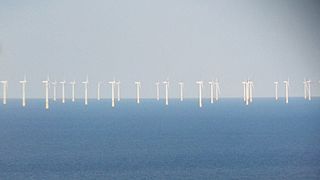
Gwynt y Môr is a 576-megawatt (MW) offshore wind farm located off the coast of north Wales and is the fifth largest operating offshore windfarm in the world. The farm has 160 wind turbines of 150 metres (490 ft) tip height above mean sea level.

<span class="mw-page-title-main">Barrow Offshore Wind Farm</span> Offshore wind farm in the East Irish Sea near Barrow-in-Furness, Cumbria, England

The Barrow Offshore Wind Farm is a 30 turbine 90MW capacity offshore wind farm in the East Irish Sea approximately seven kilometres southwest of Walney Island, near Barrow-in-Furness, Cumbria, England.

<span class="mw-page-title-main">Beatrice Wind Farm</span> Wind farm close to the Beatrice oil field in the Moray Firth, off the north east coast of Scotland

The Beatrice Offshore Wind Farm now known as Beatrice Offshore Windfarm Ltd (BOWL) project, is an offshore wind farm close to the Beatrice oil field in the Moray Firth, part of the North Sea 13 km off the north east coast of Scotland.

Bladt Industries A/S is an international steel contractor specialising in large-scale and highly complex steel structures. It operate within three key areas of business providing steel solutions for the wind and renewable energy sector, for the oil and gas industry and for infrastructure.

<span class="mw-page-title-main">Walney Wind Farm</span> Offshore wind farm off the coast of Cumbria, England

Walney Wind Farms are a group of offshore wind farms 9 miles (14 km) west of Walney Island off the coast of Cumbria, England, in the Irish Sea. The group, operated by Ørsted, consists of Walney Phase 1, Phase 2 and the Walney Extension. The extension has a capacity of 659 MW and it was the world's second largest offshore wind farm in 2018.

Wind power in New Jersey is in the early stages of development. New Jersey has just six wind turbines, but the state has plans to develop several major offshore wind projects on the continental shelf of the Atlantic Ocean off the southern Jersey Shore. Legislation has been enacted to support the industry through economic incentives and to permit wind turbines on existing piers.

Shetland HVDC Connection is a high-voltage direct current submarine power cable under construction to connect Shetland to the British mainland.

The Beatrice Oil Field is a small oilfield consisting of 3 platforms located 24 km off the north east coast of Scotland. It began operations in 1980 with the field finally being decommissioned in 2017.

Dogger Bank Wind Farm is a group of offshore wind farms under construction 130 to 200 kilometres off the east coast of Yorkshire, England in the North Sea. It is considered to be the world's largest offshore windfarm. It was developed by the Forewind consortium, with three phases envisioned - first phase, second phase and third phase. In 2015, the third phase was abandoned, while the first and second phases were granted consent. It was initially expected that the Dogger Bank development will consist of four offshore wind farms, each with a capacity of up to 1.2 GW, creating a combined capacity of 4.8 GW. As of 2023, a total of 277 turbines are expected to be built and produce a capacity of 3.6 GW, enough to power 6 million homes.

Hornsea Wind Farm is a Round 3 wind farm which began construction in 2018. Sited in the North Sea 120 km (75 mi) off the east coast of England, the eventual wind farm group is planned to have a total capacity of up to 6 gigawatt (GW).

South Fork Wind Farm is a utility-scale offshore wind farm on the Outer Continental Shelf Offshore Rhode Island, providing energy to New York state.

The United Kingdom became the world leader of offshore wind power generation in October 2008 when it overtook Denmark.

References

  1. "Our infrastructure". www.elia.be. Retrieved 2023-09-09.
  2. "Open Infrastructure Map". openinframap.org. Retrieved 2023-09-09.
  3. "HoogspanningsNet Netkaart". webkaart.hoogspanningsnet.com. Retrieved 2023-09-09.
  4. "Open Infrastructure Map". openinframap.org. Retrieved 2023-09-09.
  5. Yonemoto, Norihiro (2003). "Construction of the World's First Long-Distance 500kV XLPE Cable Line". Fujikura Technical Review. 32: 26–30.
  6. "Hoogspanningsnet Nederland - Asset gegevens TenneT TSO B.V." www.arcgis.com. Retrieved 2023-08-20.
  7. "Open Infrastructure Map". openinframap.org. Retrieved 2023-08-20.
  8. "HoogspanningsNet Netkaart". webkaart.hoogspanningsnet.com. Retrieved 2023-08-20.
  9. "Net op zee". www.netopzee.eu. Retrieved 2023-09-09.
  10. "Beatrice Offshore Windfarm". Beatrice Offshore Windfarm. Retrieved 1 April 2020.
  11. "Open Infrastructure Map". Open Infrastructure Map. Retrieved 1 April 2020.
  12. "Open Infrastructure Map". Open Infrastructure Map. Retrieved 2 April 2020.
  13. "Brechfa Forest West Onshore Wind Farm". Innogy. Retrieved 31 March 2020.
  14. "Burbo Bank Extension". 4C Offshore. Retrieved 31 March 2020.
  15. "Caithness-Moray Transmission Project" (PDF). SSE. Retrieved 1 April 2020.
  16. "Caithness - Moray". Caithness - Moray. Retrieved 2019-01-12.
  17. Keane, Kevin (2019-01-11). "Major subsea electricity link completed". BBC News. Retrieved 2019-01-12.
  18. "Open Infrastructure Map". Open Infrastructure Map. Retrieved 31 March 2020.
  19. "Electric Mountain - Dinorwig power station". Electric Mountain. Retrieved 31 March 2020.
  20. Boothroyd, John (10 December 2021). "Power for the past". British Archaeology. No. 182. York. pp. 49–50. ISSN   1357-4442.
  21. "Dudgeon Offshore Wind Farm". Dudgeon Offshore Wind Farm. Retrieved 31 March 2020.
  22. "East Anglia One". Scottish Power. Archived from the original on 17 February 2019. Retrieved 31 March 2020.
  23. "Archived copy" (PDF). Archived from the original (PDF) on 2014-10-19. Retrieved 2014-10-14.{{cite web}}: CS1 maint: archived copy as title (link)
  24. "Open Infrastructure Map". Open Infrastructure Map. Retrieved 31 March 2020.
  25. "Open Infrastructure Map". Open Infrastructure Map. Retrieved 31 March 2020.
  26. "Greater Gabbard". SSE. Retrieved 31 March 2020.
  27. "Gunfleet Sands wind farm". Power Technology. Retrieved 31 March 2020.
  28. "Gwynt y Mor wind farm". Innogy. Retrieved 31 March 2020.
  29. "Orsted Our wind farms". Orsted. Retrieved 31 March 2020.
  30. "Open Infrastructure Map". Open Infrastructure Map. Retrieved 1 April 2020.
  31. "Kentish Flats". Vattenhall. Retrieved 31 March 2020.
  32. "Open Infrastructure Map". Open Infrastructure Map. Retrieved 31 March 2020.
  33. "London Array wind farm". Power Technology. Retrieved 31 March 2020.
  34. "Energy for London". Energy for London. Retrieved 1 April 2020.
  35. 1 2 3 "London Power Tunnels". London Power Tunnels. Retrieved 31 March 2020.
  36. "Open Infrastructure Map". Open Infrastructure Map. Retrieved 1 April 2020.
  37. "Mutual Energy". Mutual Energy. Retrieved 30 March 2020.
  38. "Ormonde Wind Farm". Vattenfall Ormonde. Retrieved 31 March 2020.
  39. "Race Bank offshore wind farm". Orsted. Retrieved 31 March 2020.
  40. "The UK south coast's first offshore wind farm". Rampion Offshore. Retrieved 31 March 2020.
  41. "Sheringham Schoal". Sheringham Schoal. Retrieved 31 March 2020.
  42. The Electricity Council (1987). Electricity supply in the United Kingdom: a Chronology. London: The Electricity Council. p. 99. ISBN   085188105X.
  43. "BritNed". BritNed. Retrieved 30 March 2020.
  44. EirGrid. "Interconnection". Interconnection. Archived from the original on 22 February 2020. Retrieved 30 March 2020.
  45. "Channel Cable". Channel Cable. Retrieved 30 March 2020.
  46. "Interconnexion". 4C Offshore. Retrieved 30 March 2020.
  47. "Manx Utilities". Manx Utilities. Retrieved 1 April 2020.
  48. "Interconnected to the heart of Europe's electricity market". Nemolink. Retrieved 30 March 2020.
  49. "North Sea Link". North Sea Link. Retrieved 30 March 2020.