Lighthouses
| Name | Image | Year built | Location & coordinates | Class of light | Focal height | NGA number | Admiralty number | Range nml |
|---|---|---|---|---|---|---|---|---|
| Abligini Island Lighthouse | n/a | New Britain 6°18′20.3″S150°04′33.0″E / 6.305639°S 150.075833°E | Fl W 10s. | 103 metres (338 ft) | 10890 | K3506.5 | 10 | |
| Adele Island Lighthouse | n/a | Louisiade Archipelago 11°26′53.7″S154°23′51.7″E / 11.448250°S 154.397694°E | Fl W 8s. | 43 metres (141 ft) | 26284 | K3450.5 | 16 | |
| Alim Island Lighthouse | n/a | Admiralty Islands 2°53′39.5″S147°03′26.1″E / 2.894306°S 147.057250°E | Fl W 5s. | 32 metres (105 ft) | 10928 | K3476 | 10 | |
| Ava Point Lighthouse | n/a | Morobe Province 10°34′10.8″S149°52′47.2″E / 10.569667°S 149.879778°E | Fl W 12s. | 188 metres (617 ft) | 26320 | K3456.5 | 10 | |
| Basilisk Passage Lighthouse | Image Archived 2016-10-18 at the Wayback Machine | n/a | Port Moresby 9°32′20.2″S147°08′02.1″E / 9.538944°S 147.133917°E | Fl W 5s. | 9 metres (30 ft) | 26352 | K3458 | 10 |
| Basilisk Passage Range Front Lighthouse | n/a | Port Moresby 9°29′53.3″S147°11′06.2″E / 9.498139°S 147.185056°E | Oc W 4s. | 38 metres (125 ft) | 26360 | K3459 | 18 | |
| Basilisk Passage Range Rear Lighthouse | n/a | Port Moresby 9°29′47.3″S147°11′19.3″E / 9.496472°S 147.188694°E | Oc W 6s. | 90 metres (300 ft) | 26364 | K3459.1 | 10 | |
| Boera Head Lightouse | Image Archived 2016-10-23 at the Wayback Machine | n/a | Port Moresby 9°23′22.9″S147°00′51.1″E / 9.389694°S 147.014194°E | Fl W 2.5s. | 33 metres (108 ft) | 26392 | K3563.8 | 10 |
| Bomatu Point Lighthouse | n/a | Trobriand Islands 8°24′19.9″S151°06′46.5″E / 8.405528°S 151.112917°E | Fl (3) W 15s. | 31 metres (102 ft) | 26416 | K3436 | 10 | |
| Bonarua Island Lighthouse | n/a | Bonarua Hili Hili Island 10°45′18.0″S150°22′54.0″E / 10.755000°S 150.381667°E (NGA) | Fl (3) W 15s. | 209 metres (686 ft) | 26316 | K3456 | 10 | |
| Bright Island Lighthouse | n/a | Engineer Islands 10°32′01.2″S151°12′45.5″E / 10.533667°S 151.212639°E | Fl W 2.5s. | 16 metres (52 ft) | 26292 | K3444 | 10 | |
| Cape Concordia Lighthouse | n/a | Vanimo 2°40′22.6″S141°18′15.8″E / 2.672944°S 141.304389°E | Fl W 5s. | 68 metres (223 ft) | 26130 | K3400 | 10 | |
| Cape Cretin Lighthouse | n/a | Nussing Island ~ 6°39′20.1″S147°51′34.0″E / 6.655583°S 147.859444°E | Fl W 6s. | 21 metres (69 ft) | 26188 | K3406 | 10 | |
| Cape Croisilles | n/a | Madang Province 4°50′51.8″S145°48′17.1″E / 4.847722°S 145.804750°E | Fl (2) W 6s. | 22 metres (72 ft) | 26160 | K3401.8 | 10 | |
| Cape Gerhard | n/a | Morobe Province 6°44′48.7″S147°34′37.9″E / 6.746861°S 147.577194°E | Fl (3) W 12s. | 22 metres (72 ft) | 26192 | K3408 | 10 | |
| Cape Gourdon Lighthouse | n/a | Madang Province 4°23′09.3″S145°19′20.0″E / 4.385917°S 145.322222°E | Fl (3) W 9s. | 15 metres (49 ft) | 26156 | K3401.6 | 10 | |
| Cape Hollman | n/a | West New Britain Province 4°59′30.0″S150°07′18.0″E / 4.991667°S 150.121667°E | Fl W 6s. | 8 metres (26 ft) | 10880 | K3484 | 10 | |
| Cape Lambert Lighthouse | n/a | 4°05′30.0″S151°31′12.0″E / 4.091667°S 151.520000°E | Fl (3) W 15s. | 20 metres (66 ft) | 10864 | K3492 | 10 | |
| Cape L'Averdy Lighthouse | n/a | Bougainville Island 5°32′29.0″S155°03′52.8″E / 5.541389°S 155.064667°E | Fl W 6s. | 25 metres (82 ft) | 10824 | K4884 | 15 | |
| Cape Moem Lighthouse | n/a | Wewak 3°33′04.3″S143°42′07.9″E / 3.551194°S 143.702194°E | Fl G 5s. | 8 metres (26 ft) | 26142 | K3400.6 | 4 | |
| Cape Oxford Lighthouse | n/a | East New Britain Province 5°26′43.5″S152°05′02.5″E / 5.445417°S 152.084028°E | Fl (3) W 15s. | 94 metres (308 ft) | 10892 | K3506 | 10 | |
| Cape St. George Lighthouse | n/a | New Ireland Province 4°50′54.0″S152°52′36.0″E / 4.848333°S 152.876667°E | Fl W 5s. | 101 metres (331 ft) | 10896 | K3514 | 10 | |
| Cape Tawui Lighthouse | n/a | New Britain 4°08′09.7″S152°10′11.6″E / 4.136028°S 152.169889°E | Fl W 7.5s. | 47 metres (154 ft) | 10852 | K3494 | 18 | |
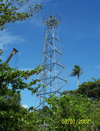
| Coast Watchers Lighthouse |  | 1959 | Madang 5°12′44.6″S145°48′53.4″E / 5.212389°S 145.814833°E | Fl W 15s. | 28 metres (92 ft) | 26172 | K3402 | 12 |
| Condor Point Lighthouse | n/a | Madang Province 4°07′08.2″S144°51′44.5″E / 4.118944°S 144.862361°E | Fl (2) W 8s. | 15 metres (49 ft) | 26152 | K3401.4 | 10 | |
| Hood Point Lighthouse | Image | n/a | Central Province 10°06′12.0″S147°43′36.6″E / 10.103333°S 147.726833°E | Q (2) W 8s. | 8 metres (26 ft) | 26348 | K3457 | 10 |
| Hospital Hill Lighthouse | n/a | Arawa 6°13′44.3″S155°34′22.4″E / 6.228972°S 155.572889°E | Fl W 5s. | 87 metres (285 ft) | 10812 | K4884.5 | n/a | |
| Idihi Island Lighthouse |  | n/a | Port Moresby 9°25′39.0″S146°53′00.3″E / 9.427500°S 146.883417°E | Fl (2) W 5s. | 23 metres (75 ft) | 26384 | K3464 | 10 |
| Ipoteto Island Lighthouse | n/a | Morobe Province 9°37′45.2″S150°01′24.0″E / 9.629222°S 150.023333°E | Fl (2) W 8s. | 23 metres (75 ft) | 26260 | K3432 | 10 | |
| Jomard Islands Lighthouse | n/a | Jomard Islands 11°15′19.1″S152°08′08.3″E / 11.255306°S 152.135639°E | Fl W 10s. | 24 metres (79 ft) | 26276 | K3450.3 | 10 | |
| Kegawam Island Lighthouse | n/a | Engineer Islands 10°21′13.7″S151°23′06.6″E / 10.353806°S 151.385167°E | Fl W 6s. | 8 metres (26 ft) | 26264 | K3438 | 10 | |
| Kiau Point Lighthouse | n/a | 5°12′13.3″S147°05′33.2″E / 5.203694°S 147.092556°E | Fl W 5s. | 23 metres (75 ft) | 10888 | K3478 | 10 | |
| Kimbe Bay No 12 Lighthouse | n/a | Kimbe Bay 5°16′32.0″S150°57′51.0″E / 5.275556°S 150.964167°E | Fl (2) W 10s. | 13 metres (43 ft) | 10871.7 | K3490.32 | 10 | |
| Kitava Island Lighthouse | n/a | Trobriand Islands 8°38′43.4″S151°19′52.6″E / 8.645389°S 151.331278°E | Fl W 7.5s. | 107 metres (351 ft) | 26420 | K3437 | 10 | |
| Lunn Island Lighthouse | Image | n/a | Lunn Island 10°47′12.6″S152°00′26.2″E / 10.786833°S 152.007278°E | Fl W 4s. | 15 metres (49 ft) | 26272 | K3449 | 15 |
| Mait Island Lighthouse | n/a | New Ireland Province 3°00′03.7″S150°43′35.7″E / 3.001028°S 150.726583°E | Fl W 10s. | 79 metres (259 ft) | 10900 | K3512 | 10 | |
| Madehas Island Lighthouse | n/a | Buka Island 5°27′37.4″S154°38′03.7″E / 5.460389°S 154.634361°E | Fl W 10s. | 137 metres (449 ft) | 10828 | K4883 | 16 | |
| Oro Bay Range Front Lighthouse | n/a | Oro Province 8°54′10.9″S148°28′22.6″E / 8.903028°S 148.472944°E | Fl W 3s. | 119 metres (390 ft) | 26220 | K3424 | 18 | |
| Oro Bay Range Rear Lighthouse | n/a | Oro Province 8°54′15.1″S148°28′14.8″E / 8.904194°S 148.470778°E | Fl W 10s. | 133 metres (436 ft) | 26224 | K3424.1 | 18 | |
| Otua Islet Lighthouse | n/a | Bougainville Island 6°27′31.1″S155°58′25.9″E / 6.458639°S 155.973861°E | Fl W 5s. | 26 metres (85 ft) | 10788 | K4886 | 14 | |
| Rabaul Range Front Lighthouse | Image | n/a | Rabaul 4°11′56.5″S150°10′07.6″E / 4.199028°S 150.168778°E | Fl W 2s. | 28 metres (92 ft) | 10844 | K3498 | 10 |
| Rabaul Range Rear Lighthouse | Image Archived 2016-03-07 at the Wayback Machine | n/a | Rabaul 4°11′42.0″S150°10′06.0″E / 4.195000°S 150.168333°E (NGA) | Fl W 5s. | 38 metres (125 ft) | 10848 | K3498.1 | 7 |
| Rothery Passage Lighthouse | n/a | Central Province 10°21′04.1″S148°41′27.8″E / 10.351139°S 148.691056°E | Fl (3) W 15s. | 22 metres (72 ft) | 26344 | K3456.7 | 10 | |
| Seeadler Harbor Lighthouse | Image | n/a | Seeadler Harbor 1°57′37.8″S147°19′03.5″E / 1.960500°S 147.317639°E | Fl (4) W 16s. | 27 metres (89 ft) | 10916 | K3507 | 10 |
| Spear Island Lighthouse | Image | n/a | Oro Province 8°59′22.4″S149°08′16.7″E / 8.989556°S 149.137972°E | Fl W 6s. | 19 metres (62 ft) | 26228 | K3426 | 10 |
| Steffan Strait Lighthouse | n/a | New Ireland Province 2°42′29.3″S150°36′48.6″E / 2.708139°S 150.613500°E | Fl (2) W 8s. | 13 metres (43 ft) | 10904 | K3511 | 10 | |
| Strathord Islands Lighthouse | n/a | Strathord Islands 10°13′19.6″S151°51′59.4″E / 10.222111°S 151.866500°E | Fl (3) W 12s. | 8 metres (26 ft) | 26296 | K3448 | 10 | |
| Weka Una Rock Lighthouse | Image | n/a | Morobe Province 10°36′10.3″S150°36′38.2″E / 10.602861°S 150.610611°E | Fl (2) W 8s. | 10 metres (33 ft) | 26324 | K3455 | 10 |
| Yule Island Lighthouse | n/a | Yule Island 8°49′37.5″S146°32′03.3″E / 8.827083°S 146.534250°E | Fl (3) W 15s. | 54 metres (177 ft) | 26400 | K3465 | 8 | |
