
Hudson County is the smallest and most densely populated county in the U.S. state of New Jersey. It lies west of the lower Hudson River, which was named for Henry Hudson, the sea captain who explored the area in 1609. Part of New Jersey's Gateway Region in the New York metropolitan area, the county seat is Jersey City, which is the county's largest city in terms of both population and area. The county is part of the North Jersey region of the state.

Newark Bay is a tidal bay at the confluence of the Passaic and Hackensack Rivers in northeastern New Jersey. It is home to the Port Newark-Elizabeth Marine Terminal, the largest container shipping facility in Port of New York and New Jersey, the second busiest in the United States. An estuary, it is periodically dredged to accommodate seafaring ships.

The New York–New Jersey Harbor Estuary, also known as the Hudson-Raritan Estuary, is in the northeastern states of New Jersey and New York on the East Coast of the United States. The system of waterways of the Port of New York and New Jersey forms one of the most intricate natural harbors in the world and one of the busiest ports of the United States. The harbor opens onto the New York Bight in the Atlantic Ocean to the southeast and Long Island Sound to the northeast.

The River Line was a Conrail rail line located between Jersey City, New Jersey and Selkirk, New York, running along the west side of the Hudson Palisades and, after passing through a tunnel at Haverstraw, New York, along the west bank of the Hudson River. It was previously the New York Central's West Shore Railroad and Weehawken Branch. The River Line has since been split into several sections, following the 1999 division of Conrail assets between Norfolk Southern Railway and CSX Transportation.

Greenville is the southernmost section of Jersey City in Hudson County, in the U.S. state of New Jersey.
Paterson Plank Road is a road that runs through Passaic, Bergen and Hudson Counties in northeastern New Jersey. The route, originally laid in the colonial era, connects the city of Paterson and the Hudson River waterfront. It has largely been superseded by Route 3, but in the many towns it passes it has remained an important local thoroughfare, and in some cases been renamed.

Croxton is a section of Jersey City in the New Jersey Meadowlands in Hudson County, in the U.S. state of New Jersey.
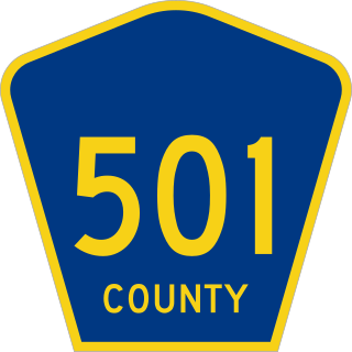
County Route 501 is a county highway in New Jersey in two segments spanning Middlesex, Hudson, and Bergen counties. The southern section runs from South Plainfield to Perth Amboy, the northern section runs from Bayonne to Rockleigh, and the two sections are connected by New York State Route 440 across Staten Island.

Bergen Point is a point of land that lends its name to the adjacent neighborhood in Bayonne in Hudson County, in the U.S. state of New Jersey. The point is located on the north side of Kill van Kull at Newark Bay. It is the section of the city closest to the Bayonne Bridge. Historically the term has been used more broadly as synonymous with Constable Hook, from which it is geographically separated at Port Johnson.

Bergen Hill refers to the lower Hudson Palisades in New Jersey, where they emerge on Bergen Neck, which in turn is the peninsula between the Hackensack and Hudson Rivers, and their bays. In Hudson County, it reaches a height of 260 feet.

Pavonia was the first European settlement on the west bank of the North River that was part of the seventeenth-century province of New Netherland in what would become the present Hudson County, New Jersey.

Droyer's Point is a section of Jersey City, New Jersey, at Newark Bay that was the site of the Jersey City Airport and later of Roosevelt Stadium, both of which were demolished. It has become a residential and commercial district.

Bergen Neck is the peninsula between the Upper New York Bay and the Newark Bay in the Hudson County, New Jersey municipalities of Bayonne and Jersey City. Its southernmost tip, Bergen Point, is separated from Staten Island by the Kill van Kull, which is crossed by the Bayonne Bridge.
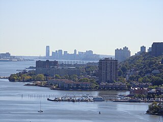
The Hudson Waterfront is an urban area of northeastern New Jersey along the lower reaches of the Hudson River, the Upper New York Bay and the Kill van Kull. Though the term can specifically mean the shoreline, it is often used to mean the contiguous urban area between the Bayonne Bridge and the George Washington Bridge that is approximately 19 miles (31 km) long. Historically, the region has been known as Bergen Neck, the lower peninsula, and Bergen Hill, lower Hudson Palisades. It has sometimes been called the Gold Coast.

County Route 617 is 4.55-mile (7.32 km) long and follows one street, Summit Avenue along the ridge of the Hudson Palisades in Hudson County, New Jersey. Its southern end is CR 622, or Grand Street, at Communipaw Junction in the Bergen-Lafayette Section of Jersey City. Its northern end is CR 691, 32nd Street, a section of the Bergen Turnpike, in Union City.

Bergen Hill is the name given to the emergence of the Hudson Palisades along the Bergen Neck peninsula in Hudson County, New Jersey and the inland neighborhood of Jersey City, New Jersey, where they rise from the coastal plain at the Upper New York Bay. The name is taken from the original 17th-century New Netherland settlement of Bergen, which in Dutch means hills.

The Bergen Section of Jersey City, New Jersey is the neighborhood on either side of Kennedy Boulevard between Saint Peter's College/ McGinley Square and Communipaw Avenue in the Bergen-Lafayette section of the city. The name Bergen, used throughout Hudson County, is taken from the original Bergen, New Netherland settlement at Bergen Square.