Hamilton Park Historic District | |
View to the south | |
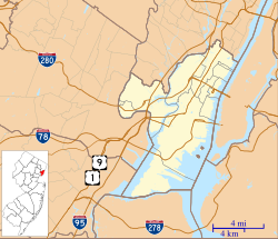
Location | Roughly bounded by Brunswick, Grove, 6th, and 9th Streets, Jersey City, New Jersey |
---|---|
Coordinates | 40°43′39″N74°2′42″W / 40.72750°N 74.04500°W Coordinates: 40°43′39″N74°2′42″W / 40.72750°N 74.04500°W |
Area | 42 acres (17 ha) |
Architectural style | Late Victorian |
NRHP reference No. | 79001493 [1] |
NJRHP No. | 1507 [2] |
Significant dates | |
Added to NRHP | January 25, 1979 |
Designated NJRHP | April 27, 1978 |
Hamilton Park is a neighborhood in Historic Downtown Jersey City, Hudson County, New Jersey, United States, centered on a park with the same name. Hamilton Park is located west of Newport, north of Harsimus Cove, north and east of The Village and south of Boyle Plaza. The Victorian age park is located between Eighth Street and Ninth Street and Hamilton Place on the west and McWilliams Place on the East. Like the Van Vorst Park neighborhood to the south, this quiet park is surrounded by nineteenth century brownstones. [3] The park underwent renovations completed in 2010. [4]
The park produces several events throughout the year, some of which include
Jersey City is the second-most populous city in the U.S. state of New Jersey, after Newark. It is the seat of Hudson County as well as the county's largest city. The U.S. Census Bureau's Population Estimates Program calculated that the city's population was 262,075 in 2019, ranking as the 80th-most-populous incorporated place in the nation. The 2019 estimate represents an increase of about 5.8% from the 2010 United States Census, when the city's population was at 247,597, ranking the city the nation's 78th-largest by population.
Hoboken, New Jersey is home to many parks, historical landmarks, and other places of interest.
Downtown is an area of Jersey City, New Jersey, United States, which includes the Historic Downtown and the Waterfront. Historic Downtown can be further broken down into the neighborhoods of Harsimus Cove, The Village, Van Vorst Park, Grove Street, Hamilton Park and Boyle Plaza. The Waterfront includes the Powerhouse Arts District/WALDO, Newport, the Harborside Financial Center and Paulus Hook. Historic Downtown is the area west of Marin Boulevard, while the Waterfront lies to the east. Many of the names of Jersey City's downtown neighborhoods come from Dutch words or Dutch names from the early inhabitants along the Hudson.
Downtown Paterson is the main commercial district of Paterson, Passaic County, New Jersey, United States. The area is the oldest part of the city, along the banks of the Passaic River and its Great Falls. It is roughly bounded by Interstate 80, Garret Mountain Reservation, Route 19, Oliver Street, and Spruce Street on the south; the Passaic River, West Broadway, Cliff Street, North 3rd Street, Haledon Avenue, and the borough of Prospect Park on the west; and the Passaic River also to the north.
The Harsimus Stem Embankment, also called Sixth Street Embankment, is a half-mile-long historic railroad embankment, now abandoned and largely overgrown with foliage, in the heart of the historic downtown of Jersey City, New Jersey in the United States. The 27-foot-high (8.2 m) embankment runs along the south side of Sixth Street west from Marin Boulevard to Brunswick Street. It is the border between the Harsimus and Hamilton Park neighborhoods. The overhead tracks of the beam bridge west of Brunswick Street were dismantled but the stone abutments remain.
The Great Atlantic and Pacific Tea Company Warehouse is a historic formerly commercial building at 150 Bay Street in Jersey City, Hudson County, New Jersey, United States. Built as a warehouse for The Great Atlantic & Pacific Tea Company (A&P) in 1900, it is the major surviving remnant of a five-building complex of the nation's first major grocery store chain. It was designated a National Historic Landmark in 1978, and now houses a mix of residences and storage facilities.
The Powerhouse Arts District is a historic warehouse district in Downtown Jersey City, New Jersey, United States. Its name derives from the unused generating station Hudson and Manhattan Railroad Powerhouse. This neighborhood was previously called "WALDO", an acronym for Work And Live District Overlay, but has since been renamed though is still occasionally used on maps and in local parlance. Part of what was once called the Horseshoe Section, the neighborhood's informal borders are Newport to the north, Exchange Place to the east, Paulus Hook to the south and Harsimus Cove to the west.
Communipaw is an unincorporated community and neighborhood located within Jersey City in Hudson County, New Jersey, United States. It is located west of Liberty State Park and east of Bergen Hill, and the site of one of the earliest European settlements in North America. It gives its name to the historic avenue which runs from its eastern end near Liberty State Park Station through the neighborhoods of Bergen-Lafayette and the West Side that then becomes the Lincoln Highway. Communipaw Junction, or simply, The Junction, is an intersection where Communipaw, Summit Avenue, Garfield Avenue, and Grand Street meet, and where the toll house for the Bergen Point Plank Road was situated. Communipaw Cove at Upper New York Bay, is part of the 36-acre (150,000 m2) state nature preserve in the park and one of the few remaining tidal salt marshes in the Hudson River estuary.
The Dr. William Barrow Mansion, is located at 83 Wayne Street between Barrow Street and Jersey Avenue in Downtown Jersey City, Hudson County, New Jersey, United States. The mansion was added to the National Register of Historic Places on May 2, 1977 and is located within the Van Vorst Park Historic District, which itself was dedicated on March 5, 1980 and is roughly bounded by Railroad Avenue, and Henderson, Grand, Bright, and Monmouth Streets.
The Hudson and Manhattan Railroad Powerhouse, also known as the Jersey City Powerhouse in Jersey City, Hudson County, New Jersey, United States, was built in 1908. The powerhouse made possible the subway system between New Jersey and New York for the Hudson and Manhattan Railroad. The powerhouse was closed in 1929 and used as a storage place for railroad equipment. In the 1990s, the building was cited by Preservation New Jersey as one of the state's ten most endangered historic sites. The powerhouse was added to the National Register of Historic Places on November 23, 2001.
Harsimus is a neighborhood within Downtown Jersey City, Hudson County, New Jersey, United States. The neighborhood stretches from the Harsimus Stem Embankment on the north to Christopher Columbus Drive on the south between Coles Street and Grove Street or more broadly, to Marin Boulevard. It borders the neighborhoods of Hamilton Park to the north, Van Vorst Park to the south, the Village to the west, and the Powerhouse Arts District to the east. Newark Avenue has traditionally been its main street. The name is from the Lenape, used by the Hackensack Indians who inhabited the region and could be translated as Crow’s Marsh. From many years, the neighborhood was part of the "Horseshoe", a political delineation created by its position between the converging rail lines and political gerrymandering.
The Village is a neighborhood in the western section of Historic Downtown in Jersey City. It is bordered by Hamilton Park and Harsimus Cove to the east and the Turnpike Extension to the west, on the other side of which Jones Park and Mary Benson Park are located. Newark Avenue is the major street across the Village from Grove Street at the east to Bergen Hill at the west. The neighborhood for many years was considered the city's "Little Italy" neighborhood. Brunswick Street, between 1st and 10th Streets was once full of merchants and nicknamed "Bushel Avenue". St. Anthony of Padua Roman Catholic Church at 457 Monmouth St. received its historic designation on March 22, 2004.
Van Vorst Park is an upper income neighborhood in the Historic Downtown of Jersey City, Hudson County, New Jersey, United States, centered on a park sharing the same name. The neighborhood is located west of Paulus Hook and Marin Boulevard, north of Grand Street, east of the Turnpike Extension, and south of The Village and Christopher Columbus Drive. Much of it is included in the Van Vorst Park Historical District.
Bergen-Lafayette is a section of Jersey City, New Jersey.
Hudson County, New Jersey has historic districts which have been designated as such on a municipal, state, or federal level, or combination therof. Some are listed on New Jersey Register of Historic Places and are included on National Register of Historic Places listings in Hudson County, New Jersey. The following is intended to be a list of places which encompasses an area or group of buildings or structures.
The West End is the former name of the only neighborhood in Historic Downtown Jersey City, New Jersey that is entirely west of the New Jersey Turnpike's Newark Bay Extension.
Jersey City and Harsimus Cemetery is a historic rural cemetery located in Jersey City, New Jersey. It was established in 1829 by the first cemetery company founded in the State of New Jersey and is the size of 6 acres (24,000 m2). The cemetery is an early example of Garden Style landscape cemeteries. The cemetery fell into disrepair and was abandoned in 2008. A volunteer group has since been founded to maintain the cemetery.
The Hudson Shakespeare Company is a regional Shakespeare touring festival based in Jersey City in Hudson County, New Jersey, that produces an annual summer Shakespeare in the Park festival and often features lesser done Shakespeare works such as The Two Noble Kinsmen and Timon of Athens. The company also produces several modern-day productions in non theatrical venues such as their courtroom shows of Inherit the Wind and A Few Good Men in the Hoboken Municipal Courtroom. It produce a yearly educational program that ranges from student workshops to full length Shakespeare productions.
Wikimedia Commons has media related to Hamilton Park, Jersey City . |