List of scheduled monuments in Merthyr Tydfil County Borough

Last updated

Merthyr Tydfil County Borough has 43 scheduled monuments. The prehistoric scheduled sites include many burial cairns and several defensive enclosures. The Roman period is represented by a Roman Road. The medieval periods include two inscribed stones, several house platforms and two castle sites. Finally the modern period has 14 sites, mainly related to Merthyr's industries, including coal mining, transportation and iron works. Almost all of Merthyr Tydfil was in the historic county of Glamorgan, with several of the northernmost sites having been in Brecknockshire.

Contents

Scheduled monuments have statutory protection. The compilation of the list is undertaken by Cadw Welsh Historic Monuments, which is an executive agency of the National Assembly of Wales. [1] The list of scheduled monuments below is supplied by Cadw [2] with additional material from RCAHMW and Glamorgan-Gwent Archaeological Trust.

Scheduled monuments in Merthyr Tydfil County Borough

ImageNameSite typeCommunityLocationDetails Historic County PeriodSAM No
& Refs
Gelligaer Standing StoneStanding stone Bedlinog 51°43′20″N3°17′58″W / 51.7221°N 3.2994°W / 51.7221; -3.2994 (Gelligaer Common Standing Stone) ,
SO103034
A 2 m (6.6 ft) high stone on open moorland. Probably Bronze Age and with the possible remains of a Bronze Age burial alongside. An inscription on the stone, now mostly illegible, is described as either post-Roman/Early Christian or Early Medieval. [3] [4] [5] Glamorganshire
  • Prehistoric [4]
  • Early Medieval [3]
GM221
Coed Cae Round CairnsRound cairn Bedlinog 51°41′21″N3°18′46″W / 51.6892°N 3.3127°W / 51.6892; -3.3127 (Coed Cae Round Cairns) ,
ST093997
Located in a cairnfield with at least 19 stony mounds, the scheduling consists of a group of eight Bronze Age burial cairns. [6] [7] Glamorganshire
  • Prehistoric [6]
  • Bronze Age [8]
GM271
Gelligaer Common Round CairnsRound cairn Bedlinog 51°43′16″N3°18′03″W / 51.7211°N 3.3007°W / 51.7211; -3.3007 (Gelligaer Common Round Cairns) ,
SO102032
A group of eleven Bronze Age burial cairns. [9] Glamorganshire
GM220
Carn Castell y Meibion ring cairnRing cairn Troed-y-rhiw [12] [13] 51°43′07″N3°23′52″W / 51.7185°N 3.3979°W / 51.7185; -3.3979 (Carn Castell y Meibion ring cairn) ,
SO035031
A ring cairn, possibly dating to the Bronze Age, with an 8 m (26 ft) diameter and surrounded by a 3 m (9.8 ft) wide stony ring bank. [12] [13] [14] GlamorganshirePrehistoric [14]
Bronze Age [12] [13]
GM586
Brynbychan Round CairnRound cairn Merthyr Vale, [15] [16] (also Mountain Ash), [17] (see also Rhondda Cynon Taff) 51°40′52″N3°21′23″W / 51.6812°N 3.3564°W / 51.6812; -3.3564 (Brynbychan Round Cairn) ,
ST063989
A Bronze Age circular cairn with a diameter of 18 m (59 ft). There is an OS triangulation pillar on the site. [15] [16] [17] GlamorganshirePrehistoric [17]
Bronze Age [15] [16]
GM286
Cefn Merthyr Round CairnsCairnfield Merthyr Vale 51°41′32″N3°19′43″W / 51.6922°N 3.3287°W / 51.6922; -3.3287 (Cefn Merthyr Round Cairns) ,
SO082001
GlamorganshirePrehistoric
GM272
[18]
Morlais Hill ring cairnRing cairn Pant 51°46′39″N3°22′29″W / 51.7774°N 3.3747°W / 51.7774; -3.3747 (Morlais Hill ring cairn) ,
SO052096
GlamorganshirePrehistoric
GM563
[19]
Tir Lan round barrow cemeteryRound barrow Treharris 51°41′09″N3°18′36″W / 51.6857°N 3.31°W / 51.6857; -3.31 (Tir Lan round barrow cemetery) ,
ST095993
The remains of six Bronze Age round barrows, three to the north-west and three to the south-east of Tir Lan farm. All six remain substantially intact despite being reduced by ploughing in the past. [20] GlamorganshirePrehistoric [20] GM270
[21]
Garn Las EarthworkRound cairn Troed-y-rhiw, (also Aberdare), (see also Rhondda Cynon Taf) 51°43′29″N3°24′26″W / 51.7248°N 3.4073°W / 51.7248; -3.4073 (Garn Las Earthwork) ,
SO028038
The remains a circular burial cairn measuring 14 m (46 ft) in diameter, probably dating to the Bronze Age. [22] Glamorganshire
GM236
Merthyr Common Round CairnsRound cairn Troed-y-rhiw 51°43′46″N3°20′09″W / 51.7295°N 3.3357°W / 51.7295; -3.3357 (Merthyr Common Round Cairns) ,
SO078042
A group of six Bronze Age burial cairns ranging from 5 to 19 m (16 to 62 ft) in diameter. [25] GlamorganshirePrehistoric [25] GM222
[21]
Carn Ddu platform cairnPlatform Cairn Vaynor 51°48′13″N3°23′59″W / 51.8037°N 3.3998°W / 51.8037; -3.3998 (Carn Ddu platform cairn) ,
SO035125
GlamorganshirePrehistoric
GM570
[26]
Cefn Cil-Sanws ring cairnRing cairn Vaynor 51°47′15″N3°24′58″W / 51.7875°N 3.4162°W / 51.7875; -3.4162 (Cefn Cil-Sanws ring cairn) ,
SO024108
GlamorganshirePrehistoric
GM567
[27]
Cefn Cil-Sanws, Cairn on SW side ofRound Cairn Vaynor 51°46′43″N3°24′53″W / 51.7785°N 3.4147°W / 51.7785; -3.4147 (Cefn Cil-Sanws, Cairn on SW side of) ,
SO024098
BrecknockshirePrehistoric
GM599
[28]
Coetgae'r Gwartheg barrow cemeteryRound cairn Vaynor 51°47′37″N3°25′08″W / 51.7935°N 3.419°W / 51.7935; -3.419 (Coetgae'r Gwartheg barrow cemetery) ,
SO022114
GlamorganshirePrehistoric
GM568
[29]
Garn Pontsticill ring cairnRing cairn Vaynor 51°47′48″N3°22′30″W / 51.7966°N 3.375°W / 51.7966; -3.375 (Garn Pontsticill ring cairn) ,
SO052117
GlamorganshirePrehistoric
GM569
[30]
Dyke 315m E of Tyla-GlasDitch Bedlinog 51°42′12″N3°17′15″W / 51.7033°N 3.2876°W / 51.7033; -3.2876 (Dyke 315m E of Tyla-Glas) ,
SO111012
The remains of a later prehistoric/medieval dyke with a clearly defined bank and ditch running east-west across a ridge top. The 3 m (9.8 ft) wide ditch is 1.5 m (4.9 ft) deep at its east end. [31] GlamorganshirePrehistoric [31] GM260
[21]
Cefn Cil-Sanws Defended EnclosureEnclosure - Defensive Vaynor 51°46′47″N3°24′38″W / 51.7796°N 3.4105°W / 51.7796; -3.4105 (Cefn Cil-Sanws Defended Enclosure) ,
SO027099
BrecknockshirePrehistoric
GM600
[32]
Enclosure East of Nant Cwm MoelEnclosure - Defensive Vaynor 51°47′32″N3°23′38″W / 51.7922°N 3.394°W / 51.7922; -3.394 (Enclosure East of Nant Cwm Moel) ,
SO039113
GlamorganshirePrehistoric
GM518
[33]
Enclosure on Coedcae'r YchainEnclosure - Defensive Vaynor 51°47′29″N3°25′00″W / 51.7915°N 3.4167°W / 51.7915; -3.4167 (Enclosure on Coedcae'r Ychain) ,
SO023112
GlamorganshirePrehistoric
GM519
[34]
Track of Roman road, Gelligaer Common (geograph 1968870).jpg Gelligaer Common Roman RoadRoad Bedlinog 51°43′21″N3°18′03″W / 51.7226°N 3.3007°W / 51.7226; -3.3007 (Gelligaer Common Roman Road) ,
SO102034
GlamorganshireRoman
GM556
[35]
Nant Crew Inscribed Stone (now in St John's Church, Cefn Coed )Standing stone Vaynor 51°45′46″N3°24′13″W / 51.7628°N 3.4035°W / 51.7628; -3.4035 (Nant Crew Inscribed Stone (now in Cefn Coed Church)) ,
SO032081
A 1.5 m (5 ft) high square-sectioned pillar stone thought to date to the Bronze Age. A Latin inscription on the west face and cross incised on the north face are from the 6th and 7th-9th centuries. Holes in the stone indicate that it had been used as a gatepost. [36] [37] [38] BrecknockshireEarly Medieval [37] BR145
Platform Houses and Cairn Cemetery on Dinas NoddfaHouse platforms (& Cairnfield) Bedlinog 51°43′10″N3°18′48″W / 51.7195°N 3.3132°W / 51.7195; -3.3132 (Platform Houses and Cairn Cemetery on Dinas Noddfa) ,
SO093031
Medieval house platforms, also prehistoric cairnfieldGlamorganshireMedieval
GM314
[39]
Platform Houses on Coly UchafPlatform house Bedlinog 51°42′40″N3°18′58″W / 51.7112°N 3.3161°W / 51.7112; -3.3161 (Platform Houses on Coly Uchaf) ,
SO091022
GlamorganshireMedieval
GM320
[40]
Castell Morlais Castle (geograph 4091229).jpg Morlais Castle Castle Pant 51°46′36″N3°22′44″W / 51.7768°N 3.3789°W / 51.7768; -3.3789 (Morlais Castle) ,
SO049095
The collapsed remains of a castle begun in 1288 by Gilbert de Clare, Lord of Glamorgan. The walls enclosed an area of approximately 130 by 60 m (430 by 200 ft). It was captured during the 1294-95 rebellion of Madog ap Llywelyn and may have been abandoned shortly afterwards. [41] [42] [43] [44] GlamorganshireMedieval [43] GM028
Cae Burdydd motte near Vaynor (geograph 3718583).jpg Cae Burdydd CastleMotte Vaynor 51°46′57″N3°22′56″W / 51.7824°N 3.3823°W / 51.7824; -3.3823 (Cae Burdydd Castle) ,
SO047102
A 3 m (9.8 ft) high motte and ditch dating to the medieval period. The diameter of 23 m (75 ft) narrows to 9 m (30 ft) at the top. [45] [46] [47] BrecknockshireMedieval [46] BR118
Cefn Car settlementBuilding (Unclassified) Vaynor 51°48′30″N3°25′32″W / 51.8084°N 3.4256°W / 51.8084; -3.4256 (Cefn Car settlement) ,
SO018131
GlamorganshireMedieval
GM571
[48]
Gurnos Quarry Tramroad & LeatIndustrial monument Gurnos 51°45′45″N3°24′01″W / 51.7624°N 3.4002°W / 51.7624; -3.4002 (Gurnos Quarry Tramroad & Leat) ,
SO034080
GlamorganshirePost-Medieval/Modern
GM478
[49]
Sarn Howell Pond and WatercoursesPond Town 51°44′50″N3°19′27″W / 51.7471°N 3.3241°W / 51.7471; -3.3241 (Sarn Howell Pond and Watercourses) ,
SO086062
GlamorganshirePost-Medieval/Modern
GM494
[50]
Egg-ended boiler shed, Abercanaid.jpg Abercanaid egg-ended boilerEgg-ended Boiler, re-purposed as garden shed Troed-y-rhiw 51°43′29″N3°22′04″W / 51.7248°N 3.3679°W / 51.7248; -3.3679 (Abercanaid egg-ended boiler) ,
SO056037
GlamorganshirePost-Medieval/Modern
GM572
[51] [52]
Cyfarthfa Canal LevelCanal Level Cyfarthfa 51°44′20″N3°23′15″W / 51.7388°N 3.3876°W / 51.7388; -3.3876 (Cyfarthfa Canal Level) ,
SO042053
GlamorganshirePost-Medieval/Modern
GM467
[53]
Cyfarthfa Tramroad Section at HeolgerrigTramroad Cyfarthfa 51°44′46″N3°24′16″W / 51.7462°N 3.4044°W / 51.7462; -3.4044 (Cyfarthfa Tramroad Section at Heolgerrig) ,
SO031062
GlamorganshirePost-Medieval/Modern
GM495
[54]
Iron Ore Scours and Patch Workings at Winch Fawr, Merthyr TydfilIron mine Cyfarthfa 51°45′07″N3°25′27″W / 51.752°N 3.4241°W / 51.752; -3.4241 (Iron Ore Scours and Patch Workings at Winch Fawr, Merthyr Tydfil) ,
SO017068
GlamorganshirePost-Medieval/Modern
GM554
[55]
Ynys Fach Iron FurnacesIndustrial monument Cyfarthfa 51°44′42″N3°23′03″W / 51.745°N 3.3841°W / 51.745; -3.3841 (Ynys Fach Iron Furnaces) ,
SO045060
GlamorganshirePost-Medieval/Modern
GM331
[56]
Penydarren Tramway-geograph.org.uk-1999890.jpg Penydarren Tram RoadTrackway Merthyr Vale 51°40′15″N3°19′49″W / 51.6707°N 3.3304°W / 51.6707; -3.3304 (Penydarren Tram Road) ,
ST080977
GlamorganshirePost-Medieval/Modern
GM359
[57]
Iron canal bridge from Rhydycar.jpg Iron Canal Bridge from RhydycarBridge Park 51°45′01″N3°23′09″W / 51.7504°N 3.3857°W / 51.7504; -3.3857 (Iron Canal Bridge from Rhydycar) ,
SO044066
GlamorganshirePost-Medieval/Modern
GM486
[58]
Pont y Cafnau iron rail bridge and aqueduct (1793) - geograph.org.uk - 1022863.jpg Pont-y-Cafnau tramroad bridgeBridge Park 51°45′17″N3°23′44″W / 51.7546°N 3.3956°W / 51.7546; -3.3956 (Pont y Cafnau Tramroad Bridge) ,
SO037071
An ironwork bridge spanning the River Taff constructed in 1793. The name, meaning "bridge of troughs", comes from its unusual three tier design of a tramroad between two watercourses, one beneath the bridge deck and the other on an upper wooden structure which is no longer present. Pont-y-Cafnau is also Grade II* listed. [59] [60] [61] [62] Glamorganshire
GM424
Merthyr Tramroad: Morlais Castle sectionTramroad Pant 51°46′43″N3°22′57″W / 51.7786°N 3.3826°W / 51.7786; -3.3826 (Merthyr Tramroad: Morlais Castle section) ,
SO047097
GlamorganshirePost-Medieval/Modern
GM594
[64]
Merthyr Tramroad Tunnel (Trevithick's Tunnel)Tramroad Troed-y-rhiw 51°44′06″N3°22′07″W / 51.7349°N 3.3686°W / 51.7349; -3.3686 (Merthyr Tramroad Tunnel (Trevithick's Tunnel)) ,
SO055049
GlamorganshirePost-Medieval/Modern
GM573
[65]
Cwmdu Air Shaft & FanAir Shaft Cyfarthfa 51°44′14″N3°24′14″W / 51.7371°N 3.4039°W / 51.7371; -3.4039 (Cwmdu Air Shaft & Fan) ,
SO031051
GlamorganshirePost-Medieval/Modern
GM460
[66]
Cyfarthfa Iron Works - furnace bank - geograph.org.uk - 1025206.jpg Remains of Blast Furnaces, Cyfarthfa IronworksBlast Furnace Park 51°45′08″N3°23′43″W / 51.7521°N 3.3952°W / 51.7521; -3.3952 (Remains of Blast Furnaces, Cyfarthfa Ironworks) ,
SO037068
GlamorganshirePost-Medieval/Modern
GM425
[67]
Tai Mawr Leat for Cyfarthfa Iron WorksLeat Park 51°45′31″N3°24′17″W / 51.7586°N 3.4046°W / 51.7586; -3.4046 (Tai Mawr Leat for Cyfarthfa Iron Works) ,
SO031076
GlamorganshirePost-Medieval/Modern
GM479
[68]
Deserted Iron Mining Village, Ffos-y-franIndustrial monument Troed-y-rhiw 51°44′31″N3°20′47″W / 51.742°N 3.3463°W / 51.742; -3.3463 (Deserted Iron Mining Village, Ffos-y-fran) ,
SO071056
GlamorganshirePost-Medieval/Modern
GM496
[69]
Merthyr Tydfil UK location map.svg
Red pog.svg
Brown pog.svg
Brown pog.svg
Brown pog.svg
Brown pog.svg
Brown pog.svg
Brown pog.svg
Brown pog.svg
Brown pog.svg
Brown pog.svg
Brown pog.svg
Brown pog.svg
Brown pog.svg
Brown pog.svg
Brown pog.svg
Brown pog.svg
Brown pog.svg
Brown pog.svg
Brown pog.svg
Blue pog.svg
Green pog.svg
Gold pog.svg
Gold pog.svg
Gold pog.svg
Gold pog.svg
Gold pog.svg
Red pog.svg
Red pog.svg
Red pog.svg
Red pog.svg
Red pog.svg
Red pog.svg
Red pog.svg
Red pog.svg
Red pog.svg
Red pog.svg
Red pog.svg
Red pog.svg
Red pog.svg
Red pog.svg
Red pog.svg
Red pog.svg
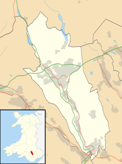
Scheduled monuments in Merthyr Tydfil, Wales.
Brown pog.svg =Prehistoric Blue pog.svg =Roman Green pog.svg =Early Medieval
Gold pog.svg =Medieval Red pog.svg =Post-Medieval/Modern
Map all coordinates using: OpenStreetMap

See also

Related Research Articles

<span class="mw-page-title-main">Merthyr Mawr</span>

Merthyr Mawr is a village and community in Bridgend, Wales. The village is about 2+12 miles from the centre of Bridgend town. The population of the community at the 2011 census was 267. The community occupies the area west of the Ewenny River, between Bridgend and Porthcawl. It takes in the settlement of Tythegston and a stretch of coastal sand dunes known as Merthyr Mawr Warren. It is in the historic county of Glamorgan.

References

  1. Cadw: Ancient Monuments and Scheduling. Accessed 25 April 2013
  2. Cadw will send their list as a spreadsheet, or other electronic formats, on request, as indicated at www.whatdotheyknow.com. This list uses information dated May 2012
  3. 1 2 "Cefn Gelli-gaer Inscribed Stone (305944)". Coflein. RCAHMW . Retrieved 2 October 2021.
  4. 1 2 Cadw. "Gelligaer Common Standing Stone (GM221)". National Historic Assets of Wales .
  5. Gelligaer Stone (ID PRN00635m) in the ' SMR ' for Glamorgan-Gwent Archaeological Trust (GGAT)
  6. 1 2 Cadw. "Coed Cae Round Cairns (GM271)". National Historic Assets of Wales.
  7. "Coedcae, Cairnfield (91925)". Coflein. RCAHMW. Retrieved 20 October 2021.
  8. Coedcae Cairnfield (ID PRN00565m) in the 'SMR' for Glamorgan-Gwent Archaeological Trust (GGAT). Retrieved 20 October 2021
  9. 1 2 Cadw. "Gelligaer Common Round Cairns (GM220)". National Historic Assets of Wales.
  10. "Carn Y Bugail, Gelligaer Common (301283)". Coflein. RCAHMW . Retrieved 20 October 2021.
  11. Carn Bugail (Gelligaer Common Round Cairns SAM Gm 220e) (ID PRN00631m) in the 'SMR' for Glamorgan-Gwent Archaeological Trust (GGAT)
  12. 1 2 3 "Carn Castellymeibion, Ring Cairn (305675)". Coflein. RCAHMW. Retrieved 4 October 2021.
  13. 1 2 3 Carn Castell Y Meibion B (Penwaun Iago North) (GM586) (ID PRN00490m) in the ' SMR ' for Glamorgan-Gwent Archaeological Trust (GGAT)
  14. 1 2 Cadw. "Carn Castell y Meibion ring cairn (GM586)". National Historic Assets of Wales.
  15. 1 2 3 "Brynbychan Cairn (94651)". Coflein. RCAHMW. Retrieved 5 October 2021.
  16. 1 2 3 TWYN BRYN BYCHAN ROUND CAIRN (ID PRN00559m) in the ' SMR ' for Glamorgan-Gwent Archaeological Trust (GGAT)
  17. 1 2 3 Cadw. "Brynbychan Round Cairn (GM286)". National Historic Assets of Wales.
  18. coflein NPRN: not yet identified. GGAT PRN not yet identified. Cadw SAM: GM272: Cefn Merthyr Round Cairns
  19. coflein NPRN: not yet identified. GGAT PRN not yet identified. Cadw SAM: GM563: Morlais Hill ring cairn
  20. 1 2 Cadw. "Tir Lan round barrow cemetery (GM270)". National Historic Assets of Wales.
  21. 1 2 3 coflein NPRN: not yet identified. GGAT PRN not yet identified
  22. 1 2 Cadw. "Garn Las Earthwork (GM236)". National Historic Assets of Wales.
  23. "Garn Las (305670)". Coflein. RCAHMW. Retrieved 7 December 2021.
  24. Garn Las (ID PRN00487m) in the 'SMR' for Glamorgan-Gwent Archaeological Trust (GGAT)
  25. 1 2 Cadw. "Merthyr Common Round Cairns (GM222)". National Historic Assets of Wales.
  26. coflein NPRN: not yet identified. GGAT PRN not yet identified. Cadw SAM: GM570: Carn Ddu platform cairn
  27. coflein NPRN: not yet identified. GGAT PRN not yet identified. Cadw SAM: GM567: Cefn Cil-Sanws ring cairn
  28. coflein NPRN: not yet identified. GGAT PRN not yet identified. Cadw SAM: GM599: Cefn Cil-Sanws, Cairn on SW side of
  29. coflein NPRN: not yet identified. GGAT PRN not yet identified. Cadw SAM: GM568: Coetgae'r Gwartheg barrow cemetery
  30. coflein NPRN: not yet identified. GGAT PRN not yet identified. Cadw SAM: GM569: Garn Pontsticill ring cairn
  31. 1 2 Cadw. "Dyke 315m E of Tyla-Glas (GM260)". National Historic Assets of Wales.
  32. coflein NPRN: not yet identified. GGAT PRN not yet identified. Cadw SAM: GM600: Cefn Cil-Sanws Defended Enclosure
  33. coflein NPRN: not yet identified. GGAT PRN not yet identified. Cadw SAM: GM518: Enclosure East of Nant Cwm Moel
  34. coflein NPRN: not yet identified. GGAT PRN not yet identified. Cadw SAM: GM519: Enclosure on Coedcae'r Ychain
  35. coflein NPRN: not yet identified. GGAT PRN not yet identified. Cadw SAM: GM556: Gelligaer Common Roman Road
  36. "Nant Crew Inscribed Stone (now In Cefn Coed Church) (275615)". Coflein. RCAHMW. Retrieved 2 October 2021.
  37. 1 2 Cadw. "Nant Crew Inscribed Stone (now in Cefn Coed Church) (BR145)". National Historic Assets of Wales.
  38. Nant Crew Inscribed Stone (Now in Cefn Coed Church) (ID PRN00052m) in the ' SMR ' for Glamorgan-Gwent Archaeological Trust (GGAT)
  39. coflein NPRN: 15303. GGAT PRN not yet identified. Cadw SAM: GM314: Platform Houses and Cairn Cemetery on Dinas Noddfa
  40. coflein NPRN: not yet identified. GGAT PRN not yet identified. Cadw SAM: GM320: Platform Houses on Coly Uchaf
  41. Newman 1995, pp. 441–42.
  42. "Morlais Castle, Pant, Merthyr Tydfil (93014)". Coflein. RCAHMW. Retrieved 2 October 2021.
  43. 1 2 Cadw. "Morlais Castle (GM028)". National Historic Assets of Wales.
  44. Morlais Castle, Pant) (ID PRN00443m) in the ' SMR ' for Glamorgan-Gwent Archaeological Trust (GGAT)
  45. "Cae Burdydd, Mound (305711)". Coflein. RCAHMW. Retrieved 2 October 2021.
  46. 1 2 Cadw. "Cae Burdydd Castle (BR118)". National Historic Assets of Wales.
  47. Cae Burdydd (ID PRN00439m) in the ' SMR ' for Glamorgan-Gwent Archaeological Trust (GGAT)
  48. coflein NPRN: not yet identified. GGAT PRN not yet identified. Cadw SAM: GM571: Cefn Car settlement
  49. coflein NPRN: not yet identified. GGAT PRN not yet identified. Cadw SAM: GM478: Gurnos Quarry Tramroad & Leat
  50. coflein NPRN: not yet identified. GGAT PRN not yet identified. Cadw SAM: GM494: Sarn Howell Pond and Watercourses
  51. coflein NPRN: 309757. GGAT PRN not yet identified. Cadw SAM: GM572: Abercanaid haystack boiler
  52. "Abercanaid haystack boiler". Google Streetview.
  53. coflein NPRN: not yet identified. GGAT PRN not yet identified. Cadw SAM: GM467: Cyfarthfa Canal Level
  54. coflein NPRN: not yet identified. GGAT PRN not yet identified. Cadw SAM: GM495: Cyfarthfa Tramroad Section at Heolgerrig
  55. coflein NPRN: not yet identified. GGAT PRN not yet identified. Cadw SAM: GM554: Iron Ore Scours and Patch Workings at Winch Fawr, Merthyr Tydfil
  56. coflein NPRN: not yet identified. GGAT PRN not yet identified. Cadw SAM: GM331: Ynys Fach Iron Furnaces
  57. coflein NPRN: not yet identified. GGAT PRN not yet identified. Cadw SAM: GM359: Penydarren Tram Road
  58. coflein NPRN: not yet identified. GGAT PRN not yet identified. Cadw SAM: GM486: Iron Canal Bridge from Rhydycar
  59. Newman 1995, pp. 443–44.
  60. Cadw. "Pont-y-Cafnau (11408)". National Historic Assets of Wales. Retrieved 2 October 2021.
  61. 1 2 Cadw. "Pont y Cafnau Tramroad Bridge (GM424)". National Historic Assets of Wales.
  62. 1 2 "Pont-y-cafnau, Merthyr Tydfil (34860)". Coflein. RCAHMW . Retrieved 2 October 2021.
  63. PONT Y CAFNAU (ID PRN01090m) in the 'SMR' for Glamorgan-Gwent Archaeological Trust (GGAT)
  64. coflein NPRN: not yet identified. GGAT PRN not yet identified. Cadw SAM: GM594: Merthyr Tramroad: Morlais Castle section
  65. coflein NPRN: not yet identified. GGAT PRN not yet identified. Cadw SAM: GM573: Merthyr Tramroad Tunnel (Trevithick's Tunnel)
  66. coflein NPRN: not yet identified. GGAT PRN not yet identified. Cadw SAM: GM460: Cwmdu Air Shaft & Fan
  67. coflein NPRN: not yet identified. GGAT PRN not yet identified. Cadw SAM: GM425: Remains of Blast Furnaces, Cyfarthfa Ironworks
  68. coflein NPRN: not yet identified. GGAT PRN not yet identified. Cadw SAM: GM479: Tai Mawr Leat for Cyfarthfa Iron Works
  69. coflein NPRN: not yet identified. GGAT PRN not yet identified. Cadw SAM: GM496: Deserted Iron Mining Village, Ffos-y-fran

Bibliography