Trelewis

Last updated

Trelewis
Relocated Trelewis War Memorial - geograph.org.uk - 3220797.jpg
Relocated Trelewis War Memorial
Merthyr Tydfil UK location map.svg
Red pog.svg
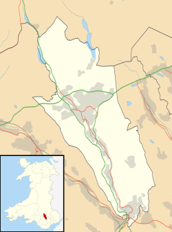
Trelewis
Location within Merthyr Tydfil
Population2,029 
OS grid reference ST095975
  Cardiff 14 mi (23 km)
Principal area
Preserved county
Country Wales
Sovereign state United Kingdom
Post town TREHARRIS
Postcode district CF46
Dialling code 01443
Police South Wales
Fire South Wales
Ambulance Welsh
UK Parliament
Senedd Cymru – Welsh Parliament
List of places
UK
Wales
Merthyr Tydfil
51°40′03″N3°17′48″W / 51.6676°N 3.2967°W / 51.6676; -3.2967

Trelewis is a small village in the Taff Bargoed Valley of south-east Wales, currently located in the southern part of Merthyr Tydfil County Borough. It is a former mining village and together with nearby Bedlinog was until 1974 part of the Gelligaer Urban District Council area of the county of Glamorgan. The villages name means 'Lewis Town' and was named after the Lewis family who owned a farm on the area where the village is now built.

Contents

Location

It is around one-third of a mile (0.5 km) north of Nelson, 3 miles (4.8 km) south of Bedlinog, and around two-thirds of a mile (1.1 km) east of the Treharris, from which it is divided by the Taff Bargoed river. It lies 5 miles (8 km) north of the town of Pontypridd, 6 miles (10 km) west of Caerphilly, and 10+12 miles (17 km) south of Merthyr Tydfil. The village is at an altitude of 490 feet (150 m). [1]

Government

Trelewis is in the Merthyr Tydfil County Borough, which covers the villages of Trelewis and Bedlinog. The Bedlinog & Trelewis Ward is the only electoral area within the Merthyr Tydfil County Borough Council area with a Community Council. The Council was created in 1974 by the former Gelligaer Urban District Council prior to its abolition and the subsequent transfer of Trelewis and Bedlinog into the Merthyr administrative area upon local government reorganisation in that year, to which most people in Bedlinog and Trelewis were opposed.[ citation needed ]

History and amenities

During the latter nineteenth century, a coal mine opened in the village which led to a large expansion of the village. In 1878 the Trelewis school opened, this was replaced in 1984 with a new modern school. [2] There is a freight-only railway line, the Taff Bargoed branch opened in 1876 of the former Great Western Railway and Rhymney Railway, running through the village and this line carries coal from Ffos-y-fran opencast colliery. Bedlinog is to the north of Trelewis on this line, whilst Nelson is to the south.

Trelewis Welfare, a former member of the Welsh Football League, played in the village. Trelewis also has a park and an outdoor bowls club, Trelewis Welfare Outdoor Bowls which was founded in 1932, and following the closure of Treharris Bowling Club, merged in 2017 to form Trelewis & Treharris Welfare Outdoor Bowls Club.

Location grid

Related Research Articles

<span class="mw-page-title-main">Merthyr Tydfil</span> Town in Wales

Merthyr Tydfil is the main town in Merthyr Tydfil County Borough, Wales, administered by Merthyr Tydfil County Borough Council. It is about 23 miles (37 km) north of Cardiff. Often called just Merthyr, it is said to be named after Tydfil, daughter of King Brychan of Brycheiniog, who according to legend was slain at Merthyr by pagans about 480 CE. Merthyr generally means "martyr" in modern Welsh, but here closer to the Latin martyrium: a place of worship built over a martyr's relics. Similar place names in south Wales are Merthyr Cynog, Merthyr Dyfan and Merthyr Mawr.

<span class="mw-page-title-main">Ynysybwl</span> Human settlement in Wales

Ynysybwl is a village in Cwm Clydach in Wales. It is situated in the county borough of Rhondda Cynon Taf, roughly 15 miles (24 km) north-north-west of Cardiff, 4 miles (6 km) north of Pontypridd and 16 miles (26 km) south of Merthyr Tydfil, and forms part of the community of Ynysybwl and Coed-y-Cwm.

The Rhymney Railway was a railway company in South Wales, founded to transport minerals and materials to and from collieries and ironworks in the Rhymney Valley of South Wales, and to docks in Cardiff. It opened a main line in 1858, and a limited passenger service was operated in addition.

<span class="mw-page-title-main">South Wales Valleys</span> Group of industrialised peri-urban valleys in South Wales

The South Wales Valleys are a group of industrialised peri-urban valleys in South Wales. Most of the valleys run north–south, roughly parallel to each other. Commonly referred to as "The Valleys", they stretch from Carmarthenshire in the west to Monmouthshire in the east; to the edge of the pastoral country of the Vale of Glamorgan and the coastal plain near the cities of Swansea, Cardiff, and Newport.

Bedlinog is a small village located in The Taff Bargoed valley, 10 km (6 mi) north of Pontypridd, 10 km (6 mi) north west of Caerphilly and 10 km (6 mi) south east of Merthyr Tydfil in south-east Wales. It is currently in the south of Merthyr Tydfil County Borough, but until 1974 was part of Gelligaer Urban District Council in the county of Glamorgan.

<span class="mw-page-title-main">Quakers Yard railway station</span> Railway station in Merthyr Tydfil, Wales

Quakers Yard railway station serves the village of Edwardsville in the community of Treharris, Merthyr Tydfil, Wales. It is located on the Merthyr Tydfil branch of the Merthyr Line. Passenger services are provided by Transport for Wales.

<span class="mw-page-title-main">Merthyr Vale</span> Human settlement in Wales

Merthyr Vale is a linear village and community in the Welsh county borough of Merthyr Tydfil. Lying on the A4054 road it is on the east bank of the River Taff.

<span class="mw-page-title-main">Treharris</span> Human settlement in Wales

Treharris is a small town and community in the Taff Bargoed Valley in the south of Merthyr Tydfil County Borough, South Wales. It is located about 0.6 miles (1.0 km) west of Trelewis, from which it is separated by the Taff Bargoed river, and 0.9 miles (1.4 km) from Nelson in Caerphilly county borough and has a population of 6,356 from the 2011 Census. As a community, Treharris includes the villages of Quakers Yard and Edwardsville. Due to steepness and narrowness of both the Taff and Taff Bargoed valleys at Treharris several notable bridges and viaducts have been built in the area.

<span class="mw-page-title-main">Quakers Yard</span> Human settlement in Wales

Quakers Yard or Quaker's Yard is a village in the Merthyr Tydfil County Borough, situated where the Taff Bargoed Valley joins the Taff Valley. The settlement is part of the community of Treharris.

<span class="mw-page-title-main">District of Rhymney Valley</span> Former district of Mid Glamorgan, Wales

Rhymney Valley was one of six local government districts in Mid Glamorgan from 1974 to 1996.

<span class="mw-page-title-main">Nelson, Caerphilly</span> Village, Wales

Nelson is a village and community in the County Borough of Caerphilly, Wales. It sits five miles north of Caerphilly and ten miles north of Cardiff, at the lower end of the Taff Bargoed Valley, and lies adjacent to Treharris, Trelewis and Quakers Yard.

<span class="mw-page-title-main">Gelligaer</span>

Gelligaer is a community in the County Borough of Caerphilly, Wales, in the Rhymney River valley. As well as the village of Gelligaer, the community also includes the small towns of Hengoed and Ystrad Mynach. The population of the community at the 2011 census was 18,408.

<span class="mw-page-title-main">Fochriw</span> Human settlement in Wales

Fochriw is a village located in Caerphilly County Borough, Wales, United Kingdom. It was well known for its neighbouring collieries, which employed nearly the entire local population in the early 20th century. It lies within the historic county boundaries of Glamorgan. The village appears as the backdrop on the BBC Wales sitcom High Hopes credits. The villages population was recorded as 1,250 in 2011.

<span class="mw-page-title-main">Cilfynydd</span> Human settlement in Wales

Cilfynydd is a village in the county borough of Rhondda Cynon Taf, Wales, a mile from the South Wales Valleys town of Pontypridd, and 13 miles north of the capital city, Cardiff. Cilfynydd is also an electoral ward for the county council and Pontypridd Town Council.

<span class="mw-page-title-main">Taff Bargoed</span>

The Taff Bargoed is a river and valley near Pontypridd in South Wales, and lies off the Abercynon roundabout on the A470 road, and is approximately 14 miles from Cardiff. The main settlements are Nelson, Edwardsville, Quakers Yard, Treharris, Trelewis, and Bedlinog. The valley is situated where the three County Boroughs of Caerphilly, Rhondda Cynon Taff, and Merthyr Tydfil meet.

<span class="mw-page-title-main">Deep Navigation Colliery</span>

Deep Navigation Colliery was a coal mine in South Wales, that operated from 1872 until 1991.

<span class="mw-page-title-main">Merthyr Tydfil County Borough</span> County borough in Wales

Merthyr Tydfil County Borough is a county borough in the south-east of Wales. In mid 2018, it had an estimated population of 60,183 making it the smallest local authority in Wales by both population and land area. It is located in the historic county of Glamorgan and takes its name from the town with the same name. The county borough consists of the northern part of the Taff Valley and the smaller neighbouring Taff Bargoed Valley. It borders the counties of Rhondda Cynon Taf to the west, Caerphilly County Borough to the east, and Powys to the north.

<span class="mw-page-title-main">Cwm Bargoed railway station</span> Disused railway station in Fochriw, Caerphilly

Cwm Bargoed railway station was near the village of Fochriw, in the Taff Bargoed valley of Caerphilly County Borough, Wales, from 1876 to 1964 on the Rhymney Railway. The station was 4 km (2.5 mi) east of Merthyr Tydfil, but was in a parallel valley.

References

  1. "Trelewis, Merthyr Tydfil". ordnancesurvey.co.uk.
  2. "Trelewis". treharrisdistrict.co.uk. Retrieved 23 July 2018.