Gurnos

Last updated

The A465 road embankment at the north end of the Gurnos estate Top End of Gurnos - geograph.org.uk - 831348.jpg
The A465 road embankment at the north end of the Gurnos estate

Gurnos is a community of Merthyr Tydfil County Borough in Wales, United Kingdom. It consists principally of the Gurnos Estate. The population in 2011 5,280. [1]

Contents

Background

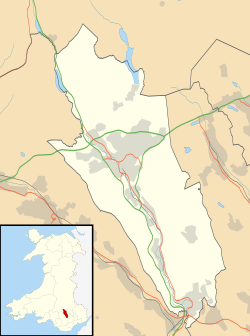
The Gurnos Estate is a large housing estate established by Merthyr Tydfil Council in the early 1950s and expanded over many years. Many of the initial streets were named after trees; such as Oak, Acacia and Rowan. A major expansion took place during the 1970s, including the building of Prince Charles Hospital. Streets on 1970s development were named after flowers and shrubs; such as Lavender, Heather, Lupin and Forsythia, with the exception of the three most recent areas known as Pen-Gurnos, Pen-y-Dre and Pen-y-Fan View. The area built since the 1970s is still often referred to locally as The New Estate. The community population at the 2011 census was 5,280. [2]

The area was formerly open land, including the long-established Gurnos Farm. It also encompassed the notoriously dangerous Goitre Pond.

The design and planning of the Gurnos estate borrows ideas from the Radburn system. The estate has become notorious throughout Wales, with the reputation of being an area of deprivation and crime. [3] [4]

The Gurnos Tavern, one of the two community centres and many of the maisonette flats were demolished to make greener areas during the late 1990s.

Amenities

The Gurnos estate includes a main small shopping centre at Chestnut Way, known locally as The Gurnos Shops, a social club ( The Gurnos Club), and a community centre, all located within a few yards of each other. Other shops were also part of the estate's design at Pen-Gurnos and Clover Road. There have also been two pubs, the Gurnos Tavern and later The Matchstick Man, named after late boxer Johnny Owen, however both have since closed.

The Clover Road Stores are a small shopping section on Clover Road. They have a Convenience Store, and also a Fish and chip shop.

In 1999 the 3Gs Development Trust was established to work with the communities of the Gurnos and Galon Uchaf, offering support, information and developmental activities. [5] The trust's offices are based at The Gurnos Shops, together with other centres including a youth centre at Forsythia Close. The name 3Gs illustrates the local perception that there are two estates, separated by Prince Charles Hospital; the Old Gurnos and the New Estate; being two of the Gs, together with Galon Uchaf being the third. Penydarren was later added to the 3Gs remit and by 2013 the organisation's remit was expanded to include other wards as the Communities First North Cluster. [6]

The only secondary school in the area is Pen-Y-Dre High School, there are also two primary schools; Goetre Primary School and St Aloysius Roman Catholic Primary School.

Related Research Articles

<span class="mw-page-title-main">Merthyr Tydfil</span> Town in Wales

Merthyr Tydfil is the main town in Merthyr Tydfil County Borough, Wales, administered by Merthyr Tydfil County Borough Council. It is about 23 miles (37 km) north of Cardiff. Often called just Merthyr, it is said to be named after Tydfil, daughter of King Brychan of Brycheiniog, who according to legend was slain at Merthyr by pagans about 480 CE. Merthyr generally means "martyr" in modern Welsh, but here closer to the Latin martyrium: a place of worship built over a martyr's relics. Similar place names in south Wales are Merthyr Cynog, Merthyr Dyfan and Merthyr Mawr.

<span class="mw-page-title-main">Taff Trail</span> Walking and cycling track in South Wales

The Taff Trail is a walking and cycle path that runs for 55 miles (89 km) between Cardiff Bay and Brecon in Wales. It is so named because it follows the course of the River Taff. Along much of its length, it follows the National Cycle Network Route 8 that continues to Holyhead, and is substantially off-road.

<span class="mw-page-title-main">River Taff</span> River in Wales which flows into Cardiff Bay

The River Taff is a river in Wales. It rises as two rivers in the Brecon Beacons; the Taf Fechan and the Taf Fawr before becoming one just north of Merthyr Tydfil. Its confluence with the River Severn estuary is in Cardiff.

<span class="mw-page-title-main">Maesgeirchen</span> Human settlement in Wales

Maesgeirchen is a large housing estate on the edge of the city of Bangor in Gwynedd, north-west Wales, with roughly 4,000 inhabitants.

<span class="mw-page-title-main">Quakers Yard railway station</span> Railway station in Merthyr Tydfil, Wales

Quakers Yard railway station serves the village of Edwardsville in the community of Treharris, Merthyr Tydfil, Wales. It is located on the Merthyr Tydfil branch of the Merthyr Line. Passenger services are provided by Transport for Wales.

<span class="mw-page-title-main">Penywaun</span> Human settlement in Wales

Penywaun is a community, electoral ward and north-western suburb of Aberdare in the Cynon Valley within the county borough of Rhondda Cynon Taf, Wales. At the 2011 census, the population of the ward was registered as 3,063.

<span class="mw-page-title-main">Merthyr Vale</span> Human settlement in Wales

Merthyr Vale is a linear village and community in the Welsh county borough of Merthyr Tydfil. Lying on the A4054 road it is on the east bank of the River Taff.

<span class="mw-page-title-main">Llandaff North</span> District and community of Cardiff, Wales

Llandaff North, is a district, community and coterminous electoral ward in the north of Cardiff, the capital city of Wales.

Bishop Hedley High School is a Roman Catholic secondary school, established in 1967, and located in Penydarren, Merthyr Tydfil, South Wales. The vast majority of the pupils of the school stem from the Heads of the Valleys, serving parishes from Aberdare, Hirwaun, Merthyr Tydfil, Merthyr Vale, Gurnos, Dowlais, Ebbw Vale, Tredegar and Rhymney. The school serves a catchment area of economic disadvantage which is a result of the decline of heavy industry, especially mining and steelmaking in the South Wales Valleys and the surrounding areas.

Pen y Dre High School is an 11-16 mixed-sex comprehensive school situated in the Gurnos district of Merthyr Tydfil, Wales.

Vaynor and Penderyn High School was situated at Cefn Coed, Merthyr Tydfil in Wales. Although now part of Merthyr Tydfil, the area covered by the school was part of the old county of Brecknockshire (Breconshire) until local government reorganisation in 1974. The designated catchment area of the school was made up of the communities served principally by Ysgol y Graig Primary in Merthyr Tydfil and Penderyn and Hirwaun Primary Schools in Rhondda Cynon Taff, and is an area which suffers a high degree of economic deprivation. The school had an age range of 11-18 and a capacity of 455 places which would be small for a secondary school even if full.

<span class="mw-page-title-main">Taff Bargoed</span>

The Taff Bargoed is a river and valley near Pontypridd in South Wales, and lies off the Abercynon roundabout on the A470 road, and is approximately 14 miles from Cardiff. The main settlements are Nelson, Edwardsville, Quakers Yard, Treharris, Trelewis, and Bedlinog. The valley is situated where the three County Boroughs of Caerphilly, Rhondda Cynon Taff, and Merthyr Tydfil meet.

<span class="mw-page-title-main">Michael Gustavius Payne</span> Welsh painter

Michael Gustavius Payne is a Welsh figurative painter. He paints primarily in oils and is influenced by mythological themes within a contemporary context. During his early exhibiting career he was known as Michael Payne, before he began using his full name. Since late 2012 he has dropped his first name and now uses the shorter Gustavius Payne.

Penmoelallt or Onllwyn is a hill in the northern part of the county borough of Rhondda Cynon Taff in south Wales. It lies within the Brecon Beacons National Park and Fforest Fawr Geopark. To its east lies the deep valley of Cwm Taf and to its north a rather shallower valley in which the Nant Cadlan originates. To the west is the hill known as Mynydd-y-glog and to the south are slopes draining into the River Taff and the Afon Cynon. The hill culminates in a broken plateau with several knolls rising above the 420m contour. Its afforested nature makes it difficult to determine the precise location of its highest point but this probably lies somewhere around OS grid ref SO 003096. Older maps indicate a spot height of 1376 ft above sea level at SO 000090.

Penydarren is a community and electoral ward in Merthyr Tydfil County Borough in Wales.

Gerrion Jones a.k.a. Wacky is a Welsh art collector. He is best known for his curation of the Punk Forever exhibition which features artwork by Billy Childish, Jamie Reid and Jimmy Cauty.

<span class="mw-page-title-main">Cefn-coed-y-cymmer</span> Historic site

Cefn-coed-y-cymmer is a small community on the northwestern edge of Merthyr Tydfil County Borough in Wales. It is situated in the neck of land between the rivers Taf Fawr and Taf Fechan at their confluence. The village lies within the community of Vaynor. Immediately to the north of the village is the hill of Cefn Cil Sanws on the southern slopes of which is Merthyr Tydfil Golf Club. The village is bounded both to the north and the west by the Brecon Beacons National Park.

<span class="mw-page-title-main">Merthyr Tydfil County Borough</span> County borough in Wales

Merthyr Tydfil County Borough is a county borough in the south-east of Wales. In mid 2018, it had an estimated population of 60,183 making it the smallest local authority in Wales by both population and land area. It is located in the historic county of Glamorgan and takes its name from the town with the same name. The county borough consists of the northern part of the Taff Valley and the smaller neighbouring Taff Bargoed Valley. It borders the counties of Rhondda Cynon Taf to the west, Caerphilly County Borough to the east, and Powys to the north.

Town is the name of a local government community and electoral ward in the town of Merthyr Tydfil, in Merthyr Tydfil County Borough, Wales.

References

  1. "Custom report - Nomis - Official Labour Market Statistics".
  2. "Communitry population 2011" . Retrieved 9 November 2015.
  3. 21.17 EDT (7 May 2005). "Crowds flock to 'baby in bag' estate | UK news". The Guardian. Retrieved 10 February 2019.{{cite web}}: CS1 maint: numeric names: authors list (link)
  4. Donald Nicolson & Lois Bibbings, Feminist perspectives on criminal law (p 124ff)
  5. "Archived copy" (PDF). Archived from the original (PDF) on 21 February 2014. Retrieved 27 November 2012.{{cite web}}: CS1 maint: archived copy as title (link)
  6. "3Gs Development Trust".

51°45′32″N3°22′52″W / 51.75889°N 3.38111°W / 51.75889; -3.38111