Quakers Yard

Last updated

Quakers Yard
  • Welsh: Mynwent y Crynwyr
Quakers Yard.jpg
Merthyr Tydfil UK location map.svg
Red pog.svg
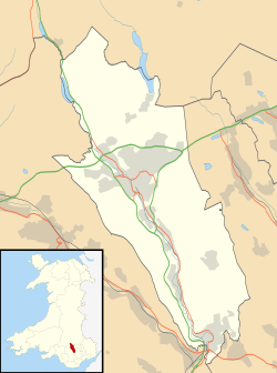
Quakers Yard
Location within Merthyr Tydfil
OS grid reference ST093965
Community
Principal area
Ceremonial county
Country Wales
Sovereign state United Kingdom
Post town Treharris
Postcode district CF46
Dialling code 01443
Police South Wales
Fire South Wales
Ambulance Welsh
UK Parliament
Senedd Cymru – Welsh Parliament
List of places
UK
Wales
Merthyr Tydfil
51°39′37″N3°18′41″W / 51.6603°N 3.3113°W / 51.6603; -3.3113 Coordinates: 51°39′37″N3°18′41″W / 51.6603°N 3.3113°W / 51.6603; -3.3113

Quakers Yard or Quaker's Yard [1] (Welsh : Mynwent y Crynwyr) is a village in the Merthyr Tydfil County Borough, situated where the Taff Bargoed Valley joins the Taff Valley. The settlement is part of the community of Treharris.

Contents

History

Ysgol Rhyd Y Grug Ysgol Rhyd Y Grug - geograph.org.uk - 85782.jpg
Ysgol Rhyd Y Grug

The early place name for the district was 'Rhyd y Grug' or 'The Ford of the Rustling Waters'. This ford was a simple and easy crossing place of the nearby River Taff, close to its junction with the smaller Taff Bargoed river. The ford was replaced in later years by the narrow stone bridge over the River Taff. Quakers Yard railway station opened in 1858.

During the early 17th century those who 'dissented' from the King's Religion were persecuted. This often took the form of imprisonment, or death. By about 1650 a 'dissenting group' of Baptists, independents and Quakers were worshipping at nearby Berthlwyd Farm, Pentwyn (Top of the Hill). The Quakers in turn, soon broke away to establish their own separate community. In the year 1667, these Quakers opened their own Quaker burial ground. It was on a piece of land on the Pantannas Estate and was owned by Mary Chapman. In her will of 1700, she left the burial ground to the Quakers. However, this burial ground was very small as the Quakers did not want to draw attention to it. To find this burial ground now is even harder as a new road in Quakers Yard was built through this site.

Notable people

The Jacobite David Morgan, executed for his part in the Jacobite rising of 1745, lived at the farm of Penygraig on the hillside north of Edwardsville.

One of the most famous British boxers of all time, Jimmy Wilde (1892–1969) was born at Pentwyn Deintyr, Quakers Yard. Known as 'The ghost with the Hammer in his hand', he fought 864 contests and lost on 4 occasions only. He was Flyweight Champion of the World (Universal) from 1916 to 1921.

Andrew Coombs was born in Merthyr Tydfil and resided in Quakers Yard. He won 10 full international rugby caps between 2013 and 2014, and also captained the Newport Gwent Dragons region. After retirement from rugby he became a rugby pundit with S4C and BBC Television.

Schools

The primary school Ysgol Gymraeg Gynradd Rhyd y Grug was located in the village until pupils were relocated to Aberfan. The redundant school buildings near the confluence of the rivers in Quakers Yard have been demolished.

Railways

Quakers Yard station is located on the Merthyr Line in Treharris. The station was opened as "Quakers Yard Low Level" by the Taff Vale Railway in 1858. [2]

Location grid


Related Research Articles

<span class="mw-page-title-main">Taff Vale Railway</span> Railway company and line in South Wales

The Taff Vale Railway (TVR) was a standard gauge railway in South Wales, built by the Taff Vale Railway Company to serve the iron and coal industries around Merthyr Tydfil and to connect them with docks in Cardiff. It was opened in stages in 1840 and 1841.

<span class="mw-page-title-main">River Taff</span> River in Wales which flows into Cardiff Bay

The River Taff is a river in Wales. It rises as two rivers in the Brecon Beacons; the Taf Fechan and the Taf Fawr before becoming one just north of Merthyr Tydfil. Its confluence with the River Severn estuary is in Cardiff.

The Rhymney Railway was a railway company in South Wales, founded to transport minerals and materials to and from collieries and ironworks in the Rhymney Valley of South Wales, and to docks in Cardiff. It opened a main line in 1858, and a limited passenger service was operated in addition.

<span class="mw-page-title-main">Grangetown railway station</span> Railway station in Cardiff, Wales

Grangetown railway station is a railway station serving the Grangetown district of Cardiff, Wales. It is located on the Vale of Glamorgan Line 1 mile (1.5 km) south west of Cardiff Central towards Bridgend via Barry, Penarth and Barry Island.

<span class="mw-page-title-main">Hengoed railway station</span> Railway station in Caerphilly, Wales

Hengoed railway station is the name of an operational National Rail station situated in Hengoed, Wales, on the Rhymney Line of the Valley Lines network.

<span class="mw-page-title-main">Taffs Well railway station</span> Railway station in Rhondda Cynon Taf, Wales

Taffs Well railway station is a railway station serving the village of Taff's Well, Rhondda Cynon Taf, Wales, as well as neighbouring Gwaelod-y-Garth, Cardiff. It is located on the Merthyr Line and the Rhondda Line. Passenger services are provided by Transport for Wales.

<span class="mw-page-title-main">Quakers Yard railway station</span> Railway station in Merthyr Tydfil, Wales

Quakers Yard railway station serves the village of Edwardsville in the community of Treharris, Merthyr Tydfil, Wales. It is located on the Merthyr Tydfil branch of the Merthyr Line. Passenger services are provided by Transport for Wales.

<span class="mw-page-title-main">Aber railway station</span> Railway station in Caerphilly, Wales

Aber railway station is a railway station serving the town of Caerphilly, south Wales. It is a stop on the Rhymney Line 8+14 miles (13.3 km) north of Cardiff Central on the Valley Lines network.

<span class="mw-page-title-main">Merthyr Vale</span> Human settlement in Wales

Merthyr Vale is a linear village and community in the Welsh county borough of Merthyr Tydfil. Lying on the A4054 road it is on the east bank of the River Taff.

<span class="mw-page-title-main">Treharris</span> Human settlement in Wales

Treharris is a small town and community in the Taff Bargoed Valley in the south of Merthyr Tydfil County Borough, South Wales. It is located about 0.6 miles (1.0 km) west of Trelewis, from which it is separated by the Taff Bargoed river, and 0.9 miles (1.4 km) from Nelson in Caerphilly county borough and has a population of 6,356 from the 2011 Census. As a community, Treharris includes the villages of Quakers Yard and Edwardsville. Due to steepness and narrowness of both the Taff and Taff Bargoed valleys at Treharris several notable bridges and viaducts have been built in the area.

<span class="mw-page-title-main">Nelson, Caerphilly</span> Village, Wales

Nelson is a village and community in the County Borough of Caerphilly, Wales. It sits five miles north of Caerphilly and ten miles north of Cardiff, at the lower end of the Taff Bargoed Valley, and lies adjacent to Treharris, Trelewis and Quakers Yard.

<span class="mw-page-title-main">Fochriw</span> Human settlement in Wales

Fochriw is a village located in Caerphilly County Borough, Wales, United Kingdom. It was well known for its neighbouring collieries, which employed nearly the entire local population in the early 20th century. It lies within the historic county boundaries of Glamorgan. The village appears as the backdrop on the BBC Wales sitcom High Hopes credits. The villages population was recorded as 1,250 in 2011.

<span class="mw-page-title-main">Trelewis</span> Human settlement in Wales

Trelewis is a small village in the Taff Bargoed Valley of south-east Wales, currently located in the southern part of Merthyr Tydfil County Borough. It is a former mining village and together with nearby Bedlinog was until 1974 part of the Gelligaer Urban District Council area of the county of Glamorgan. The villages name means 'Lewis Town' and was named after the Lewis family who owned a farm on the area where the village is now built.

<span class="mw-page-title-main">Taff Bargoed</span>

The Taff Bargoed is a river and valley near Pontypridd in South Wales, and lies off the Abercynon roundabout on the A470 road, and is approximately 14 miles from Cardiff. The main settlements are Nelson, Edwardsville, Quakers Yard, Treharris, Trelewis, and Bedlinog. The valley is situated where the three County Boroughs of Caerphilly, Rhondda Cynon Taff, and Merthyr Tydfil meet.

The Llancaiach Branch railway line was a mineral branch line in Glamorganshire, South Wales. It was authorised in 1836 as part of the Taff Vale Railway, and its purpose was to connect collieries at Llancaiach and bring their output to Cardiff for onward shipment. It was designed by Isambard Kingdom Brunel and built on the standard gauge. It opened in 1841 from a junction with the Merthyr line immediately south of Abercynon. It was intended to be horse worked, and included a self-acting rope-worked inclined plane near the junction. The collieries were slow to use the line, preferring their customary use of a tramroad and the Glamorganshire Canal, and the value of the line was diminished when the Taff Vale Extension line, an east-west connecting line belonging to the Newport, Abergavenny and Hereford Railway, intersected it and cut off the colliery connections, and the line became dormant.

<span class="mw-page-title-main">Aberfan</span> Human settlement in Wales

Aberfan is a former coal mining village in the Taff Valley 4 mi (6 km) south of the town of Merthyr Tydfil, Wales.

<span class="mw-page-title-main">Ynysboeth</span> Human settlement in Wales

Ynysboeth is a local community within the Mountain Ash (Aberpennar) postal district of the Cynon Valley in the County Borough of Rhondda Cynon Taf, South East Wales.

<span class="mw-page-title-main">Deep Navigation Colliery</span>

Deep Navigation Colliery was a coal mine in South Wales, that operated from 1872 until 1991.

<span class="mw-page-title-main">Merthyr Tydfil County Borough</span> County borough in Wales

Merthyr Tydfil County Borough is a county borough in the south-east of Wales. In mid 2018, it had an estimated population of 60,183. It is located in the historic county of Glamorgan and takes its name from the town with the same name. The county borough consists of the northern part of the Taff Valley and the smaller neighbouring Taff Bargoed Valley. It borders the counties of Rhondda Cynon Taf to the west, Caerphilly County Borough to the east, and Powys to the north.

Pontypool Clarence Street railway station was a station on the former Taff Vale Extension (TVE) of the Newport, Abergavenny and Hereford Railway. The TVE was opened in 1857 to link up with the Taff Vale Railway (TVR) at Quakers Yard which connected onto Merthyr Tydfil. A major achievement of this railway was the building of the Crumlin Viaduct over the Ebbw River. The TVE linked directly with the Vale of Neath Railway at Merthyr and further linked Pontypool to Swansea and Neath. The main purpose of this line was the transport of coal across the country.

References

  1. "Map of Quaker's Yard". Streetmap.co.uk. Retrieved 24 February 2023.
  2. Hutton, John (2006). The Taff Vale Railway, vol. 1. Silver Link. ISBN   978-1-85794-249-1.