List of Roman-to-modern scheduled monuments in Powys (Brecknockshire)

Last updated

Powys is the largest administrative county in Wales. With over a quarter of Wales's land area, covering much of the eastern half of the country, it is a county of remote uplands, low population and no coastline. It was created in more or less its current form in 1974, and is the only one of the large county units created at that time to have been carried forward intact at the 1996 local government re-organisation. It comprises three historic counties, namely Montgomeryshire, Radnorshire, and most of Brecknockshire. There are 950 Scheduled monuments within the county, which is far more than can be sensibly covered in one list. Each of the 3 historic counties is therefore listed separately, and each of these has two lists - one for the prehistoric sites and one for the Roman, medieval and post-medieval sites.

Contents

This list shows the sites in Brecknockshire dating to Roman, medieval, post-medieval through to modern times. The area is also historically known as Breconshire, (not including those parts that are no longer in Powys). Brecknockshire is the southern third of Powys, and encompasses the Brecon Beacons National Park, the Black Mountains and Mynydd Epynt. The River Wye separates it from Radnorshire. There are 135 scheduled monuments on this list. Of these, 10 are Roman, all of which are military in purpose, being either roads or forts and camps. Nine date from the Early Middle Ages, mainly inscribed stones but also including a Crannog. There are 78 sites from the post-Norman Medieval period, including castles, mottes and moated sites, churches, town defenses and agricultural holdings. The 38 post-medieval sites are even more diverse, covering bridges, tramways, aqueducts, agricultural sites and lost villages, lead mines, coal mines, industrial sites, and two war-time features from the 1940s.

The 254 scheduled sites dating to prehistoric periods are listed at List of prehistoric scheduled monuments in Powys (Brecknockshire)

Scheduled monuments have statutory protection. It is illegal to disturb the ground surface or any standing remains. The compilation of the list is undertaken by Cadw Welsh Historic Monuments, which is an executive agency of the National Assembly of Wales. [1] The list of scheduled monuments below is supplied by Cadw [2] with additional material from RCAHMW and Clwyd-Powys Archaeological Trust.

Roman to modern scheduled monuments in Brecknockshire

The list is sorted by date, and then by Community so that sites of similar age and locality are placed near each other. Clicking on the heading arrows will sort the list by that information.

ImageNameSite typeCommunityLocationDetailsPeriod SAM No
& Refs
Roman Fort at Pen y Gaer Roman fort Llanfihangel Cwmdu with Bwlch and Cathedine 51°53′23″N3°12′35″W / 51.8897°N 3.2098°W / 51.8897; -3.2098 (Roman Fort at Pen y Gaer) ,
SO168219
Roman
BR174
[3]
Abererbwll Roman Fort Roman fort Llangamarch, (also Llanfair-ar-y-bryn, see Carmarthenshire) 52°03′36″N3°40′46″W / 52.06°N 3.6794°W / 52.06; -3.6794 (Abererbwll Roman Fort) ,
SN849415
Roman
CM373
[4]
Y Pigwyn Marching camp Llywel, (also Myddfai, see Carmarthenshire) 51°58′01″N3°42′26″W / 51.967°N 3.7071°W / 51.967; -3.7071 (Y Pigwyn) ,
SN828312
Roman
BR003
[5]
Roman Road on Mynydd Illtyd, south-western section Road Maescar 51°55′13″N3°30′44″W / 51.9202°N 3.5123°W / 51.9202; -3.5123 (Roman Road on Mynydd Illtyd, south-western section) ,
SN960257
Roman
BR224
[6]
Roman Road on Mynydd Illtyd, North-Eastern section Road Trallong 51°55′40″N3°30′02″W / 51.9277°N 3.5005°W / 51.9277; -3.5005 (Roman Road on Mynydd Illtyd, North-Eastern section) ,
SN969265
Roman
BR225
[7]
Caerau Roman Site Roman fort Treflys 52°08′23″N3°34′27″W / 52.1398°N 3.5743°W / 52.1398; -3.5743 (Caerau Roman Site) ,
SN923502
Roman
BR148
[8]
Tynewydd Roman Road Road Treflys 52°09′13″N3°33′23″W / 52.1536°N 3.5563°W / 52.1536; -3.5563 (Tynewydd Roman Road) ,
SN936517
Roman
BR380
[9]
Brecon Gaer Roman Fort Cadw logo.png Roman fort Yscir 51°57′23″N3°27′06″W / 51.9565°N 3.4517°W / 51.9565; -3.4517 (The Gaer, Brecon) ,
SO003296
Roman
BR001
[10]
Roman Marching Camp NE of Maen Madog Marching camp Ystradfellte 51°50′07″N3°33′49″W / 51.8354°N 3.5637°W / 51.8354; -3.5637 (Roman Marching Camp NE of Maen Madog) ,
SN923163
Roman
BR162
[11]
Section of Road NE of Coelbren Fort Road Ystradfellte 51°47′18″N3°38′23″W / 51.7883°N 3.6397°W / 51.7883; -3.6397 (Section of Road NE of Coelbren Fort) ,
SN870112
Roman
BR074
[12]
Crickadarn Camp Enclosure Erwood 52°04′10″N3°19′56″W / 52.0695°N 3.3323°W / 52.0695; -3.3323 (Crickadarn Camp) ,
SO087420
Early Medieval
BR033
[13]
Cross-Slab in Churchyard Cross Glyn Tarell 51°56′36″N3°26′20″W / 51.9433°N 3.439°W / 51.9433; -3.439 (Cross-Slab in Churchyard) ,
SO011281
Early Medieval
BR121
[14]
Cross-Slab in Church Cross-marked stone Honddu Isaf 51°58′53″N3°24′28″W / 51.9815°N 3.4079°W / 51.9815; -3.4079 (Cross-Slab in Church) ,
SO034323
Early Medieval
BR120
[15]
Inscribed Stone in Church Inscribed stone Llanfihangel Cwmdu with Bwlch and Cathedine 51°54′25″N3°11′33″W / 51.907°N 3.1925°W / 51.907; -3.1925 (Inscribed Stone in Church) ,
SO180238
Early Medieval
BR109
[16]
Cross-Slab in Church Cross Llanfrynach 51°55′44″N3°19′33″W / 51.929°N 3.3257°W / 51.929; -3.3257 (Cross-Slab in Church) ,
SO089264
Early Medieval
BR122
[17]
Llangorse Lake crannog - geograph.org.uk - 522864.jpg Crannog in Llangorse Lake Crannog Llangors 51°56′01″N3°16′07″W / 51.9337°N 3.2685°W / 51.9337; -3.2685 (Crannog in Llangorse Lake) ,
SO128268
A royal hall of the kings of Brycheiniog, now surviving as an artificial island constructed of an oak palisade into which layers of stone, and soil were added. Archaeological digs in the waterlogged conditions have discovered textiles, leather, bronze items, a reliquary and a dugout boat.Early Medieval
(9th century)
BR158
[18]
Early Christian Inscribed Stone in Defynnog Church Inscribed stone Maescar 51°56′22″N3°33′54″W / 51.9394°N 3.565°W / 51.9394; -3.565 (Early Christian Inscribed Stone in Defynnog Church) ,
SN925279
Early Medieval
BR182
[19]
Ponsticill Inscribed Stone Inscribed stone Talybont-on-Usk 51°48′35″N3°20′45″W / 51.8098°N 3.3457°W / 51.8098; -3.3457 (Ponsticill Inscribed Stone) ,
SO073132
Early Medieval
BR141
[20]
Maen Madoc in the sunshine - geograph.org.uk - 693640.jpg
Maen Madoc Inscribed stone Ystradfellte 51°49′49″N3°34′14″W / 51.8302°N 3.5706°W / 51.8302; -3.5706 (Maen Madoc) ,
SN918157
Early Medieval
BR018
[21]
Brecon Castle Castle Brecon 51°56′58″N3°23′38″W / 51.9494°N 3.3938°W / 51.9494; -3.3938 (Brecon Castle) ,
SO043287
Medieval
BR022
[22]
Castle Mound 800m NNW of Ty'n-y-Caeau Motte Brecon 51°57′22″N3°21′16″W / 51.9561°N 3.3544°W / 51.9561; -3.3544 (Castle Mound 800m NNW of Ty'n-y-Caeau) ,
SO070295
Medieval
BR046
[23]
St Eluned's Chapel and WellChapel Brecon 51°56′52″N3°22′21″W / 51.9478°N 3.3726°W / 51.9478; -3.3726 (St Eluned's Chapel and Well) ,
SO057286
Medieval
BR236
[24]
Town Wall and Gatehouse at Captain's Walk Town Wall Brecon 51°56′45″N3°23′29″W / 51.9458°N 3.3913°W / 51.9458; -3.3913 (Town Wall and Gatehouse at Captain's Walk) ,
SO045284
Medieval
BR177
[25]
Town Wall at Watton Mount Town defences Brecon 51°56′48″N3°23′18″W / 51.9467°N 3.3882°W / 51.9467; -3.3882 (Town Wall at Watton Mount) ,
SO046284
Medieval
BR150
[26]
Bronllys Castle Cadw logo.png Castle Bronllys 52°00′16″N3°14′27″W / 52.0044°N 3.2407°W / 52.0044; -3.2407 (Bronllys Castle) ,
SO149347
Medieval
BR008
[27]
Bronllys moated site Moated Site Bronllys 52°00′20″N3°14′59″W / 52.0056°N 3.2497°W / 52.0056; -3.2497 (Bronllys moated site) ,
SO143348
Medieval
BR058
[28]
Builth Castle Motte Builth 52°08′57″N3°23′54″W / 52.1492°N 3.3983°W / 52.1492; -3.3983 (Builth Castle) ,
SO044510
Medieval
BR031
[29]
Caer Beris Motte Cilmery 52°08′46″N3°25′09″W / 52.1461°N 3.4192°W / 52.1461; -3.4192 (Caer Beris) ,
SO029507
Medieval
BR093
[30]
Crickhowell Castle Castle Crickhowell 51°51′26″N3°08′15″W / 51.8572°N 3.1376°W / 51.8572; -3.1376 (Crickhowell Castle) ,
SO217182
Medieval
BR111
[31]
Maes-Celyn Castle Mound Motte Crickhowell 51°52′06″N3°09′12″W / 51.8682°N 3.1532°W / 51.8682; -3.1532 (Maes-Celyn Castle Mound) ,
SO206194
Medieval
BR055
[32]
Cwmhindda Deserted Rural Settlement Platform house Duhonw 52°06′58″N3°24′15″W / 52.1162°N 3.4041°W / 52.1162; -3.4041 (Cwmhindda Deserted Rural Settlement) ,
SO039473
Medieval
BR280
[33]
Castle Earthwork 200m S of Coed Caeau Ringwork Erwood 52°03′42″N3°22′26″W / 52.0618°N 3.3738°W / 52.0618; -3.3738 (Castle Earthwork 200m S of Coed Caeau) ,
SO059412
Medieval
BR179
[34]
Gwenddwr Deserted Village Deserted Rural Settlement Erwood 52°04′53″N3°21′59″W / 52.0813°N 3.3663°W / 52.0813; -3.3663 (Gwenddwr Deserted Village) ,
SO064434
Medieval
BR168
[35]
Llanfilo Moated Site Moated Site Felin-fach 51°59′03″N3°17′03″W / 51.9843°N 3.2842°W / 51.9843; -3.2842 (Llanfilo Moated Site) ,
SO119325
Medieval
BR152
[36]
Medieval Building in Llanfilo Village Building (Unclassified) Felin-fach 51°59′27″N3°17′01″W / 51.9907°N 3.2836°W / 51.9907; -3.2836 (Medieval Building in Llanfilo Village) ,
SO119332
Medieval
BR221
[37]
Moated Site 670m NE of Lower Penwaun Moated Site Felin-fach 51°58′46″N3°20′07″W / 51.9795°N 3.3352°W / 51.9795; -3.3352 (Moated Site 670m NE of Lower Penwaun) ,
SO083320
Medieval
BR180
[38]
Moated Site 800m NE of Felinfach Moated Site Felin-fach 51°59′35″N3°18′42″W / 51.993°N 3.3117°W / 51.993; -3.3117 (Moated Site 800m NE of Felinfach) ,
SO100335
Medieval
BR049
[39]
Moated Site E of Pont-y-Bat Wood Moated Site Felin-fach 52°00′08″N3°17′42″W / 52.0022°N 3.295°W / 52.0022; -3.295 (Moated Site E of Pont-y-Bat Wood) ,
SO112345
Medieval
BR050
[40]
Moated Site in Llanfilo Village Moated Site Felin-fach 51°59′24″N3°17′02″W / 51.9901°N 3.284°W / 51.9901; -3.284 (Moated Site in Llanfilo Village) ,
SO119331
Medieval
BR195
[41]
Oaklands Moated Site Moated Site Felin-fach 51°58′45″N3°20′50″W / 51.9793°N 3.3473°W / 51.9793; -3.3473 (Oaklands Moated Site) ,
SO075320
Medieval
BR041
[42]
Cilwhybert Castle Mound Motte Glyn Tarell 51°55′51″N3°26′06″W / 51.9309°N 3.4349°W / 51.9309; -3.4349 (Cilwhybert Castle Mound) ,
SO014267
Medieval
BR127
[43]
Craig Cerrig-Gleisiad Deserted Rural Settlement Deserted Rural Settlement Glyn Tarell 51°53′31″N3°30′17″W / 51.8919°N 3.5048°W / 51.8919; -3.5048 (Craig Cerrig-Gleisiad Deserted Rural Settlement) ,
SN965225
Medieval
BR266
[44]
Earthwork 675m W of Dan-y-Cefn Ringwork Glyn Tarell 51°55′58″N3°26′35″W / 51.9327°N 3.4431°W / 51.9327; -3.4431 (Earthwork 675m W of Dan-y-Cefn) ,
SO008270
Medieval
BR170
[45]
Aberllynfi chapelChapel Gwernyfed 52°02′03″N3°12′28″W / 52.0342°N 3.2079°W / 52.0342; -3.2079 (Aberllynfi chapel) ,
SH172379
Medieval
BR351
[46]
Glasbury Old ChurchChurch Gwernyfed 52°02′33″N3°12′09″W / 52.0425°N 3.2024°W / 52.0425; -3.2024 (Glasbury Old Church) ,
SO176389
Medieval
BR350
[47]
Great House Mound & Bailey Castle Motte & Bailey Gwernyfed 52°02′05″N3°12′31″W / 52.0348°N 3.2085°W / 52.0348; -3.2085 (Great House Mound & Bailey Castle) ,
SO171380
Medieval
BR080
[48]
Castle Mound near Swan Hotel Motte Hay 52°04′21″N3°07′48″W / 52.0726°N 3.1299°W / 52.0726; -3.1299 (Castle Mound near Swan Hotel) ,
SO226421
Medieval
BR077
[49]
Hay Castle Castle Hay 52°04′25″N3°07′33″W / 52.0737°N 3.1257°W / 52.0737; -3.1257 (Hay Castle) ,
SO229423
Medieval
BR076
[50]
Castell Madoc Ringwork Motte Honddu Isaf 52°01′23″N3°25′19″W / 52.0231°N 3.4219°W / 52.0231; -3.4219 (Castell Madoc Ringwork) ,
SO025370
Medieval
BR155
[51]
Castell Madoc Mound Motte Honddu Isaf 52°01′19″N3°25′23″W / 52.0219°N 3.423°W / 52.0219; -3.423 (Castle Madoc Mound) ,
SO024369
Medieval
BR192
[52]
Llandefaelog Fach Motte Motte Honddu Isaf 51°58′52″N3°24′33″W / 51.9812°N 3.4093°W / 51.9812; -3.4093 (Llandefaelog Fach Motte) ,
SO033323
Medieval
BR191
[53]
Earthworks SW of Church Earthwork (unclassified) Llanafan Fawr 52°11′21″N3°30′47″W / 52.1893°N 3.513°W / 52.1893; -3.513 (Earthworks SW of Church) ,
SN966556
Medieval
BR089
[54]
Hafotau Settlement on Bryn Melys Rectangular hut settlement Llanafan Fawr 52°13′42″N3°33′57″W / 52.2282°N 3.5659°W / 52.2282; -3.5659 (Hafotau Settlement on Bryn Melys) ,
SN931600
Medieval
BR215
[55]
Ringwork near Coed Ty-Mawr Ringwork Llanafan Fawr 52°12′27″N3°29′06″W / 52.2075°N 3.4851°W / 52.2075; -3.4851 (Ringwork near Coed Ty-Mawr) ,
SN986576
Medieval
BR098
[56]
Alexanderstone Mound and Bailey Castle Motte & Bailey Llanddew 51°57′42″N3°21′02″W / 51.9616°N 3.3506°W / 51.9616; -3.3506 (Alexanderstone Mound and Bailey Castle) ,
SO073301
Medieval
BR045
[57]
Earthworks South West of Llanddew Church Earthwork (unclassified) Llanddew 51°58′01″N3°22′41″W / 51.967°N 3.378°W / 51.967; -3.378 (Earthworks South West of Llanddew Church) ,
SO054307
Medieval
BR196
[58]
Llanddew Castle Castle Llanddew 51°58′03″N3°22′34″W / 51.9676°N 3.376°W / 51.9676; -3.376 (Llanddew Castle) ,
SO055307
Medieval
BR057
[59]
Castell Blaen-Llynfi Castle Llanfihangel Cwmdu with Bwlch and Cathedine 51°53′53″N3°14′38″W / 51.898°N 3.244°W / 51.898; -3.244 (Castell Blaen-Llynfi) ,
SO145228
Medieval
BR009
[60]
Tretower Barn Barn Llanfihangel Cwmdu with Bwlch and Cathedine 51°53′00″N3°11′01″W / 51.8834°N 3.1837°W / 51.8834; -3.1837 (Tretower Barn) ,
SO186211
Medieval
BR146
[61]
Tretower Castle.jpg Tretower Castle Cadw logo.png Castle Llanfihangel Cwmdu with Bwlch and Cathedine 51°53′02″N3°11′10″W / 51.8839°N 3.1862°W / 51.8839; -3.1862 (Tretower Castle) ,
SO184212
Medieval
BR014
[62]
Tretower Court Cadw logo.png House (domestic) Llanfihangel Cwmdu with Bwlch and Cathedine 51°53′00″N3°11′05″W / 51.8832°N 3.1846°W / 51.8832; -3.1846 (Tretower Court) ,
SO185211
Medieval
BR117
[63]
Tretower Shrunken Medieval Settlement Shrunken medieval village Llanfihangel Cwmdu with Bwlch and Cathedine 51°53′05″N3°11′04″W / 51.8848°N 3.1844°W / 51.8848; -3.1844 (Tretower Shrunken Medieval Settlement) ,
SO185213
Medieval
BR238
[64]
Hen Castell Moated Site Llangattock 51°50′32″N3°08′38″W / 51.8422°N 3.144°W / 51.8422; -3.144 (Hen Castell) ,
SO212165
Medieval
BR056
[65]
House Platforms and Hollow Ways in the Shrunken Medieval Village of Llanfihangel Tal-y-Llyn House platform Llangors 51°56′54″N3°17′21″W / 51.9483°N 3.2893°W / 51.9483; -3.2893 (House Platforms and Hollow Ways in the Shrunken Medieval Village of Llanfihangel Tal-y-Llyn) ,
SO114285
Medieval
BR220
[66]
Twmpan Castle Mound Motte Llangors 51°55′22″N3°16′22″W / 51.9228°N 3.2728°W / 51.9228; -3.2728 (Twmpan Castle Mound) ,
SO125256
Medieval
BR054
[67]
Llangynidr Deserted Medieval Village (part of) Deserted Medieval Village Llangynidr 51°51′56″N3°13′45″W / 51.8655°N 3.2293°W / 51.8655; -3.2293 (Llangynidr Deserted Medieval Village (part of)) ,
SO154192
Medieval
BR187
[68]
Pen Bwlych Glascwm Pillow Mounds Pillow mound Llangynidr 51°50′19″N3°19′07″W / 51.8386°N 3.3185°W / 51.8386; -3.3185 (Pen Bwlych Glascwm Pillow Mounds) ,
SO092163
Medieval
BR252
[69]

Llanthomas Castle Mound.jpg

Llanthomas Castle Mound Motte Llanigon 52°03′22″N3°09′17″W / 52.056°N 3.1548°W / 52.056; -3.1548 (Llanthomas Castle Mound) ,
SO209403
Medieval
BR078
[70]
The Scottish Pedlar Wayside Cross Cross Llanigon 52°02′25″N3°07′30″W / 52.0403°N 3.125°W / 52.0403; -3.125 (The Scottish Pedlar Wayside Cross) ,
SO229385
Medieval
BR200
[71]
Corn Drying Kiln 340m S of Cryn-Fryn Corn-drying kiln Llanwrthwl 52°14′45″N3°30′10″W / 52.2457°N 3.5027°W / 52.2457; -3.5027 (Corn Drying Kiln 340m S of Cryn-Fryn) ,
SN974619
Medieval
BR183
[72]
Hafotau Settlement on Esgair Gwar-y-Cae Rectangular hut settlement Llanwrthwl 52°14′27″N3°35′08″W / 52.2407°N 3.5855°W / 52.2407; -3.5855 (Hafotau Settlement on Esgair Gwar-y-Cae) ,
SN918614
Medieval
BR216
[73]
Allt Fach Deserted Rural Settlement Deserted Rural Settlement Llywel 51°50′39″N3°40′38″W / 51.8441°N 3.6771°W / 51.8441; -3.6771 (Allt Fach Deserted Rural Settlement) ,
SN845175
Medieval
BR263
[74]
Deserted Farmstead South of Ffynnon yr Oerfa Rectangular hut settlement Llywel 51°59′10″N3°39′17″W / 51.9861°N 3.6548°W / 51.9861; -3.6548 (Deserted Farmstead South of Ffynnon yr Oerfa) ,
SN864332
Medieval
BR223
[75]
Rectangular Hut, Afon Tawe Rectangular hut Llywel 51°52′57″N3°40′16″W / 51.8825°N 3.6711°W / 51.8825; -3.6711 (Rectangular Hut, Afon Tawe) ,
SN850217
Medieval
BR260
[76]
Trecastle Mound and Bailey Castle Motte & Bailey Llywel 51°56′58″N3°37′39″W / 51.9494°N 3.6274°W / 51.9494; -3.6274 (Trecastle Mound and Bailey Castle) ,
SN882291
Medieval
BR026
[77]
Castell-Du, Sennybridge Castle Maescar 51°56′37″N3°34′23″W / 51.9436°N 3.573°W / 51.9436; -3.573 (Castell-Du, Sennybridge) ,
SN919284
Medieval
BR126
[78]
Clawdd British Enclosure Maescar 52°01′07″N3°39′33″W / 52.0186°N 3.6591°W / 52.0186; -3.6591 (Clawdd British) ,
SN862368
Medieval
BR032
[79]
Hirllwyn Camp Enclosure Maescar 52°01′51″N3°37′16″W / 52.0308°N 3.6211°W / 52.0308; -3.6211 (Hirllwyn Camp) ,
SN888381
Medieval
BR143
[80]
Cefn Barn Ringwork Ringwork Talgarth 51°58′28″N3°14′45″W / 51.9745°N 3.2458°W / 51.9745; -3.2458 (Cefn Barn Ringwork) ,
SO145314
Medieval
BR088
[81]
Tower at Great Porthamel - geograph.org.uk - 3918704.jpg Porthamel Tower Tower Talgarth 52°00′32″N3°13′33″W / 52.0088°N 3.2259°W / 52.0088; -3.2259 (Porthamal Tower) ,
SO159351
Medieval
BR047
[82]
Tredustan Castle Mound Motte Talgarth 51°59′01″N3°15′13″W / 51.9836°N 3.2536°W / 51.9836; -3.2536 (Tredustan Castle Mound) ,
SO140324
Medieval
BR082
[83]
Trefecca Castle Mound Motte Talgarth 51°58′58″N3°15′04″W / 51.9827°N 3.251°W / 51.9827; -3.251 (Trefecca Castle Mound) ,
SO141323
Medieval
BR083
[84]
Trefecca-Fawr Moated Site Fishpond Talgarth 51°58′40″N3°14′58″W / 51.9778°N 3.2494°W / 51.9778; -3.2494 (Trefecca-Fawr Moated Site) ,
SO142317
Medieval
BR087
[85]
Cwm Cwareli Longhouse and Long Hut Longhouse Talybont-on-Usk 51°53′09″N3°22′15″W / 51.8858°N 3.3707°W / 51.8858; -3.3707 (Cwm Cwareli Longhouse and Long Hut) ,
SO058217
Medieval
BR282
[86]
Tor y Foel Deserted Rural Settlement Platform house Talybont-on-Usk 51°51′51″N3°17′27″W / 51.8643°N 3.2907°W / 51.8643; -3.2907 (Tor y Foel Deserted Rural Settlement) ,
SO112192
Medieval
BR283
[87]
Churchyard Cross, St Issau's Church Cross The Vale of Grwyney 51°53′45″N3°02′57″W / 51.8957°N 3.0493°W / 51.8957; -3.0493 (Churchyard Cross, St Issau's Church) ,
SO278224
Medieval
BR172
[88]
Cwm Beusych Deserted Rural Settlement Platform house The Vale of Grwyney 51°53′15″N3°04′26″W / 51.8876°N 3.0739°W / 51.8876; -3.0739 (Cwm Beusych Deserted Rural Settlement) ,
SO261215
Medieval
BR298
[89]
Llwyn y Brain Deserted Rural Settlement Platform house The Vale of Grwyney 51°54′05″N3°03′13″W / 51.9014°N 3.0537°W / 51.9014; -3.0537 (Llwyn y Brain Deserted Rural Settlement) ,
SO276230
Medieval
BR300
[90]
Two platform buildings on eastern side of Partrishow Hill Platform House The Vale of Grwyney 51°53′21″N3°03′17″W / 51.8892°N 3.0547°W / 51.8892; -3.0547 (Two platform buildings on eastern side of Partrishow Hill) ,
SO275217
Medieval
BR416
[91]
Y Cwrt Deserted Rural Settlement Platform house The Vale of Grwyney 51°53′14″N3°04′02″W / 51.8871°N 3.0673°W / 51.8871; -3.0673 (Y Cwrt Deserted Rural Settlement) ,
SO266214
Medieval
BR299
[92]
Cwm Camlais Castle Motte Trallong 51°55′24″N3°31′09″W / 51.9234°N 3.5192°W / 51.9234; -3.5192 (Cwm Camlais Castle) ,
SN956260
Medieval
BR037
[93]
Tir-cyd Deserted Rural Settlement Deserted Rural Settlement Trallong 52°01′39″N3°33′39″W / 52.0274°N 3.5608°W / 52.0274; -3.5608 (Tir-cyd Deserted Rural Settlement) ,
SN930377
Medieval
BR290
[94]
Caerau Castle Mound Motte Treflys 52°08′20″N3°34′30″W / 52.139°N 3.575°W / 52.139; -3.575 (Caerau Castle Mound) ,
SN923501
Medieval
BR130
[95]
Fforest Castle Mound Motte Treflys 52°09′21″N3°34′51″W / 52.1559°N 3.5809°W / 52.1559; -3.5809 (Fforest Castle Mound) ,
SN919520
Medieval
BR131
[96]
Aberyscir Castle Mound Motte Yscir 51°57′20″N3°27′22″W / 51.9555°N 3.4561°W / 51.9555; -3.4561 (Aberyscir Castle Mound) ,
SO000295
Medieval
BR021
[97]
Castell Coch Motte & Bailey Ystradfellte 51°49′08″N3°32′43″W / 51.8189°N 3.5453°W / 51.8189; -3.5453 (Castell Coch) ,
SN935144
Medieval
BR081
[98]
Enclosures East of Afon Llia Enclosure - Agricultural Ystradfellte 51°51′15″N3°33′31″W / 51.8541°N 3.5586°W / 51.8541; -3.5586 (Enclosures East of Afon Llia) ,
SN927184
Medieval
BR258
[99]
Brecon Bridge Bridge Brecon 51°56′51″N3°23′37″W / 51.9476°N 3.3937°W / 51.9476; -3.3937 (Brecon Bridge) ,
SO043285
Post-Medieval/Modern
BR004
[100]
Pont GihirychBridge Cray 51°52′41″N3°37′12″W / 51.8781°N 3.6201°W / 51.8781; -3.6201 (Pont Gihirych) ,
SN885211
Post-Medieval/Modern
BR199
[101]
Porthmawr Crickhowell.jpg Porth Mawr Gatehouse Crickhowell 51°51′37″N3°08′15″W / 51.8604°N 3.1376°W / 51.8604; -3.1376 (Porth Mawr) ,
SO217185
Post-Medieval/Modern
BR114
[102]
Cefn Corast Deserted Rural Settlement Rectangular hut Duhonw 52°06′13″N3°27′43″W / 52.1036°N 3.4619°W / 52.1036; -3.4619 (Cefn Corast Deserted Rural Settlement) ,
SN999460
Post-Medieval/Modern
BR289
[103]
Hendy Long Hut Rectangular hut Erwood 52°06′41″N3°22′41″W / 52.1114°N 3.378°W / 52.1114; -3.378 (Hendy Long Hut) ,
SO057467
Post-Medieval/Modern
BR281
[104]
Y Gyrn Hut Platform (N) House platform Glyn Tarell 51°53′40″N3°28′43″W / 51.8945°N 3.4786°W / 51.8945; -3.4786 (Y Gyrn Hut Platform (N)) ,
SN983228
Post-Medieval/Modern
BR390
[105]
Y Gyrn Hut Platform (S) House platform Glyn Tarell 51°53′32″N3°28′47″W / 51.8923°N 3.4798°W / 51.8923; -3.4798 (Y Gyrn Hut Platform (S)) ,
SN982225
Post-Medieval/Modern
BR393
[106]
Y Gyrn Hut Platforms House platform Glyn Tarell 51°53′35″N3°28′44″W / 51.8931°N 3.4788°W / 51.8931; -3.4788 (Y Gyrn Hut Platforms) ,
SN983226
Post-Medieval/Modern
BR392
[107]
Y Gyrn Longhuts Deserted Rural Settlement Glyn Tarell 51°53′37″N3°28′44″W / 51.8935°N 3.4788°W / 51.8935; -3.4788 (Y Gyrn Longhuts) ,
SN983228
Blaenglyn longhousePost-Medieval/Modern
BR391
[108]
Garden Earthworks at Old GwernyfedGarden Gwernyfed 52°01′16″N3°11′38″W / 52.0212°N 3.194°W / 52.0212; -3.194 (Garden Earthworks at Old Gwernyfed) ,
SO181365
Post-Medieval/Modern
BR193
[109]
Brynich Aqueduct (Brecknock & Abergavenny Canal) Aqueduct Llanfrynach 51°56′11″N3°20′27″W / 51.9365°N 3.3409°W / 51.9365; -3.3409 (Brynich Aqueduct (Brecknock & Abergavenny Canal)) ,
SO079273
Post-Medieval/Modern
BR185
[110]
Llwyn-on Farmstead Farmstead Llanfrynach 51°50′42″N3°24′31″W / 51.8451°N 3.4087°W / 51.8451; -3.4087 (Llwyn-on Farmstead) ,
SO030172
Post-Medieval/Modern
BR240
[111]
CrickhowellBrideDetail.JPG Crickhowell Bridge Bridge Llangattock 51°51′23″N3°08′32″W / 51.8564°N 3.1421°W / 51.8564; -3.1421 (Crickhowell Bridge) ,
SO214181
Post-Medieval/Modern
BR005
[112]
Disgwylfa Tramroads Tramroad Llangattock, (also Llanelly), (see also Monmouthshire) 51°49′08″N3°08′14″W / 51.8189°N 3.1371°W / 51.8189; -3.1371 (Disgwylfa Tramroads) ,
SO217139
Post Medieval/Modern
MM340
[113]
Llangattock Tramroad Inclines Tramroad Llangattock 51°50′19″N3°09′51″W / 51.8385°N 3.1641°W / 51.8385; -3.1641 (Llangattock Tramroad Inclines) ,
SO198161
Post-Medieval/Modern
BR234
[114]
Nant Morlais Hafod Enclosure Llangynidr 51°47′51″N3°20′59″W / 51.7974°N 3.3498°W / 51.7974; -3.3498 (Nant Morlais Hafod) ,
SO070118
Post-Medieval/Modern
BR279
[115]
Cerrig Llwydion Deserted Rural Settlement Deserted Rural Settlement Llanwrthwl 52°14′51″N3°38′25″W / 52.2474°N 3.6402°W / 52.2474; -3.6402 (Cerrig Llwydion Deserted Rural Settlement) ,
SN881622
Post-Medieval/Modern
BR287
[116]
Dalrhiw Lead Mine Lead mine Llanwrthwl 52°14′02″N3°38′03″W / 52.2338°N 3.6341°W / 52.2338; -3.6341 (Dalrhiw Lead Mine) ,
SN885607
Post-Medieval/Modern
BR231
[117]
Hafod Rhiwnant Deserted Rural Settlement Longhouse Llanwrthwl 52°13′38″N3°38′48″W / 52.2271°N 3.6466°W / 52.2271; -3.6466 (Hafod Rhiwnant Deserted Rural Settlement) ,
SN876600
Post-Medieval/Modern
RD199
[118]
Nant-y-Car South Lead Mine Lead mine Llanwrthwl 52°14′05″N3°37′58″W / 52.2348°N 3.6328°W / 52.2348; -3.6328 (Nant-y-Car South Lead Mine) ,
SN885608
Post-Medieval/Modern
BR232
[119]
Nant-y-Garw Lead Mine Lead mine Llanwrthwl 52°13′56″N3°38′54″W / 52.2323°N 3.6482°W / 52.2323; -3.6482 (Nant-y-Garw Lead Mine) ,
SN875606
Post-Medieval/Modern
BR233
[120]
Nant-y-Gro DamDam Llanwrthwl 52°15′32″N3°34′51″W / 52.2589°N 3.5809°W / 52.2589; -3.5809 (Nant-y-Gro Dam) ,
SN921634
Post-Medieval/Modern
BR387
[121]
Nant y Gaseg long hut Rectangular hut Maescar 51°52′10″N3°31′31″W / 51.8694°N 3.5254°W / 51.8694; -3.5254 (Nant y Gaseg long hut) ,
SN950200
Post-Medieval/Modern
BR284
[122]
Pant-y-Blodau Deserted Rural Settlement Rectangular hut Maescar 52°01′25″N3°36′58″W / 52.0237°N 3.6161°W / 52.0237; -3.6161 (Pant-y-Blodau Deserted Rural Settlement) ,
SN892373
Post-Medieval/Modern
BR288
[123]
Pillow Mounds at Pant Mawr Pillow mound Tawe-Uchaf 51°48′27″N3°37′06″W / 51.8074°N 3.6183°W / 51.8074; -3.6183 (Pillow Mounds at Pant Mawr) ,
SN885133
Post-Medieval/Modern
BR173
[124]
Afon Hepste Settlement Enclosure Enclosure - Domestic Ystradfellte 51°48′59″N3°29′12″W / 51.8164°N 3.4867°W / 51.8164; -3.4867 (Afon Hepste Settlement Enclosure) ,
SN976141
Post-Medieval/Modern
BR412
[125]
Glynneath Gunpowder Works Industrial monument Ystradfellte, (also Hirwaun), (see also Rhondda, Cynon, Taff) 51°45′57″N3°33′55″W / 51.7658°N 3.5654°W / 51.7658; -3.5654 (Glynneath Gunpowder Works) ,
SN920086
Post-Medieval/Modern
BR230
[126]
Mynydd y Garn Enclosure Enclosure Ystradfellte 51°48′35″N3°30′21″W / 51.8096°N 3.5059°W / 51.8096; -3.5059 (Mynydd y Garn Enclosure) ,
SN962134
Post-Medieval/Modern
BR410
[127]
Mynydd y Garn Lluest East Enclosure Ystradfellte 51°48′42″N3°30′29″W / 51.8118°N 3.508°W / 51.8118; -3.508 (Mynydd y Garn Lluest East) ,
SN961136
Post-Medieval/Modern
BR409
[128]
Mynydd y Garn Lluest West Enclosure Ystradfellte 51°48′30″N3°30′36″W / 51.8083°N 3.51°W / 51.8083; -3.51 (Mynydd y Garn Lluest West) ,
SN959132
Post-Medieval/Modern
BR408
[129]
Abercrave Ironworks Industrial monument Ystradgynlais 51°47′58″N3°43′38″W / 51.7994°N 3.7272°W / 51.7994; -3.7272 (Abercrave Ironworks) ,
SN809126
Post-Medieval/Modern
BR222
[130]
Swansea Canal Aqueduct at Ystalyfera - geograph.org.uk - 45095.jpg Canal Aqueduct over the River Twrch, Ystalyfera Aqueduct Ystradgynlais, (also Ystalyfera, see Neath Port Talbot) 51°46′06″N3°46′48″W / 51.7684°N 3.7799°W / 51.7684; -3.7799 (Canal Aqueduct over the River Twrch, Ystalyfera) ,
SN772092
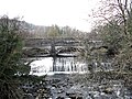
Stone aqueduct built over a weir, carrying the Swansea Canal over the River Twrch. Its three massive arches make it the largest of the five aqueducts on the canal. Built in 1798 by Thomas Sheasby, it was innovative in using Hydraulic cement to line the trough instead of puddled clay. Its proximity to the Capitol Cinema gave it the local name of 'Capitol Bridge'. It was restored in 1995 but is not currently water-filled, the canal route on either side being dry.Post-Medieval/Modern
(1798)
GM396
[131]
Claypon's Tramroad at Ystradgynlais Tramroad Ystradgynlais, (also Seven Sisters), (also Tawe-Uchaf), (see also Neath Port Talbot) 51°46′24″N3°43′18″W / 51.7734°N 3.7218°W / 51.7734; -3.7218 (Tramroad at Ystradgynlais) ,
SN812097
Early tramroad, bringing coal from Drim Colliery and limestone (needed as a flux) from the quarries of Mynydd y Drum to the Ynyscedwyn Ironworks in the Swansea Valley. Built by Joseph Claypon in 1832 and in use until 1867, the tramroad linked with the Brecon Forest Tramroad, [132] and parts were later incorporated into the Swansea Vale Railway.Post-Medieval/Modern
(1832)
GM399
[133]
Cribarth Limestone Quarries and Tramroads Quarry Ystradgynlais 51°48′49″N3°42′05″W / 51.8136°N 3.7013°W / 51.8136; -3.7013 (Cribarth Limestone Quarries and Tramroads) ,
SN828141
Post-Medieval/Modern
BR237
[134]
Lefel Fawr Coal Adit Coal Adit Ystradgynlais 51°47′53″N3°43′09″W / 51.798°N 3.7193°W / 51.798; -3.7193 (Lefel Fawr Coal Adit) ,
SN815124
Post-Medieval/Modern
BR201
[135]
Ynysgedwyn Colliery, Fan House Fan House Ystradgynlais 51°47′10″N3°44′20″W / 51.786°N 3.7388°W / 51.786; -3.7388 (Ynysgedwyn Colliery, Fan House) ,
SN801111
Colliery ventilation shaft Guibal fan house, built around 1880, for Hendre-ladis Colliery, later Ynysgedwyn colliery, which closed in 1967. [136] Post-Medieval/Modern
BR198
[137]
Coed Chwefri Vickers Machine Gun Emplacement Pillbox Cilmery 52°09′01″N3°25′06″W / 52.1503°N 3.4182°W / 52.1503; -3.4182 (Coed Chwefri Vickers Machine Gun Emplacement) ,
SO030511
Polygonal concrete pillbox with three Embrasures and gun platforms, with views across the Chwefri valley, close to Builth Wells.Post-Medieval/Modern
BR399
[138]
Anti Tank Cubes at Pont ar Daf - geograph.org.uk - 549731.jpg Storey Arms Anti-invasion Defences Infantry support trench Glyn Tarell 51°52′03″N3°28′16″W / 51.8676°N 3.4712°W / 51.8676; -3.4712 (Storey Arms Anti-invasion Defences) ,
SN988198
Dating to the early part of World War II, two pillboxes, trenches, and two lines of anti-tank blocks formed part of the Western Command Stop Line, in case of an invasion via Ireland.Post-Medieval/Modern
BR337
[139]
Powys UK location map.svg
Blue pog.svg
Blue pog.svg
Blue pog.svg
Blue pog.svg
Blue pog.svg
Blue pog.svg
Blue pog.svg
Blue pog.svg
Blue pog.svg
Blue pog.svg
Green pog.svg
Green pog.svg
Green pog.svg
Green pog.svg
Green pog.svg
Green pog.svg
Green pog.svg
Green pog.svg
Green pog.svg
Gold pog.svg
Gold pog.svg
Gold pog.svg
Gold pog.svg
Gold pog.svg
Gold pog.svg
Gold pog.svg
Gold pog.svg
Gold pog.svg
Gold pog.svg
Gold pog.svg
Gold pog.svg
Gold pog.svg
Gold pog.svg
Gold pog.svg
Gold pog.svg
Gold pog.svg
Gold pog.svg
Gold pog.svg
Gold pog.svg
Gold pog.svg
Gold pog.svg
Gold pog.svg
Gold pog.svg
Gold pog.svg
Gold pog.svg
Gold pog.svg
Gold pog.svg
Gold pog.svg
Gold pog.svg
Gold pog.svg
Gold pog.svg
Gold pog.svg
Gold pog.svg
Gold pog.svg
Gold pog.svg
Gold pog.svg
Gold pog.svg
Gold pog.svg
Gold pog.svg
Gold pog.svg
Gold pog.svg
Gold pog.svg
Gold pog.svg
Gold pog.svg
Gold pog.svg
Gold pog.svg
Gold pog.svg
Gold pog.svg
Gold pog.svg
Gold pog.svg
Gold pog.svg
Gold pog.svg
Gold pog.svg
Gold pog.svg
Gold pog.svg
Gold pog.svg
Gold pog.svg
Gold pog.svg
Gold pog.svg
Gold pog.svg
Gold pog.svg
Gold pog.svg
Gold pog.svg
Gold pog.svg
Gold pog.svg
Gold pog.svg
Gold pog.svg
Gold pog.svg
Gold pog.svg
Gold pog.svg
Gold pog.svg
Gold pog.svg
Gold pog.svg
Gold pog.svg
Gold pog.svg
Gold pog.svg
Gold pog.svg
Red pog.svg
Red pog.svg
Red pog.svg
Red pog.svg
Red pog.svg
Red pog.svg
Red pog.svg
Red pog.svg
Red pog.svg
Red pog.svg
Red pog.svg
Red pog.svg
Red pog.svg
Red pog.svg
Red pog.svg
Red pog.svg
Red pog.svg
Red pog.svg
Red pog.svg
Red pog.svg
Red pog.svg
Red pog.svg
Red pog.svg
Red pog.svg
Red pog.svg
Red pog.svg
Red pog.svg
Red pog.svg
Red pog.svg
Red pog.svg
Red pog.svg
Red pog.svg
Red pog.svg
Red pog.svg
Red pog.svg
Red pog.svg
Red pog.svg
Red pog.svg
Scheduled Monuments in Becknockshire, Powys, Wales.
Blue pog.svg =Roman Green pog.svg =Early Medieval Gold pog.svg =Medieval
Red pog.svg =Post-Medieval/Modern
Map all coordinates using: OpenStreetMap

See also

References

  1. Cadw: Ancient Monuments and Scheduling. Accessed 25 April 2013
  2. Cadw will send their list as a spreadsheet, or other electronic formats, on request, as indicated at www.whatdotheyknow.com. This list uses information dated May 2012
  3. coflein NPRN: not yet identified. CPAT PRN not yet identified. Cadw SAM: BR174: Roman Fort at Pen y Gaer
  4. coflein NPRN: not yet identified. CPAT PRN not yet identified. Cadw SAM: CM373: Abererbwll Roman Fort
  5. coflein NPRN: not yet identified. CPAT PRN not yet identified. Cadw SAM: BR003: Y Pigwyn
  6. coflein NPRN: not yet identified. CPAT PRN not yet identified. Cadw SAM: BR224: Roman Road on Mynydd Illtyd, south-western section
  7. coflein NPRN: not yet identified. CPAT PRN not yet identified. Cadw SAM: BR225: Roman Road on Mynydd Illtyd, North-Eastern section
  8. coflein NPRN: not yet identified. CPAT PRN not yet identified. Cadw SAM: BR148: Caerau Roman Site
  9. coflein NPRN: not yet identified. CPAT PRN not yet identified. Cadw SAM: BR380: Tynewydd Roman Road
  10. coflein NPRN: not yet identified. CPAT PRN not yet identified. Cadw SAM: BR001: The Gaer, Brecon
  11. coflein NPRN: not yet identified. CPAT PRN not yet identified. Cadw SAM: BR162: Roman Marching Camp NE of Maen Madog
  12. coflein NPRN: not yet identified. CPAT PRN not yet identified. Cadw SAM: BR074: Section of Road NE of Coelbren Fort
  13. coflein NPRN: not yet identified. CPAT PRN not yet identified. Cadw SAM: BR033: Crickadarn Camp
  14. coflein NPRN: not yet identified. CPAT PRN not yet identified. Cadw SAM: BR121: Cross-Slab in Churchyard
  15. coflein NPRN: not yet identified. CPAT PRN not yet identified. Cadw SAM: BR120: Cross-Slab in Church
  16. coflein NPRN: not yet identified. CPAT PRN not yet identified. Cadw SAM: BR109: Inscribed Stone in Church
  17. coflein NPRN: not yet identified. CPAT PRN not yet identified. Cadw SAM: BR122: Cross-Slab in Church
  18. coflein NPRN: not yet identified. CPAT PRN: 630. Cadw SAM: BR158: Crannog in Llangorse Lake
  19. coflein NPRN: not yet identified. CPAT PRN not yet identified. Cadw SAM: BR182: Early Christian Inscribed Stone in Defynnog Church
  20. coflein NPRN: not yet identified. CPAT PRN not yet identified. Cadw SAM: BR141: Ponsticill Inscribed Stone
  21. coflein NPRN: not yet identified. CPAT PRN not yet identified. Cadw SAM: BR018: Maen Madoc
  22. coflein NPRN: not yet identified. CPAT PRN not yet identified. Cadw SAM: BR022: Brecon Castle
  23. coflein NPRN: not yet identified. CPAT PRN not yet identified. Cadw SAM: BR046: Castle Mound 800m NNW of Ty'n-y-Caeau
  24. coflein NPRN: not yet identified. CPAT PRN not yet identified. Cadw SAM: BR236: St Eluned's Chapel and Well
  25. coflein NPRN: not yet identified. CPAT PRN not yet identified. Cadw SAM: BR177: Town Wall and Gatehouse at Captain's Walk
  26. coflein NPRN: not yet identified. CPAT PRN not yet identified. Cadw SAM: BR150: Town Wall at Watton Mount
  27. coflein NPRN: not yet identified. CPAT PRN not yet identified. Cadw SAM: BR008: Bronllys Castle
  28. coflein NPRN: not yet identified. CPAT PRN not yet identified. Cadw SAM: BR058: Bronllys moated site
  29. coflein NPRN: not yet identified. CPAT PRN not yet identified. Cadw SAM: BR031: Builth Castle
  30. coflein NPRN: not yet identified. CPAT PRN not yet identified. Cadw SAM: BR093: Caer Beris
  31. coflein NPRN: not yet identified. CPAT PRN not yet identified. Cadw SAM: BR111: Crickhowell Castle
  32. coflein NPRN: not yet identified. CPAT PRN not yet identified. Cadw SAM: BR055: Maes-Celyn Castle Mound
  33. coflein NPRN: not yet identified. CPAT PRN not yet identified. Cadw SAM: BR280: Cwmhindda Deserted Rural Settlement
  34. coflein NPRN: not yet identified. CPAT PRN not yet identified. Cadw SAM: BR179: Castle Earthwork 200m S of Coed Caeau
  35. coflein NPRN: not yet identified. CPAT PRN not yet identified. Cadw SAM: BR168: Gwenddwr Deserted Village
  36. coflein NPRN: not yet identified. CPAT PRN not yet identified. Cadw SAM: BR152: Llanfilo Moated Site
  37. coflein NPRN: not yet identified. CPAT PRN not yet identified. Cadw SAM: BR221: Medieval Building in Llanfilo Village
  38. coflein NPRN: not yet identified. CPAT PRN not yet identified. Cadw SAM: BR180: Moated Site 670m NE of Lower Penwaun
  39. coflein NPRN: not yet identified. CPAT PRN not yet identified. Cadw SAM: BR049: Moated Site 800m NE of Felinfach
  40. coflein NPRN: not yet identified. CPAT PRN not yet identified. Cadw SAM: BR050: Moated Site E of Pont-y-Bat Wood
  41. coflein NPRN: not yet identified. CPAT PRN not yet identified. Cadw SAM: BR195: Moated Site in Llanfilo Village
  42. coflein NPRN: not yet identified. CPAT PRN not yet identified. Cadw SAM: BR041: Oaklands Moated Site
  43. coflein NPRN: not yet identified. CPAT PRN not yet identified. Cadw SAM: BR127: Cilwhybert Castle Mound
  44. coflein NPRN: not yet identified. CPAT PRN not yet identified. Cadw SAM: BR266: Craig Cerrig-Gleisiad Deserted Rural Settlement
  45. coflein NPRN: not yet identified. CPAT PRN not yet identified. Cadw SAM: BR170: Earthwork 675m W of Dan-y-Cefn
  46. coflein NPRN: not yet identified. CPAT PRN not yet identified. Cadw SAM: BR351: Aberllynfi chapel
  47. coflein NPRN: not yet identified. CPAT PRN not yet identified. Cadw SAM: BR350: Glasbury Old Church
  48. coflein NPRN: not yet identified. CPAT PRN not yet identified. Cadw SAM: BR080: Great House Mound & Bailey Castle
  49. coflein NPRN: not yet identified. CPAT PRN not yet identified. Cadw SAM: BR077: Castle Mound near Swan Hotel
  50. coflein NPRN: not yet identified. CPAT PRN not yet identified. Cadw SAM: BR076: Hay Castle
  51. coflein NPRN: not yet identified. CPAT PRN not yet identified. Cadw SAM: BR155: Castell Madoc Ringwork
  52. coflein NPRN: not yet identified. CPAT PRN not yet identified. Cadw SAM: BR192: Castle Madoc Mound
  53. coflein NPRN: not yet identified. CPAT PRN not yet identified. Cadw SAM: BR191: Llandefaelog Fach Motte
  54. coflein NPRN: not yet identified. CPAT PRN not yet identified. Cadw SAM: BR089: Earthworks SW of Church
  55. coflein NPRN: not yet identified. CPAT PRN not yet identified. Cadw SAM: BR215: Hafotau Settlement on Bryn Melys
  56. coflein NPRN: not yet identified. CPAT PRN not yet identified. Cadw SAM: BR098: Ringwork near Coed Ty-Mawr
  57. coflein NPRN: not yet identified. CPAT PRN not yet identified. Cadw SAM: BR045: Alexanderstone Mound and Bailey Castle
  58. coflein NPRN: not yet identified. CPAT PRN not yet identified. Cadw SAM: BR196: Earthworks South West of Llanddew Church
  59. coflein NPRN: not yet identified. CPAT PRN not yet identified. Cadw SAM: BR057: Llanddew Castle
  60. coflein NPRN: not yet identified. CPAT PRN not yet identified. Cadw SAM: BR009: Castell Blaen-Llynfi
  61. coflein NPRN: not yet identified. CPAT PRN not yet identified. Cadw SAM: BR146: Tretower Barn
  62. coflein NPRN: not yet identified. CPAT PRN not yet identified. Cadw SAM: BR014: Tretower Castle
  63. coflein NPRN: not yet identified. CPAT PRN not yet identified. Cadw SAM: BR117: Tretower Court
  64. coflein NPRN: not yet identified. CPAT PRN not yet identified. Cadw SAM: BR238: Tretower Shrunken Medieval Settlement
  65. coflein NPRN: not yet identified. CPAT PRN not yet identified. Cadw SAM: BR056: Hen Castell
  66. coflein NPRN: not yet identified. CPAT PRN not yet identified. Cadw SAM: BR220: House Platforms and Hollow Ways in the Shrunken Medieval Village of Llanfihangel Tal-y-Llyn
  67. coflein NPRN: not yet identified. CPAT PRN not yet identified. Cadw SAM: BR054: Twmpan Castle Mound
  68. coflein NPRN: not yet identified. CPAT PRN not yet identified. Cadw SAM: BR187: Llangynidr Deserted Medieval Village (part of)
  69. coflein NPRN: not yet identified. CPAT PRN not yet identified. Cadw SAM: BR252: Pen Bwlych Glascwm Pillow Mounds
  70. coflein NPRN: not yet identified. CPAT PRN not yet identified. Cadw SAM: BR078: Llanthomas Castle Mound
  71. coflein NPRN: not yet identified. CPAT PRN not yet identified. Cadw SAM: BR200: The Scottish Pedlar Wayside Cross
  72. coflein NPRN: not yet identified. CPAT PRN not yet identified. Cadw SAM: BR183: Corn Drying Kiln 340m S of Cryn-Fryn
  73. coflein NPRN: not yet identified. CPAT PRN not yet identified. Cadw SAM: BR216: Hafotau Settlement on Esgair Gwar-y-Cae
  74. coflein NPRN: not yet identified. CPAT PRN not yet identified. Cadw SAM: BR263: Allt Fach Deserted Rural Settlement
  75. coflein NPRN: not yet identified. CPAT PRN not yet identified. Cadw SAM: BR223: Deserted Farmstead South of Ffynnon yr Oerfa
  76. coflein NPRN: not yet identified. CPAT PRN not yet identified. Cadw SAM: BR260: Rectangular Hut, Afon Tawe
  77. coflein NPRN: not yet identified. CPAT PRN not yet identified. Cadw SAM: BR026: Trecastle Mound and Bailey Castle
  78. coflein NPRN: not yet identified. CPAT PRN not yet identified. Cadw SAM: BR126: Castell-Du, Sennybridge
  79. coflein NPRN: not yet identified. CPAT PRN not yet identified. Cadw SAM: BR032: Clawdd British
  80. coflein NPRN: not yet identified. CPAT PRN not yet identified. Cadw SAM: BR143: Hirllwyn Camp
  81. coflein NPRN: not yet identified. CPAT PRN not yet identified. Cadw SAM: BR088: Cefn Barn Ringwork
  82. coflein NPRN: not yet identified. CPAT PRN not yet identified. Cadw SAM: BR047: Porthamal Tower
  83. coflein NPRN: not yet identified. CPAT PRN not yet identified. Cadw SAM: BR082: Tredustan Castle Mound
  84. coflein NPRN: not yet identified. CPAT PRN not yet identified. Cadw SAM: BR083: Trefecca Castle Mound
  85. coflein NPRN: not yet identified. CPAT PRN not yet identified. Cadw SAM: BR087: Trefecca-Fawr Moated Site
  86. coflein NPRN: not yet identified. CPAT PRN not yet identified. Cadw SAM: BR282: Cwm Cwareli Longhouse and Long Hut
  87. coflein NPRN: not yet identified. CPAT PRN not yet identified. Cadw SAM: BR283: Tor y Foel Deserted Rural Settlement
  88. coflein NPRN: not yet identified. CPAT PRN not yet identified. Cadw SAM: BR172: Churchyard Cross, St Issau's Church
  89. coflein NPRN: not yet identified. CPAT PRN not yet identified. Cadw SAM: BR298: Cwm Beusych Deserted Rural Settlement
  90. coflein NPRN: not yet identified. CPAT PRN not yet identified. Cadw SAM: BR300: Llwyn y Brain Deserted Rural Settlement
  91. coflein NPRN: not yet identified. CPAT PRN not yet identified. Cadw SAM: BR416: Two platform buildings on eastern side of Partrishow Hill
  92. coflein NPRN: not yet identified. CPAT PRN not yet identified. Cadw SAM: BR299: Y Cwrt Deserted Rural Settlement
  93. coflein NPRN: not yet identified. CPAT PRN not yet identified. Cadw SAM: BR037: Cwm Camlais Castle
  94. coflein NPRN: not yet identified. CPAT PRN not yet identified. Cadw SAM: BR290: Tir-cyd Deserted Rural Settlement
  95. coflein NPRN: not yet identified. CPAT PRN not yet identified. Cadw SAM: BR130: Caerau Castle Mound
  96. coflein NPRN: not yet identified. CPAT PRN not yet identified. Cadw SAM: BR131: Fforest Castle Mound
  97. coflein NPRN: not yet identified. CPAT PRN not yet identified. Cadw SAM: BR021: Aberyscir Castle Mound
  98. coflein NPRN: not yet identified. CPAT PRN not yet identified. Cadw SAM: BR081: Castell Coch
  99. coflein NPRN: not yet identified. CPAT PRN not yet identified. Cadw SAM: BR258: Enclosures East of Afon Llia
  100. coflein NPRN: not yet identified. CPAT PRN not yet identified. Cadw SAM: BR004: Brecon Bridge
  101. coflein NPRN: not yet identified. CPAT PRN not yet identified. Cadw SAM: BR199: Pont Gihirych
  102. coflein NPRN: not yet identified. CPAT PRN not yet identified. Cadw SAM: BR114: Porth Mawr
  103. coflein NPRN: not yet identified. CPAT PRN not yet identified. Cadw SAM: BR289: Cefn Corast Deserted Rural Settlement
  104. coflein NPRN: not yet identified. CPAT PRN not yet identified. Cadw SAM: BR281: Hendy Long Hut
  105. coflein NPRN: not yet identified. CPAT PRN not yet identified. Cadw SAM: BR390: Y Gyrn Hut Platform (N)
  106. coflein NPRN: not yet identified. CPAT PRN not yet identified. Cadw SAM: BR393: Y Gyrn Hut Platform (S)
  107. coflein NPRN: not yet identified. CPAT PRN not yet identified. Cadw SAM: BR392: Y Gyrn Hut Platforms
  108. coflein NPRN: not yet identified. CPAT PRN: 81366. Cadw SAM: BR391: Y Gyrn Longhuts
  109. coflein NPRN: not yet identified. CPAT PRN not yet identified. Cadw SAM: BR193: Garden Earthworks at Old Gwernyfed
  110. coflein NPRN: not yet identified. CPAT PRN not yet identified. Cadw SAM: BR185: Brynich Aqueduct (Brecknock & Abergavenny Canal)
  111. coflein NPRN: not yet identified. CPAT PRN not yet identified. Cadw SAM: BR240: Llwyn-on Farmstead
  112. coflein NPRN: not yet identified. CPAT PRN not yet identified. Cadw SAM: BR005: Crickhowell Bridge
  113. coflein NPRN: not yet identified. CPAT PRN not yet identified. Cadw SAM: MM340: Disgwylfa Tramroads
  114. coflein NPRN: not yet identified. CPAT PRN not yet identified. Cadw SAM: BR234: Llangattock Tramroad Inclines
  115. coflein NPRN: not yet identified. CPAT PRN not yet identified. Cadw SAM: BR279: Nant Morlais Hafod
  116. coflein NPRN: not yet identified. CPAT PRN not yet identified. Cadw SAM: BR287: Cerrig Llwydion Deserted Rural Settlement
  117. coflein NPRN: not yet identified. CPAT PRN not yet identified. Cadw SAM: BR231: Dalrhiw Lead Mine
  118. coflein NPRN: not yet identified. CPAT PRN not yet identified. Cadw SAM: RD199: Hafod Rhiwnant Deserted Rural Settlement
  119. coflein NPRN: not yet identified. CPAT PRN not yet identified. Cadw SAM: BR232: Nant-y-Car South Lead Mine
  120. coflein NPRN: not yet identified. CPAT PRN not yet identified. Cadw SAM: BR233: Nant-y-Garw Lead Mine
  121. coflein NPRN: not yet identified. CPAT PRN not yet identified. Cadw SAM: BR387: Nant-y-Gro Dam
  122. coflein NPRN: not yet identified. CPAT PRN not yet identified. Cadw SAM: BR284: Nant y Gaseg long hut
  123. coflein NPRN: not yet identified. CPAT PRN not yet identified. Cadw SAM: BR288: Pant-y-Blodau Deserted Rural Settlement
  124. coflein NPRN: not yet identified. CPAT PRN not yet identified. Cadw SAM: BR173: Pillow Mounds at Pant Mawr
  125. coflein NPRN: not yet identified. CPAT PRN not yet identified. Cadw SAM: BR412: Afon Hepste Settlement Enclosure
  126. coflein NPRN: not yet identified. CPAT PRN not yet identified. Cadw SAM: BR230: Glynneath Gunpowder Works
  127. coflein NPRN: not yet identified. CPAT PRN not yet identified. Cadw SAM: BR410: Mynydd y Garn Enclosure
  128. coflein NPRN: not yet identified. CPAT PRN not yet identified. Cadw SAM: BR409: Mynydd y Garn Lluest East
  129. coflein NPRN: not yet identified. CPAT PRN not yet identified. Cadw SAM: BR408: Mynydd y Garn Lluest West
  130. coflein NPRN: not yet identified. CPAT PRN not yet identified. Cadw SAM: BR222: Abercrave Ironworks
  131. coflein NPRN: 109. CPAT PRN: 01046.40w. Cadw SAM: GM396: Canal Aqueduct over the River Twrch, Ystalyfera
  132. Fforest Fawr Geopark: The Brecon Forest Tramroad accessed 3 March 2013
  133. coflein NPRN: 80115. CPAT PRN: 00716w. Cadw SAM: GM399: Tramroad at Ystradgynlais
  134. coflein NPRN: not yet identified. CPAT PRN not yet identified. Cadw SAM: BR237: Cribarth Limestone Quarries and Tramroads
  135. coflein NPRN: not yet identified. CPAT PRN not yet identified. Cadw SAM: BR201: Lefel Fawr Coal Adit
  136. BBC Wales archive - penrhos-playing-fields Accessed 17 March 2014
  137. coflein NPRN: 33733. CPAT PRN: 19333. Cadw SAM: BR198: Ynysgedwyn Colliery, Fan House
  138. coflein NPRN: 270331. CPAT PRN: 110461. Cadw SAM: BR399: Coed Chwefri Vickers Machine Gun Emplacement
  139. coflein NPRN: 405619. CPAT PRN: 110474. Cadw SAM: BR337: Storey Arms Anti-invasion Defences