List of streams of Aruba

Last updated

Map all coordinates using: OpenStreetMap  
Download coordinates as: KML
Map of Aruba Aruba - Encyclopaedie van Nederlandsch West-Indie-Antilles part 1, right.gif
Map of Aruba

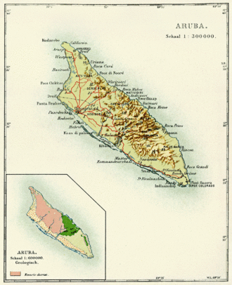
This is a list of streams of Aruba. Streams (rooi from the Dutch word) are listed in alphabetical order. Water from these streams flows into the Caribbean Sea watershed. There are no rivers, per se, in Aruba. The link to the right shows a map of Aruba with the location of the mouths of the streams annotated. [1]

Contents

Streams

The names and coordinates of the mouths of the streams in Aruba are listed below: [1]

See also

Related Research Articles

<span class="mw-page-title-main">Arctic Archipelago</span> Group of islands in the Arctic Ocean, off the coast of northern Canada

The Arctic Archipelago, also known as the Canadian Arctic Archipelago, is an archipelago lying to the north of the Canadian continental mainland, excluding Greenland.

<span class="mw-page-title-main">Bonnieville, Kentucky</span> City in Kentucky, United States

Bonnieville is a home rule-class city in Hart County, Kentucky, in the United States. The population was 255 at the 2010 census.

<span class="mw-page-title-main">ABC islands (Leeward Antilles)</span> Aruba, Bonaire and Curaçao

The ABC islands is the physical group of Aruba, Bonaire, and Curaçao, the three westernmost islands of the Leeward Antilles in the Caribbean Sea. These have a shared political history and a status of Dutch underlying ownership, since the Anglo-Dutch Treaty of 1814 ceded them back to the Netherlands, as Curaçao and Dependencies from 1815. They are a short distance north of the Falcón State, Venezuela. Aruba and Curaçao are autonomous, self governing constituent countries of the Kingdom of the Netherlands, while Bonaire is a special municipality of the Netherlands. Territories of the Kingdom of the Netherlands, the countries, and its special municipalities, are outside the European Union; citizens have Dutch nationality and the former colonial power benefits from preferential trade, mineral and natural resource rights, particularly offshore.

<span class="mw-page-title-main">Extreme points of North America</span> Most prominent locations of the continents physical boundaries

This is a list of the extreme points of North America: the points that are highest and lowest, and farther north, south, east or west than any other location on the continent. Some of these points are debatable, given the varying definitions of North America.

<span class="mw-page-title-main">Inhaca Island</span> Island in Mozambique

Inhaca Island is a subtropical island of Mozambique off the East African coast. The main village is Inhaca, situated just over a kilometer from Inhaca Airport. Various tourist lodges are situated along the northwestern coastline. The island is flanked by protected areas along the western and eastern coastlines, while the majority of the population lives in the interior.

The Northern Forest Canoe Trail (NFCT) is a 740-mile (1,190 km) marked canoeing trail in the northeastern United States and Canada, extending from Old Forge in the Adirondacks of New York to Fort Kent, Maine. Along the way, the trail also passes through the states and provinces of Vermont, Quebec, and New Hampshire. The trail was opened on June 3, 2006.

The West Branch Oyster River is a 3.3-mile-long (5.3 km) tributary of the Oyster River in Warren, Maine. From its source, the stream runs about 2 miles south and 1 mile east to its confluence with the main stem of the Oyster River.

Torsukattak may refer to the following landforms in Greenland, from north to south:

<span class="mw-page-title-main">Ben Badis, Sidi Bel Abbès</span> Commune and town in Sidi Bel Abbès Province, Algeria

Ben Badis is a town and commune in Sidi Bel Abbès Province in northwestern Algeria.

<span class="mw-page-title-main">Saltes Island</span>

Saltes Island is a fluvial islet in the Huelva River estuary, in the province of Huelva, Andalusia, Spain. It is part of the Odiel Marshes biosphere reserve.

Gunter Creek is a stream in Barry County of southwest Missouri. The headwaters of Gunter Creek are located south of Butterfield and the stream flows northeast to its confluence with Flat Creek south of McDowell.

<span class="mw-page-title-main">Beaches of Aruba</span>

There are more than a dozen beaches of Aruba. Aruba is part of the Kingdom of the Netherlands and an island country in the mid-south of the Caribbean Sea.

References

  1. 1 2 "GeoNames". National Geospatial Intelligence Agency. Retrieved August 2, 2021.