Little America, Wyoming

Last updated
Little America, Wyoming
CDP
Little America Penguin Billboard.JPG
Billboard near Little America, Wyoming, 2002
WYMap-doton-LittleAmerica.PNG
Location of Little America, Wyoming
Coordinates: 41°32′43″N109°52′20″W / 41.54528°N 109.87222°W / 41.54528; -109.87222 Coordinates: 41°32′43″N109°52′20″W / 41.54528°N 109.87222°W / 41.54528; -109.87222
Country United States
State Wyoming
County Sweetwater
Area
  Total7.8 sq mi (20.1 km2)
  Land7.8 sq mi (20.1 km2)
  Water0.0 sq mi (0.0 km2)
Elevation
[1]
6,424 ft (1,958 m)
Population
 (2010)
  Total68
  Density8.7/sq mi (3.4/km2)
Time zone UTC-7 (Mountain (MST))
  Summer (DST) UTC-6 (MDT)
ZIP code
82929
Area code 307
FIPS code 56-46935 [2]
GNIS feature ID1590725 [1]

Little America is a census-designated place (CDP) in Sweetwater County, Wyoming, United States. The population was 68 at the 2010 census. The community got its name from the Little America motel, which was purposefully located in a remote location as a haven, not unlike the Little America base camp the polar explorer Richard E. Byrd set up in the Antarctic in 1928. [3] However, being situated on a coast-to-coast highway and offering travel services, it thrived, launching a chain of travel facilities by the same name. Its developer, Robert Earl Holding, died on April 19, 2013, with a personal net worth of over $3 billion. [4]

Contents

Geography

Little America is located on U.S. Route 30 at 41°32′43″N109°52′20″W / 41.545398°N 109.872112°W / 41.545398; -109.872112 (41.545398, -109.872112). [5]

According to the United States Census Bureau, the CDP has a total area of 7.8 square miles (20.1 km2), of which 7.8 square miles (20.1 km2) is land and 0.13% is water.

Demographics

As of the census [2] of 2000, there were 56 people, 24 households, and 13 families residing in the CDP. The population density was 7.2 people per square mile (2.8/km2). There were 48 housing units at an average density of 6.2/sq mi (2.4/km2). The racial makeup of the CDP was 71.43% White, 28.57% from other races. Hispanic or Latino of any race were 44.64% of the population.

There were 24 households, out of which 45.8% had children under the age of 18 living with them, 33.3% were married couples living together, 20.8% had a female householder with no husband present, and 45.8% were non-families. 41.7% of all households were made up of individuals, and none had someone living alone who was 65 years of age or older. The average household size was 2.33 and the average family size was 3.23.

In the CDP, the population was spread out, with 32.1% under the age of 18, 28.6% from 18 to 24, 28.6% from 25 to 44, 10.7% from 45 to 64, . The median age was 21 years. For every 100 females, there were 100.0 males. For every 100 females age 18 and over, there were 123.5 males.

The median income for a household in the CDP was $18,125, and the median income for a family was $18,750. Males had a median income of $12,250 versus $8,750 for females. The per capita income for the CDP was $7,408. In spite of Little America's 100% employment rate, 29.7% of the population is below the poverty line, and 100% of the households responding to the census were tenants of absentee landlords. [6]

Education

Public education in the community of Little America is provided by Sweetwater County School District #2.

Related Research Articles

<span class="mw-page-title-main">Sweetwater County, Wyoming</span> County in Wyoming, United States

Sweetwater County is a county in southwestern Wyoming, United States. As of the 2020 United States Census, the population was 42,272, making it the fourth-most populous county in Wyoming. Its county seat is Green River. By area, it is the largest county in Wyoming. Its southern boundary line abuts the north lines of the states of Colorado and Utah.

<span class="mw-page-title-main">Sawmill, Arizona</span> CDP in Apache County, Arizona

Sawmill is a census-designated place (CDP) in Apache County, Arizona, United States. Sawmill is a part of Fort Defiance Agency, which is on the Navajo Nation. The population was 748 at the 2010 census. It is named after and developed around a sawmill. A trading post has been present since 1907.

<span class="mw-page-title-main">Belfry, Montana</span> Census-designated place in Montana, United States

Belfry is a census-designated place (CDP) in Carbon County, Montana, United States. It is part of the Billings, Montana Metropolitan Statistical Area. The population was 218 at the 2010 census. It is located approximately 11 miles (18 km) from the Wyoming border, roughly halfway between Billings, Montana and Cody, Wyoming.

<span class="mw-page-title-main">Fox Farm-College, Wyoming</span> Census-designated place in Wyoming, United States

Fox Farm-College is a census-designated place (CDP) in Laramie County, Wyoming, United States. It is part of the Cheyenne, Wyoming Metropolitan Statistical Area. The population was 3,876 people at the 2020 census.

<span class="mw-page-title-main">Ranchettes, Wyoming</span> Census-designated place in Wyoming, United States

Ranchettes is a census-designated place (CDP) in Laramie County, Wyoming, United States. It is part of the Cheyenne, Wyoming Metropolitan Statistical Area. The population was 5,798 at the 2010 census.

Antelope Hills is a census-designated place in Natrona County, Wyoming, United States. It is part of the Casper, Wyoming Metropolitan Statistical Area. The population was 97 at the 2010 census.

Arrowhead Springs is a census-designated place (CDP) in Sweetwater County, Wyoming, United States. The population was 63 at the 2010 census.

<span class="mw-page-title-main">Bairoil, Wyoming</span> Town in Wyoming, United States

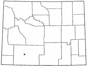
Bairoil is a town in Sweetwater County, Wyoming, United States. The population was 106 at the 2010 census.

Clearview Acres is a census-designated place (CDP) in Sweetwater County, Wyoming, United States. The population was 795 at the 2010 census.

<span class="mw-page-title-main">Eden, Wyoming</span> CDP in Wyoming, United States

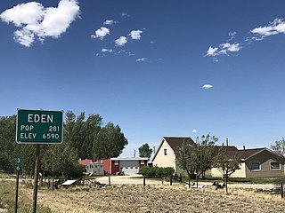
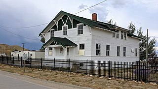
Eden is a census-designated place (CDP) in Sweetwater County, Wyoming, United States. The population was 281 at the 2010 census.

<span class="mw-page-title-main">Farson, Wyoming</span> CDP in Wyoming, United States

Farson is a census-designated place (CDP) in Sweetwater County, Wyoming, United States. The population was 313 at the 2010 census.

<span class="mw-page-title-main">Granger, Wyoming</span> Town in Sweetwater County, Wyoming, United States

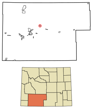
Granger is a town along Blacks Fork near the western edge of Sweetwater County, Wyoming, United States. The population was 139 at the 2010 census. It is located near the confluence of the Blacks Fork and the Hams Fork rivers. The geography of the area is flat with semi-arid scrub.

<span class="mw-page-title-main">James Town, Wyoming</span> CDP in Wyoming, United States

James Town is a census-designated place (CDP) in Sweetwater County, Wyoming, United States. The population was 536 at the 2010 census.

<span class="mw-page-title-main">McKinnon, Wyoming</span> Census-designated place in Sweetwater County, Wyoming, United States

McKinnon is a census-designated place (CDP) in Sweetwater County, Wyoming, United States. The population was 60 at the 2010 census.

North Rock Springs is a census-designated place (CDP) in Sweetwater County, Wyoming, United States. The population was 2,207 at the 2010 census.

Purple Sage is a census-designated place (CDP) in Sweetwater County, Wyoming, United States. The population was 535 at the 2010 census.

<span class="mw-page-title-main">Reliance, Wyoming</span> CDP in Wyoming, United States

Reliance is a census-designated place (CDP) in Sweetwater County, Wyoming, United States. The population was 714 at the 2010 census.

Sweeney Ranch is an unincorporated community in Sweetwater County, Wyoming, United States. The population was 17 at the 2000 census, when it was a census-designated place (CDP).

<span class="mw-page-title-main">Table Rock, Wyoming</span> Ghost town in Wyoming, United States

Table Rock is a ghost town in Sweetwater County, Wyoming, United States. It was also part of a census-designated place at the 2000 census, with a population of 82, but by the 2010 census the population had dropped to 0.

Washam is a census-designated place (CDP) in Sweetwater County, Wyoming, United States. The population was 51 at the 2010 census.

References

  1. 1 2 U.S. Geological Survey Geographic Names Information System: Little America, Wyoming
  2. 1 2 "U.S. Census website". United States Census Bureau . Retrieved 2008-01-31.
  3. "Antarctic Explorers: Richard e. Byrd".
  4. "Robert Earl Holding, Wide-Ranging Entrepreneur, Dies at 86". The New York Times. April 22, 2013. Retrieved April 23, 2013.
  5. "US Gazetteer files: 2010, 2000, and 1990". United States Census Bureau. 2011-02-12. Retrieved 2011-04-23.
  6. "Poverty, All people in Zip Code Tabulation Area (ZCTA5) 82929". United States Census Bureau. Retrieved 8 October 2022.

Commons-logo.svg Media related to Little America, Wyoming at Wikimedia Commons