Lomas, Naranjito, Puerto Rico

Last updated
Lomas
Barrio
Barrio Lomas, Naranjito, Puerto Rico.jpg
View from Lomas
Lomas, Naranjito, Puerto Rico locator map.png
Location of Lomas within the municipality of Naranjito shown in red
Caribbean location map.svg
Red pog.svg
Lomas
Location of Puerto Rico
Coordinates: 18°18′57″N66°16′08″W / 18.315891°N 66.268848°W / 18.315891; -66.268848 [1]
Commonwealth Flag of Puerto Rico.svg  Puerto Rico
Municipality Flag of Naranjito, Puerto Rico.svg Naranjito
Area
[1]
  Total2.92 sq mi (7.6 km2)
  Land2.92 sq mi (7.6 km2)
  Water0 sq mi (0 km2)
Elevation
[2]
728 ft (222 m)
Population
 (2010)
  Total3,865
  Density1,323.6/sq mi (511.0/km2)
 Source: 2010 Census
Time zone UTC−4 (AST)
Zip code
00719

Lomas is a barrio in the municipality of Naranjito, Puerto Rico. Its population in 2010 was 3,865. [3] [4] [5]

Contents

History

Lomas was in Spain's gazetteers [6] until Puerto Rico was ceded by Spain in the aftermath of the Spanish–American War under the terms of the Treaty of Paris of 1898 and became an unincorporated territory of the United States. In 1899, the United States Department of War conducted a census of Puerto Rico finding that the population of Lomas barrio was 994. [7]

Historical population
CensusPop.Note
1900 994
1910 1,0556.1%
1920 1,32225.3%
1930 1,170−11.5%
1940 1,81655.2%
1950 2,15318.6%
1960 2,50416.3%
1970 2,5281.0%
1980 3,00418.8%
1990 3,96131.9%
2000 4,1264.2%
2010 3,865−6.3%
U.S. Decennial Census
1899 (shown as 1900) [8] 1910-1930 [9]
1930-1950 [10] 1980-2000 [11] 2010 [12]

Sectors

Barrios (which are, in contemporary times, roughly comparable to minor civil divisions) [13] in turn are further subdivided into smaller local populated place areas/units called sectores (sectors in English). The types of sectores may vary, from normally sector to urbanización to reparto to barriada to residencial, among others. [14] [15] [16]

The following sectors are in Lomas barrio: [17] [18]

Lomas Jaguas, Parcelas Las Riveras (Lomas García), Sector Arturo Morales, Sector Cleto, Sector Cuchillas, Sector Cuchillas Pacheco, Sector El Cielito, Sector Flor Rivera, Sector García, Sector Guayabo, Sector La Jagua, Sector La Rueda, Sector Loma Linda, Sector Lomas Centro, Sector Lomas Vallés, Sector Matos, Sector Quiles, Sector Rafael Padilla, Sector Sico Martínez (Los Pampers), Sector Susín Vázquez, Sector Tacho Vázquez, and Sector Tavo Vázquez (Chárriez).

See also

Related Research Articles

<span class="mw-page-title-main">Naranjito barrio-pueblo</span> Historical and administrative center (seat) of Naranjito, Puerto Rico

Naranjito barrio-pueblo is a barrio and the administrative center (seat) of Naranjito, a municipality of Puerto Rico. Its population in 2010 was 1,157.

<span class="mw-page-title-main">Achiote, Naranjito, Puerto Rico</span> Barrio of Puerto Rico

Achiote is a barrio in the municipality of Naranjito, Puerto Rico. Its population in 2010 was 3,919.

<span class="mw-page-title-main">Anones</span> Barrio of Naranjito, Puerto Rico

Anones is a barrio in the municipality of Naranjito, Puerto Rico. Its population in 2010 was 4,976. Anones is located to the South of the urban center of the municipality. There are schools and shops here and it is the most mountainous area of the municipality.

<span class="mw-page-title-main">Cedro Arriba</span> Barrio of Naranjito, Puerto Rico

Cedro Arriba is a barrio in the municipality of Naranjito, Puerto Rico. Its population in 2010 was 3,876.

<span class="mw-page-title-main">Cedro Abajo</span> Barrio of Naranjito, Puerto Rico

Cedro Abajo is a barrio in the municipality of Naranjito, Puerto Rico. Its population in 2010 was 4,627.

<span class="mw-page-title-main">Nuevo, Naranjito, Puerto Rico</span> Barrio of Puerto Rico

Nuevo is a barrio in the municipality of Naranjito, Puerto Rico. Its population in 2010 was 4,004.

<span class="mw-page-title-main">Guadiana, Naranjito, Puerto Rico</span> Barrio of Puerto Rico

Guadiana is a barrio in the municipality of Naranjito, Puerto Rico. Its population in 2010 was 3,978.

<span class="mw-page-title-main">Jaguas, Ciales, Puerto Rico</span> Barrio of Puerto Rico

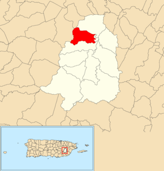
Jaguas is a barrio in the municipality of Ciales, Puerto Rico. Its population in 2010 was 4,545.

<span class="mw-page-title-main">Cuchillas, Corozal, Puerto Rico</span> Barrio of Puerto Rico

Cuchillas is a rural barrio in the municipality of Corozal, Puerto Rico. Its population in 2010 was 1,551.

<span class="mw-page-title-main">Guanajibo, Hormigueros, Puerto Rico</span> Barrio of Puerto Rico

Guanajibo is a barrio in the municipality of Hormigueros, Puerto Rico. Its population in 2010 was 5,959.

<span class="mw-page-title-main">Jagual, San Lorenzo, Puerto Rico</span> Barrio of Puerto Rico

Jagual is a barrio in the municipality of San Lorenzo, Puerto Rico. Its population in 2010 was 4,042.

<span class="mw-page-title-main">Jaguas, Gurabo, Puerto Rico</span> Barrio of Puerto Rico

Jaguas is a barrio in the municipality of Gurabo, Puerto Rico. Its population in 2010 was 2,083.

<span class="mw-page-title-main">Mamey, Patillas, Puerto Rico</span> Barrio of Puerto Rico

Mamey is a barrio in the municipality of Patillas, Puerto Rico. Its population in 2010 was 1,380.

<span class="mw-page-title-main">Quebrada Cruz</span> Barrio of Toa Alta, Puerto Rico

Quebrada Cruz is a barrio in the municipality of Toa Alta, Puerto Rico. Its population in 2010 was 5,343 living in over 30 sectors.

<span class="mw-page-title-main">Hato, San Lorenzo, Puerto Rico</span> Barrio of Puerto Rico

Hato is a barrio in the municipality of San Lorenzo, Puerto Rico. Its population in 2010 was 6,945.

<span class="mw-page-title-main">Lomas, Canóvanas, Puerto Rico</span> Barrio of Puerto Rico

Lomas is a barrio in the municipality of Canóvanas, Puerto Rico. Its population in 2010 was 5,336.

<span class="mw-page-title-main">Cuchillas, Morovis, Puerto Rico</span> Barrio of Puerto Rico

Cuchillas is a rural barrio in the municipality of Morovis, Puerto Rico. Cuchillas has fourteen sectors and its population in 2010 was 2,333.

<span class="mw-page-title-main">Río Lajas, Toa Alta, Puerto Rico</span> Barrio of Puerto Rico

Río Lajas is a barrio in the municipality of Toa Alta, Puerto Rico. Its population in 2010 was 2,566.

<span class="mw-page-title-main">Hato Nuevo, Gurabo, Puerto Rico</span> Barrio of Puerto Rico

Hato Nuevo is a barrio in the municipality of Gurabo, Puerto Rico. Its population in 2010 was 9,345.

<span class="mw-page-title-main">Rabanal, Cidra, Puerto Rico</span> Barrio of Puerto Rico

Rabanal is a barrio in the municipality of Cidra, Puerto Rico. Its population in 2010 was 4,228.

References

  1. 1 2 "US Gazetteer 2019". US Census. US Government.
  2. U.S. Geological Survey Geographic Names Information System: Lomas barrio
  3. Picó, Rafael; Buitrago de Santiago, Zayda; Berrios, Hector H. Nueva geografía de Puerto Rico: física, económica, y social, por Rafael Picó. Con la colaboración de Zayda Buitrago de Santiago y Héctor H. Berrios. San Juan Editorial Universitaria, Universidad de Puerto Rico,1969.
  4. Gwillim Law (20 May 2015). Administrative Subdivisions of Countries: A Comprehensive World Reference, 1900 through 1998. McFarland. p. 300. ISBN   978-1-4766-0447-3 . Retrieved 25 December 2018.
  5. Puerto Rico: 2010 Population and Housing Unit Counts.pdf (PDF). U.S. Dept. of Commerce, Economics and Statistics Administration, U.S. Census Bureau. 2010.
  6. "Anuario del comercio, de la industria, de la magistratura y de la administración. 1881". Biblioteca Nacional de España (in Spanish). p. 1614. Retrieved 4 April 2023.
  7. Joseph Prentiss Sanger; Henry Gannett; Walter Francis Willcox (1900). Informe sobre el censo de Puerto Rico, 1899, United States. War Dept. Porto Rico Census Office (in Spanish). Imprenta del gobierno. p.  162.
  8. "Report of the Census of Porto Rico 1899". War Department Office Director Census of Porto Rico. Archived from the original on July 16, 2017. Retrieved September 21, 2017.
  9. "Table 3-Population of Municipalities: 1930 1920 and 1910" (PDF). United States Census Bureau. Archived (PDF) from the original on August 17, 2017. Retrieved September 21, 2017.
  10. "Table 4-Area and Population of Municipalities Urban and Rural: 1930 to 1950" (PDF). United States Census Bureau. Archived (PDF) from the original on August 30, 2015. Retrieved September 21, 2014.
  11. "Table 2 Population and Housing Units: 1960 to 2000" (PDF). United States Census Bureau. Archived (PDF) from the original on July 24, 2017. Retrieved September 21, 2017.
  12. Puerto Rico: 2010 Population and Housing Unit Counts.pdf (PDF). U.S. Dept. of Commerce Economics and Statistics Administration U.S. Census Bureau. 2010. Archived (PDF) from the original on 2017-02-20. Retrieved 2019-08-02.
  13. "US Census Barrio-Pueblo definition". factfinder.com. US Census. Archived from the original on 13 May 2017. Retrieved 5 January 2019.
  14. "Agencia: Oficina del Coordinador General para el Financiamiento Socioeconómico y la Autogestión (Proposed 2016 Budget)". Puerto Rico Budgets (in Spanish). Retrieved 28 June 2019.
  15. Rivera Quintero, Marcia (2014), El vuelo de la esperanza: Proyecto de las Comunidades Especiales Puerto Rico, 1997-2004 (first ed.), San Juan, Puerto Rico Fundación Sila M. Calderón, ISBN   978-0-9820806-1-0
  16. "Leyes del 2001". Lex Juris Puerto Rico (in Spanish). Retrieved 24 June 2020.
  17. "Plan Territorial (2012)" (PDF). JP PR Gov (in Spanish). Gobierno Municipal de Naranjito -Oficina de Planificación y Ordenación Territorial. p. 43. Retrieved 26 June 2019.
  18. "PRECINTO ELECTORAL NARANJITO 073" (PDF). Comisión Estatal de Elecciones (in Spanish). PR Government. 26 September 2019. Archived (PDF) from the original on 22 July 2020. Retrieved 21 July 2020.