Lord Howe Seamount Chain

Last updated
Lord Howe Seamount Chain
Zealandia, topographic map.jpg
Topographic map of Zealandia with the Lord Howe Rise to the north west of New Zealand labelled.
Lord Howe Seamount Chain
Transparent.svg
Transparent.svg
500km
311miles
L
o
r
d
H
o
w
e
S
e
a
m
o
u
n
t
s
Yellow pog.svg
Zeehaen
Yellow pog.svg
Horsehead Seamount
Yellow pog.svg
Chesterfield Plateau
Yellow pog.svg
Nova Bank
Yellow pog.svg
Argo Bank
Yellow pog.svg
Kelso Bank
Yellow pog.svg
Transparent square.svg
Yellow pog.svg
Transparent square.svg
Red pog.svg
Transparent square.svg
Red pog.svg
Transparent square.svg
Red pog.svg
Transparent square.svg
Red pog.svg
Transparent square.svg
Yellow pog.svg
Flinders Seamount
Yellow pog.svg
Heemskerck
Pacific Ocean laea location map.svg
Lord Howe Seamount Chain
(yellow are seamounts, red islands)
Location
Location Coral and Tasman seas
Coordinates 26°22′36.7″S159°15′37.9″E / 26.376861°S 159.260528°E / -26.376861; 159.260528
Geology
Type Seamount chain
Age of rock 28–6.4  Ma [1]

The Lord Howe Seamount Chain formed during the Miocene. It features many coral-capped guyots and is one of the two parallel seamount chains alongside the east coast of Australia; the Lord Howe and Tasmantid seamount chains both run north-south through parts of the Coral Sea and Tasman Sea. [2] [1] These chains have longitudes of approximately 159°E and 156°E respectively. [2]

Contents

Geography

The Lord Howe Seamount Chain has been known under a variety of different gazetted names, including the Lord Howe Seamounts, Lord Howe Guyots, Lord Howe Rise Guyots and the Middleton Chain. [3]

The Lord Howe Seamount Chain is on the western slope of Lord Howe Rise, a deep-sea elevated plateau which is a submerged part of Zealandia. [2] [4] The Tasmantid and Lord Howe seamount chains are both broadly within the Tasman basin which is the abyssal plain between Lord Howe Rise and the Australian continental shelf. The two chains lie on opposite sides of the Dampier Ridge which is believed to be a submerged continental fragment, that is over 250 million years old, and had split from the Australian plate during Tasman Sea formation. [5] Earlier magnetic studies suggest that the Dampier Ridge is adjunct to the Tasman Sea's former extinct mid oceanic ridge, [6] and it had been postulated to be much younger. [2]

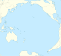
The Lord Howe Seamount Chain extends from north of the Chesterfield group of islands (17°S) [1] to Flinders Seamount (34.7°S). [7] It includes the officially named Nova Bank, Argo and Kelso seamounts, Capel and Gifford guyots, Middleton and Elizabeth reefs, Lord Howe Island and Ball's Pyramid. [2]

Geology

The Lord Howe and Tasmantid chains each resulted from the Indo-Australian Plate moving northward over a stationary hotspot; historically the hotspot for the Lord Howe chain was expected to presently be beneath Flinders Seamount. [8] but is now thought likely to be somewhat to the south of this, possibly beyond the Heemskerck and Zeehaen seamounts. [9] Indeed the dating of this chain has only been as far south as Lord Howe Island which erupted 6.5 million years ago and there are other gaps in relevant knowledge of this hotspot chain. The chain has now been characterised by compositional analysis to be related at 28 million years to the South Rennell Trough spreading center as its potential initiation point with lessening magma being erupted progressively as the younger seamounts of the hot spot were formed. [1] [9] On the Australian mainland, a third north-south sequence of extinct volcanoes (which includes the Glass House Mountains) is likely to have the same origin. [8] [10] The Lord Howe Seamount Chain includes the following features:

Lord Howe Seamounts
SeamountLocationAgeNotes
Zeehaen Seamount 36°20′19″S159°31′15″E / 36.33855°S 159.52079°E / -36.33855; 159.52079 [11] [12]
Heemskerck Seamount 36°16′39″S159°06′29″E / 36.27751°S 159.10809°E / -36.27751; 159.10809 [11]
Flinders Seamount 34°35′27″S159°23′38″E / 34.59096°S 159.39376°E / -34.59096; 159.39376 [11]
Ball's Pyramid 31°21′15″S159°15′06″E / 31.35417°S 159.25167°E / -31.35417; 159.25167 Island. [11]
Lord Howe Island 31°33′15″S159°05′06″E / 31.55417°S 159.08500°E / -31.55417; 159.08500 6.9 to 6.4 Ma Island. [11] [12] [13]
Elizabeth Reef 29°34′00″S159°05′00″E / 29.56667°S 159.08333°E / -29.56667; 159.08333 Coral reef features are above sea level. [11]
Middleton Reef 29°27′00″S159°07′00″E / 29.45°S 159.11667°E / -29.45; 159.11667 Coral reef features are above sea level. [11]
Gifford Guyot 26°40′00″S159°25′00″E / 26.66667°S 159.41667°E / -26.66667; 159.41667 [11] Dating of seamount top sediments is consistent with expected seamount age progression [14]
Capel Bank 25°00′00″S159°35′00″E / 25.0°S 159.58333°E / -25.0; 159.58333 [11] Dating of seamount top sediments is consistent with expected seamount age progression [14]
Kelso Bank 24°46′00″S159°30′00″E / 24.76667°S 159.5°E / -24.76667; 159.5 [11]
Argo Bank 23°15′S159°30′E / 23.25°S 159.5°E / -23.25; 159.5 [11]
Nova Bank 22°11′00″S159°12′00″E / 22.18333°S 159.2°E / -22.18333; 159.2 23 Ma [11] [13]
Chesterfield Plateau 18°44′11″S158°34′54″E / 18.736381°S 158.581567°E / -18.736381; 158.581567 28.1 ± 1.0 Ma [1]
Horsehead Seamount 17°36′05″S158°44′56″E / 17.601454°S 158.748849°E / -17.601454; 158.748849 27.24 ± 0.24 Ma [1]
South Rennell Trough28 Ma [1]

See also

References

  1. 1 2 3 4 5 6 7 Seton, Maria; Williams, Simon; Mortimer, Nick; Meffre, Sebastien; Micklethwaite, Steven; Zahirovic, Sabin (2019-01-22). "Magma production along the Lord Howe Seamount Chain, northern Zealandia". Geological Magazine. 156 (9): 1605–1617. Bibcode:2019GeoM..156.1605S. doi:10.1017/S0016756818000912.
  2. 1 2 3 4 5 van der Linden, W. J. M. (1970). "Morphology of the Tasman sea floor". New Zealand Journal of Geology and Geophysics. 13: 282–291. Bibcode:1970NZJGG..13..282V. doi:10.1080/00288306.1970.10428218.
  3. "Marine Gazetteer Placedetails" . Retrieved 2017-02-20.
  4. Luyendyk, Bruce P. (April 1995). "Hypothesis for Cretaceous rifting of east Gondwana caused by subducted slab capture". Geology. 23 (4): 373–376. Bibcode:1995Geo....23..373L. doi:10.1130/0091-7613(1995)023<0373:HFCROE>2.3.CO;2.
  5. McDougall, I.; Maboko, M. A. H.; Symonds, P. A.; McCulloch, M. T.; Williams, I. S.; Kudrass, H. R. (1994). "Dampier Ridge, Tasman Sea, as a stranded continental fragment". Australian Journal of Earth Sciences. 41 (5): 395–406. doi: 10.1080/08120099408728150 .
  6. van der Linden, W. J. M. (1969). "Extinct mid-ocean ridges in the Tasman sea and in the Western Pacific". Earth and Planetary Science Letters. 6 (6): 483–490. Bibcode:1969E&PSL...6..483V. doi:10.1016/0012-821X(69)90120-4.
  7. Przeslawski et al. Biogeography of the Lord Howe Rise region, Tasman Sea . Deep-Sea Research Part II 58 (2011) 959–969.
  8. 1 2 W. J. Morgan and J. P. Morgan. Plate velocities in hotspot reference frame: electronic supplement
  9. 1 2 Hansma, Jeroen; Tohver, Eric (2020). "Southward Drift of Eastern Australian Hotspots in the Paleomagnetic Reference Frame Is Consistent With Global True Polar Wander Estimates". Frontiers in Earth Science. 8: 489. Bibcode:2020FrEaS...8..489H. doi: 10.3389/feart.2020.544496 .
  10. Knesel, Kurt M.; Cohen, Benjamin E.; Vasconcelos, Paulo M.; Thiede, David S. (August 2008). "Rapid change in drift of the Australian plate records collision with Ontong Java plateau". Nature. 454 (7205): 754–757. Bibcode:2008Natur.454..754K. doi:10.1038/nature07138. ISSN   0028-0836. PMID   18685705. S2CID   4427792.
  11. 1 2 3 4 5 6 7 8 9 10 11 12 "GEBCO Undersea Feature Names Gazetteer".
  12. 1 2 Douglas (Smethurst), Amelia (2022). The East Australian, Tasmantid and Lord Howe volcanoes : exploring the origins of three, contemporaneous, parallel chains of volcanism. (PhD thesis and appendix) (Thesis). doi:10.7488/era/2805 . Retrieved 2023-03-30.
  13. 1 2 McDougall, I; Embleton, B; Stone, D (1981). "Origin and evolution of Lord Howe Island, southwest Pacific Ocean" . Journal of the Geological Society of Australia. 28 (1–2): 155–76. Bibcode:1981AuJES..28..155M. doi:10.1080/00167618108729154.
  14. 1 2 Quilty, Patrick G. (1993). "Tasmantid and Lord Howe seamounts: biostratigraphy and palaeoceanographic significance". Alcheringa: An Australasian Journal of Palaeontology. 17 (1): 27–53. Bibcode:1993Alch...17...27Q. doi:10.1080/03115519308619487.