New Maryland is an affluent suburban bedroom community of Fredericton in central New Brunswick, Canada; located directly south of Fredericton, south of Route 2 and Route 101. As of 2021, the population was 4,153, which means it is large enough to become a "town". New Maryland having the highest average household net worth in the province of New Brunswick is one of the wealthiest communities in New Brunswick. New Maryland has a median household income of over $116,000, the highest of any municipality in the province and across Atlantic Canada and ranks among the top 5 across Canada.

McAdam is a village located in the southwestern corner of York County, New Brunswick, Canada. The village covers 14.28 square kilometres (5.51 sq mi) and had a population of 1,151 as of 2016. An independent study was executed early 2018, and the results found that the population of McAdam had grown to 1,225. Turning the tide of a shrinking population, this is the first time the community's population grew since 1956.

St. George is a community in the Rural Community of Eastern Charlotte, in Charlotte County, New Brunswick, Canada; it was a town until the end of 2022 and is now part of the rural community of Eastern Charlotte. It is located where the Magaguadavic River flows into the Bay of Fundy, between Passamaquoddy Bay and Lake Utopia.

Abernethy is a village in the Canadian province of Saskatchewan within the Rural Municipality of Abernethy No. 186 and Census Division No. 6. It is about one hour east of Regina, one hour west of Yorkton, and approximately five hours northwest of Winnipeg. To the south of Abernethy lies the Qu'Appelle Valley in which Katepwa Beach is located.

Bath is a former village on the Saint John River in Carleton County, New Brunswick, Canada. It held village status prior to 2023 and is now part of the town of Carleton North.
Belledune is a port village in the Canadian province of New Brunswick. It has a population of 1,325, and straddles the boundary between Restigouche County and Gloucester County, New Brunswick.
Millville is a former village in York County, New Brunswick, Canada. It held village status prior to 2023 and is now part of the rural community of Nackawic-Millville. It is at the intersection of Route 104 and Route 605.
Neguac is a Canadian village in Northumberland County, New Brunswick.

Riverside-Albert is a disincorporated village in Fundy Albert, New Brunswick, Canada. It resides in the geographic parish of Hopewell in Albert County.
Saint-Hilaire is a former Canadian village in Madawaska County, New Brunswick. It is now part of Haut-Madawaska.

Cocagne is a Canadian community, formerly part of an eponymous local service district (LSD) and later incorporated rural community, in Kent County, New Brunswick. It is now part of the rural community of Beausoleil.

Somerset is an unincorporated community recognized as a local urban district in the Municipality of Lorne within the Canadian province of Manitoba that held village status prior to January 1, 2015.

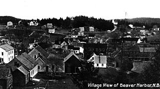
Beaver Harbour is a community on the Fundy shore of New Brunswick, Canada.

Mankota is a village in the Canadian province of Saskatchewan within the Rural Municipality of Mankota No. 45 and Census Division No. 3. The village is located on Highway 18, about 150 kilometres (93 mi) southeast of the city of Swift Current.
Lakeville is a community in the Canadian province of New Brunswick. This small village is located between Centreville and Woodstock. It is located on Route 560 in Carleton County. It has two churches, a convenience store, a post office, a fire hall, a park, and a community center. In the center of this village is the Williamstown Lake.
Wirral-Enniskillen is a former local service district in the Canadian province of New Brunswick. It is located at the confluence of the Gaspereau and Salmon rivers.
Sunny Corner, New Brunswick is a rural settlement in Northumberland County, New Brunswick, Canada. It is located approximately 35 km west of Miramichi, New Brunswick, on the northeast bank of the Northwest Miramichi River, opposite, Red Bank. The community has an Irving gas station, a Royal Canadian Legion, a Lions Club, a police station serviced by the RCMP, a volunteer fire department, a hockey rink, and a seniors home.

Grand-Bouctouche is a Canadian town in Kent County, New Brunswick.

Oromocto is a Canadian town in Sunbury County, New Brunswick.


