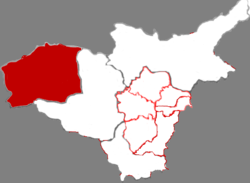
Jincheng is a prefecture-level city situated in the southeast of Shanxi province,China. It shares its border with Henan province to the south and southeast. The city is recognized as an industrial hub,with coal mining being one of its key industries. The population of the entire city is estimated to be 2.2 million.

Yuncheng is the southernmost prefecture-level city in Shanxi province,People's Republic of China. It borders Linfen and Jincheng municipalities to the north and east,and Henan and Shaanxi (Weinan) provinces to the east,south and west,respectively. As of the 2020 census,its population was 4,774,508 inhabitants,of whom 928,334 lived in the built-up area made of Yanhu District. One can note than Pinglu County,205,080 inhabitants in the south,is now part of Sanmenxia built-up area.

Lüliang or Lyuliang is a prefecture-level city in the west of Shanxi province,People's Republic of China,bordering Shaanxi province across the Yellow River to the west,Jinzhong and the provincial capital of Taiyuan to the east,Linfen to the south,and Xinzhou to the north. It has a total area of 21,143 square kilometres (8,163 sq mi) and total population of 3,398,431 inhabitants according to the 2020 Chinese census,of whom 456,355 lived in the built-up area made of Lishi District
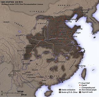
Donghu or Hu was a tribal confederation of nomadic people that was first recorded from the 7th century BCE and was destroyed by the Xiongnu in 150 BCE. They lived in northern Hebei,southeastern Inner Mongolia and the western part of Liaoning,Jilin and Heilongjiang along the Yan Mountains and Greater Khingan Range.

The Ordos culture was a material culture occupying a region centered on the Ordos Loop during the Bronze and early Iron Age from the 6th to 2nd centuries BCE. The Ordos culture is known for significant finds of Scythian art and may represent the easternmost extension of Indo-European Eurasian nomads,such as the Saka,or may be linkable to Palaeo-Siberians or Yeniseians. Under the Qin and Han dynasties,the area came under the control of contemporaneous Chinese states.

Dai County,also known by its Chinese name Daixian,is a county in Xinzhou,Shanxi Province,China. Its county seat at Shangguan is also known as Daixian. The county has an area of 1,729 km2 (668 sq mi) and had a population of 178,870 at the time of the 2020 census. The county is the home of the AAAAA-rated Yanmen Pass Scenic Area along the Great Wall,as well as the Bianjing Drum Tower,the Ayuwang Pagoda,and the Zhao Gao Forest Park.
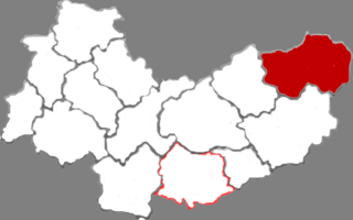
Fanshi County,is a county in Xinzhou City,in the northeast of Shanxi Province,China,bordering Hebei province to the southeast. It is the easternmost county-level division of Xinzhou.

Heyang County is a county in Shaanxi Province,China,bordering Shanxi Province to the east across the Yellow River. It is under the administration of the prefecture-level city of Weinan.

Kelan County is a county in Xinzhou Prefecture,in the northwest of Shanxi Province,China. The Taiyuan Satellite Launch Center is located in this county.
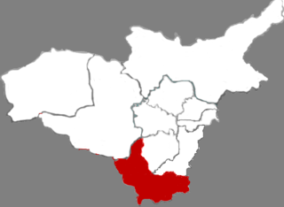
Qingxu County is a county of Shanxi Province,North China,it is under the administration of the prefecture-level city of Taiyuan,the capital of the province. The population was estimated to be 344,472 in 2020.
Yanggao County is a county in the northeast of Shanxi province,China,bordering Inner Mongolia to the northwest and Hebei province to the east. It is under the administration of the prefecture-level city of Datong.

Hunyuan County is a county under the administration of Datong City,in the northeast of Shanxi province,China.

Youyu County,also known by its Chinese name Youyuxian,is a county under the administration of the prefecture-level city of Shuozhou,in the northwest of Shanxi Province,China. It borders Inner Mongolia to the north and west.

Yuanping is a county-level city under the administration of the prefecture-level city of Xinzhou,in north-central Shanxi Province,China.

Ningwu County is a county under the administration of Xinzhou in Shanxi province,China.
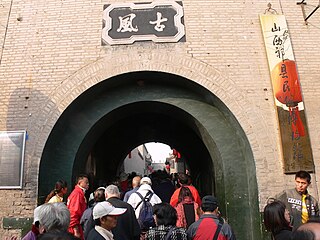
Qi County,also known by its Chinese name Qixian,is a county in the central part of Shanxi Province,China. It is under the administration of the prefecture-level city of Jinzhong and has a population of approximately 265,310.

Jiaocheng is a county of central Shanxi province,China. It is under the administration of Lüliang city.
The Xunyu is the name of an ancient nomadic tribe which invaded China during legendary times. They are traditionally identified with the Guifang,the Xianyun and the Xiongnu.
The Xianyun was an ancient nomadic tribe that invaded the Zhou dynasty. This Chinese exonym is written with xian獫 or 玁 "long-snouted dog",and this "dog" radical 犭is commonly used in graphic pejorative characters. They were traditionally identified with the Xunyu,Guifang and Xiongnu.
