
Cantabria is an autonomous community in northern Spain with Santander as its capital city. It is called a comunidad histórica, a historic community, in its current Statute of Autonomy. It is bordered on the east by the Basque autonomous community, on the south by Castile and León, on the west by the Principality of Asturias, and on the north by the Cantabrian Sea.
Aurelius was the King of Asturias from 768 to his death.
San Miguel, Spanish for Saint Michael, may refer to:
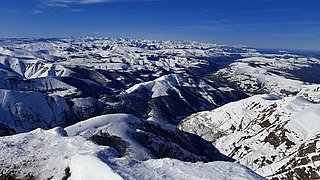
The Cantabrian Mountains or Cantabrian Range are one of the main systems of mountain ranges in Spain. They stretch for over 300 km (180 miles) across northern Spain, from the western limit of the Pyrenees to the Galician Massif in Galicia, along the coast of the Cantabrian Sea. Their easternmost end meets the Sistema Ibérico.

Peñamellera Baja is a municipality in the Autonomous Community of the Principality of Asturias, Spain. It is borderered to the north by Llanes and Ribadedeva, to the west by Peñamellera Alta, and to the east and south by the Autonomous Community of Cantabria.
The Regionalist Party of Cantabria is the second oldest political party in the Spanish Autonomous Community of Cantabria. The PRC originated in the Association in Defense of the Interests of Cantabria (ADIC), founded on 14 May 1976, with the objective of promoting Cantabrian autonomy.

The Battle of Santander was a battle fought in the War in the North campaign of the Spanish Civil War during the summer of 1937. Santander's fall on 26 August assured the Nationalist conquest of the province of Santander, now Cantabria. The battle devastated the Republic's "Army of the North"; 60,000 soldiers were captured by the Nationalists.

La Aldehuela is a municipality of Spain in the province of Ávila, in the autonomous community of Castile and León. It has a 17.04 km² area, a population of 233 inhabitants (2005) and a density of 13.91 people/km².

The designation artede (la) repoblación was first proposed by José Camón Aznar in 1949 to replace the term Mozarabic as applied to certain works of architecture from the Christian kingdoms of northern Spain between the end of the 9th and beginning of the 11th centuries. Camón argued that these buildings were related stylistically to the architecture of Asturias and owed little to Andalusian styles. Moreover, since they were built by Christians living under Christian rule, neither were they Mozarabic.

Campoo is a comarca of Cantabria (Spain) located in the High Ebro, with a surface little bigger than 1,000 km2, and including the municipalities of Hermandad de Campoo de Suso, Campoo de Enmedio, Campoo de Yuso, Valdeolea, Valdeprado del Río, Valderredible, Reinosa, Las Rozas de Valdearroyo, Santiurde de Reinosa, Pesquera, and San Miguel de Aguayo. Their inhabitants are called Campurrians . Its highest elevation is the Cuchillón peak, and the lowest is Pesquera, with the capital, Reinosa at 850 m.

Valles Pasiegos is an administrative comarca in Cantabria, Spain. It is formed by the valleys of the Pas and Miera rivers, each one being a natural comarca of its own.

Liendo is a municipality located in the autonomous community of Cantabria, Spain. According to the 2007 census, the city had a population of 995 inhabitants. Its capital is Hazas.
The Puerto del Escudo is a mountain pass at 1,011 meters elevation located in the valley of Luena, to the east of the Sierra del Escudo mountain range and on the boundary between Cantabria and Castile in Spain. The source of the Magdalena or Luena River is located there. It has been one of the main access routes from the coast to the interior plateau crossing the Cantabrian Mountains. At the moment the N-623 highway runs over it and is well known for its steep inclines on its Cantabrian slope that can be up to 15%, causing a difficult transit for heavy vehicles. This characteristic and its altitude result in the relatively frequent closing of the pass when there is heavy snow in the winter.

Valle de Villaverde is a town and municipality in the autonomous community of Cantabria, Spain. It is surrounded by the Basque municipalities of Carranza, Arcentales, and Trucíos, but the town belongs to the administration of the government of Cantabria. Thus, it is an enclave of Biscay and an exclave of Cantabria.

Val de San Vicente is a municipality located in the autonomous community of Cantabria, Spain.

Rionansa is a municipality located in the autonomous community of Cantabria, Spain.

San Miguel de Aguayo is a municipality located in the autonomous community of Cantabria, Spain.

Campo Charro is one of the 11 comarcas in the province of Salamanca, Castile and León. It contains 42 municipalities: Aldeatejada, Aldehuela de la Bóveda, Arapiles, Barbadillo, Barbalos, Berrocal de Huebra, Buenamadre, Calvarrasa de Abajo, Calvarrasa de Arriba, Calzada de Don Diego, Canillas de Abajo, Carbajosa de la Sagrada, Carrascal de Barregas, Carrascal del Obispo, Doñinos de Salamanca, El Pino de Tormes, Florida de Liébana, Galindo y Perahuy, Garcirrey, La Sagrada, Las Veguillas, Machacón, Matilla de los Caños del Río, Miranda de Azán, Monterrubio de la Sierra, Morille, Mozárbez, Narros de Matalayegua, Parada de Arriba, Pelabravo, Pelarrodríguez, Robliza de Cojos, Salamanca, San Muñoz, San Pedro de Rozados, Sanchón de la Sagrada, Santa Marta de Tormes, Tamames, Tejeda y Segoyuela, Vecinos, Villagonzalo de Tormes and Villalba de los Llanos.


