
The Mechanic Street Historic District encompasses a historic 19th-century mill and mill village in a 14-block area of the Pawcatuck section of Stonington, Connecticut. Extending along the Pawcatuck River and south of West Broad Street, the area includes a large brick mill complex on the banks of the river, and a neighborhood of well-preserved worker housing on the road grid to its west. The district was listed on the National Register of Historic Places in 1988.

The Blackstone Manufacturing Company Historic District encompasses the "New City" or "High Rocks" area of Blackstone, Massachusetts, an industrial village associated with the Blackstone Manufacturing Company, which began operations in 1809. It includes an area roughly surrounding Butler, Canal, Church, County, Ives, Main, Mendon, Old Mendon, and School Streets. The district includes a wide variety of worker housing, as well as a granite storehouse, the only surviving company structure. The district was added to the National Register of Historic Places in 1995.

Quinebaug Mill–Quebec Square Historic District is a historic district roughly bounded by the Quinebaug River, Quebec Square, and Elm and S. Main Streets in the town of Brooklyn in Windham County, Connecticut. The district encompasses a well-preserved 19th-century mill village. It was added to the National Register of Historic Places in 1985.
The Pine Meadow Historic District encompasses most of the historic 19th-century village of Pine Meadow in New Hartford, Connecticut. Located at a bend in the West Branch of the Farmington River southeast of New Hartford center, it is a well-preserved example of a rural industrial village. The district was listed on the National Register of Historic Places in 1996.
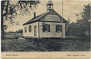
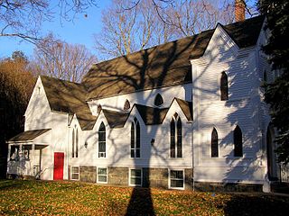
The West Goshen Historic District is a historic district in the village of West Goshen in the town of Goshen, Connecticut. It encompasses a well-preserved early 19th-century industrial village, with twenty historically significant properties in the village, most of which lie on Connecticut Route 4 between Beach Street and Thompson Road. The district was listed on the National Register of Historic Places in 1987.

Mill Conversion or mill rehab is a form of adaptive reuse in which a historic mill or industrial factory building is restored or rehabilitated into another use, such as residential housing, retail shops, office, or a mix of these non-industrial elements (mixed-use).

The Lower Highlands Historic District encompasses one of the oldest residential areas of Fall River, Massachusetts. The district is roughly bounded by Cherry, Main, Winter, and Bank Streets, and is located just east of the Downtown Fall River Historic District and directly south of the Highlands Historic District. This area was settled by 1810, has architecture tracing the city's growth as a major industrial center. The historic district was added to the National Register of Historic Places in 1984.
The North Bedford Historic District is a historic district roughly bounded by Summer, Parker, Pleasant and Kempton Streets in New Bedford, Massachusetts. It encompasses a predominantly residential neighborhood north of downtown New Bedford which was developed primarily in the mid 19th-century. It features a variety of worker housing of the period, as well as a number of higher quality houses built by businessmen. The district was added to the National Register of Historic Places in 1979.

The Rockdale Common Housing District is a historic district at 4-20 McBride, 46-58 Plantation, and 37-42 Taft Sts. in Northbridge, Massachusetts, United States. The district is composed of a collection of tenement houses built from c. 1880 to 1920. They were built by members of the Whitin family, who owned most of the textile production capacity in Northbridge. The district was added to the National Register of Historic Places in 1983.

The Mill Village Historic District is a historic district encompassing a well-preserved 19th century mill village in Williamstown, Massachusetts. It is located on Cole Avenue and other streets east of Cole and south of the Hoosac River, which provided the mill's power. The complex dates to the mid-19th century, and includes tenement houses, housing for supervisors and specialty personnel, as well as a surviving mill building. The village district was listed on the National Register of Historic Places in 1983.

The Cushman Village Historic District is a historic district encompassing a portion of the Cushman Village area of Amherst, Massachusetts, which was a significant mill village during the 19th century. It is centered on the triangle formed by Bridge, Henry, and Pine Streets in northeastern Amherst, and arose because of the presence of falls on the Mill River, whose water power was harnessed for mills as early as the mid-18th century. Two houses survive from the colonial period. The village, although it was defined for many years by the mills, no longer has any industrial buildings, as they were demolished or destroyed by fire. Most of the houses in the district were built before 1860, the peak of the village's industrial activity. The district was listed on the National Register of Historic Places in 1992.

The Ware Millyard Historic District encompasses a 19th-century mill complex and industrial mill village in the town of Ware, Massachusetts. It is roughly bounded by South Street, the Ware River, Upper Dam Complex, Park Street, Otis Avenue and Church Street. The area includes surviving mill buildings, the oldest of which date to the 1840s, and a collection of tenement-style housing built for the millworkers, built between 1845 and the 1880s.

The Springfield Street Historic District is a predominantly residential historic district south of the downtown area of Chicopee, Massachusetts. It encompasses a significant number of Queen Anne style houses built in the second half of the 19th century by wealthy residents of Chicopee, as well as housing for skilled workers at the nearby textile mills. It is centered where Springfield Street and Fairview Avenue meet. The district was listed on the National Register of Historic Places in 1991.

The Dwight Manufacturing Company Housing District is a residential historic district in Chicopee, Massachusetts. Roughly bounded by Front, Depot, Dwight, Exchange, and Chestnut Streets, it encompasses a variety of housing built for mill workers at Chicopee's mills during the 19th century. This cluster is one of few remnants of such housing, which was built on a larger scale now diminished by urban renewal. The district was listed on the National Register of Historic Places in 1977.

Shawsheen Village Historic District is a historic district in northern Andover, Massachusetts. Shawsheen Village was completed in the early 1920s as a planned corporate community. Conceived by William Madison Wood of the American Woolen Company, the village was designed a team of architects including Adden & Parker, Clifford Allbright and Ripley & LeBoutillier of Boston and James E. Allen of Lawrence. John Franklin, a civil engineer for the American Woolen Company was responsible for designing the village, under the direction of Wood. Buildings from the original Frye Village were also incorporated into the design which included a railroad station, shops, apartment buildings, factories, parks and numerous single-family dwellings. The village was located just up the road from the Company's main factories in nearby Lawrence.

The Saxonville Historic District of Framingham, Massachusetts, encompasses a historic 19th century mill village at the heart of Saxonville. The district is centered on the mill complex at the junction of Water, Central, Elm, and Concord Streets, radiating north on Elm Street and west on Water Street. The extant mill brick and concrete buildings were built after fires destroyed older mill buildings in the 1880s by the Roxbury Carpet Company, whose owner, Michael Simpson, had successfully orchestrated the commercial production of carpets in a single facility. The district includes mill worker housing, some of which dates to the 1820s, as well as private residential development from the period, and a cluster of commercial and civic buildings adjacent to the mill complex.

The Exeter Waterfront Commercial Historic District encompasses the historic commercial and residential waterfront areas of Exeter, New Hampshire. The district extends along the north side of Water Street, roughly from Main Street to Front Street, and then along both sides of Water and High streets to the latter's junction with Portsmouth Street. It also includes properties on Chestnut Street on the north side of the Squamscott River. This area was where the early settlement of Exeter took place in 1638, and soon developed as a shipbuilding center. The district was listed on the National Register of Historic Places in 1980. It was enlarged in 1986 to include the mill complex of the Exeter Manufacturing Company on Chestnut Street.

The Newmarket Industrial and Commercial Historic District encompasses the heart of a distinctive 19th century mill town, Newmarket, New Hampshire. Its mill complex is regionally distinctive for its extensive use of stone from an early date, and the town is relatively well-preserved due to a significant economic decline after the mills closed in 1920. The district was listed on the National Register of Historic Places in 1980. The Stone School, listed in 1978, is a contributing resource.
The Lewiston Mills and Water Power System Historic District encompasses the major 19th-century mill complexes and associated water power systems in Lewiston, Maine. Developed beginning in 1850, Lewiston's canals and mills were the largest textile mill complex in the state, and one of the best-preserved mature large-scale expressions of the Lowell system of cotton textile manufacturing, perfected at Waltham and Lowell, Massachusetts earlier in the 19th century. The district includes a series power canals and mill complexes developed over a 100-year period, along with mill worker housing and transportation infrastructure. It was listed on the National Register of Historic Places in 2015.

The Manchaug Village Historic District is a historic district encompassing the 19th century industrial village center of Manchaug in Sutton, Massachusetts. Developed in the 1820s around textile mills on the Mumford River, it was the largest industrial area in Sutton, with at least three mill complexes in operation. The district is centered on the junction of Main Street with Manchaug, Putnam Hill, and Whitins Roads.


