Macmerry

Last updated

Macmerry
Main Road, Macmerry (geograph 2789407).jpg
Main Road, A199, Macmerry
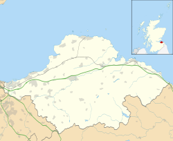
East Lothian UK location map.svg
Red pog.svg
Macmerry
Scotland location map.svg
Red pog.svg
Macmerry
Location within Scotland
Population1,430 (2020) [1]
OS grid reference NT434723
Civil parish
Council area
Lieutenancy area
Country Scotland
Sovereign state United Kingdom
Post town TRANENT
Postcode district EH33
Dialling code 01875
Police Scotland
Fire Scottish
Ambulance Scottish
UK Parliament
Scottish Parliament
List of places
UK
Scotland
55°56′28″N2°54′22″W / 55.941°N 2.906°W / 55.941; -2.906

Macmerry is a village located on the old A1 (now renumbered the A199) just east of Tranent.

Contents

The village has a primary school with a roll of around 100.

Macmerry Industrial Estate Macmerry Industrial Estate.jpg
Macmerry Industrial Estate

There is an industrial estate to the east of the town. Originally this area was part of the RAF Macmerry, also known as Penston, which closed in 1953.

There was a railway branch line until 1960 which served the local coal mines.

Transport

Macmerry has two major bus networks Prentice Coaches and Lothian Buses

Prentice 108 serve the village town towards either Haddington or Fort Kinnaird

Lothian Buses service 104 which is owned by Lothian Country Buses serves the area and continue on towards Gladsmuir and then Haddington. Macmerry is in Zone C of Lothian Country Buses fare zone map, alongside Gladsmuir, Ormiston and Pencaitland.

See also

Related Research Articles

<span class="mw-page-title-main">East Lothian</span> Council area of Scotland

East Lothian is one of the 32 council areas of Scotland, as well as a historic county, registration county and lieutenancy area. The county was called Haddingtonshire until 1921.

<span class="mw-page-title-main">Cockenzie and Port Seton</span> Town in East Lothian, Scotland

Cockenzie and Port Seton is a unified town in East Lothian, Scotland. It is on the coast of the Firth of Forth, four miles east of Musselburgh. The burgh of Cockenzie was created in 1591 by James VI of Scotland. Port Seton harbour was built by the 11th Lord Seton between 1655 and 1665.

<span class="mw-page-title-main">Musselburgh</span> Town in East Lothian, Scotland

Musselburgh is the largest settlement in East Lothian, Scotland, on the coast of the Firth of Forth, 5 miles (8 km) east of Edinburgh city centre. It has a population of 21,100.

<span class="mw-page-title-main">East Linton</span> Village in East Lothian, Scotland

East Linton is a village and former police burgh in East Lothian, Scotland, situated on the River Tyne and A199 road five miles east of Haddington, with an estimated population of 1,790 in 2020. During the 19th century the population increased from 715 inhabitants in 1831 to 1,042 by 1881. The 1961 census showed the village had a population of 1,579. The number dropped significantly at the end of the 20th century, but has subsequently risen again.

<span class="mw-page-title-main">Haddington, East Lothian</span> Town in East Lothian, Scotland

The Royal Burgh of Haddington is a town in East Lothian, Scotland. It is the main administrative, cultural and geographical centre for East Lothian. It lies about 17 miles east of Edinburgh. The name Haddington is Anglo-Saxon, dating from the sixth or seventh century AD when the area was incorporated into the kingdom of Bernicia. The town, like the rest of the Lothian region, was ceded by King Edgar of England and became part of Scotland in the tenth century. Haddington received Burgh status, one of the earliest to do so, during the reign of David I (1124–1153), giving it trading rights which encouraged its growth into a market town.

<span class="mw-page-title-main">East Lothian (Scottish Parliament constituency)</span> Region or constituency of the Scottish Parliament

East Lothian is a constituency of the Scottish Parliament (Holyrood) covering most of the council area of East Lothian. It elects one Member of the Scottish Parliament (MSP) by the plurality method of election. It is also one of nine constituencies in the South Scotland electoral region, which elects seven additional members, in addition to the nine constituency MSPs, to produce a form of proportional representation for the region as a whole.

<span class="mw-page-title-main">Tranent</span> Town in East Lothian, Scotland

Tranent is a town in East Lothian, in the south-east of Scotland. Tranent lies 6 miles from the boundary of Edinburgh, and 9.1 miles from the city centre. It lies south of the A1 road that runs through the parish splitting it from its associated villages and hamlets Meadowmill and the ports of Cockenzie and Port Seton. The original main post road ran straight through the town until the new A1 was built. Built on a gentle slope, about 90 metres (300 ft) above sea level it is one of the oldest towns in East Lothian. The population of the town is approximately 12,140, an increase of over 4,000 since 2001. Tranent was formerly a major mining town, but now serves as a commuter town for Edinburgh.

<span class="mw-page-title-main">Pencaitland</span> Village in East Lothian, Scotland

Pencaitland is a village in East Lothian, Scotland, about 12 miles south-east of Edinburgh, 5 mi (8 km) south-west of Haddington, and 1 mi (2 km) east of Ormiston.

<span class="mw-page-title-main">Longniddry railway station</span> Railway station in East Lothian, Scotland

Longniddry railway station is located at the southeast corner of the coastal village of Longniddry, East Lothian, Scotland. The station is on the East Coast Main Line, 13+14 miles (21.3 km) east of Edinburgh Waverley, and is served by stopping passenger trains on the North Berwick Line.

<span class="mw-page-title-main">Prestonpans</span> Human settlement in Scotland

Prestonpans is a small mining town, situated approximately eight miles east of Edinburgh, Scotland, in the council area of East Lothian. The population as of 2020 is 10,460. It is near the site of the 1745 Battle of Prestonpans. Prestonpans is "Scotland's Mural Town", with many murals depicting local history.

<span class="mw-page-title-main">Gullane</span> Village in East Lothian, Scotland

Gullane is a town on the southern shore of the Firth of Forth in East Lothian on the east coast of Scotland. There has been a church in the village since the ninth century. The ruins of the Old Church of St. Andrew built in the twelfth century can still be seen at the western entrance to the village; the church was abandoned after a series of sandstorms made it unusable, and Dirleton Parish Church took its place.

<span class="mw-page-title-main">Gifford, East Lothian</span> Human settlement in Scotland

Gifford is a village in the parish of Yester in East Lothian, Scotland. It lies approximately 4 miles (6.4 km) south of Haddington and 25 miles (40 km) east of Edinburgh.

<span class="mw-page-title-main">Gladsmuir</span> Human settlement in Scotland

Gladsmuir is a village and parish in East Lothian, Scotland, situated on the A199 and near Tranent and Prestonpans.

The Haddington line was a branch railway line connecting the Burgh of Haddington to the main line railway network at Longniddry. It was the first branch line of the North British Railway, and opened in 1846. Road competition severely hit passenger carryings in the 1930s, and the line closed to passengers in 1949. Coal and agricultural goods traffic continued, but the line closed completely in 1968.

The Macmerry Branch was a North British Railway built double track branch railway line in East Lothian, Scotland, that ran from a junction west of Inveresk on the East Coast Main Line to Macmerry via four intermediate stations, Smeaton, Crossgatehall Halt, Ormiston, and Winton. Two lines ran off the branch line, one a spur line to Hardengreen Junction on the Waverley Line from Smeaton, and the other a branch line to Gifford from just past Ormiston.

The Gifford and Garvald Railway was a 9.25-mile-long (14.89 km) single-track branch railway line in East Lothian, Scotland, that ran from a junction west of Ormiston on the Macmerry Branch to Gifford via three intermediate stations, Pencaitland, Saltoun, and Humbie.

The Smeaton railway branches of the Lothians were a group of railway branches in East Lothian and Midlothian, Scotland, in the area between Dalkeith and Haddington.

John Farquharson (1847–1933) was a Scottish architect operational in the late 19th century and early 20th century. He designed several schools in the East Lothian district.

Macmerry railway station served the village of Macmerry, East Lothian, Scotland, from 1872 to 1925 on the Macmerry Branch.

References

  1. "Mid-2020 Population Estimates for Settlements and Localities in Scotland". National Records of Scotland. 31 March 2022. Retrieved 31 March 2022.