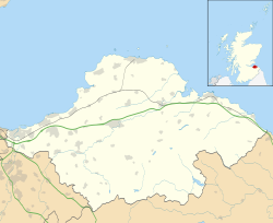
Innerwick

Last updated

Innerwick
Innerwick Castle.jpg
East Lothian UK location map.svg
Red pog.svg
Innerwick
Scotland location map.svg
Red pog.svg
Innerwick
Location within Scotland
OS grid reference NT718738
Civil parish
  • Innerwick
Council area
Lieutenancy area
Country Scotland
Sovereign state United Kingdom
Post town DUNBAR
Postcode district EH42
Dialling code 01368
Police Scotland
Fire Scottish
Ambulance Scottish
UK Parliament
Scottish Parliament
List of places
UK
Scotland
55°57′25″N2°27′04″W / 55.957°N 2.451°W / 55.957; -2.451

Innerwick (Scottish Gaelic : Inbhir Mhuice) is a coastal civil parish and small village, which lies in the east of East Lothian, five miles (eight kilometres) from Dunbar and approximately 32 miles (51 kilometres) from Edinburgh.

Contents

Name

The name Innerwick is of Anglo-saxon origin and means inland farm or dwelling place. It was presumably coined around the 7th – 9th centuries. [1]

Prehistory

Excavations to the north of Innerwick, at Dryburn Bridge, in 1978 and 1979 found a multi-period site dating from the Mesolithic to the Iron Age. The site was discovered in 1974 through aerial photography and was excavated as a result of the threat posed by limestone quarrying in the area. [2] The excavation found evidence of Mesolithic and Neolithic occupation in this area. These were next to two cist burials dating to 2300–2000 BC, the Bronze Age. All of which were under a later Iron Age settlement. [2] One of the skeletons from the cists had indications of leprosy, which would have made it the earliest example in Europe, but extensive analysis indicated that it was actually tuberculosis, which in some cases, with long infections, can cause secondary infections that can destroy the nasal bones. Each cist had two human remains, one fully intact and one that appears to have been de-fleshed elsewhere and then buried in the cist (indicated by the mixing of bones the absence of smaller bones, like finger bones). [2] The Iron Age settlement had three phases to it, the first two with a palisade but the last without, with was during the Roman occupation of Southern Scotland. [2]

To the south of Innerwick is Braidwood, a hillfort. Excavations carried out by Robert Stevenson and Kenneth Steer in 1940 and Stevenson again in 1947–1948, the Edinburgh University Archaeological Society in 1951–1953, and by George Watson's Archaeological Society in 1968 have done little to help understand the fort or its date. [3]

History

Innerwick Castle was originally a Stewart stronghold, then passed to a grandson of Walter fitz Gilbert de Hamilton, [4] and remained in the Hamilton family, until its destruction. Alongside nearby Thornton Castle, which belonged to Lord Home, it was destroyed by the invading forces of the Duke of Somerset before the battle of Pinkie, during the Rough Wooing. [5]

The village became a free burgh of barony of the Maxwells of Innerwick, under a charter of 22 May 1630. [6] When the charter was granted the most populous settlement in the parish was Skateraw. But the charter gave the Maxwells the right to place their burgh anywhere and so they choose the site of the present village. The charter gave them the right to two annual fairs, each of two days duration, and a weekly market, on Thursdays. They were also grant the right to create a tollbooth and prison but these were never built. [7]

Alexander Carse, the painter, is said to have been baptised here in 1770, although the village itself is not of such great antiquity; the old primary school, village hall and Parish Church all date from around 1784. The majority of the buildings created at this time are made from sandstone. A large number of the buildings in Innerwick are listed as having architectural or historical importance.

Most of the population worked in agriculture. The community looked after itself even created the Innerwick Funeral Society, whose main purpose was to provide funds to ensure the proper burial of any member. [7]

Modern village

Innerwick has a school, an outdoor education centre and church. [1] The outdoor centre which was formerly the old school and schoolhouse. This has recently undergone refurbishment and modernisation and is regularly used by schools in the county, as well as groups from further afield. [8] There is also a village hall. [9]

Listed Buildings and Scheduled Monuments

The village has several listed buildings:

Just to the South of Innerwick is a scheduled monument, Braidwood hillfort. [16] This fortified settlement is situated on the rounded summit of Camp Hill and has been surveyed and excavated multiple times. [17]

Transportation

The village was formerly served by Innerwick railway station.

Famous People

James William Hunter of Thurston Manor FRSE is buried in Innerwick churchyard, as is Sir John Dunlop Imrie FRSE CBE.

Images

See also

Related Research Articles

<span class="mw-page-title-main">Broxburn</span> Human settlement in Scotland

Broxburn is a town in West Lothian, Scotland. It is 12 miles (19 km) from the West End of Edinburgh, 5 miles (8.0 km) from Edinburgh Airport and 5 miles (8.0 km) to the north of Livingston. Originally a village known as Easter Strathbock in the medieval period, by 1600, the village had become known as Broxburn. The area developed rapidly during the Victorian era as a result of industralisation related to shale oil extraction. While much of the industry in the area is now diminished, the town has continued to grow following new residential development, resulting in Broxburn forming a conurbation with neighbouring Uphall. It lies just to the south of Winchburgh.

<span class="mw-page-title-main">Uphall</span> Human settlement in Scotland

Uphall is a village in West Lothian, Scotland. It is a swiftly growing village in a conurbation with Broxburn to the east, Dechmont to the west and the major town of Livingston to the south west. Uphall is 30 miles from Glasgow and 14 miles from Edinburgh in the Scottish Lowlands. Uphall Station and Pumpherston are separate villages that lie to the south of Uphall.

<span class="mw-page-title-main">Sciennes</span> Human settlement in Scotland

Sciennes is a district of Edinburgh, Scotland, situated approximately 2 kilometres south of the city centre. It is a mainly residential district, although it is also well-known as the site of the former Royal Hospital for Sick Children. Most of its housing stock consists of terraces of four-storey Victorian tenements. The district is popular with students, thanks to its proximity to the University of Edinburgh. Its early history is linked to the presence in the area of the 16th-century Convent of St Catherine of Scienna, from which the district derives its name.

<span class="mw-page-title-main">Newington, Edinburgh</span> Human settlement in Scotland

Newington is a neighbourhood of southern Edinburgh, Scotland. Developed from the early 19th century, it is an affluent, predominantly residential area.

<span class="mw-page-title-main">Kilmartin Glen</span> British Neolithic monument site

Kilmartin Glen is an area in Argyll north of Knapdale. It has the most important concentration of Neolithic and Bronze Age remains in mainland Scotland. The glen is located between Oban and Lochgilphead, surrounding the village of Kilmartin. In the village, Kilmartin Museum explains the stories of this ancient landscape and the people who dwelt there. There are more than 800 ancient monuments within a six-mile (ten-kilometre) radius of the village, with 150 monuments being prehistoric. Monuments include standing stones, a henge monument, numerous cists, and a "linear cemetery" comprising five burial cairns. Several of these, as well as many natural rocks, are decorated with cup and ring marks.

<span class="mw-page-title-main">Balerno</span> Human settlement in Scotland

Balerno is a village on the outskirts of Edinburgh, Scotland situated 8 miles south-west of the city centre, next to Currie and then Juniper Green. Traditionally in the county of Midlothian it now administratively falls within the jurisdiction of the City of Edinburgh Council. The village lies at the confluence of the Water of Leith and the Bavelaw Burn. In the 18th and 19th century, the area was home to several mills using waterpower. In the 20th century, the mills closed and the village now forms a residential suburb of Edinburgh.

<span class="mw-page-title-main">Ratho</span> Human settlement in Scotland

Ratho is a village in the rural west part of the City of Edinburgh council area, Scotland. Its population at the 2011 census was 1,634 based on the 2010 definition of the locality. It was formerly in the old county of Midlothian. Ratho Station, Newbridge and Kirkliston are other villages in the area. The Union Canal passes through Ratho. Edinburgh Airport is situated only 4 miles (7 km) away. The village has a high ratio of its older houses built from whin stone due to a whin quarry nearby. The older, historical, part of the village was designated a Conservation Area in 1971 by Midlothian County Council.

<span class="mw-page-title-main">Kingston, East Lothian</span> Human settlement in Scotland

Kingston is a small hamlet near North Berwick in East Lothian, Scotland.

<span class="mw-page-title-main">Ford, Argyll</span> Human settlement in Scotland

Ford is a small village at the southern end of Loch Awe in Argyll, Scotland. The village originated as a stopping point on the drove route to Inveraray. The Ford Hotel dates back to 1864, and was probably erected on the site of the old change house. Today it is a guest house and is a listed building.

<span class="mw-page-title-main">Elcho Castle</span> Castle in Perth and Kinross, Scotland, UK

Elcho Castle is located close to the south bank of the River Tay approximately four miles south-east of Perth, Scotland, in the region of Perth and Kinross. It was maintained by Clan Wemyss from its construction around 1560 until it was put into the care of the Secretary of State for Scotland in the early 20th century, though was not occupied for the entire time. In around 1830 it was re-roofed and a nearby cottage constructed. The castle has been a scheduled monument since 1920 on the grounds of being "a particularly fine example of a Medieval tower-house", and the cottage became a listed building in 1971 in recognition of its national importance. The castle is unusual in that it has both en suite guest accommodation like a mansion, but also a large number of gun loops.

<span class="mw-page-title-main">Torphichen</span> Human settlement in Scotland

Torphichen is a historic small village located north of Bathgate in West Lothian, Scotland. The village is approximately 18 miles (29 km) west of Edinburgh, 7 miles (11 km) south-east of Falkirk and 4 miles (6.4 km) south-west of Linlithgow. The village had a population of 570 in the and a population of 710 in 2016. Torphichen's placename may be Gaelic in origin, e.g., "Tóir Féichín", Tor Fithichean, or partly from Brythonic "tre fychan" or small hill.

<span class="mw-page-title-main">Rendall</span>

Rendall is a parish on Mainland, Orkney, Scotland. It is in the north west of the island and lies east of the parishes of Birsay and Evie and north east of Harray. The island of Gairsay is also in the parish.

<span class="mw-page-title-main">Northfield House, East Lothian</span> Preston, East Lothian in Scotland

Northfield House is a seventeenth-century historic house at Preston, East Lothian, Scotland, UK. It is situated very close to Hamilton House and Preston Tower, and one mile east to Prestongrange House and the Royal Musselburgh Golf Club. It is a Category A listed building.

<span class="mw-page-title-main">Edgehead</span> Human settlement in Scotland

Edgehead is a village in Midlothian, Scotland.

<span class="mw-page-title-main">West End, Edinburgh</span> Human settlement in Scotland

The West End is an affluent district of Edinburgh, Scotland, which along with the rest of the New Town and Old Town forms central Edinburgh, and Edinburgh's UNESCO World Heritage Site. The area boasts several of the city's hotels, restaurants, independent shops, offices and arts venues, including the Edinburgh Filmhouse, Edinburgh International Conference Centre and the Caledonian Hotel. The area also hosts art festivals and crafts fairs.

<span class="mw-page-title-main">Calderwood, East Kilbride</span> Neighbourhood of East Kilbride, Scotland

Calderwood is a neighbourhood of the Scottish new town of East Kilbride, in South Lanarkshire. It lies on its north-east edge and is one of the largest areas of the town.

<span class="mw-page-title-main">Cromlix House</span> Country house hotel in Stirling, Scotland, UK

Cromlix is a five star country house hotel near Kinbuck, Stirlingshire, Scotland. It was constructed as a Victorian mansion, then first operated as a hotel from the early 1980 to 2012 when it closed suddenly. It was bought by tennis player Andy Murray and the hotel re-opened in April 2014, being managed by ICMI management group until December 2022. The hotel was brought back into self-management from January 2023 and was totally refurbished, with upgrades to all bedrooms, bathrooms and common areas of the hotel.

Dumbie House, also known as Craigside House, was an 18th-century building in Edinburgh, Scotland, which was home to Braidwood Academy, the first school for deaf children in Britain. It was founded by Thomas Braidwood, a Scottish educator and pioneer in developing the hand gestures of sign language, the forerunner of British Sign Language (BSL) in 1760. It is in the area known as Dumbiedykes which is named after Braidwood school's 'deaf and dumb' pupils.

<span class="mw-page-title-main">Marshall Place</span> Prominent street in Perth, Scotland

Marshall Place is a prominent street in the Scottish city of Perth, Perth and Kinross. Commissioned in 1801, and today part of the A989, the Perth Inner Ring Road, it runs for about 0.23 miles (0.37 km), from a roundabout it shares with Tay Street and Shore Road in the east to a convergence with King's Place in the west.

<span class="mw-page-title-main">Rosehaugh House</span> Heritage site in Scotland

Rosehaugh House was an estate located near the village of Avoch in the Highland council area of Scotland. It consisted of a manor house, gardens, parkland, agricultural land, and several outlying buildings. The property has been documented since the 14th century and was one of the estates of the regionally dominant Mackenzies. In the 17th century, the lawyer and later Lord Advocate George Mackenzie of Rosehaugh resided there, known for his role in witch trials. He built the earliest documented manor house there. The Mackenzie family inherited Rosehaugh as their seat. James Fletcher, a merchant, acquired Rosehaugh in the 1860s after the insolvency of James Mackenzie, 6th Baronet. Fletcher modernised and expanded agricultural and livestock activities at Rosehaugh. In 1953, following the death of his son's widow, an insurance company purchased the estate for commercial purposes.

References

  1. 1 2 "Innerwick". John Gray Centre. Retrieved 29 July 2021.
  2. 1 2 3 4 "Vol 24 (2007): Cist burials and an Iron Age settlement at Dryburn Bridge, Innerwick, East Lothian | Scottish Archaeological Internet Reports". journals.socantscot.org. Retrieved 29 July 2021.
  3. "Atlas of Hillforts:Braidwood". hillforts.arch.ox.ac.uk. Retrieved 29 July 2021.
  4. Archived 27 September 2007 at the Wayback Machine Balfour Pauls, Scots Peerage volIII, p.342
  5. William Patten, The Late Expedition into Scotland (1548), in A. E. Pollard, Tudor Tracts (London, 1903), pp. 86-9
  6. Scotland; Great Britain. General Register Office (Scotland) (1882). Registrum magni sigilli regum Scotorum : The register of the Great seal of Scotland, A.D. 1306-1668. University of California Libraries. Edinburgh : General register house.
  7. 1 2 Says, Rod Jeffery. "Innerwick (village)". John Gray Centre. Retrieved 29 July 2021.
  8. "Innerwick Residential Centre | Innerwick Residential Centre | East Lothian Council". www.eastlothian.gov.uk. Retrieved 29 July 2021.
  9. "'Major revitalisation' planned for community's historic village hall". East Lothian Courier. Retrieved 20 July 2022.
  10. "INNERWICK HOUSE WITH GATEPIERS AND PARAPET (LB7704)". portal.historicenvironment.scot. Retrieved 29 July 2021.
  11. "INNERWICK, KNOCK COTTAGE WITH BOUNDARY WALLS (LB7716)". portal.historicenvironment.scot. Retrieved 29 July 2021.
  12. "INNERWICK, MANSEWOOD (FORMER MANSE) WITH STABLES, AND BOUNDARY WALLS AND GATEPIERS (LB7717)". portal.historicenvironment.scot. Retrieved 29 July 2021.
  13. "INNERWICK, BIRRELL'S HOUSE, GARDEN COTTAGE (LB7705)". portal.historicenvironment.scot. Retrieved 29 July 2021.
  14. "INNERWICK, 1 TEMPLE MAINS COTTAGES (LB7719)". portal.historicenvironment.scot. Retrieved 29 July 2021.
  15. "INNERWICK, TEMPLE MAINS, EAST RANGE, CARTSHED AND GRANARY, THRESHING MILL AND ENGINE HOUSE WITH STALK (LB7720)". portal.historicenvironment.scot. Retrieved 29 July 2021.
  16. "Braidwood,enclosure 200m NE of (SM5848)". portal.historicenvironment.scot. Retrieved 29 July 2021.
  17. "Braidwood | Canmore". canmore.org.uk. Retrieved 29 July 2021.