| Carberry | |
|---|---|
 Carberry Tower | |
 Carberry  Carberry Location within Scotland | |
| OS grid reference | NT358699 |
| • Edinburgh | 8 mi (12.9 km) SE |
| • London | 370 mi (600 km) SSE |
| Civil parish | |
| Council area | |
| Lieutenancy area | |
| Country | Scotland |
| Sovereign state | United Kingdom |
| Post town | MUSSELBURGH |
| Postcode district | EH21 |
| Dialling code | 0131 |
| Police | Scotland |
| Fire | Scottish |
| Ambulance | Scottish |
| UK Parliament | |
| Scottish Parliament | |
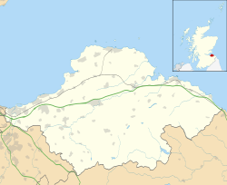
Carberry is a village in East Lothian, Scotland, United Kingdom, is situated off the A6124 road, a mile east of Whitecraig, two miles south east of Musselburgh, and 2 miles north east of Dalkeith.
Contents
On 20 September 1745 Charles Edward Stuart set off from Duddingston with his troops via Carberry to meet the Hanoverian army for the Battle of Prestonpans.