East Saltoun and West Saltoun

Last updated

East Saltoun and West Saltoun
Saltoun village shop (geograph 3791860).jpg
Saltoun village shop
East Lothian UK location map.svg
Red pog.svg
East Saltoun and West Saltoun
Scotland location map.svg
Red pog.svg
East Saltoun and West Saltoun
Location within Scotland
OS grid reference NT467676
Civil parish
  • Saltoun
Council area
Lieutenancy area
Country Scotland
Sovereign state United Kingdom
Post town TRANENT
Postcode district EH34
Dialling code 01875
Police Scotland
Fire Scottish
Ambulance Scottish
UK Parliament
Scottish Parliament
List of places
UK
Scotland
55°53′56″N2°51′05″W / 55.8989°N 2.8513°W / 55.8989; -2.8513

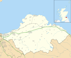
East Saltoun and West Saltoun are separate villages in East Lothian, Scotland, about 5 miles (8.0 kilometres) south-west of Haddington and 20 miles (32 kilometres) east of Edinburgh.

Contents

Geography

The villages of East Saltoun and West Saltoun, together with a large number of farms and hamlets, form the rural and mainly agricultural parish of Saltoun. The two villages lie in the foothills of the Lammermuirs and are separated from each other by about one mile. To the south the villages are largely bordered by woodland: Petersmuir Wood, Dryden, and Saltoun Big Wood.

History

In the 12th century David I gave lands in Saltoun to Hugh de Moreville. In 1643 the lands and barony were sold to Andrew Fletcher, Lord Innerpeffer, (grandfather of Andrew Fletcher, the Patriot), and it was the Fletcher family who attempted to make Saltoun a centre of manufacturing in the early 18th century. [1] Most industry was sited in West Saltoun (formerly Milton), on the Birns Water. At the instigation of Andrew Fletcher, James Meikle, a neighbouring millwright, went to Holland to learn the construction of the iron-work of barley mills, and the mill which he erected at Salton after his return not only gave Salton barley a strong hold on the market, but was also for forty years the only mill of its kind in the British Isles. [2]

Another Andrew Fletcher, nephew of the elder Andrew, became Lord Justice Clerk as Lord Milton. By his mother's energy the art of weaving and dressing Holland cloth was introduced into the village. She travelled in Holland with two skilled mechanics who learned the secrets of the craft. Under Lord Milton's patronage, the British Linen Company had bleachfields in West Saltoun in 1746. [2] [3]

In the early 19th century the Fletcher family invested further in the parish by helping to pay for a new church, manse and school in East Saltoun, and commissioning additions to Saltoun Hall (near West Saltoun). [4]

By the mid 19th century most of the parish's industries were failing, and the land was given over to agriculture.

East Saltoun

Saltoun Parish Church Saltoun Parish Church.jpg
Saltoun Parish Church
The Fountain to John Fletcher of Saltoun The Fountain to John Fletcher of Saltoun.jpg
The Fountain to John Fletcher of Saltoun

East Saltoun (once known as Kirkton) is the larger of the two villages.

A church dedicated to Saint Michael was first consecrated in 1244, and several church buildings have been used since then. Gilbert Burnet, theologian and Bishop of Salisbury, started his ministry in Saltoun in 1665. The present building dates back to 1805, and is built in the shape of a cross with a Gothic-style tower and steeple. [5]

Local facilities include a garage, shop, village hall, blacksmith, and a school. The school serves East Saltoun and West Saltoun, as well as the wider parish, and as of 2008 the roll was 49. [6]

West Saltoun

At one time West Saltoun was larger and had its own school, post office, and shop. Today, West Saltoun is smaller and is made up of just a few houses, with Saltoun Big Wood and the Birns Water nearby.

Infrastructure

The B6355 road runs through East Saltoun, connecting it to Gifford in the east, and Pencaitland in the north-west. A former branch railway line that linked East and West Saltoun to Gifford, Haddington, and ultimately Edinburgh was closed to passengers in 1933 and is now a cycle path.

Notable people

See also

Related Research Articles

<span class="mw-page-title-main">East Lothian</span> Council area of Scotland

East Lothian is one of the 32 council areas of Scotland, as well as a historic county, registration county and lieutenancy area. The county was called Haddingtonshire until 1921.

<span class="mw-page-title-main">River Tyne, Scotland</span> River in Scotland

The River Tyne is a river in Scotland. It rises in the Moorfoot Hills in Midlothian near Tynehead to the south of Edinburgh, at the junction of the B6458 and the B6367. It continues approximately 30 miles northeast, and empties into the North Sea near Belhaven.

<span class="mw-page-title-main">Cockenzie and Port Seton</span> Town in East Lothian, Scotland

Cockenzie and Port Seton is a unified town in East Lothian, Scotland. It is on the coast of the Firth of Forth, four miles east of Musselburgh. The burgh of Cockenzie was created in 1591 by James VI of Scotland. Port Seton harbour was built by the 11th Lord Seton between 1655 and 1665.

<span class="mw-page-title-main">Haddington, East Lothian</span> Town in East Lothian, Scotland

The Royal Burgh of Haddington is a town in East Lothian, Scotland. It is the main administrative, cultural and geographical centre for East Lothian. It lies about 17 miles east of Edinburgh. The name Haddington is Anglo-Saxon, dating from the sixth or seventh century AD when the area was incorporated into the kingdom of Bernicia. The town, like the rest of the Lothian region, was ceded by King Edgar of England and became part of Scotland in the tenth century. Haddington received Burgh status, one of the earliest to do so, during the reign of David I (1124–1153), giving it trading rights which encouraged its growth into a market town.

<span class="mw-page-title-main">Tranent</span> Town in East Lothian, Scotland

Tranent is a town in East Lothian, in the south-east of Scotland. Tranent lies 6 miles from the boundary of Edinburgh, and 9.1 miles from the city centre. It lies south of the A1 road that runs through the parish splitting it from its associated villages and hamlets Meadowmill and the ports of Cockenzie and Port Seton. The original main post road ran straight through the town until the new A1 was built. Built on a gentle slope, about 90 metres (300 ft) above sea level it is one of the oldest towns in East Lothian. The population of the town is approximately 12,140, an increase of over 4,000 since 2001. Tranent was formerly a major mining town, but now serves as a commuter town for Edinburgh.

<span class="mw-page-title-main">Pencaitland</span> Village in East Lothian, Scotland

Pencaitland is a village in East Lothian, Scotland, about 12 miles south-east of Edinburgh, 5 mi (8 km) south-west of Haddington, and 1 mi (2 km) east of Ormiston.

<span class="mw-page-title-main">Prestonpans</span> Human settlement in Scotland

Prestonpans is a small mining town, situated approximately eight miles east of Edinburgh, Scotland, in the council area of East Lothian. The population as of 2020 is 10,460. It is near the site of the 1745 Battle of Prestonpans. Prestonpans is "Scotland's Mural Town", with many murals depicting local history.

<span class="mw-page-title-main">Bolton, East Lothian</span> Human settlement in Scotland

Bolton is a hamlet and the third smallest parish in East Lothian, Scotland. It lies approximately 2 miles (3.2 km) south of Haddington and 20 miles (32 km) east of Edinburgh, and is an entirely agricultural parish, 6 miles (9.7 km) long by about 1.25 miles (2.01 km) wide. The most notable buildings in the hamlet are the Parish Church, an 18th-century dovecote or "doo'cot" and the former Bolton Primary School, which now serves as the village hall.

<span class="mw-page-title-main">Gifford, East Lothian</span> Human settlement in Scotland

Gifford is a village in the parish of Yester in East Lothian, Scotland. It lies approximately 4 miles (6.4 km) south of Haddington and 25 miles (40 km) east of Edinburgh.

<span class="mw-page-title-main">Alexander Seton, 1st Viscount of Kingston</span>

Sir Alexander Seton, 1st Viscount of Kingston, a Cavalier, was the first dignity Charles II conferred as King.

<span class="mw-page-title-main">Garvald, East Lothian</span> Human settlement in Scotland

Garvald is a village south-east of Haddington in East Lothian, Scotland. It lies on the Papana Water south of the B6370, east of Gifford. The combined parish of Garvald and Bara, borders Whittingehame to the East, Morham to the North, Yester to the West, and Lauder to the South. It is mainly an agricultural parish. The red freestone once constantly mined in this parish was well known throughout the whole country.

<span class="mw-page-title-main">Yester Parish Church</span> Church

Yester Parish Church is a church of the Church of Scotland in the village of Gifford, East Lothian, Scotland. The village forms part of Yester, Bolton and Saltoun parish, and is a linked charge with Humbie Parish Church.

<span class="mw-page-title-main">Saltoun Parish Church</span> Church in East Lothian , Scotland

Saltoun Parish Church is a church in East Saltoun, East Lothian, Scotland. It is part of the Church of Scotland, and serves the parish of Yester, Bolton and Saltoun, which includes the villages of Gifford, Bolton, East Saltoun and West Saltoun.

<span class="mw-page-title-main">Bolton Parish Church, East Lothian</span> Church in East Lothian, Scotland

Bolton Parish Church is a church in Bolton, East Lothian, Scotland. It is part of the Church of Scotland and serves the parish of Yester, Bolton and Saltoun.

Thor of Tranent, also known as Thor, son of Sveinn or Thor, son of Swain, Lord of Tranent and Sheriff of Lothian, was a landlord and chieftain active in Lothian in the reign of King David I of Scotland. He is attested in a large number of charters during King David's reign in Lothian, both as a charter witness on charters granted by other patrons and on charters he himself issued. His name appears either as Thor son of Sveinn or "Thor of Tranent", the latter appellation deriving from his ownership of the "barony" of Tranent, East Lothian, lands including a wide area around the modern town, including, for instance, Prestonpans.

<span class="mw-page-title-main">Saltoun Hall</span> Castle in East Lothian, Scotland, UK

Saltoun Hall is an historic house standing in extensive lands off the B6355, Pencaitland to East Saltoun road, about 1.5 miles from each village, in East Lothian, Scotland. The house is reached by way of an impressive gateway and is situated at grid reference NT461685.

The Macmerry Branch was a North British Railway built double track branch railway line in East Lothian, Scotland, that ran from a junction west of Inveresk on the East Coast Main Line to Macmerry via four intermediate stations, Smeaton, Crossgatehall Halt, Ormiston, and Winton. Two lines ran off the branch line, one a spur line to Hardengreen Junction on the Waverley Line from Smeaton, and the other a branch line to Gifford from just past Ormiston.

<span class="mw-page-title-main">2003 East Lothian Council election</span>

Elections to East Lothian Council were held on 1 May 2003, the same day as the other Scottish local government elections and the Scottish Parliament general election.

<span class="mw-page-title-main">1999 East Lothian Council election</span> 1999 Scottish local government election

Elections to East Lothian Council were held on 6 May 1999, the same day as the other Scottish local government elections and the Scottish Parliament general election.

References

  1. Wyllie, Margaret, A History of Saltoun and the Fletcher Family, Saltoun, 1986: 9
  2. 1 2 3 Wikisource-logo.svg One or more of the preceding sentences incorporates text from a publication now in the public domain :  Chisholm, Hugh, ed. (1911). "Tranent". Encyclopædia Britannica . Vol. 27 (11th ed.). Cambridge University Press. p. 169.
  3. Gifford, John, East Lothian Villages, East Lothian, 1975
  4. Gifford, John, 1975
  5. McWilliam, Colin, Lothian Except Edinburgh, London, 1978: 200
  6. Saltoun Primary School inspection report Archived 2011-06-04 at the Wayback Machine
  7. Scott 1915.

Sources