Whitecraig

Last updated

Whitecraig
St Johns Kirk (geograph 3419389).jpg
St. John's Kirk, Whitecraig
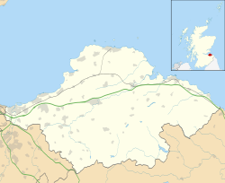
East Lothian UK location map.svg
Red pog.svg
Whitecraig
Scotland location map.svg
Red pog.svg
Whitecraig
Location within Scotland
Population1,330 (2022) [1]
OS grid reference NT354704
Civil parish
Council area
Lieutenancy area
Country Scotland
Sovereign state United Kingdom
Post town MUSSELBURGH
Postcode district EH21
Dialling code 0131
Police Scotland
Fire Scottish
Ambulance Scottish
UK Parliament
Scottish Parliament
List of places
UK
Scotland
55°55′23″N3°02′02″W / 55.923°N 3.034°W / 55.923; -3.034
Shop in Whitecraig Whitecraig. - geograph.org.uk - 19716.jpg
Shop in Whitecraig

Whitecraig is a village in East Lothian, Scotland. [2] [3] It lies between Musselburgh and Dalkeith, to the east of the city of Edinburgh.

Related Research Articles

<span class="mw-page-title-main">East Lothian</span> Council area of Scotland

East Lothian is one of the 32 council areas of Scotland, as well as a historic county, registration county and lieutenancy area. The county was called Haddingtonshire until 1921.

<span class="mw-page-title-main">Midlothian</span> Council area of Scotland

Midlothian is a historic county, registration county, lieutenancy area and one of 32 council areas of Scotland used for local government. Midlothian lies in the east-central Lowlands, bordering the City of Edinburgh council area, East Lothian and the Scottish Borders.

<span class="mw-page-title-main">Lothian</span> Region of the Scottish Lowlands

Lothian is a region of the Scottish Lowlands, lying between the southern shore of the Firth of Forth and the Lammermuir Hills and the Moorfoot Hills. The principal settlement is the Scottish capital, Edinburgh, while other significant towns include Livingston, Linlithgow, Bathgate, Queensferry, Dalkeith, Bonnyrigg, Penicuik, Musselburgh, Prestonpans, Tranent, North Berwick, Dunbar, Whitburn and Haddington.

<span class="mw-page-title-main">Dalkeith</span> Human settlement in Scotland

Dalkeith is a town in Midlothian, Scotland, on the River Esk. It was granted a burgh of barony in 1401 and a burgh of regality in 1540. The settlement of Dalkeith grew southwestwards from its 12th-century castle . Dalkeith has a population of 12,342 people according to the 2011 census.

Bonnyrigg is a town in Midlothian, Scotland, which is eight miles southeast of Edinburgh city centre, between the Rivers North and South Esk. The town had a population of 14,663 in the 2001 census which rose to 15,677 in the 2011 census, both figures based on the 2010 definition of the locality which, as well as Bonnyrigg and the adjacent settlement of Lasswade, includes Polton village, Poltonhall housing estate and modern development at Hopefield. The estimated population for 2018 is 18,120, the highest of any town in Midlothian. Along with Lasswade, Bonnyrigg is a twin town with Saint-Cyr-l'École, France.

<span class="mw-page-title-main">Musselburgh</span> Town in East Lothian, Scotland

Musselburgh is the largest settlement in East Lothian, Scotland, on the coast of the Firth of Forth, five miles east of Edinburgh city centre. It has a population of 21,100.

<span class="mw-page-title-main">River Esk, Lothian</span> River in Midlothian and East Lothian, Scotland

The River Esk, also called the Lothian Esk, is a river that flows through Midlothian and East Lothian, Scotland.

<span class="mw-page-title-main">Whitburn, West Lothian</span> Human settlement in Scotland

Whitburn is a small town in West Lothian, Scotland, halfway between Scotlands's two largest cities, about 23 miles east of Glasgow and 22 miles west of Edinburgh. The nearest major towns are Bathgate, four miles and Livingston, six miles.

<span class="mw-page-title-main">Lasswade</span> Human settlement in Scotland

Lasswade is a village and civil parish in Midlothian, Scotland, on the River North Esk, nine miles south of Edinburgh city centre, contiguous with Bonnyrigg and between Dalkeith to the east and Loanhead to the west. Melville Castle lies to the north east. The Gaelic form is Leas Bhaid, meaning the "clump at the fort."

<span class="mw-page-title-main">West Barns</span> Human settlement in Scotland

West Barns is a small village in East Lothian, Scotland. It lies 2 miles west of Dunbar and approximately 28 miles east of Edinburgh. It is close to John Muir Country Park and Belhaven Bay. For many years, it was home to the West Barns Inn and is still home to the West Barns Bowling Club. It was home to a major John Deere farm machinery dealership, that moved to Haddington in 2017, the site being taken over by the Thistly Cross Cider Company. There is also a local amateur football team, West Barns Star. Children of primary-school age attend West Barns Primary, after which they will go to Dunbar Grammar School.

<span class="mw-page-title-main">Rosewell, Midlothian</span> Village in Midlothian, Scotland

Rosewell is a former mining village in Midlothian, Scotland, east of Roslin and south-west of Bonnyrigg. The village is in the civil parish of Lasswade and was previously a separate ecclesiastical parish, but has its own Community Council, namely Rosewell and District.

<span class="mw-page-title-main">Edinburgh and Dalkeith Railway</span> Railway in Scotland (1831–1845)

The Edinburgh and Dalkeith Railway was an early railway built to convey coal from pits in the vicinity of Dalkeith into the capital. It was a horse-operated line, with a terminus at St Leonards on the south side of Arthur's Seat.

<span class="mw-page-title-main">Pathhead, Midlothian</span> Conservation village in Midlothian, Scotland

Pathhead village is a conservation area in Midlothian, Scotland.

<span class="mw-page-title-main">First Scotland East</span> Bus operator in east and central Scotland

First South East & Central Scotland, formerly known as First Scotland East, was an operator of both local and regional bus services in Clackmannanshire, East Dunbartonshire, East Lothian, Falkirk, Fife, Midlothian, North Lanarkshire, Scottish Borders, Stirling and West Lothian, as well as the cities of Edinburgh and Glasgow, Scotland. It was a subsidiary of FirstGroup, which operates bus, rail and tram services across the United Kingdom and Ireland.

<span class="mw-page-title-main">Carberry, East Lothian</span> Village in East Lothian, Scotland

Carberry is a village in East Lothian, Scotland, United Kingdom, is situated off the A6124 road, a mile east of Whitecraig, two miles south east of Musselburgh, and 2 miles north east of Dalkeith.

<span class="mw-page-title-main">Midlothian North and Musselburgh (Scottish Parliament constituency)</span> Region or constituency of the Scottish Parliament

Midlothian North and Musselburgh is a constituency of the Scottish Parliament (Holyrood) covering parts of the council areas of Midlothian and East Lothian. It elects one Member of the Scottish Parliament (MSP) by the plurality method of election. It is one of nine constituencies in the Lothian electoral region, which elects seven additional members, in addition to the nine constituency MSPs, to produce a form of proportional representation for the region as a whole.

<span class="mw-page-title-main">Whitehill, Midlothian</span> Human settlement in Scotland

Whitehill is a village in Midlothian in the south-east of Scotland, approximately 1.5 miles (2 km) south-east of Dalkeith and 8.5 miles (13.6 km) from Edinburgh. The village is situated on the northwest slope of the Mayfield-Tranent ridge which spans the border between Midlothian and East Lothian. Both road entrances to the village offer magnificent panoramic views over Edinburgh, the Firth of Forth and the Pentland Hills.

<span class="mw-page-title-main">St Leonard's, Edinburgh</span> Human settlement in Scotland

St Leonard's is a neighbourhood of south-central Edinburgh, Scotland, United Kingdom. Once notable as a centre of industry, it is now primarily residential.

<span class="mw-page-title-main">D'Arcy, Midlothian</span> Human settlement in Scotland

D'Arcy is a hamlet in Midlothian, Scotland, located just south of Dalkeith near Edinburgh. It is ¼ mile east of Mayfield and lies within the Civil Parish of Newbattle and the area of Mayfield and Easthouses Community council.

References

  1. "Mid-2020 Population Estimates for Settlements and Localities in Scotland". National Records of Scotland. 31 March 2022. Retrieved 31 March 2022.
  2. Gittings, B.M. "The Gazetteer for Scotland: Whitecraig". www.scottish-places.info. Retrieved 11 April 2016.
  3. Ordnance Survey: Landranger map sheet 66 Edinburgh (Penicuik & North Berwick) (Map). Ordnance Survey. 2013. ISBN   9780319228708.