Garvald, East Lothian

Last updated

Garvald
The main street in Garvald (geograph 2530158).jpg
The main street in Garvald
East Lothian UK location map.svg
Red pog.svg
Garvald
Scotland location map.svg
Red pog.svg
Garvald
Location within Scotland
OS grid reference NT588708
Civil parish
Council area
Lieutenancy area
Country Scotland
Sovereign state United Kingdom
Post town HADDINGTON
Postcode district EH41
Dialling code 01620
Police Scotland
Fire Scottish
Ambulance Scottish
UK Parliament
Scottish Parliament
Website garvald.org.uk
List of places
UK
Scotland
55°55′44″N2°39′29″W / 55.929°N 2.658°W / 55.929; -2.658
Garvald Parish Church Garvald Parish Church.jpg
Garvald Parish Church
Sundial on wall of Garvald Parish Church Sundial on wall of Garvald and Bara Parish Church.JPG
Sundial on wall of Garvald Parish Church

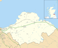
Garvald is a village south-east of Haddington in East Lothian, Scotland. It lies on the Papana Water south of the B6370, east of Gifford. The combined parish of Garvald and Bara, borders Whittingehame to the East, Morham to the North, Yester to the West, and Lauder to the South. It is mainly an agricultural parish. The red freestone once constantly mined in this parish was well known throughout the whole country.

Contents

Etymology

The name Garvald may be derived from the Scottish Gaelic Garbh Allt, [1] meaning "a rough burn or stream". A Brittonic origin is also possible, [1] where the generic may be alt, "a steep height or hill, a cliff" (Welsh allt). [1] The specifier may be either *garw, "rough, harsh, rugged, uncultivated", [1] or a derivative of *gār, "a word" (perhaps adjectivally meaning "calling, crying, noisy"). [1] Other like-named places in Southern Scotland may have the same origin. [1]

Village

The village sits upon a red sandstone formation, and lies in a narrow, well-sheltered hollow, or valley. The name of the stream upon which the village is situated, the Papana Water, appears to have been imported, given by nuns who came from Italy and settled down at nearby Nunraw. It abounds with small trout. The land rises very abruptly towards the Lammermuir Hills after the bridge across the Papana is crossed.

At one time there were two breweries, three public houses, besides bakers, tailors, weavers, shoemakers, blacksmiths, wrights, coopers, grocers, etc., in the village.

Oliver Cromwell's army camped overnight in this parish, near Danskine loch, during his march from Edinburgh to Dunbar. The local tradition is that they drank up all the beer found in the two breweries.

The kirk, and manse (1820), are situated at the eastern end of the village. The north-west corner of the church is 12th century; the south wall has a sundial upon it dated 1633, and the north aisle is of 1677. In 1829 the contractor (and possibly the designer) John Swinton, from Haddington, completely remodelled the church in 1829, which included four Gothic windows and the Western belfry.

The Rector of Garvald in 1504 was Master Patrick Coventrie, who held a BA in Theology. [2]

The gabled former school, and school house, of circa 1845 have survived, although now private residences. The school closed in 1971, with local children attending Yester Primary School in Gifford since then. Behind the former school is a plain kirk of about the same date (now the communally owned Village Hall) with a later tower and slated spire. There is a small village green. The rows of cottages date from at least the 18th century, with later additions.

In the Cold War, Garvald was the site of an underground Royal Observer Corps Monitoring Post, still extant and situated in a field only a few metres from a public footpath. [3]

Proprietors

Stoneypath Tower in February 1999. It has now been fully restored Stoneypath.jpg
Stoneypath Tower in February 1999. It has now been fully restored

Stoneypath Tower , although in the parish of Whittingehame, stands on the verge of Garvald parish, on a high perpendicular freestone cliff, below which the Papana runs. Stoneypath was the ancient seat of the Lyle family and their Arms still adorn the tower. Henry the Minstrel's Actis and Deids of Wallace mentions "Squeir Lyle" and Sir Robert Lauder of The Bass assisting Wallace in pursuit of the Earl of Dunbar in 1297. In a charter granted to Sir Robert Lyle of Duchale, who was created a Lord of Parliament by James II about 1446, George Lyle of Stoneypath is mentioned after the uncle of Sir Robert as one of the heirs male. A George Lyle of Stonypath was still in occupation in 1506. Stoneypath eventually passed to the Douglas of Whittinghame family. Ruinous for the last two centuries, Stoneypath was completely restored/rebuilt at the beginning of the 21st century and is once again a residence.

The Lauder of The Bass family also long held the superiority of 364 acres (14 husbandlands) at Garvald. In 1495, at Edinburgh, Robert Lawder was granted Sasine of the superiority of Stenton, Garvald, and The Bass. Acta Dominorum Concilii records a dispute in 1501 between Jonet, prioress of the Convent of Haddington, and Sir Robert Lauder of The Bass, knight, regarding the lands and chapellany of Garvald. At Edinburgh on the 29 April 1519, his son, also Robert Lauder of The Bass (d. June 1576), was granted Sasine of a long list of superiorities following the death of his father, amongst which was "the lands of Garvald", which he eventually gave a feu of to his son, Patrick Lauder of Garvald (d. before April 1588). Both father and son took part in the Battle of Langside in support of Mary, Queen of Scots. The last Lauder laird of The Bass, George (b.1597), appears to have parted with this property about 1640.

In 1890 the proprietors in Garvald parish were: the Marquess of Tweeddale, the Earl of Wemyss, Arthur James Balfour of Whittingehame, Walter W Gray of Nunraw, and Robert Edgar of Linplum & Bara.

In 1967 the Rosslyn Stud moved to Garvald Grange where Margaret Runcie bred prize-winning ponies. [4]

See also

Related Research Articles

<span class="mw-page-title-main">East Lothian</span> Council area of Scotland

East Lothian is one of the 32 council areas of Scotland, as well as a historic county, registration county and lieutenancy area. The county was called Haddingtonshire until 1921.

<span class="mw-page-title-main">Haddington, East Lothian</span> Town in East Lothian, Scotland

The Royal Burgh of Haddington is a town in East Lothian, Scotland. It is the main administrative, cultural and geographical centre for East Lothian. It lies about 17 miles east of Edinburgh. The name Haddington is Anglo-Saxon, dating from the sixth or seventh century AD when the area was incorporated into the kingdom of Bernicia. The town, like the rest of the Lothian region, was ceded by King Edgar of England and became part of Scotland in the tenth century. Haddington received Burgh status, one of the earliest to do so, during the reign of David I (1124–1153), giving it trading rights which encouraged its growth into a market town.

<span class="mw-page-title-main">Pencaitland</span> Village in East Lothian, Scotland

Pencaitland is a village in East Lothian, Scotland, about 12 miles south-east of Edinburgh, 5 mi (8 km) south-west of Haddington, and 1 mi (2 km) east of Ormiston.

<span class="mw-page-title-main">Whittingehame</span> Human settlement in Scotland

Whittingehame is a parish with a small village in East Lothian, Scotland, about halfway between Haddington and Dunbar, and near East Linton. The area is on the slopes of the Lammermuir Hills. Whittingehame Tower dates from the 15th century and remains a residence.

Sir Robert Lauder of the Bass was a Scottish knight, armiger, and Governor of the Castle at Berwick-upon-Tweed. He was also a member of the old Scottish Parliament. The Lauders held the feudal barony of The Bass, East Lothian, Edrington Castle and lands in the parish of Mordington, Berwickshire, Tyninghame in Haddingtonshire, and numerous other estates and properties elsewhere in Scotland.

<span class="mw-page-title-main">Bara, East Lothian</span> Human settlement in Scotland

Bara, anciently spelt Baro, is an agricultural parish in East Lothian, Scotland, which adjoins the parish of Garvald to the east, and Lauder across the Lammermuir Hills. It is south-west of Haddington.

<span class="mw-page-title-main">Gifford, East Lothian</span> Human settlement in Scotland

Gifford is a village in the parish of Yester in East Lothian, Scotland. It lies approximately 4 miles (6.4 km) south of Haddington and 25 miles (40 km) east of Edinburgh.

<span class="mw-page-title-main">Stenton</span> Human settlement in Scotland

Stenton is a parish and village in East Lothian, Scotland. It is bounded on the north by parts of the parishes of Prestonkirk and Dunbar, on the east by Spott and on the west by Whittingehame. The name is said to be of Saxon derivation. The village has a number of houses, a school, and a church.

<span class="mw-page-title-main">Edrington</span> Castle in the UKs Scottish Borders

Edrington is a medieval estate occupying the lower part of Mordington parish in Berwickshire, Scotland, five miles (8.0 km) west of Berwick-upon-Tweed. From probably the 14th century, if not earlier, a castle occupied the steep hill above the mill of the same name on the Whiteadder Water. The castle ruin is still marked on today's Ordnance Survey maps, and still appears in locality references in The Berwickshire News. The principal farm of the estate is Edrington Mains.

<span class="mw-page-title-main">Morham</span>

Morham, East Lothian, sometimes spelt Moram, Morum, or Morhame in old records, is the smallest (agricultural) parish in Scotland, sandwiched between five other parishes: Haddington, Garvald, Yester, Whittingehame, and Prestonkirk, in the undulating lower reaches of the Lammermuir Hills.

<span class="mw-page-title-main">Alexander Seton, 1st Viscount of Kingston</span>

Sir Alexander Seton, 1st Viscount of Kingston, a Cavalier, was the first dignity Charles II conferred as King.

Henry Lauder, Lord St Germains was a Scottish lawyer and landowner.

Nunraw is an estate in East Lothian, Scotland. It includes the White Castle, a hillfort, situated on the edge of the Lammermuir Hills, two miles south of the village of Garvald, Nunraw House was formerly used as the Guesthouse for retreatants at Sancta Maria Abbey the Cistercian monastery on the hillside nearby. Sir James Balfour Paul, Lord Lyon King of Arms, writing in 1905 stated that Whitecastle and Nunraw are the same place and that the lairds there were often referred to by one or the other of these territorial designations.

<span class="mw-page-title-main">Sancta Maria Abbey, Nunraw</span> Abbey in East Lothian, Scotland, UK

Nunraw Abbey or Sancta Maria Abbey, Nunraw is a working Trappist monastery. It was the first Cistercian house to be founded in Scotland since the Scottish Reformation. Founded in 1946 by monks from Mount St. Joseph Abbey, Roscrea, Ireland, and consecrated as an Abbey in 1948, it nestles at the foot of the Lammermuir Hills on the southern edge of East Lothian. The estate of the abbey is technically called White Castle after an early hill-fort on the land.

<span class="mw-page-title-main">William Douglas of Whittingehame</span> Scottish judge, died 1595

William Douglas of Whittingehame was a Senator of the College of Justice at Edinburgh, and a Royal conspirator.

Robert Lauder of The Bass was an important noble in Haddingtonshire, the Merse, and Fife. Stodart remarks that "to 1600 the barons of the Bass sat in almost every parliament". He was a firm supporter of Mary, Queen of Scots whom he accompanied to Carberry Hill on 14 June 1567, and fought for at the battle of Langside.

Sir Robert Lauder of Popill was a Scottish landowner and an adherent of Mary, Queen of Scots.

Tyninghame is a small settlement in East Lothian, Scotland, about two miles north-east of East Linton. Together with the nearby settlement of Whitekirk, it gives its name to the parish of Whitekirk and Tyninghame.

References

  1. 1 2 3 4 5 6 James, Alan. "A Guide to the Place-Name Evidence" (PDF). SPNS - The Brittonic Language in the Old North. Archived from the original (PDF) on 13 August 2017. Retrieved 25 November 2018.
  2. Bain, FSA (Scot), &c., Joseph, editor, Calendar of Documents relating to Scotland, vol. iv, 1357 - 1509, Edinburgh, 1888: 444-5
  3. "Report - - Garvald ROC Post - East Lothian, Scotland - 06/06/2013 | ROC Posts". 28DaysLater.co.uk. Retrieved 23 February 2022.
  4. "Margaret Runcie – pony breeder, exhibitor and judge from Rosslyn stud". The Scottish Farmer. 13 January 2023. Retrieved 2 July 2023.