Magama | |
|---|---|
 Interactive map of Magama | |
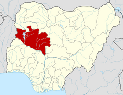
 Magama Location in Nigeria | |
| Coordinates: 10°28′N5°03′E / 10.467°N 5.050°E | |
| Country | |
| State | Niger State |
| Government | |
| • Local Government Chairman and the Head of the Local Government Council | Idris Aliyu Babangida |
| Area | |
• Total | 4,107 km2 (1,586 sq mi) |
| Population (2006 census) | |
• Total | 181,653 |
| Time zone | UTC+1 (WAT) |
| 3-digit postal code prefix | 923 |
| ISO 3166 code | NG.NI.MM |
Magama is a Local Government Area in Niger State, Nigeria. Its headquarters are in the town of Nasko in the west of the area.
Contents
It has an area of 4,107 km2 and a population of 181,653 at the 2006 census.
The postal code of the area is 923. [1]