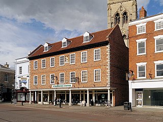
Magnus, Newark-on-Trent

Last updated

Magnus [1]
Winchilsea Avenue towards Magnus CE school, Newark - geograph.org.uk - 2681676.jpg
Winchilsea Avenue, Newark-on-Trent
Nottinghamshire UK location map.svg
Red pog.svg
Magnus [4]
Location within Nottinghamshire
  London 125 mi (201 km)  S
Civil parish
District
Shire county
Region
Country England
Sovereign state United Kingdom
Post town Newark
Postcode district NG24
Dialling code 01636
Police Nottinghamshire
Fire Nottinghamshire
Ambulance East Midlands
List of places
UK
England
Nottinghamshire
53°03′59″N0°48′20″W / 53.066289°N 0.805605°W / 53.066289; -0.805605

Magnus is a ward [5] and suburb [6] of Newark-on-Trent in the Newark & Sherwood district in the county of Nottinghamshire, England. It is one of the seven wards on Newark Town Council. [7]

Geography and amenities

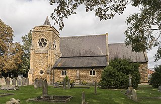
Christ Church, Boundary Street, Newark Christ Church, Newark - geograph.org.uk - 6696991.jpg
Christ Church, Boundary Street, Newark

While Magnus is only a ward of the town council, it covers an area between Bowbridge Lane, Boundary Street, and London Road. [8] it is mentioned in multiple places around Newark. [9] These include:

Related Research Articles

<span class="mw-page-title-main">Newark-on-Trent</span> Market town in Nottinghamshire, England

Newark-on-Trent or Newark is a market town and civil parish in the Newark and Sherwood district in Nottinghamshire, England. It is on the River Trent, and was historically a major inland port. The A1 road bypasses the town on the line of the ancient Great North Road. The town's origins are likely to be Roman, as it lies on a major Roman road, the Fosse Way. It grew up around Newark Castle, St Mary Magdalene church and later developed as a centre for the wool and cloth trades.

<span class="mw-page-title-main">City of St Albans</span> Local authority district in England

St Albans, also known as the City and District of St Albans, is a non-metropolitan district with both borough and city status in Hertfordshire, England. Its council is based in St Albans, the largest settlement in the district. The district also includes the town of Harpenden and several villages. The district borders North Hertfordshire, Welwyn Hatfield, Hertsmere, Watford, Three Rivers, Dacorum, and Central Bedfordshire.

<span class="mw-page-title-main">Cherwell (district)</span> Non-metropolitan district in England

Cherwell is a local government district in northern Oxfordshire, England. The district was created in 1974 and takes its name from the River Cherwell, which drains south through the region to flow into the River Thames at Oxford. Towns in Cherwell include Banbury and Bicester. Kidlington is a contender for largest village in England.

<span class="mw-page-title-main">West Lindsey</span> District in England

West Lindsey is a local government district in Lincolnshire, England. Its council is based in Gainsborough, the district's largest town. The district also includes the towns of Caistor and Market Rasen, along with numerous villages and surrounding rural areas. The east of the district includes part of the Lincolnshire Wolds, a designated Area of Outstanding Natural Beauty.

<span class="mw-page-title-main">Borough of Melton</span> Borough and non-metropolitan district in England

Melton is a local government district with borough status in north-eastern Leicestershire, England. It is named after its only town, Melton Mowbray. The borough also includes numerous villages and surrounding rural areas. The north of the district includes part of the Vale of Belvoir. Melton is the least populous district of its type and the fourth least populous district in England overall.

<span class="mw-page-title-main">Borough of Erewash</span> Borough in eastern Derbyshire, England

Erewash is a local government district with borough status in Derbyshire, England. The borough is named after the River Erewash. The council has offices in both the borough's towns of Ilkeston and Long Eaton. The borough also includes several villages and surrounding rural areas. Some of the built-up areas in the east of the borough form part of the Nottingham Urban Area.

<span class="mw-page-title-main">North Kesteven</span> District in England

North Kesteven is a local government district in Lincolnshire, England. The council is based in Sleaford. The district also contains the town of North Hykeham, which adjoins the neighbouring city of Lincoln, along with numerous villages and surrounding rural areas.

<span class="mw-page-title-main">Newark and Sherwood</span> Non-metropolitan local government district in Nottinghamshire, England

Newark and Sherwood is a local government district in Nottinghamshire, England. It is the largest district by area in the county. The council is based in Newark-on-Trent, the area's largest town. The district also includes the towns of Southwell and Ollerton along with a large rural area containing many villages. Much of the district lies within the ancient Sherwood Forest and there are also extensive forestry plantations in the area.

<span class="mw-page-title-main">Test Valley</span> Borough and non-metropolitan district in England

Test Valley is a local government district with borough status in Hampshire, England, named after the valley of the River Test. The council is based in the borough's largest town of Andover. The borough also contains the town of Romsey and numerous villages and surrounding rural areas. A small part of the borough at its southern end lies within the New Forest National Park, and part of the borough north of Andover lies within the North Wessex Downs, a designated Area of Outstanding Natural Beauty.

<span class="mw-page-title-main">Borough of Wyre</span> Borough and non-metropolitan district in England

Wyre is a local government district with borough status on the coast of Lancashire, England. The council is based in Poulton-le-Fylde and the borough also contains the towns of Cleveleys, Fleetwood, Garstang, Preesall and Thornton, along with numerous villages and surrounding rural areas. Some of the borough's built-up areas form part of the wider Blackpool urban area. Eastern parts of the borough lie within the Forest of Bowland, a designated Area of Outstanding Natural Beauty.

<span class="mw-page-title-main">Rushcliffe</span> Non-metropolitan district and borough in England

Rushcliffe is a local government district with borough status in south Nottinghamshire, England. Its council is based in West Bridgford. The borough also includes the towns of Bingham and Cotgrave as well as numerous villages and surrounding rural areas. Some of the built-up areas in the north-west of the borough, including West Bridgford, form part of the Nottingham Urban Area.

<span class="mw-page-title-main">Dover District</span> Non-metropolitan district in England

Dover is a local government district in Kent, England. It is named after its largest town, the port town of Dover. The council is based in Whitfield on the outskirts of Dover. The district also covers the towns of Deal, Sandwich and Walmer as well as the surrounding rural areas.

<span class="mw-page-title-main">Epping Forest District</span> Non-metropolitan district in England

Epping Forest District is a local government district in Essex, England. It is named after the ancient woodland of Epping Forest, a large part of which lies within the district. The district covers northeastern parts of the urban area of London, including the suburban towns of Epping, Loughton, Waltham Abbey, Chigwell, and Buckhurst Hill, as well as rural areas beyond it. The district is situated in the west of the county, bordering north-eastern Greater London.

<span class="mw-page-title-main">Borough of Basildon</span> Non-metropolitan district and borough in England

The Borough of Basildon is a local government district with borough status in Essex, England. It is named after its largest town, Basildon, where the council is based. The borough also includes the towns of Billericay and Wickford and surrounding rural areas.

<span class="mw-page-title-main">Rochford District</span> Non-metropolitan district in England

Rochford is a local government district in Essex, England. It is named after one of its main settlements, Rochford, where the council is based. The largest town in the district is Rayleigh. Other places in the district include Hockley, Ashingdon, Great Wakering, Canewdon and Hullbridge.

<span class="mw-page-title-main">Borough of Brentwood</span> District in Essex, England

The Borough of Brentwood is a local government district with borough status in Essex, England. The borough is named after its main town of Brentwood, where the council is based; it includes several villages and the surrounding rural area.

<span class="mw-page-title-main">Newark (UK Parliament constituency)</span> Parliamentary constituency in the United Kingdom, 1885 onwards

Newark is a constituency in Nottinghamshire, England. It is represented by Robert Jenrick of the Conservative Party, who won the seat in a by-election on 5 June 2014, following the resignation of Patrick Mercer in April 2014.

<span class="mw-page-title-main">Southwell, Nottinghamshire</span> Cathedral town in Nottinghamshire, England

Southwell is a minster and market town, and a civil parish, in the district of Newark and Sherwood in Nottinghamshire, England. It is home to the grade-I listed Southwell Minster, the cathedral of the Anglican Diocese of Southwell and Nottingham. The population of the town was recorded at 7,491 in the 2021 census.

<span class="mw-page-title-main">Castle, Newark-on-Trent</span> Suburb and ward of Newark-on-Trent in Nottinghamshire, England

Castle is a ward and suburb of Newark-on-Trent, in the Newark & Sherwood district in the county of Nottinghamshire, England. It is one of the seven wards on Newark Town Council.

<span class="mw-page-title-main">Devon, Newark-on-Trent</span> Suburb and ward of Newark-on-Trent in Nottinghamshire, England

Devon is a ward and suburb of Newark-on-Trent, in the Newark & Sherwood district in the county of Nottinghamshire, England. It is one of the seven wards on Newark Town Council.

References

  1. "Your Town Councillors". www.newark.gov.uk. Retrieved 26 September 2024.
  2. "Your Town Councillors". www.newark.gov.uk. Retrieved 26 September 2024.
  3. "Your Town Councillors". www.newark.gov.uk. Retrieved 26 September 2024.
  4. "Your Town Councillors". www.newark.gov.uk. Retrieved 26 September 2024.
  5. "Election results for NEWARK TOWN COUNCIL - SLEAFORD WARD, 4 May 2023". democracy.newark-sherwooddc.gov.uk. 4 May 2023. Retrieved 6 October 2024.
  6. "Local elections 2023: Big changes in councils across district". Newark Advertiser. 5 May 2023. Retrieved 6 October 2024.
  7. Fisher, Stuart (19 December 2013). British River Navigations: Inland Cuts, Fens, Dikes, Channels and Non-tidal Rivers. A&C Black. ISBN   978-1-4729-0084-5 . Retrieved 6 October 2024.
  8. Cooper, Chris (30 May 2013). The Great North Road: Then and Now. After the Battle. ISBN   978-1-3990-7650-0 . Retrieved 6 October 2024.
  9. "Is this the worst street in Newark for potholes?". Newark Advertiser. 8 December 2023. Retrieved 6 October 2024.
  10. "Home". Magnus C of E Academy. Retrieved 6 October 2024.
  11. "Based In Newark | Magnus Community Sports Center | Newark". magnussports. Retrieved 6 October 2024.
  12. Frecknall, Trevor (30 August 2014). Newark in the Great War. Pen and Sword. ISBN   978-1-4738-3869-7 . Retrieved 6 October 2024.