
This article is about the demographic features of the population of Botswana, including population density, ethnicity, education level, health of the populace, economic status, religious affiliations and other aspects of the population.
Ramotswa is a village in South-East District of Botswana, southwest of the capital of Gaborone. The population was 27,760 in 2011 census. It is the tribal capital of the BaLete, an ethnic majority springing from the Nguni tribe.

Kgalagadi is a district in southwest Botswana, lying along the country's border with Namibia and South Africa. The administrative center is Tsabong. The district of Kgalagadi covers a large part of the Kalahari Desert. It has a total area of 105,200 km² and has a population of 42,000 (2001). More than one-third of the district is covered by the Kgalagadi Transfrontier Park, which extends into South Africa, and which is a major tourist attraction.

The North-East District is one of the administrative districts of Botswana. Its capital is Francistown. In 2011, North-East had a population of 60,264 people. The district is predominantly occupied by Kalanga-speaking people, the BaKalanga. The district is administered by a district administration and district council, which are responsible for local administration.

The North-West District or Ngamiland is one of the first-level administrative subdivisions of Botswana. For census and administrative purposes Ngamiland is subdivided into Ngamiland East, Ngamiland West and Ngamiland Delta (Okavango). It is governed by a District Commissioner, appointed by the national government, and the elected North-West District Council. The administrative centre is Maun.

Gumare or Gomare is a rural village located in the North-West District of Botswana, near the Okavango Delta. The population of Gumare was 6,067 in 2001 census, but had risen to 8,532 iby the 2011 census.
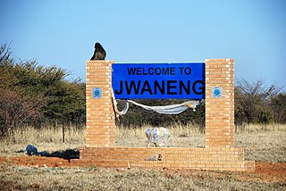
Jwaneng is a town located in the Southern District of Botswana, but it is not part of this, being a separate district, with its own Town Council.

Kasane is a town in Botswana, close to Africa's 'Four Corners', where four countries almost meet: Botswana, Namibia, Zambia and Zimbabwe. It is at the far north-eastern corner of Botswana where it serves as the administrative center of the Chobe District. The population of Kasane was 9,244 in 2011 census.
Letlhakane is a village in the Central District of Botswana. Letlhakane is the headquarters of the Boteti sub-district. It is located south of Mmatshumo and the population of the village was 22,911 in 2011 census.
Kanye is a village in southern Botswana, located 83 kilometres (52 mi) south-west of the capital, Gaborone. It is the administrative centre of the Southern District, and had a population of 45,196 at the 2011 census, making it the eighth-largest village in the country. Kanye is the traditional capital of the Ngwaketse tribe, who first settled in the area in the 1790s. The town is the longest continuously occupied tribal capital in the country.

Shakawe is a village located in the northwest corner of Botswana at the beginning of the Okavango Delta, close to Namibia and Angola. Shakawe is awakening from its former status as a sleepy little outpost on the Okavango. For travellers, Shakawe means a Botswana entry or exit stamp or a staging post for a visit to the Tsodilo Hills, 40 km away. For Southern African holiday-makers, it is most often the start of a fishing trip in the Okavango Panhandle. It also provides access to the Caprivi Strip. The record high temperature ever registered in Shakawe was 39.6 °C (103.3 °F). The lowest temperature registered in Shakawe was −6.1 °C (21.0 °F).
Botswana is experiencing one of the most severe HIV/AIDS epidemics in the world. The national HIV prevalence rate among adults ages 15 to 49 is 24.8 percent, which is the third highest in the world, behind Lesotho and Eswatini. HIV/AIDS threatens the many developmental gains Botswana has achieved since its independence in 1966, including economic growth, political stability, a rise in life expectancy, and the establishment of functioning public educational and health care systems.
Bogogobo is a village in Kgalagadi District of Botswana. It is located close to the border with South Africa and has a primary school. The population was 360 in 2011 census.
Gabane is a village in Kweneng District of Botswana. It is located 15 km (10 mi) west of Gaborone, the capital of Botswana. The population was 10,399 in 2001 census, making it the fourth largest settlement in Kweneng. Its population was 14,842 at the 2011 census. It's now part of Gaborone agglomeration home to 421,907 inhabitants at the 2011 census.
Lerala is a village in Central District of Botswana. The village is located at the south-eastern end of the Tswapong Hills, 30 km (19 mi) from the Limpopo River and the border with South Africa and approximately 90 km (56 mi) east of Palapye. The population of Lerala was 6,871 in the 2011 census, which was a 20.5% increase from the 2001 population.
Otse is a village in the South-East District of Botswana. It is located 60 km south of Gaborone, along the Gaborone–Lobatse road and close to the border with South Africa. This village is home to the Balete people who are related to those in Ramotswa, Gabane and Mogobane. The population was 7,636 in 2011 census.
Kumakwane is a village in Kweneng District of Botswana. It is located 25 km west of the capital of Botswana, Gaborone. The population was 9,595 in 2011 census.
Mmopane is a village in the Kweneng District of Botswana. The village is located around 15 km from Gaborone, the capital of Botswana. The population was 3,512 in 2001 census and 14,655 at the 2011 census. It's now part of Gaborone agglomeration home to 421,907 inhabitants at the 2011 census.
Kopong is a small village in Kweneng District of Botswana. It is located around 25 km north of Gaborone, the capital of Botswana. The population was 5,571 in 2001 census and 9,520 at the 2011 census, making it the sixth largest settlement in Kweneng. It is now becoming a suburb of Gaborone agglomeration home to 421,907 inhabitants at the 2011 census.
