Malerkotla district

Last updated
Malerkotla district
Eidgah, Malerkotla 1.jpg
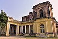
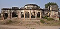
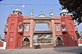
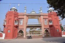
Eidgah in Malerkotla
Malerkotla in Punjab (India).svg
Location in Punjab
Coordinates: 30°32′N75°53′E / 30.53°N 75.88°E / 30.53; 75.88
Country Flag of India.svg  India
State Emblem of Punjab (India) on a white background (1).png Punjab
DivisionPatiala
Established02 June 2021
Headquarters Malerkotla
Government
   Deputy Commissioner Sh.Sanyam Agarwal, IAS
   Senior Superintendent of Police Smt. Alka Meena IPS
Area
  Total
684 km2 (264 sq mi)
Population
 (2011)
  Total
429,754
  Rank23rd
  Density629/km2 (1,630/sq mi)
Languages
  Official Punjabi
Time zone UTC+5:30 (IST)
PIN
148XXX
Vehicle registration PB-28(for Malerkotla)
PB-76(for Ahmedgarh)
PB-82(for Ahmedgarh SDM)
PB-92(for Amargarh)
Headquarters Malerkotla
Sex ratio 896 /
Literacy76.28%
Lok Sabha constituency Sangrur
Fatehgarh Sahib
Punjab Legislative Assembly constituency2

Malerkotla

Amargarh
Precipitation 450 millimetres (18 in)
Avg. summer temperature48 °C (118 °F)
Avg. winter temperature7 °C (45 °F)
Website malerkotla.nic.in

Malerkotla district is a district in Punjab state of India. It was formed after the bifurcation of Sangrur district. Malerkotla district was carved out of Sangrur and became the 23rd district of Punjab on 02 June, 2021, on the occasion of Eid. [1] District Malerkotla is divided into three Tahsils: Malerkotla, Amargarh and Ahmedgarh. [2]

Contents

History

Malerkotla was a princely state from 1454 until 20 August 1948, when it become a part of formed Patiala and East Punjab States Union (PEPSU). Within PEPSU, it was incorporated into Sangrur district. Amargarh region, on the other hand, had been part of Patiala State before 1948 [3] and was also merged into Sangrur district under PEPSU. In 1956, PEPSU was dissolved and merged into the state of Punjab.

Administration

Malerkotla district is in the state of Punjab in northern India. It is the 23rd district in the Indian state of Punjab. [4]

On 2 June 2021, Malerkotla was carved out of Sangrur to become the 23rd district of Punjab. The new district comprises three subdivisions: Malerkotla, Amargarh, and Ahmedgarh. [5]

Demographics

Population

Malerkotla district has a population of 429,754 according to the 2011 census. [6] It has an area of 684 Sq Km. It has 3 revenue divisions , municipalities & CD Blocks. There are 175 Gram Panchayats & 192 villages. 40.50% of the population lives in urban areas. Scheduled Castes make up 93,047 (21.65%) of the population. [7]

Religion

Sikhism is the majority religion, and is mainly rural. Unlike the rest of erstwhile Punjab, the Muslims of Malerkotla did not move to Pakistan during Partition and Malerkotla still has a sizeable minority of Muslims. [1] Hindus are the third-largest community in urban areas. [8]

Religion in Malerkotla district (2011) [8]
ReligionPercent
Sikhism
50.89%
Islam
33.26%
Hinduism
15.19%
Other or not stated
0.66%
Religious groups in Malerkotla State (British Punjab province era)
Religious
group
1881 [9] [10] [11] 1891 [12] 1901 [13] 1911 [14] [15] 1921 [16] 1931 [17] 1941 [18]
Pop. %Pop.%Pop.%Pop.%Pop.%Pop.%Pop.%
Sikhism Khanda.svg 28,9317,62510,49521,01821,82828,98230,320
Islam Star and Crescent.svg 24,61626,86627,22925,94228,41331,41733,881
Hinduism Om.svg [a] 16,17839,97338,40922,90229,45921,25223,482
Jainism Jain Prateek Chihna.svg 1,3231,2761,3611,2685851,286310
Christianity Christian cross.svg 315121437135116
Zoroastrianism Faravahar.svg 0000000
Buddhism Dharma Wheel (2).svg 0000000
Judaism Star of David.svg 000000
Others0000000
Total population71,05175,75577,50671,14480,32283,07288,109
Note1: British Punjab province era district borders are not an exact match in the present-day due to various bifurcations to district borders — which since created new districts — throughout the historic Punjab Province region during the post-independence era that have taken into account population increases.

Note2: British Punjab province era figures are for Malerkotla State.

Language

Languages of Malerkotla district (2011) [19]
  1. Punjabi (96.69%)
  2. Urdu (3.21%)
  3. Others (1.1%)

Politics

Malerkotla district is part of the Malerkotla Assembly constituency. Mohammad Jamil Ur Rehman (AAP) is the MLA since 2022. [20]

The district is part of the Sangrur Lok Sabha constituency. By-election to Sangrur Lok Sabha constituency was held on 23 June 2022 and Simranjit Singh Mann was selected as the MP. [21]

Notable people

Monuments and attractions of Malerkotla

See also

Notes

  1. 1931-1941: Including Ad-Dharmis

References

  1. 1 2 "Punjab CM declares state's only Muslim-majority town Malerkotla as district on Eid" . Retrieved 2021-05-18.
  2. Malerkotla tahsil
  3. Punjab Phulkian States Gazetteers, Volume XVII-A, 1904, p. 139. Available at Archive.org
  4. "Malerkotla is Punjab's 23rd district". The Hindu. 2021-05-14. ISSN   0971-751X . Retrieved 2021-05-14.
  5. About Malerkotla district
  6. "Demography | District Malerkotla, Government of Punjab | India" . Retrieved 2022-05-16.
  7. "District Census Handbook: Sangrur" (PDF). Census of India. Registrar General and Census Commissioner of India. 2011.
  8. 1 2 "Table C-01 Population by Religious Community: Punjab". censusindia.gov.in. Registrar General and Census Commissioner of India.
  9. "Census of India, 1881 Report on the Census of the Panjáb Taken on the 17th of February 1881, vol. I." 1881. JSTOR   saoa.crl.25057656 . Retrieved 26 December 2024.
  10. "Census of India, 1881 Report on the Census of the Panjáb Taken on the 17th of February 1881, vol. II". 1881. p. 14. JSTOR   saoa.crl.25057657 . Retrieved 26 December 2024.
  11. "Census of India, 1881 Report on the Census of the Panjáb Taken on the 17th of February 1881, vol. III". 1881. p. 14. JSTOR   saoa.crl.25057658 . Retrieved 26 December 2024.
  12. "The Punjab and its feudatories, part II--Imperial Tables and Supplementary Returns for the British Territory". 1891. p. 14. JSTOR   saoa.crl.25318669 . Retrieved 26 December 2024.
  13. "Census of India 1901. [Vol. 17A]. Imperial tables, I-VIII, X-XV, XVII and XVIII for the Punjab, with the native states under the political control of the Punjab Government, and for the North-west Frontier Province". 1901. p. 34. JSTOR   saoa.crl.25363739 . Retrieved 30 March 2024.
  14. "Census of India 1911. Vol. 14, Punjab. Pt. 2, Tables". 1911. p. 27. JSTOR   saoa.crl.25393788 . Retrieved 30 March 2024.
  15. Kaul, Harikishan (1911). "Census Of India 1911 Punjab Vol XIV Part II". p. 27. Retrieved 30 March 2024.
  16. "Census of India 1921. Vol. 15, Punjab and Delhi. Pt. 2, Tables". 1921. p. 29. JSTOR   saoa.crl.25430165 . Retrieved 30 March 2024.
  17. "Census of India 1931. Vol. 17, Punjab. Pt. 2, Tables". 1931. p. 277. JSTOR   saoa.crl.25793242 . Retrieved 30 March 2024.
  18. "Census of India, 1941. Vol. 6, Punjab". 1941. p. 42. JSTOR   saoa.crl.28215541 . Retrieved 30 March 2024.
  19. 1 2 "Table C-16 Population by Mother Tongue: Punjab". censusindia.gov.in. Registrar General and Census Commissioner of India.
  20. "Election results" . Retrieved 26 May 2022.
  21. "Sangrur Lok Sabha bypoll on June 23". Tribuneindia News Service. Retrieved 26 May 2022.