The Jaú National Park is a national park located in the state of Amazonas, Brazil. It is one of the largest forest reserves in South America, and part of a World Heritage Site.

Tefé, known in early accounts as Teffé, is a municipality in the state of Amazonas, northern Brazil.

Lábrea is the southernmost municipality in the Brazilian state of Amazonas.
Manoel Urbano is a municipality located in the center-western region of the Brazilian state of Acre. As of 2010 it was one of the poorest municipalities in Brazil, with a low Human Development Index.
Sena Madureira is a municipality located in the center of the Brazilian state of Acre. Its population is 46,511 and its area is 25,278 square kilometres (9,760 sq mi), making it the largest municipality in the state. It has a climate which combines temperatures of 78 °F (26 °C) with humidities in the upper 90s percent, all year round. It is 143 km from Rio Branco. The oldest church in Acre state is located in Sena Madureira, the Nossa Senhora da Imaculada Conceição Church (1910).

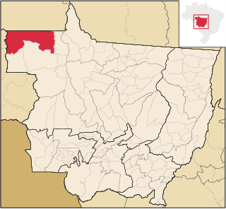
Barcelos, formerly Mariuá, is a municipality located in the State of Amazonas, northern Brazil. Its population was 27,638 (2020) and its area is 122,476 square kilometres (47,288 sq mi), making it the second largest municipality in Brazil, equivalent in size to New York state in the United States and slightly larger than North Korea.

Borba is a municipality in the state of Amazonas in northern Brazil.

Canutama is a municipality located in the Brazilian state of Amazonas, considered third largest city of the Purus Medium after Lábrea and Tapauá.

Iranduba is a municipality located in the Brazilian state of Amazonas.

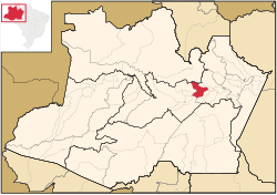
Itapiranga is a municipality located in the state of Amazonas northern Brazil on the left bank of the Solimões River about 200 km east of Manaus. Its population was 9,230 (2020) and its area is 4,231 km2.

Jutaí is a municipality located in the Brazilian state of Amazonas. Its population is 13,886 (2020) and its area is 69,552 km², making it the fifth largest municipality in Amazonas by area and the ninth largest in Brazil.

Maués is a municipality located in the Brazilian state of Amazonas. Its population was 65,040 (2020) and its area is 39,988 km2.

Novo Aripuanã is a municipality located in the Brazilian state of Amazonas.

Presidente Figueiredo is a municipality located in the Brazilian state of Amazonas. Its population was 37,193 (2020) and its area is 25,422 km2.

Novo Airão is a municipality located in the state of Amazonas in northern Brazil on the Rio Negro River about 180 km upstream of Manaus. Its population was 19,928 (2020) and its area is 37,771 km2. The town is accessible by both river and road.
Colniza is a municipality in the state of Mato Grosso, Brazil.

Anavilhanas National Park is a national park that encompasses a huge river archipelago in the Rio Negro in the state of Amazonas, Brazil. It is part of a World Heritage Site.
The Rio Negro Right Bank Environmental Protection Area is an Environmental protection area (APA) in the state of Amazonas, Brazil.
The Rio Negro Sustainable Development Reserve is a sustainable development reserve (RDS) in the state of Amazonas, Brazil.

The Lower Rio Negro Mosaic (Portuguese: Mosaico do Baixo Rio Negro is a protected area mosaic in the state of Amazonas, Brazil. It coordinates between eleven conservation units of different types in the Amazon rainforest to the northwest of the state capital, Manaus.