Fonte Boa, Amazonas

Last updated • a couple of secsFrom Wikipedia, The Free Encyclopedia
Fonte Boa
Bandeira de Fonte Boa AM.svg
Fonte Boa - brasao.jpg
Fonte Boa.svg
Location of the municipality inside Amazonas
Brazil location map.svg
Red pog.svg
Fonte Boa
Location in Brazil
Coordinates: 2°30′50″S66°5′30″W / 2.51389°S 66.09167°W / -2.51389; -66.09167
Country Flag of Brazil.svg  Brazil
Region North
State Bandeira do Amazonas.svg Amazonas
Population
 (2020)
  Total
17,005
Time zone UTC−4 (AMT)

Fonte Boa (literally, "good water spring") is a municipality located in the Brazilian state of Amazonas. Its population was 17,005 (2020) [1] and its area is 12,111 km2. [2]

Contents

The city is served by Fonte Boa Airport.

One of the city's best-known attractions is the Pirarucu Festival, which celebrates the annual fishing of the fish.

Geography

The municipality contains 45% of the 146,950 hectares (363,100 acres) Auatí-Paraná Extractive Reserve, created in 2001. [3]

Climate

Climate data for Fonte Boa, Amazonas (1981–2010, extremes 1925–present)
MonthJanFebMarAprMayJunJulAugSepOctNovDecYear
Record high °C (°F)37.0
(98.6)
36.5
(97.7)
37.5
(99.5)
36.0
(96.8)
35.7
(96.3)
34.7
(94.5)
36.3
(97.3)
37.3
(99.1)
37.0
(98.6)
38.0
(100.4)
37.6
(99.7)
36.5
(97.7)
38.0
(100.4)
Mean daily maximum °C (°F)31.7
(89.1)
31.8
(89.2)
31.7
(89.1)
31.4
(88.5)
31.1
(88.0)
30.9
(87.6)
31.3
(88.3)
32.3
(90.1)
32.6
(90.7)
32.8
(91.0)
32.4
(90.3)
32.0
(89.6)
31.8
(89.2)
Daily mean °C (°F)26.7
(80.1)
26.8
(80.2)
26.6
(79.9)
26.5
(79.7)
26.3
(79.3)
26.0
(78.8)
26.2
(79.2)
26.5
(79.7)
26.8
(80.2)
27.1
(80.8)
26.9
(80.4)
26.8
(80.2)
26.6
(79.9)
Mean daily minimum °C (°F)22.8
(73.0)
23.3
(73.9)
22.8
(73.0)
22.8
(73.0)
22.6
(72.7)
22.3
(72.1)
22.1
(71.8)
22.4
(72.3)
22.5
(72.5)
22.9
(73.2)
22.9
(73.2)
22.9
(73.2)
22.7
(72.9)
Record low °C (°F)19.0
(66.2)
18.0
(64.4)
19.0
(66.2)
13.0
(55.4)
18.4
(65.1)
16.2
(61.2)
14.5
(58.1)
15.0
(59.0)
12.0
(53.6)
19.4
(66.9)
17.9
(64.2)
14.4
(57.9)
12.0
(53.6)
Average precipitation mm (inches)237.9
(9.37)
207.9
(8.19)
257.3
(10.13)
278.0
(10.94)
271.2
(10.68)
215.4
(8.48)
179.4
(7.06)
134.7
(5.30)
146.1
(5.75)
188.0
(7.40)
176.6
(6.95)
216.6
(8.53)
2,509.1
(98.78)
Average precipitation days (≥ 1.0 mm)171517181917141212131316183
Average relative humidity (%)89.189.390.390.290.190.289.088.587.687.488.088.389.0
Mean monthly sunshine hours 129.0116.5114.0107.1118.6125.0149.0170.8165.4159.9143.1125.31,623.7
Source 1: Instituto Nacional de Meteorologia [4]
Source 2: Meteo Climat (record highs and lows) [5]

Related Research Articles

<span class="mw-page-title-main">Guaíra, Paraná</span> Municipality in South, Brazil

Guaíra is a municipality in the state of Paraná in the Southern Region of Brazil. The population is 33,310 in an area of 560 km2. The elevation is 517 m. This place name comes from the Tupi language and means "place difficult to access". It borders the Paraguayan city of Salto del Guairá, across the Paraná River, which marks the border between Brazil and Paraguay. Just like its Paraguayan twin city, it is named after the Guaíra Falls, which was located on the border with Paraguay. The falls was submerged after the construction of the Itaipu Dam in 1982.

<span class="mw-page-title-main">Paranaguá</span> Municipality in South, Brazil

Paranaguá is a city in the state of Paraná in Brazil. Founded in 1648, it is Paraná's oldest city. It is known for the Port of Paranaguá, which serves as both the sea link for Curitiba, 110 kilometres (68 mi) to the west and the capital of Paraná, and as one of the largest ports of Brazil.

<span class="mw-page-title-main">Picos</span> Municipality in Nordeste, Brazil

Picos is a municipality in the state of Piauí in the Northeast region of Brazil. Picos is the state's third-largest city, located in the south-central region of Piauí and is the most economically developed city in the region. The city's financial prosperity, combined with its geographical location, gives Picos a "commercial hub" status, especially for fuel and honey. As of 2020, the population was approximately 78,431.

The Mamirauá Sustainable Development Reserve in the Brazilian state of Amazonas, near the city of Tefé, is a 4,300-square-mile (11,000 km2) reserve near the village of Boca do Mamirauá. It includes mostly Amazonian flooded forest and wetlands. The ribeirinhos are native to the area.

Ampére is a municipality in the state of Paraná in the Southern Region of Brazil.

<span class="mw-page-title-main">Piraí do Sul</span> Municipality in Southern, Brazil

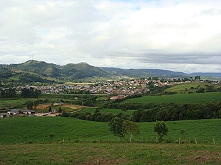
Piraí do Sul is a municipality in the state of Paraná in the Southern Region of Brazil.

<span class="mw-page-title-main">Carambeí</span> Municipality in South, Brazil

Carambeí is a municipality in the state of Paraná in the Southern Region of Brazil. The city originated from a farm that was an obligatory stop on the Caminho do Viamão between the central-west region of Rio Grande do Sul and the state of São Paulo. It was founded on April 4, 1911, by a group of Dutch immigrants and developed from the Cooperativa Batavo.

<span class="mw-page-title-main">Castro, Paraná</span> Municipality in South, Brazil

Castro is a municipality in the state of Paraná in the Southern Region of Brazil. In 2020 it had a population of 71,809 people. The main road running through the town is the PR-151 road.

<span class="mw-page-title-main">Clevelândia</span> Municipality in Southern, Brazil

Clevelândia is a municipality in the state of Paraná in the Southern Region of Brazil. Its name is an homage to American president Grover Cleveland.

Boa Ventura de São Roque is a municipality in the state of Paraná in the Southern Region of Brazil.

<span class="mw-page-title-main">São José da Boa Vista</span> Municipality in Southern, Brazil

São José da Boa Vista is a municipality in the state of Paraná in the Southern Region of Brazil.

Boa Vista da Aparecida is a municipality in the state of Paraná in the Southern Region of Brazil.

Mallet, Paraná is a municipality in the state of Paraná in the Southern Region of Brazil.

Barracão is a municipality in the state of Paraná in the Southern Region of Brazil. Barracão is part of a triple border with the state of Santa Catarina and the country of Argentina, with the border running through the middle of the municipality's urban center.

Boa Esperança do Iguaçu is a municipality in the state of Paraná in the Southern Region of Brazil.

Bom Jesus do Sul is a municipality in the state of Paraná in the Southern Region of Brazil.

Manfrinópolis is a municipality in the state of Paraná in the Southern Region of Brazil.

Marmeleiro is a municipality in the state of Paraná in the Southern Region of Brazil.

Boa Esperança is a municipality in the state of Paraná in the Southern Region of Brazil.

The Auatí-Paraná Extractive Reserve is an extractive reserve is Amazonas, Brazil.

References

  1. IBGE 2020
  2. IBGE - "Archived copy". Archived from the original on June 11, 2008. Retrieved June 11, 2008.{{cite web}}: CS1 maint: archived copy as title (link)
  3. RESEX Auatí-Paraná (in Portuguese), ISA: Instituto Socioambiental, retrieved 2016-10-21
  4. "Normais Climatológicas Do Brasil 1981–2010" (in Portuguese). Instituto Nacional de Meteorologia. Retrieved 26 October 2018.
  5. "Station Fonte Boa" (in French). Meteo Climat. Retrieved 26 October 2018.