
Jutaí is a municipality located in the Brazilian state of Amazonas. Its population is 13,886 (2020) and its area is 69,552 km2, making it the fifth largest municipality in Amazonas by area and the ninth largest in Brazil.

Novo Aripuanã is a municipality located in the Brazilian state of Amazonas.
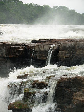
Guariba River is a river of the Mato Grosso and Amazonas states in north-western Brazil. It is a tributary of the Aripuanã River.
Sucunduri River is a river of Amazonas state in north-western Brazil, one of the main headwaters of the Canumã River.
Juruena National Park, declared in 2006, is the third largest national park of Brazil. It is located along the Juruena River, in the north of Mato Grosso state and the south of Amazonas state. It forms part of a corridor of protected areas that is meant to contain agricultural expansion into the Amazon rainforest.

The Campos Amazônicos National Park is a National park in the states of Rondônia, Amazonas and Mato Grosso, Brazil.
Acari National Park is a national park in the state of Amazonas, Brazil.
The Aripuanã National Forest is a national forest in the state of Amazonas, Brazil. It supports sustainable forestry, and also protects the environment, supports scientific research and protects the sustainable lifestyle of the traditional inhabitants of the forest.
Urupadi National Forest is a national forest (Brazil) in the state of Amazonas, Brazil.
Sucunduri State Park is a state park in the state of Amazonas, Brazil.
The Sucunduri State Forest is a state forest in the state of Amazonas, Brazil.
The Manicoré State Forest is a state forest in the state of Amazonas, Brazil.
The Aripuanã Sustainable Development Reserve is a sustainable development reserve in the state of Amazonas, Brazil.
The Aripuanã State Forest is a State forest in the state of Amazonas, Brazil.
The Apuí Mosaic is a protected area mosaic in the state of Amazonas, Brazil.
The Southern Amazon Mosaic is a protected area mosaic in Brazil.
The Guariba State Park is a State park in the state of Amazonas, Brazil.
The Guariba Extractive Reserve is an extractive reserve in the state of Amazonas, Brazil.
The Bararati Sustainable Development Reserve' is a sustainable development reserve in the state of Amazonas, Brazil.
The Apuí State Forest is a state forest in the state of Amazonas, Brazil.


