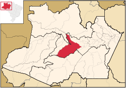
Geography
The municipal seat of Coari is one of the largest cities of the Amazonas state. It is the seat of the Roman Catholic Diocese of Coari. The area has reserves of oil and natural gas. Coari is served by Coari Airport located 6 km from downtown Coari. Porto Urucu Airport located in the district of Porto Urucu 470 km away serves the population residing and working for Petrobras.
The municipality is in the Juruá-Purus moist forests ecoregion. [2] It contains part of the Amanã Sustainable Development Reserve. [3] It contains a small portion of the 1,008,167-hectare (2,491,230-acre) Piagaçu-Purus Sustainable Development Reserve, established in 2003. [4] The municipality contains 66.15% of the 217,486-hectare (537,420-acre) Catuá-Ipixuna Extractive Reserve, established in 2003 as the first extractive reserve in the state of Amazonas. [5]
Climate
| Climate data for Coari (1981–2010, extremes 1961–present) |
|---|
| Month | Jan | Feb | Mar | Apr | May | Jun | Jul | Aug | Sep | Oct | Nov | Dec | Year |
|---|
| Record high °C (°F) | 36.9
(98.4) | 36.6
(97.9) | 36.4
(97.5) | 36.4
(97.5) | 36.0
(96.8) | 38.0
(100.4) | 39.8
(103.6) | 37.5
(99.5) | 38.3
(100.9) | 38.2
(100.8) | 38.3
(100.9) | 38.2
(100.8) | 39.8
(103.6) |
|---|
| Mean daily maximum °C (°F) | 31.8
(89.2) | 31.9
(89.4) | 32.0
(89.6) | 31.9
(89.4) | 31.7
(89.1) | 31.7
(89.1) | 32.2
(90.0) | 33.2
(91.8) | 33.3
(91.9) | 33.2
(91.8) | 32.6
(90.7) | 32.1
(89.8) | 32.3
(90.1) |
|---|
| Daily mean °C (°F) | 26.4
(79.5) | 26.4
(79.5) | 26.6
(79.9) | 26.6
(79.9) | 26.6
(79.9) | 26.4
(79.5) | 26.8
(80.2) | 27.4
(81.3) | 27.4
(81.3) | 27.3
(81.1) | 27.0
(80.6) | 26.8
(80.2) | 26.8
(80.2) |
|---|
| Mean daily minimum °C (°F) | 21.6
(70.9) | 21.8
(71.2) | 22.0
(71.6) | 22.0
(71.6) | 22.1
(71.8) | 21.9
(71.4) | 21.9
(71.4) | 22.2
(72.0) | 22.3
(72.1) | 22.4
(72.3) | 22.4
(72.3) | 22.2
(72.0) | 22.1
(71.8) |
|---|
| Record low °C (°F) | 14.6
(58.3) | 15.4
(59.7) | 10.6
(51.1) | 15.6
(60.1) | 14.0
(57.2) | 10.2
(50.4) | 11.0
(51.8) | 14.8
(58.6) | 15.0
(59.0) | 15.7
(60.3) | 16.4
(61.5) | 15.2
(59.4) | 10.2
(50.4) |
|---|
| Average precipitation mm (inches) | 264.5
(10.41) | 265.5
(10.45) | 322.3
(12.69) | 272.4
(10.72) | 213.1
(8.39) | 128.9
(5.07) | 87.2
(3.43) | 68.9
(2.71) | 100.4
(3.95) | 156.7
(6.17) | 215.6
(8.49) | 261.7
(10.30) | 2,357.2
(92.80) |
|---|
| Average precipitation days (≥ 1.0 mm) | 18 | 17 | 18 | 17 | 16 | 13 | 9 | 8 | 9 | 12 | 13 | 16 | 166 |
|---|
| Average relative humidity (%) | 85.6 | 84.9 | 84.9 | 85.0 | 85.1 | 83.9 | 80.8 | 78.1 | 78.8 | 79.7 | 81.9 | 83.6 | 82.7 |
|---|
| Mean monthly sunshine hours | 138.2 | 120.2 | 122.0 | 132.5 | 152.5 | 171.2 | 207.1 | 208.8 | 180.4 | 171.7 | 141.1 | 143.1 | 1,888.8 |
|---|
| Source 1: Instituto Nacional de Meteorologia [6] |
| Source 2: Meteo Climat (record highs and lows) [7] |
This page is based on this
Wikipedia article Text is available under the
CC BY-SA 4.0 license; additional terms may apply.
Images, videos and audio are available under their respective licenses.