Marantao, Lanao del Sur

Last updated
Marantao
Municipality
Municipality of Marantao
Ph locator lanao del sur marantao.png
Map of Lanao del Sur with Marantao highlighted
Philippines location map (square).svg
Red pog.svg
Marantao
Location within the Philippines
Coordinates: 7°57′00″N124°13′59″E / 7.95°N 124.233°E / 7.95; 124.233 Coordinates: 7°57′00″N124°13′59″E / 7.95°N 124.233°E / 7.95; 124.233
Country Flag of the Philippines.svg  Philippines
Region Autonomous Region in Muslim Mindanao (ARMM)
Province Lanao del Sur
District 1st District
Barangays 34 (see Barangays)
Government [1]
  Type Sangguniang Bayan
   Mayor Racma Bandrang K. Abinal
  Electorate 20,793 voters (2016)
Area [2]
  Total 660.00 km2 (254.83 sq mi)
Population (2015 census) [3]
  Total 32,974
  Density 50/km2 (130/sq mi)
Time zone PST (UTC+8)
ZIP code 9711
PSGC 153616000
IDD : area code +63(0)63
Climate type tropical climate
Income class 2nd municipal income class
Website www.marantao-lds.gov.ph

Marantao, officially the Municipality of Marantao, is a 2nd class municipality in the province of Lanao del Sur, Philippines. According to the 2015 census, it has a population of 32,974 people. [3]

Lanao del Sur Province in Bangsamoro Autonomous Region in Muslim Mindanao, Philippines

Lanao del Sur, officially the Province of Lanao del Sur, is a province in the Philippines located in the Bangsamoro Autonomous Region in Muslim Mindanao (BARMM). The capital is the city of Marawi, and it borders Lanao del Norte to the north, Bukidnon to the east, and Maguindanao and Cotabato to the south. To the southwest lies Illana Bay, an arm of the Moro Gulf.

Philippines Republic in Southeast Asia

The Philippines, officially the Republic of the Philippines, is an archipelagic country in Southeast Asia. Situated in the western Pacific Ocean, it consists of about 7,641 islands that are categorized broadly under three main geographical divisions from north to south: Luzon, Visayas, and Mindanao. The capital city of the Philippines is Manila and the most populous city is Quezon City, both part of Metro Manila. Bounded by the South China Sea on the west, the Philippine Sea on the east and the Celebes Sea on the southwest, the Philippines shares maritime borders with Taiwan to the north, Vietnam to the west, Palau to the east, and Malaysia and Indonesia to the south.

Contents

Kawayan Torogan

The Kawayan Torogan is the oldest known torogan in the Philippines. It is a traditional Maranao house built for royal Maranao families. There was once a campaign where the people wanted the municipalities of Marantao and Tugaya to pass an ordinance where the architectural scheme of the two towns will follow only the totogan style, in effect, preserve the Maranao people's most royal architectural style and lead to the first two towns with a planned town landscape under an indigenous Maranao architecture. However, the campaign led to deaf ears due to little funding available.

The Kawayan Torogan (also Torogan sa Kawayan)is a traditional Maranao torogan (house) built by Sultan sa Kawayan Makaantal in Bubung Malanding, Marantao, Lanao del Sur. Being the last standing example of the house of the elite members of the Maranao tribe, and the only remaining habitable torogan, it was declared as a National Cultural Treasure by the National Museum of the Philippines in 2008. The location of the structure is in Marawi City according to a 2008 declaration, however, the location was shifted into Marantao in 2015 according to another declaration. The recently updated 2018 PRECUP currently states that the Kawayan Torogan is in Pompongan-a-marantao, a barangay (village) of Marawi City, not of Marantao town. The confusion has caused scholars to push for the declaration of the kawayan torogan in Marantao as a National Cultural Treasure, as well. The National Commission for Culture and the Arts has no official statement regarding the issue yet.

Torogan

Torogan, is a traditional house built by the Maranao people of Lanao, Mindanao, Philippines. A torogan was a symbol of high social status. Such a residence was once a home to a sultan or Datu in the Maranao community. Nowadays, concrete houses are found all over Maranaw communities, but there remain torogans a hundred years old. The best-known are in Dayawan and Marawi City, and around Lake Lanao.

Barangays

Marantao is politically subdivided into 34 barangays.

Barangay administrative division in the Philippines

A barangay or baranggay (, formerly referred to as barrio, is the smallest administrative division in the Philippines and is the native Filipino term for a village, district or ward. In metropolitan areas, the term often refers to an inner city neighbourhood, a suburb or a suburban neighborhood. The word barangay originated from balangay, a kind of boat used by a group of Austronesian peoples when they migrated to the Philippines.

Poblacion or población is the common term used for the central, downtown, old town or central business district area of a Philippine city or municipality, which may take up the area of a single barangay or multiple barangays. It is sometimes shortened to Pob.

Demographics

Population census of Marantao
YearPop.±% p.a.
1918 3,640    
1939 6,783+3.01%
1948 2,494−10.52%
1960 13,720+15.26%
1970 15,861+1.46%
1975 16,496+0.79%
1980 11,777−6.52%
1990 18,404+4.57%
1995 20,942+2.45%
2000 24,647+3.55%
2007 32,075+3.70%
2010 28,550−4.15%
2015 32,974+2.78%
Source: Philippine Statistics Authority [3] [4] [5]

Related Research Articles

Tugaya, Lanao del Sur Municipality in Bangsamoro Autonomous Region in Muslim Mindanao, Philippines

Tugaya, officially the Municipality of Tugaya, is a 5th class municipality in the province of Lanao del Sur, Philippines. According to the 2015 census, it has a population of 23,814 people.

Ganassi, Lanao del Sur Municipality in Bangsamoro Autonomous Region in Muslim Mindanao, Philippines

Ganassi, officially the Municipality of Ganassi, is a 4th class municipality in the province of Lanao del Sur, Philippines. According to the 2015 census, it has a population of 23,016 people.

Bacolod-Kalawi Municipality in Bangsamoro Autonomous Region in Muslim Mindanao, Philippines

Bacolod-Kalawi, officially the Municipality of Bacolod-Kalawi, is a 3rd class municipality in the province of Lanao del Sur, Philippines. According to the 2015 census, it has a population of 20,841 people.

Balabagan Municipality in Bangsamoro Autonomous Region in Muslim Mindanao, Philippines

Balabagan, officially the Municipality of Balabagan, is a 4th class municipality in the province of Lanao del Sur, Philippines. According to the 2015 census, it has a population of 26,819 people.

Bayang Municipality in Bangsamoro Autonomous Region in Muslim Mindanao, Philippines

Bayang, officially the Municipality of Bayang, is a 5th class municipality in the province of Lanao del Sur, Philippines. According to the 2015 census, it has a population of 23,965 people.

Binidayan Municipality in Bangsamoro Autonomous Region in Muslim Mindanao, Philippines

Binidayan, officially the Municipality of Binidayan, is a 4th class municipality in the province of Lanao del Sur, Philippines. According to the 2015 census, it has a population of 22,079 people.

Buadiposo-Buntong Municipality in Bangsamoro Autonomous Region in Muslim Mindanao, Philippines

Buadiposo-Buntong, officially the Municipality of Buadiposo-Buntong, is a 4th class municipality in the province of Lanao del Sur, Philippines. According to the 2015 census, it has a population of 16,130 people.

Bubong, Lanao del Sur Municipality in Bangsamoro Autonomous Region in Muslim Mindanao, Philippines

Bubong, officially the Municipality of Bubong, is a 2nd class municipality in the province of Lanao del Sur, Philippines. According to the 2015 census, it has a population of 22,336 people.

Ditsaan-Ramain Municipality in Bangsamoro Autonomous Region in Muslim Mindanao, Philippines

Ditsaan-Ramain, officially the Municipality of Ditsaan-Ramain, is a 3rd class municipality in the province of Lanao del Sur, Philippines. According to the 2015 census, it has a population of 22,299 people.

Lumba-Bayabao Municipality in Bangsamoro Autonomous Region in Muslim Mindanao, Philippines

Lumba-Bayabao, officially the Municipality of Lumba-Bayabao, is a 2nd class municipality in the province of Lanao del Sur, Philippines. According to the 2015 census, it has a population of 36,151 people.

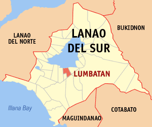
Lumbatan Municipality in Bangsamoro Autonomous Region in Muslim Mindanao, Philippines

Lumbatan, officially the Municipality of Lumbatan, is a 5th class municipality in the province of Lanao del Sur, Philippines. According to the 2015 census, it has a population of 19,105 people.

Madalum Municipality in Bangsamoro Autonomous Region in Muslim Mindanao, Philippines

Madalum, officially the Municipality of Madalum, is a 3rd class municipality in the province of Lanao del Sur, Philippines. According to the 2015 census, it has a population of 23,127 people.

Madamba Municipality in Bangsamoro Autonomous Region in Muslim Mindanao, Philippines

Madamba, officially the Municipality of Madamba, is a 4th class municipality in the province of Lanao del Sur, Philippines. According to the 2015 census, it has a population of 17,756 people.

Maguing Municipality in Bangsamoro Autonomous Region in Muslim Mindanao, Philippines

Maguing, officially the Municipality of Maguing, is a 2nd class municipality in the province of Lanao del Sur, Philippines. According to the 2015 census, it has a population of 24,531 people.

Mulondo, Lanao del Sur Municipality in Bangsamoro Autonomous Region in Muslim Mindanao, Philippines

Mulondo, officially the Municipality of Mulondo, is a 3rd class municipality in the province of Lanao del Sur, Philippines. According to the 2015 census, it has a population of 16,067 people.

Pagayawan Municipality in Bangsamoro Autonomous Region in Muslim Mindanao, Philippines

Pagayawan, officially the Municipality of Pagayawan, is a 5th class municipality in the province of Lanao del Sur, Philippines. According to the 2015 census, it has a population of 13,139 people.

Poona Bayabao Municipality in Bangsamoro Autonomous Region in Muslim Mindanao, Philippines

Poona Bayabao, officially the Municipality of Poona Bayabao, is a 4th class municipality in the province of Lanao del Sur, Philippines. According to the 2015 census, it has a population of 22,227 people.

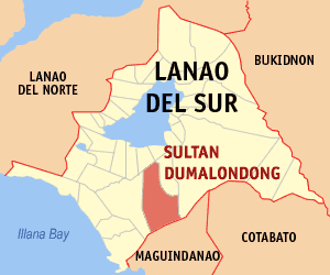
Sultan Dumalondong Municipality in Bangsamoro Autonomous Region in Muslim Mindanao, Philippines

Sultan Dumalondong, officially the Municipality of Sultan Dumalondong, is a 6th class municipality in the province of Lanao del Sur, Philippines. According to the 2015 census, it has a population of 11,298 people.

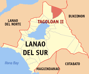
Tagoloan II Municipality in Bangsamoro Autonomous Region in Muslim Mindanao, Philippines

Tagoloan II, officially the Municipality of Tagoloan II, is a 4th class municipality in the province of Lanao del Sur, Philippines. According to the 2015 census, it has a population of 11,169 people.

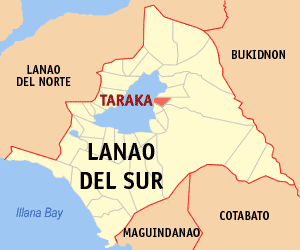
Taraka, Lanao del Sur Municipality in Bangsamoro Autonomous Region in Muslim Mindanao, Philippines

Taraka, officially the Municipality of Taraka, is a 4th class municipality in the province of Lanao del Sur, Philippines. According to the 2015 census, it has a population of 23,644 people.

References

  1. "Municipality". Quezon City, Philippines: Department of the Interior and Local Government. Retrieved 31 May 2013.
  2. "Province: Lanao del Sur". PSGC Interactive. Quezon City, Philippines: Philippine Statistics Authority . Retrieved 12 November 2016.
  3. 1 2 3 Census of Population (2015). "ARMM – Autonomous Region in Muslim Mindanao". Total Population by Province, City, Municipality and Barangay. PSA . Retrieved 20 June 2016.
  4. Census of Population and Housing (2010). "ARMM – Autonomous Region in Muslim Mindanao". Total Population by Province, City, Municipality and Barangay. NSO . Retrieved 29 June 2016.
  5. Censuses of Population (1903–2007). "ARMM – Autonomous Region in Muslim Mindanao". Table 1. Population Enumerated in Various Censuses by Province/Highly Urbanized City: 1903 to 2007. NSO.