Masiu, Lanao del Sur

Last updated
Masiu
Municipality
Municipality of Masiu
Ph locator lanao del sur masiu.png
Map of Lanao del Sur with Masiu highlighted
Philippines location map (square).svg
Red pog.svg
Masiu
Location within the Philippines
Coordinates: 7°49′N124°19′E / 7.82°N 124.32°E / 7.82; 124.32 Coordinates: 7°49′N124°19′E / 7.82°N 124.32°E / 7.82; 124.32
Country Flag of the Philippines.svg  Philippines
Region Autonomous Region in Muslim Mindanao (ARMM)
Province Lanao del Sur
District 1st District
Barangays 35 (see Barangays)
Government [1]
  Type Sangguniang Bayan
   Mayor Nesser Pangandaman, Jr.
  Electorate 13,057 voters (2016)
Area [2]
  Total 170.00 km2 (65.64 sq mi)
Population (2015 census) [3]
  Total 29,176
  Density 170/km2 (440/sq mi)
Time zone PST (UTC+8)
ZIP code 9706
PSGC 153618000
IDD : area code +63(0)63
Climate type tropical climate
Income class 5th municipal income class
Website www.masiu-lds.gov.ph

Masiu, officially the Municipality of Masiu, is a 5th class municipality in the province of Lanao del Sur, Philippines. According to the 2015 census, it has a population of 29,176 people. [3]

Lanao del Sur Province in Bangsamoro Autonomous Region in Muslim Mindanao, Philippines

Lanao del Sur, officially the Province of Lanao del Sur, is a province in the Philippines located in the Bangsamoro Autonomous Region in Muslim Mindanao (BARMM). The capital is the city of Marawi, and it borders Lanao del Norte to the north, Bukidnon to the east, and Maguindanao and Cotabato to the south. To the southwest lies Illana Bay, an arm of the Moro Gulf.

Philippines Republic in Southeast Asia

The Philippines, officially the Republic of the Philippines, is an archipelagic country in Southeast Asia. Situated in the western Pacific Ocean, it consists of about 7,641 islands that are categorized broadly under three main geographical divisions from north to south: Luzon, Visayas, and Mindanao. The capital city of the Philippines is Manila and the most populous city is Quezon City, both part of Metro Manila. Bounded by the South China Sea on the west, the Philippine Sea on the east and the Celebes Sea on the southwest, the Philippines shares maritime borders with Taiwan to the north, Vietnam to the west, Palau to the east, and Malaysia and Indonesia to the south.

Contents

Barangays

Masiu is politically subdivided into 35 barangays.

History

The oldest name of Pangampong a Masiu was Maganding Daorogen a Maorintang Anonen (Zainun di komlazsee at Encarta map), given by Bataraan di kilaten, Darangen narrated that Rajah Indarapatra of Komara Mantapoli found Potre Raina laot at the cave of Masiu’s river, Raina Laot and Indarapatra got married and bore the twins, now the darangen start sung from the twins,

Bataraan di kilaten is a noble of Bembaran, he was the son of Pazandalan a Morog, his brothers were, Dimaampao, Domalandalan, and Botawanen, the 4 brothers agreed to build their own kingdom in Kiaranda now "Ranaw" after the kingdom of Bembaran was totally destroyed, Dimaapao found "Marogong" now Unayan, Domalandalan settled in "Mimbisa" now Baloi, Botawanen stayed in "Dagodob" now Bayabao and Bataraan choose "Maganding" now eastern Masiu, Bataraan di Kilaten was married to Nomonao sa Ragiray, one of the 4 native princesses of Kiaranda a Ragat a tiongcop a layagen (Ranaw), the lovely couple settles in the area and name the place Maganding, now the people of the Pangampong a Masiu claimed descent from Bataraan di kilaten of Masiu (Zainun), According to the Taritib (traditional order) of pangampong a Ranaw, Masiu is the Largest and most documented royal sultanate of Ranao, co-equal in royal power and prestige with the other principalities of Bayabao, Unayan, and Baloi, three sections (soko) on the east and west of lake Lanao, Poona Masiu, comprise the municipality of Masiu alone, Lumba a Masiu, comprises the lowland of Molondo, Taraka and Tamparan, the last section is the sedepan a Masiu (real maganding in sultan gumander) comprises the upland of Wato Balindong, Tugaya, Bacolod, Kalawi, and Madalum. These are the traditional Inged Township of settlements upon which "Municipalities" have been superimposed by the modern provincial government. The Masiu Pangampong total territory is relatively smaller than either one of the territory of its sister principalities, but it is no less populous, fertile and productive with strategic advantages on the lake shorelines where the early Maranao ancestors founded and nourished their ancient civilization.

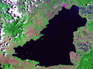
Lake Lanao lake

Lake Lanao is a large ancient lake in the Philippines, located in Lanao del Sur province in the country's southern island of Mindanao. With a surface area of 340 km2 (130 sq mi), it is the largest lake in Mindanao, and the second largest lake in the Philippines and counted as one of the 15 ancient lakes in the world. Scholars have been pushing for the lake's inclusion in the UNESCO World Heritage List.

Taraka is the branch and source of the Pangampong a Masiu, the principal seat of power of the Sultan of Masiu is maintain by the royal houses Torogan of Maruhom Rahmatullah and Maruhom Dialaloddin (grandparents of Bae sa Macadar, Sultan Mardan, Sultan a Dimasangcay and Radia Muda sa Macadar) on the banks of the Taraka’s river, These royal houses have the exclusive right to assume, the title of thrones of Sultan of Masiu and Cabugatan of Masiu as had been vested upon their family lines by the great ancestor Sarikran Balindong.

Maruhom Dialaloddin is the parents of Panimbang (former sultan of Talagian) begots Maco and Mengguel. Maco elder son of Sultan sa Talagian, "Panimbang" is a grandfathers of "Daporan" (Bae sa Macadar), Hadji Sulayman former "Diranggaren" (Sultan Mardan sa Macadar) grandfathers of Sultan sa Gandamatu, "Macaraub" Sultan a Dimasangcay sa Macadar, "Maningcal" Sultan a Radiamuda sa Macadar among Patka Apo sa Macadar the Children of Kalangit and his wife Bae sa Kalawaan of Unayan.

Nayef is both a given name and a surname. Notable people with the name include:

Demographics

Population census of Masiu
YearPop.±% p.a.
1918 4,397    
1939 5,721+1.26%
1948 7,993+3.79%
1960 8,903+0.90%
1970 12,550+3.49%
1975 15,462+4.27%
1980 12,512−4.14%
1990 17,030+3.13%
1995 20,042+3.10%
2000 24,105+4.04%
2007 30,196+3.16%
2010 25,181−6.40%
2015 29,176+2.84%
Source: Philippine Statistics Authority [3] [4] [5] [6]

Related Research Articles

Ganassi, Lanao del Sur Municipality in Bangsamoro Autonomous Region in Muslim Mindanao, Philippines

Ganassi, officially the Municipality of Ganassi, is a 4th class municipality in the province of Lanao del Sur, Philippines. According to the 2015 census, it has a population of 23,016 people.

Balabagan Municipality in Bangsamoro Autonomous Region in Muslim Mindanao, Philippines

Balabagan, officially the Municipality of Balabagan, is a 4th class municipality in the province of Lanao del Sur, Philippines. According to the 2015 census, it has a population of 26,819 people.

Balindong Municipality in Bangsamoro Autonomous Region in Muslim Mindanao, Philippines

Balindong, officially the Municipality of Balindong, is a 4th class municipality in the province of Lanao del Sur, Philippines. According to the 2015 census, it has a population of 29,180 people.

Binidayan Municipality in Bangsamoro Autonomous Region in Muslim Mindanao, Philippines

Binidayan, officially the Municipality of Binidayan, is a 4th class municipality in the province of Lanao del Sur, Philippines. According to the 2015 census, it has a population of 22,079 people.

Amai Manabilang Municipality in Bangsamoro Autonomous Region in Muslim Mindanao, Philippines

Amai Manabilang, officially the Municipality of Amai Manabilang, is a 3rd class municipality in the province of Lanao del Sur, Philippines. According to the 2015 census, it has a population of 10,401 people.

Ditsaan-Ramain Municipality in Bangsamoro Autonomous Region in Muslim Mindanao, Philippines

Ditsaan-Ramain, officially the Municipality of Ditsaan-Ramain, is a 3rd class municipality in the province of Lanao del Sur, Philippines. According to the 2015 census, it has a population of 22,299 people.

Lumba-Bayabao Municipality in Bangsamoro Autonomous Region in Muslim Mindanao, Philippines

Lumba-Bayabao, officially the Municipality of Lumba-Bayabao, is a 2nd class municipality in the province of Lanao del Sur, Philippines. According to the 2015 census, it has a population of 36,151 people.
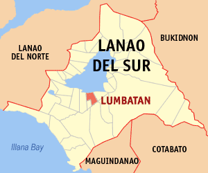
Lumbatan Municipality in Bangsamoro Autonomous Region in Muslim Mindanao, Philippines

Lumbatan, officially the Municipality of Lumbatan, is a 5th class municipality in the province of Lanao del Sur, Philippines. According to the 2015 census, it has a population of 19,105 people.

Marogong Municipality in Bangsamoro Autonomous Region in Muslim Mindanao, Philippines

Marogong, officially the Municipality of Marogong, is a 4th class municipality in the province of Lanao del Sur, Philippines. According to the 2015 census, it has a population of 21,319 people.

Mulondo, Lanao del Sur Municipality in Bangsamoro Autonomous Region in Muslim Mindanao, Philippines

Mulondo, officially the Municipality of Mulondo, is a 3rd class municipality in the province of Lanao del Sur, Philippines. According to the 2015 census, it has a population of 16,067 people.

Pagayawan Municipality in Bangsamoro Autonomous Region in Muslim Mindanao, Philippines

Pagayawan, officially the Municipality of Pagayawan, is a 5th class municipality in the province of Lanao del Sur, Philippines. According to the 2015 census, it has a population of 13,139 people.

Poona Bayabao Municipality in Bangsamoro Autonomous Region in Muslim Mindanao, Philippines

Poona Bayabao, officially the Municipality of Poona Bayabao, is a 4th class municipality in the province of Lanao del Sur, Philippines. According to the 2015 census, it has a population of 22,227 people.
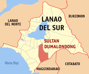
Sultan Dumalondong Municipality in Bangsamoro Autonomous Region in Muslim Mindanao, Philippines

Sultan Dumalondong, officially the Municipality of Sultan Dumalondong, is a 6th class municipality in the province of Lanao del Sur, Philippines. According to the 2015 census, it has a population of 11,298 people.
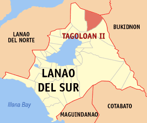
Tagoloan II Municipality in Bangsamoro Autonomous Region in Muslim Mindanao, Philippines

Tagoloan II, officially the Municipality of Tagoloan II, is a 4th class municipality in the province of Lanao del Sur, Philippines. According to the 2015 census, it has a population of 11,169 people.

Tamparan Municipality in Bangsamoro Autonomous Region in Muslim Mindanao, Philippines

Tamparan, officially the Municipality of Tamparan, is a 5th class municipality in the province of Lanao del Sur, Philippines. According to the 2015 census, it has a population of 25,874 people.
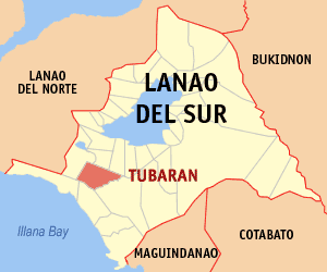
Tubaran Municipality in Bangsamoro Autonomous Region in Muslim Mindanao, Philippines

Tubaran, officially the Municipality of Tubaran, is a 4th class municipality in the province of Lanao del Sur, Philippines. According to the 2015 census, it has a population of 14,749 people.

Lumbaca-Unayan Municipality in Bangsamoro Autonomous Region in Muslim Mindanao, Philippines

Lumbaca-Unayan, officially the Municipality of Lumbaca-Unayan, is a — municipality in the province of Lanao del Sur, Philippines. According to the 2015 census, it has a population of 7,260 people.

Confederation of sultanates in Lanao uniquely decentralized Sultanate system in Lanao, within mainland Mindanao

The Sultanates of Lanao in Mindanao, Philippines were founded in the 16th century through the influence of Shariff Kabungsuan, who was enthroned as first Sultan of Maguindanao in 1520. The Maranaos of Lanao were acquainted with the sultanate system when Islam was introduced to the area by Muslim missionaries and traders from the Middle East, Indian and Malay regions who propagated Islam to Sulu and Maguindanao.

Local elections will held in the Province of Lanao del Sur on May 9, 2016 as part of the 2016 general election.Voters will select candidates for all local positions: a town mayor, vice mayor and town councilors, as well as members of the Sangguniang Panlalawigan, the vice-governor, governor and representatives for the two districts of Lanao del Sur.

Pat a Pongampong a Ranao meaning "Four Genealogical Division of Lanao" or "Four Sovereign States of Lanao", it is historically composed of Bayabao, Masiu, Unayan and Baloi in the provinces of Lanao. It was settled by the four descendants of Maranao people before Lanao del Sur and Lanao del Norte divided. Its early inhabitants are the "Magalindai Bumbaran a Borantakan Damaog a Lawakatan Kalinan" (Darangen dialect).

References

  1. "Municipality". Quezon City, Philippines: Department of the Interior and Local Government. Retrieved 31 May 2013.
  2. "Province: Lanao del Sur". PSGC Interactive. Quezon City, Philippines: Philippine Statistics Authority . Retrieved 12 November 2016.
  3. 1 2 3 Census of Population (2015). "ARMM – Autonomous Region in Muslim Mindanao". Total Population by Province, City, Municipality and Barangay. PSA . Retrieved 20 June 2016.
  4. Census of Population and Housing (2010). "ARMM – Autonomous Region in Muslim Mindanao". Total Population by Province, City, Municipality and Barangay. NSO . Retrieved 29 June 2016.
  5. Censuses of Population (1903–2007). "ARMM – Autonomous Region in Muslim Mindanao". Table 1. Population Enumerated in Various Censuses by Province/Highly Urbanized City: 1903 to 2007. NSO.
  6. "Province of Lanao del Sur". Municipality Population Data. Local Water Utilities Administration Research Division. Retrieved 17 December 2016.