Bayang, Lanao del Sur

Last updated
Bayang
Municipality
Municipality of Bayang
Ph locator lanao del sur bayang.png
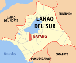
Map of Lanao del Sur with Bayang highlighted
Philippines location map (square).svg
Red pog.svg
Bayang
Location within the Philippines
Coordinates: 7°47′35″N124°11′31″E / 7.793°N 124.192°E / 7.793; 124.192 Coordinates: 7°47′35″N124°11′31″E / 7.793°N 124.192°E / 7.793; 124.192
Country Flag of the Philippines.svg  Philippines
Region Autonomous Region in Muslim Mindanao (ARMM)
Province Lanao del Sur
District 2nd District
Barangays 49 (see Barangays)
Government [1]
  Type Sangguniang Bayan
   Mayor Aslanie Balt
   Vice Mayor Johanisa Datudacula-Radiamoda
  Electorate 12,949 voters (2016)
Area [2]
  Total 230.00 km2 (88.80 sq mi)
Population (2015 census) [3]
  Total 23,965
  Density 100/km2 (270/sq mi)
Time zone PST (UTC+8)
ZIP code 9309
PSGC 153604000
IDD : area code +63(0)63
Climate type tropical climate
Income class 5th municipal income class
Website www.bayang-lds.gov.ph

Bayang, officially the Municipality of Bayang, is a 5th class municipality in the province of Lanao del Sur, Philippines. According to the 2015 census, it has a population of 23,965 people. [3]

Lanao del Sur Province in Bangsamoro Autonomous Region in Muslim Mindanao, Philippines

Lanao del Sur, officially the Province of Lanao del Sur, is a province in the Philippines located in the Bangsamoro Autonomous Region in Muslim Mindanao (BARMM). The capital is the city of Marawi, and it borders Lanao del Norte to the north, Bukidnon to the east, and Maguindanao and Cotabato to the south. To the southwest lies Illana Bay, an arm of the Moro Gulf.

Philippines Republic in Southeast Asia

The Philippines, officially the Republic of the Philippines, is an archipelagic country in Southeast Asia. Situated in the western Pacific Ocean, it consists of about 7,641 islands that are categorized broadly under three main geographical divisions from north to south: Luzon, Visayas, and Mindanao. The capital city of the Philippines is Manila and the most populous city is Quezon City, both part of Metro Manila. Bounded by the South China Sea on the west, the Philippine Sea on the east and the Celebes Sea on the southwest, the Philippines shares maritime borders with Taiwan to the north, Vietnam to the west, Palau to the east, and Malaysia and Indonesia to the south.

Contents

Battle of Bayang

In May 1902, during the Moro Rebellion (also known as the Moro–American War [4] ), Bayang was the site of a clash between Moro rebels and American troops that became known as the Battle of Bayang. The American troops, three infantry battalions and a battery of artillery totaling some 1200 men, were led to Bayang by colonel Frank Baldwin to demand the extradition of the Moros responsible for the ambushing and killing of two American soldiers at the construction of a road from Iligan to Lake Lanao, two months earlier. [5]

Moro Rebellion

The Moro Rebellion (1899–1913) was an armed conflict between the Moro people and the United States military during the Philippine-American War.

Moro people ethnic group

The collective term Moro people refers to the 13 Islamized ethnolinguistic groups of Mindanao, Sulu and Palawan. As Muslim-majority ethnic groups, they form largest non-Christian majority population in the country, and comprise about 5% of the total Philippine population, or 5 million people. Most Moros are followers of Sunni Islam of the Shafi'i madh'hab.

United States federal republic in North America

The United States of America (USA), commonly known as the United States or America, is a country composed of 50 states, a federal district, five major self-governing territories, and various possessions. At 3.8 million square miles, the United States is the world's third or fourth largest country by total area and is slightly smaller than the entire continent of Europe's 3.9 million square miles. With a population of over 327 million people, the U.S. is the third most populous country. The capital is Washington, D.C., and the largest city by population is New York City. Forty-eight states and the capital's federal district are contiguous in North America between Canada and Mexico. The State of Alaska is in the northwest corner of North America, bordered by Canada to the east and across the Bering Strait from Russia to the west. The State of Hawaii is an archipelago in the mid-Pacific Ocean. The U.S. territories are scattered about the Pacific Ocean and the Caribbean Sea, stretching across nine official time zones. The extremely diverse geography, climate, and wildlife of the United States make it one of the world's 17 megadiverse countries.

When the sultan of Bayang refused, Baldwin's troops attacked and captured the nearby cotta (fortress; "small, castle-like structures with thick, high walls" [6] ) of Binidayan on 2 May. They subsequently attempted to capture the cotta of Pandapatan, which resisted the artillery fire and was only subdued the next day after hand-to-hand combat between Moros and Americans. The number of Moro casualties is estimated at 300 to 400, including the sultan of Bayang and his brother. On the American side, ten soldiers were killed and some forty wounded. [5] [6]

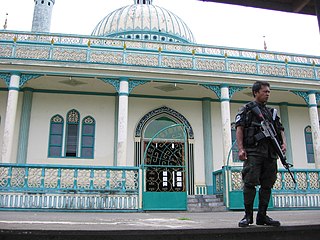
The cotta of Pandapatan has been preserved as a historical monument; the fallen of the Battle of Bayang are considered martyrs by Filipino Muslims. [4]

Martyr person who suffers persecution and death for advocating, refusing to renounce, and/or refusing to advocate a belief or cause, usually a religious one

A martyr is someone who suffers persecution and death for advocating, renouncing, refusing to renounce, or refusing to advocate a belief or cause as demanded by an external party. This refusal to comply with the presented demands results in the punishment or execution of the martyr by the oppressor. Originally applied only to those who suffered for their religious beliefs, the term has come to be used in connection with people killed for a political cause.

Barangays

Bayang is politically subdivided into 49 barangays.

Barangay administrative division in the Philippines

A barangay or baranggay (, formerly referred to as barrio, is the smallest administrative division in the Philippines and is the native Filipino term for a village, district or ward. In metropolitan areas, the term often refers to an inner city neighbourhood, a suburb or a suburban neighborhood. The word barangay originated from balangay, a kind of boat used by a group of Austronesian peoples when they migrated to the Philippines.

Poblacion or población is the common term used for the central, downtown, old town or central business district area of a Philippine city or municipality, which may take up the area of a single barangay or multiple barangays. It is sometimes shortened to Pob.

Demographics

Population census of Bayang
YearPop.±% p.a.
1918 1,982    
1939 4,480+3.96%
1948 4,817+0.81%
1960 24,315+14.44%
1970 23,772−0.23%
1975 19,455−3.94%
1980 18,811−0.67%
1990 18,928+0.06%
1995 20,060+1.09%
2000 21,020+1.01%
2007 24,185+1.95%
2010 21,472−4.24%
2015 23,965+2.11%
Source: Philippine Statistics Authority [3] [7] [8] [9]

Education

Secondary Schools:

Elementary Schools:

Point of interest

Related Research Articles

Bacolod-Kalawi Municipality in Bangsamoro Autonomous Region in Muslim Mindanao, Philippines

Bacolod-Kalawi, officially the Municipality of Bacolod-Kalawi, is a 3rd class municipality in the province of Lanao del Sur, Philippines. According to the 2015 census, it has a population of 20,841 people.

Balindong Municipality in Bangsamoro Autonomous Region in Muslim Mindanao, Philippines

Balindong, officially the Municipality of Balindong, is a 4th class municipality in the province of Lanao del Sur, Philippines. According to the 2015 census, it has a population of 29,180 people.

Buadiposo-Buntong Municipality in Bangsamoro Autonomous Region in Muslim Mindanao, Philippines

Buadiposo-Buntong, officially the Municipality of Buadiposo-Buntong, is a 4th class municipality in the province of Lanao del Sur, Philippines. According to the 2015 census, it has a population of 16,130 people.

Ditsaan-Ramain Municipality in Bangsamoro Autonomous Region in Muslim Mindanao, Philippines

Ditsaan-Ramain, officially the Municipality of Ditsaan-Ramain, is a 3rd class municipality in the province of Lanao del Sur, Philippines. According to the 2015 census, it has a population of 22,299 people.

Lumba-Bayabao Municipality in Bangsamoro Autonomous Region in Muslim Mindanao, Philippines

Lumba-Bayabao, officially the Municipality of Lumba-Bayabao, is a 2nd class municipality in the province of Lanao del Sur, Philippines. According to the 2015 census, it has a population of 36,151 people.

Lumbatan Municipality in Bangsamoro Autonomous Region in Muslim Mindanao, Philippines

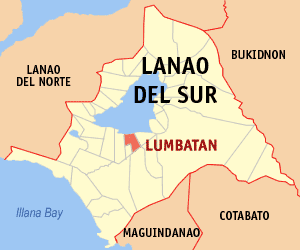
Lumbatan, officially the Municipality of Lumbatan, is a 5th class municipality in the province of Lanao del Sur, Philippines. According to the 2015 census, it has a population of 19,105 people.

Madalum Municipality in Bangsamoro Autonomous Region in Muslim Mindanao, Philippines

Madalum, officially the Municipality of Madalum, is a 3rd class municipality in the province of Lanao del Sur, Philippines. According to the 2015 census, it has a population of 23,127 people.

Madamba Municipality in Bangsamoro Autonomous Region in Muslim Mindanao, Philippines

Madamba, officially the Municipality of Madamba, is a 4th class municipality in the province of Lanao del Sur, Philippines. According to the 2015 census, it has a population of 17,756 people.

Maguing Municipality in Bangsamoro Autonomous Region in Muslim Mindanao, Philippines

Maguing, officially the Municipality of Maguing, is a 2nd class municipality in the province of Lanao del Sur, Philippines. According to the 2015 census, it has a population of 24,531 people.

Marantao Municipality in Bangsamoro Autonomous Region in Muslim Mindanao, Philippines

Marantao, officially the Municipality of Marantao, is a 2nd class municipality in the province of Lanao del Sur, Philippines. According to the 2015 census, it has a population of 32,974 people.

Mulondo, Lanao del Sur Municipality in Bangsamoro Autonomous Region in Muslim Mindanao, Philippines

Mulondo, officially the Municipality of Mulondo, is a 3rd class municipality in the province of Lanao del Sur, Philippines. According to the 2015 census, it has a population of 16,067 people.

Poona Bayabao Municipality in Bangsamoro Autonomous Region in Muslim Mindanao, Philippines

Poona Bayabao, officially the Municipality of Poona Bayabao, is a 4th class municipality in the province of Lanao del Sur, Philippines. According to the 2015 census, it has a population of 22,227 people.

Saguiaran Municipality in Bangsamoro Autonomous Region in Muslim Mindanao, Philippines

Saguiaran, officially the Municipality of Saguiaran, is a 4th class municipality in the province of Lanao del Sur, Philippines. According to the 2015 census, it has a population of 24,619 people.

Sultan Dumalondong Municipality in Bangsamoro Autonomous Region in Muslim Mindanao, Philippines

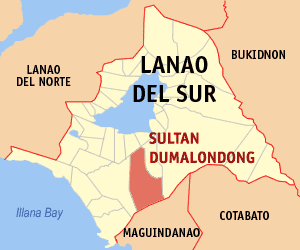
Sultan Dumalondong, officially the Municipality of Sultan Dumalondong, is a 6th class municipality in the province of Lanao del Sur, Philippines. According to the 2015 census, it has a population of 11,298 people.

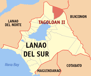
Tagoloan II Municipality in Bangsamoro Autonomous Region in Muslim Mindanao, Philippines

Tagoloan II, officially the Municipality of Tagoloan II, is a 4th class municipality in the province of Lanao del Sur, Philippines. According to the 2015 census, it has a population of 11,169 people.

Tamparan Municipality in Bangsamoro Autonomous Region in Muslim Mindanao, Philippines

Tamparan, officially the Municipality of Tamparan, is a 5th class municipality in the province of Lanao del Sur, Philippines. According to the 2015 census, it has a population of 25,874 people.

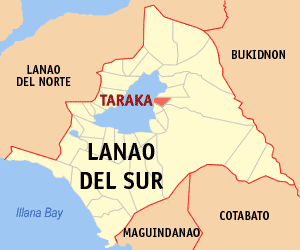
Taraka, Lanao del Sur Municipality in Bangsamoro Autonomous Region in Muslim Mindanao, Philippines

Taraka, officially the Municipality of Taraka, is a 4th class municipality in the province of Lanao del Sur, Philippines. According to the 2015 census, it has a population of 23,644 people.

Munai, Lanao del Norte Municipality in Northern Mindanao, Philippines

Munai, officially the Municipality of Munai, is a 4th class municipality in the province of Lanao del Norte, Philippines. According to the 2015 census, it has a population of 32,973 people.

Poona Piagapo, Lanao del Norte Municipality in Northern Mindanao, Philippines

Poona Piagapo, officially the Municipality of Poona Piagapo, is a 4th class municipality in the province of Lanao del Norte, Philippines. According to the 2015 census, it has a population of 27,018 people.

Tangcal, Lanao del Norte Municipality in Northern Mindanao, Philippines

Tangcal, officially the Municipality of Tangcal, is a 5th class municipality in the province of Lanao del Norte, Philippines. According to the 2015 census, it has a population of 15,181 people.

References

  1. "Municipality". Quezon City, Philippines: Department of the Interior and Local Government. Retrieved 31 May 2013.
  2. "Province: Lanao del Sur". PSGC Interactive. Quezon City, Philippines: Philippine Statistics Authority . Retrieved 12 November 2016.
  3. 1 2 3 Census of Population (2015). "ARMM – Autonomous Region in Muslim Mindanao". Total Population by Province, City, Municipality and Barangay. PSA . Retrieved 20 June 2016.
  4. 1 2 Antonio J. Montalvan II (13 May 2002). "The war that no one remembers". Philippine Daily Enquirer.
  5. 1 2 Paul J. Springer (2009). "Bayang, Battle of". In Spencer Tucker. The Encyclopedia of the Spanish-American and Philippine-American Wars. 1. ABC-CLIO. pp. 49–50.
  6. 1 2 Alexander M. Bielakowski, ed. (2013). Ethnic and Racial Minorities in the U.S. Military. ABC-CLIO. p. 444.
  7. Census of Population and Housing (2010). "ARMM – Autonomous Region in Muslim Mindanao". Total Population by Province, City, Municipality and Barangay. NSO . Retrieved 29 June 2016.
  8. Censuses of Population (1903–2007). "ARMM – Autonomous Region in Muslim Mindanao". Table 1. Population Enumerated in Various Censuses by Province/Highly Urbanized City: 1903 to 2007. NSO.
  9. "Province of Lanao del Sur". Municipality Population Data. Local Water Utilities Administration Research Division. Retrieved 17 December 2016.