
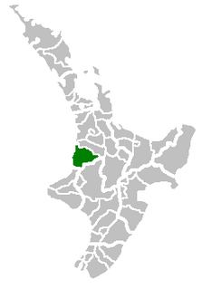
Waikato is a local government region of the upper North Island of New Zealand. It covers the Waikato District, Hauraki, Coromandel Peninsula, the northern King Country, much of the Taupo District, and parts of Rotorua District. It is governed by the Waikato Regional Council.

Te Kuiti is a small town in the north of the King Country region of the North Island of New Zealand. It lies at the junction of State Highways 3 and 30 and on the North Island Main Trunk railway, 80 kilometres (50 mi) south of Hamilton. At the 2001 census it had a resident population of 4,374, a decrease of 5.1% since 1991. The town promotes itself as the sheep shearing capital of the world and is host to the annual New Zealand National Shearing Championships.

The Waipa River is in the Waikato region of the North Island of New Zealand. The headwaters are in the Rangitoto Range east of Te Kuiti. It flows north for 115 kilometres (71 mi), passing through Otorohanga and Pirongia, before flowing into the Waikato River at Ngaruawahia. It is the Waikato's largest tributary. The Waipa's main tributary is the Puniu River.
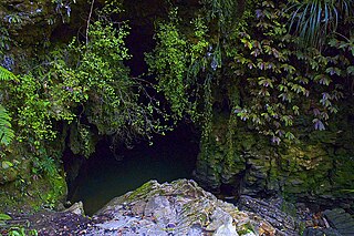
Waitomo is a rural community in the Waikato Region of New Zealand's North Island. It includes Waitomo Caves, a solutional cave system and popular local tourist attraction. Two villages, Waitomo and Hangatiki/Hangātiki, service visiting tourists.
Waitomo District is a territorial authority, located in the Waikato region, at the north of the King Country area in the North Island of New Zealand. A small part of the district, the town of Tiroa, however, lies in the Manawatu-Wanganui region.

Kawhia Harbour is one of three large natural inlets in the Tasman Sea coast of the Waikato region of New Zealand's North Island. It is located to the south of Raglan Harbour, Ruapuke and Aotea Harbour, 40 kilometres southwest of Hamilton. Kawhia is part of the Otorohanga District Council. It has a high-tide area of 68 km2 (26 sq mi) and a low-tide area of 18 km2 (6.9 sq mi).

State Highway 3 (SH 3) is one of New Zealand's eight national state highways. It serves the west coast of the country's North Island and forms a link between State Highway 1 and State Highway 2. Distances are measured from north to south.

Piopio is a small town in the Waitomo District. Situated on State Highway 3 approximately 23 km from Te Kuiti.
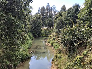
The Mangapu River is a river of the Waikato Region of New Zealand's North Island. It has its sources in numerous streams which flow generally northwards from the King Country south of Te Kuiti, the longest of which is the Mangaokewa Stream. These streams join to form the Mangapu close to Te Kuiti, and from here the river flows north, passing close to the east of Waitomo Caves, where the Mangapu caves have the largest entrance in the North Island, before flowing into the Waipa River at Otorohanga.
Waitomo was a parliamentary electorate in the Waikato region and the King Country of New Zealand, from 1919 to 1972. The electorate was represented by four Members of Parliament.
State Highway 39 (SH 39) is a New Zealand state highway that forms a western bypass of the city of Hamilton. Gazetted in 1999, it is a generally quicker route to get between Auckland and New Plymouth as well as connecting to the Waitomo Caves, just south of the SH 39 southern terminus. The southernmost 14 km section has a concurrency with SH 31, as this highway has existed for much longer.
Marokopa is a rural community in Waitomo District and Waikato Region of New Zealand. It is located close to the coast between Awakino and Kawhia Harbour. The meshblock includes the coastal township of Marokopa, at the mouth of the Marokopa River, and the south side of the small village of Awamarino, about 10 km (6.2 mi) upstream.
The Mayor of Far North officiates over the Far North District of New Zealand's North Island. The district has been administered by a district council since 1989.
The Mayor of Waimate officiates over the Waimate District of New Zealand's South Island. The district is administered by a district council.
The Mayor of Waitaki officiates over the Waitaki District of New Zealand's South Island. The district has been administered by a district council since 1989.
The Mayor of Waitomo officiates over the Waitomo District of New Zealand's North Island.
The Mayor of South Waikato officiates over the South Waikato District of New Zealand's North Island.
Waikawau is a rural community in the Waitomo District and Waikato Region of New Zealand's North Island.

