McIntyre, Georgia | |
---|---|
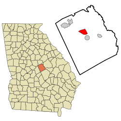
![]() Location in Wilkinson County and the state of Georgia | |
Coordinates: 32°50′50″N83°12′7″W / 32.84722°N 83.20194°W | |
Country | United States |
State | Georgia |
County | Wilkinson |
Area | |
• Total | 5.37 sq mi (13.90 km2) |
• Land | 5.18 sq mi (13.42 km2) |
• Water | 0.18 sq mi (0.48 km2) |
Elevation | 259 ft (79 m) |
Population (2020) | |
• Total | 575 |
• Density | 110.94/sq mi (42.83/km2) |
Time zone | UTC-5 (Eastern (EST)) |
• Summer (DST) | UTC-4 (EDT) |
ZIP code | 31054 |
Area code | 478 |
FIPS code | 13-48848 [2] |
GNIS feature ID | 0317929 [3] |
Website | www |
McIntyre is a town in Wilkinson County, Georgia, United States. The population was 575 in 2020.
McIntyre was founded as a depot on the Central of Georgia Railway. [4] The community was named after Thomas McIntyre, a railroad official. [5] The Georgia General Assembly incorporated McIntyre as a town in 1910. [6]
McIntyre is located at 32°50′50″N83°12′07″W / 32.847173°N 83.202057°W . [7] According to the United States Census Bureau, the town has a total area of 5.4 square miles (14 km2), of which 5.2 square miles (13 km2) is land and 0.2 square miles (0.52 km2) (2.99%) is water.
Census | Pop. | Note | %± |
---|---|---|---|
1930 | 170 | — | |
1940 | 209 | 22.9% | |
1950 | 194 | −7.2% | |
1960 | 316 | 62.9% | |
1970 | 471 | 49.1% | |
1980 | 386 | −18.0% | |
1990 | 552 | 43.0% | |
2000 | 718 | 30.1% | |
2010 | 650 | −9.5% | |
2020 | 575 | −11.5% | |
U.S. Decennial Census [8] 1850-1870 [9] 1870-1880 [10] 1890-1910 [11] 1920-1930 [12] 1940 [13] 1950 [14] 1960 [15] 1970 [16] 1980 [17] 1990 [18] 2000 [19] 2010 [20] 2020 [21] |
Race / Ethnicity (NH = Non-Hispanic) | Pop 2000 [22] | Pop 2010 [20] | Pop 2020 [21] | % 2000 | % 2010 | % 2020 |
---|---|---|---|---|---|---|
White alone (NH) | 261 | 187 | 135 | 36.35% | 28.77% | 23.48% |
Black or African American alone (NH) | 413 | 403 | 376 | 57.52% | 62.00% | 65.39% |
Native American or Alaska Native alone (NH) | 1 | 0 | 0 | 0.14% | 0.00% | 0.00% |
Asian alone (NH) | 0 | 0 | 0 | 0.00% | 0.00% | 0.00% |
Native Hawaiian or Pacific Islander alone (NH) | 0 | 0 | 0 | 0.00% | 0.00% | 0.00% |
Other race alone (NH) | 0 | 0 | 0 | 0.00% | 0.00% | 0.00% |
Mixed race or Multiracial (NH) | 5 | 6 | 18 | 0.70% | 0.92% | 3.13% |
Hispanic or Latino (any race) | 38 | 54 | 46 | 5.29% | 8.31% | 8.00% |
Total | 718 | 650 | 575 | 100.00% | 100.00% | 100.00% |
As of the census [2] of 2000, there were 718 people, 253 households, and 180 families residing in the town. By 2020, its population was 575.