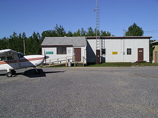
Melita is a town located in the south-western corner of the Canadian province of Manitoba. It is surrounded by the Municipality of Two Borders and occupies a bend of the Souris River. Graham Creek runs along the west side of town and into the Souris River. The population at the 2016 census was 1,042. It sits at the junction of Highways 3 and 83, approximately 320 km southwest of Winnipeg. Melita is known as the "Grasslands Bird Capital of Manitoba" and is located in Manitoba's banana belt.
Little Grand Rapids Airport is the airport serving the First Nations communities of Little Grand Rapids and the nearby Pauingassi First Nation, Manitoba, Canada. These two communities are connected to the more populated southern areas of Manitoba by a winter road which is only operational for about two months per year. During the other 10 months, this airport is the only practical way move passengers and goods in and out of the communities. The lack of roads and small size of aircraft, typically Otters, Grand Caravans or similar, makes it relatively busy compared to the population of roughly 1,500 served by the airport.

Bloodvein River Airport is located adjacent to Bloodvein River, Manitoba, Canada and serves the Bloodvein First Nation.
Brochet Airport is located 1 nautical mile west of Brochet, Manitoba, Canada.

Churchill Airport is located 3 nautical miles east-southeast of Churchill, Manitoba, Canada. The airport serves the town of Churchill and the surrounding region. Although it is a small domestic airport, it handles a relatively high number of passengers throughout the year as Churchill is a major destination for ecotourism and scientific research. Churchill Airport also serves as a transfer airport for passengers and cargo travelling between Winnipeg and remote communities in the Kivalliq Region of Nunavut.
Cross LakeAirport is located 1 nautical mile east of Cross Lake, Manitoba, Canada.
Lt. Col W.G. (Billy) Barker, VC Airport or DauphinAirport, formerly the Dauphin Regional Airport, is located 3 nautical miles south of Dauphin, Manitoba, Canada. It is named after the top Canadian fighter ace in World War I, William George Barker.
Easterville Airport is located adjacent to Easterville, Manitoba, Canada.

Flin Flon Airport is located 8 nautical miles southeast of Flin Flon, Manitoba, Canada, in the community of Bakers Narrows, on the shores of Lake Athapapuskow.
Gillam Airport is located adjacent to Gillam, Manitoba, Canada.
Gods Lake Narrows Airport is located adjacent to Gods Lake Narrows, Manitoba, Canada.

Island Lake Airport or Island Lake — Garden Hill Airport is located 5 nautical miles southwest of Island Lake, Manitoba, Canada.
Jenpeg Airport provides access to Manitoba Hydro's Jenpeg Generating Station. The landing strip is located 1.6 nautical miles from the temporary Manitoba Hydro company town, also known as Jenpeg, in the Unorganized Division No. 22, Manitoba, Canada.
Leaf Rapids Airport is located 3 nautical miles north of Leaf Rapids, Manitoba, Canada.
Lynn Lake Airport is an airport located adjacent to Lynn Lake, Manitoba, Canada. It features a 5,004 ft (1,525 m) paved runway, and is the furthest north runway of its type accessible by highway in Manitoba.
Norway House Airport is located adjacent to Norway House, Manitoba, Canada.

Thompson Municipal Airport is an airport in Mystery Lake located 3 nautical miles north of Thompson, Manitoba, Canada. It is the third-busiest airport in Manitoba after Winnipeg James Armstrong Richardson International Airport and Winnipeg/St. Andrews Airport.

Winnipeg/St. Andrews Airport or St. Andrews Airport is a general aviation facility located 10 nautical miles north northeast of Winnipeg, in the Rural Municipality of St. Andrews, Manitoba, Canada. In 2022 it was Canada's 11th busiest airport by aircraft movements.


