Mendaro | |
|---|---|
 | |
 Coat of arms | |
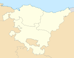 Mendaro Location of Mendaro within the Basque Country | |
| Coordinates: 43°15.85′N2°22.53′W / 43.26417°N 2.37550°W | |
| Country | |
| Autonomous community | |
| Province | Gipuzkoa |
| Eskualdea | Debabarrena |
| Founded | 1983 |
| Government | |
| • Mayor | Sonia Garcia Raposo |
| Area | |
• Total | 25.39 km2 (9.80 sq mi) |
| Elevation | 30 m (100 ft) |
| Population (2018) [1] | |
• Total | 2,010 |
| • Density | 79/km2 (210/sq mi) |
| Time zone | UTC+1 (CET) |
| • Summer (DST) | UTC+2 (CEST) |
| Postal code | 20850 |
Mendaro is a town and municipality located in the province of Gipuzkoa, in the Autonomous Community of Basque Country, northern Spain.
The Mendaro Valley is the town's namesake. There is little agreement on the origin or meaning of the word itself. Surrounded by mountains, the town is located in northeast Gipuzkoa near the Biscayan border.
Officially founded in 1983, Mendaro is considered one of Gipuzkoa's youngest municipalities.
